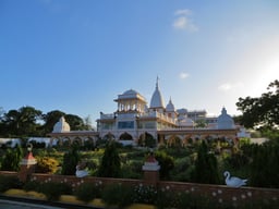
Mombasa
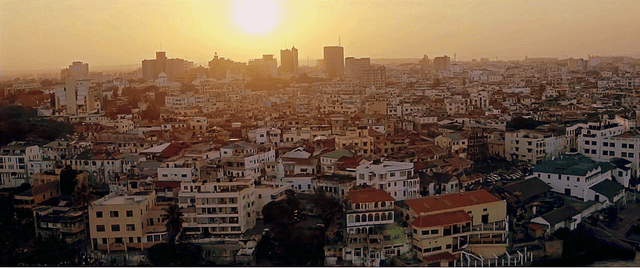
Mombasa

Mombasa | |
|---|---|
City | |
| Motto(s): Utangamano kwa Maendeleo (Unity for Development) | |
| Coordinates:4°03′S 39°40′E [53] | |
| Country | |
| County | Mombasa County |
| Founded | 900 A.D. |
| Elevation | 50 m (160 ft) |
| Population (2016) | |
| • Urban | 1,500,000[1] |
| • Metro | 3,000,000 |
| Demonym(s) | Mombasanese |
| Time zone | UTC+3 (EAT) |
| Area code(s) | 020 |
| Website | mombasa.go.ke [54] |
Mombasa (/mɒmˈbæsə/ mom-BASS-ə, also US: /-ˈbɑːs-/ -BAH-sə) is a coastal city of Kenya along the Indian Ocean. It is the country's oldest (circa 900 AD) and second-largest city[2] (after the capital Nairobi), with an estimated population of about 1.5 million people in 2017.[1] Its metropolitan region is the second largest in the country and has a population of approximately 3 million people.[2] Administratively, Mombasa is the county seat of Mombasa County.
Mombasa is a regional cultural and economic hub; it has an extra-large port and an international airport, and is an important regional tourism center. Located on the east coast of Kenya, it also is the home of one of the State House (Kenya), and is considered by some as a second capital in all but name. In Mombasa County and the former Coast Province, Mombasa's situation on the Indian Ocean made it a historical trading center,[3] and it has been controlled by many countries because of its strategic location.
Mombasa | |
|---|---|
City | |
| Motto(s): Utangamano kwa Maendeleo (Unity for Development) | |
| Coordinates:4°03′S 39°40′E [53] | |
| Country | |
| County | Mombasa County |
| Founded | 900 A.D. |
| Elevation | 50 m (160 ft) |
| Population (2016) | |
| • Urban | 1,500,000[1] |
| • Metro | 3,000,000 |
| Demonym(s) | Mombasanese |
| Time zone | UTC+3 (EAT) |
| Area code(s) | 020 |
| Website | mombasa.go.ke [54] |
History
Historical affiliations Sultan of Mombasa Before 1593 Portuguese Empire 1593–1698 Imamate of Oman 1698–1728 Portuguese Empire 1728–1729 Imamate of Oman 1729–1824 British Empire 1824–1826 Sultanate of Muscat and Oman 1826–1887 British East Africa/Kenya 1887–1963
Kenya 1963–present
Ancient and medieval
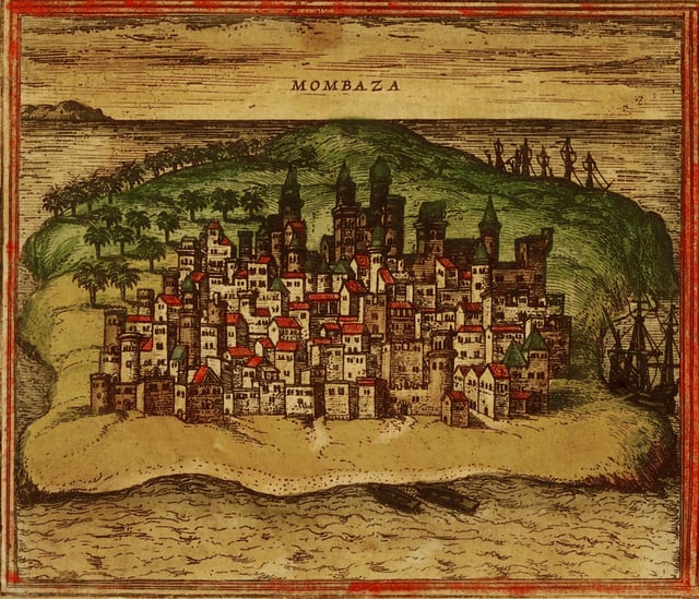
1572 Mombasa from Civitates orbis terrarum byGeorg Braun and Franz Hogenberg
The founding of Mombasa is associated with two rulers: Mwana Mkisi and Shehe Mvita. According to legend, Mwana Mkisi is the original ancestor of Mombasa's oldest lineages within Thenashara Taifa (or Twelve Nations). Families associated with the Twelve Nations are still considered the original inhabitants of the city. Mwana Mkisi was a queen from the pre-islamic era, who founded Kongowea, the original urban settlement on Mombasa Island. Importantly, both of these names have linguistic and spiritual connections with Central Africa. "Mkisi" is considered the personification of "ukisi" which means "the holy" in kiKongo. "Kongowea" can similarly be interpreted as the Swahili locative of "kongo" which denotes the essence of civilizational order in central Africa. These legends can be read as an acknowledgment of the Bantu-speaking origins of the Swahili people. Shehe Mvita superseded the dynasty of Mwana Mkisi and established the first permanent stone mosque on Mombasa Island. Mombasa's oldest extant stone mosque, Mnara, was built c. 1300. Shehe Mvita is remembered as a Muslim of great learning and so is connected more directly with the present ideals of Swahili culture that people identify with Mombasa. The ancient history associated with Mwana Mkisi and Shehe Mvita and the founding of an urban settlement on Mombasa Island is still linked to present-day peoples living in Mombasa. The Thenashara Taifa (or Twelve Nations) Swahili lineages recount this ancient history today and are the keepers of local Swahili traditions.[4]
Most of the early information on Mombasa comes from Portuguese chroniclers writing in the 16th century.
The famous Moroccan scholar and traveller Ibn Battuta visited the area during his travels to the Swahili Coast and made some mention of the city, although he only stayed one night. He noted that the people of Mombasa were Shãfi'i Muslims, religious people, trustworthy and righteous. Their mosques are made of wood, expertly built.[5]
The exact founding date of the city is unknown, but it has a long history. Kenyan school history books place the founding of Mombasa as 900 A.D. It must have been already a prosperous trading town in the 12th century, as the Arab geographer Al Idrisi mentions it in 1151. The oldest stone mosque in Mombasa, Mnara, was built c. 1300. The Mandhry Mosque, built in 1570, has a minaret that contains a regionally specific ogee arch. This demonstrates that Swahili architecture was an indigenous African product and disproves assertions that non-African Muslims brought stone architecture to the Swahili Coast.[6]
During the pre-modern period, Mombasa was an important centre for the trade in spices, gold, and ivory. Its trade links reached as far as the Indian subcontinent and modern-day China and oral historians today can still recall this period of local history. History shows that there were trade links between Mombasa and Cholas of South India. Throughout the early modern period, Mombasa was a key node in the complex and far reaching Indian Ocean trading networks, its key exports then were ivory, millet, sesamum and coconuts.
In the late pre-colonial period (late 19th century), it was the metropolis of a plantation society, which became dependent on slave labour (sources contradict whether the city was ever an important place for exporting slaves) but ivory caravans remained a major source of economic prosperity. Mombasa became the major port city of pre-colonial Kenya in the Middle Ages and was used to trade with other African port cities, the Persian Empire, the Arabian Peninsula, the Indian Subcontinent and China.[7] 16th-century Portuguese voyager Duarte Barbosa claimed, "[Mombasa] is a place of great traffic and has a good harbour in which there are always moored small craft of many kinds and also great ships, both of which are bound from Sofala and others which come from Cambay and Melinde and others which sail to the island of Zanzibar."[8]
Portuguese domination
Vasco da Gama was the first known European to visit Mombasa, receiving a chilly reception in 1498. Two years later, the town was sacked by the Portuguese. In 1502, the sultanate became independent from Kilwa Kisiwani and was renamed as Mvita (in Swahili) or Manbasa (Arabic). Portugal attacked the city again in 1528. In 1585 a joint military expedition between the Somalis of Ajuran Empire and the Turks of Ottoman Empire led by Emir 'Ali Bey successfully liberated Mombasa and other coastal cities in Southeast Africa from the Portuguese colonizers.[9] The Portuguese landlords; only Malindi remained loyal to Portugal. The Zimba overcame the towns of Sena and Tete on the Zambezi, and in 1587 they took Kilwa, killing 3,000 people. At Mombasa the Zimba slaughtered the Muslim inhabitants, but they were halted at Malindi by the Bantu-speaking Segeju and went home. This stimulated the Portuguese to take over Mombasa a third time in 1589, and four years later they built Fort Jesus to administer the region. Between Lake Malawi and the Zambezi mouth, Kalonga Mzura made an alliance with the Portuguese in 1608 and fielded 4,000 warriors to help defeat their rival Zimba, who were led by chief Lundi.
After the building of Fort Jesus Mombasa was put by the Portuguese under the rule of members of the ruling family of Malindi. In 1631 Dom Jeronimo the ruler of Mombasa slaughtered the Portuguese garrison in the city and defeated the relief force sent by the Portuguese. In 1632 Dom Jeronimo left Mombasa and became a pirate. That year the Portuguese returned and established direct rule over Mombasa.[10]
Omani rule
With the capture of Fort Jesus in 1698, the town came under the influence of the Imamate of Oman, subordinate to the Omani rulers on the island of Unguja, prompting regular local rebellions. Oman appointed three consecutive Governors (Wali in Arabic, Liwali in Swahili):
12 December 1698 – December 1698: Imam Sa'if ibn Sultan
December 1698 – 1728: Nasr ibn Abdallah al-Mazru'i
1728–12 March 1728: Shaykh Rumba
Mombasa briefly returned to Portuguese rule by captain-major Álvaro Caetano de Melo Castro (12 March 1728 – 21 September 1729), then four new Omani Liwali until 1746, when the last of them made it independent again (disputed by Oman), as the first of its recorded Sultans:
1746–1755: 'Ali ibn Uthman al-Mazru'i
1755–1773: Masud ibn Nasr al-Mazru'i
1773–1782: Abdallah ibn Muhammad al-Mazru'i
1782–1811: Ahmad ibn Muhammad al-Mazru'i (born 17–died 1814)
1812–1823: 'Abdallah ibn Ahmad al-Mazru'i (died 1823)
1823–1826: Sulayman ibn 'Ali al-Mazru'i
From 9 February 1824 to 25 July 1826, there was a British protectorate over Mombasa, represented by Governors. Omani rule was restored in 1826; seven liwalis where appointed. On 24 June 1837, it was nominally annexed by Said bin Sultan of Muscat and Oman.
British rule
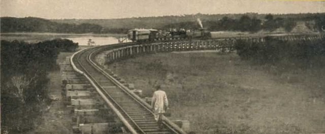
Kenya–Uganda railway near Mombasa, circa 1899
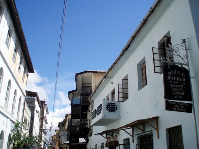
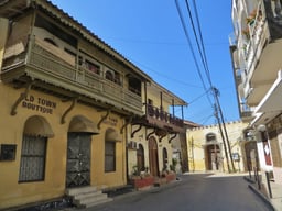
Old Town
On 25 May 1887 was relinquished to the British East Africa Association, later the Imperial British East Africa Company.It came under British administration in 1895. [11] It soon became the capital of the British East Africa Protectorate and the sea terminal of the Uganda Railway, which was started in 1896. Many workers were brought in from British India to build the railway, and the city's fortunes revived. The Sultan of Zanzibar formally presented the town to the British in 1898.
Mombasa became the capital of the Protectorate of Kenya, sometime between 1887 and around 1906.[12] The capital was later moved because, medical officers warned that the ground was swampy and urged Sir James Hayes Sadler, then Commissioner of the East Africa Protectorate, to plead with London to move the town elsewhere. Nairobi has since been Kenya's capital to date.[13]
Geography
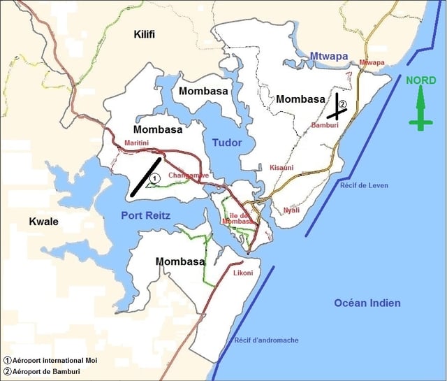
Map of Mombasa's extent.
Being a coastal town, Mombasa is characterised by a flat topography. The town of Mombasa is centred on Mombasa Island, but extends to the mainland. The island is separated from the mainland by two creeks, Port Reitz in the south and Tudor Creek in the north.
Climate
Mombasa has a tropical wet and dry climate (Köppen: As). The amount of rainfall essentially depends on the season. The rainiest months are April and May, while rainfall is minimal between January and February.
Located near the equator, Mombasa has only a slight seasonal temperature variation, with high temperatures ranging 28.8–33.7 °C (83.8–92.7 °F).
As a seaport, Mombasa is subject to detrimental consequences of a fluctuating climate. In October 2006, Mombasa experienced a large flood that affected 60,000 people.[14]
Coastal erosion has become a problem for Mombasa infrastructure. Due to rising sea levels, the coastline has been eroding at 2.5–20 cm (0.98–7.87 in) per year. This has increased the number of annual floods.[14]
| Climate data for Mombasa (1961–1990, extremes 1890–present) | |||||||||||||
|---|---|---|---|---|---|---|---|---|---|---|---|---|---|
| Month | Jan | Feb | Mar | Apr | May | Jun | Jul | Aug | Sep | Oct | Nov | Dec | Year |
| Record high °C (°F) | 35.9 (96.6) | 37.6 (99.7) | 36.4 (97.5) | 36.1 (97.0) | 35.0 (95.0) | 31.5 (88.7) | 31.0 (87.8) | 30.3 (86.5) | 31.6 (88.9) | 33.0 (91.4) | 34.0 (93.2) | 37.0 (98.6) | 37.6 (99.7) |
| Average high °C (°F) | 33.2 (91.8) | 33.7 (92.7) | 33.7 (92.7) | 32.5 (90.5) | 30.9 (87.6) | 29.4 (84.9) | 28.7 (83.7) | 28.8 (83.8) | 29.7 (85.5) | 30.5 (86.9) | 31.6 (88.9) | 32.8 (91.0) | 31.3 (88.3) |
| Daily mean °C (°F) | 27.6 (81.7) | 28.1 (82.6) | 28.3 (82.9) | 27.6 (81.7) | 26.2 (79.2) | 24.8 (76.6) | 24.0 (75.2) | 24.0 (75.2) | 24.7 (76.5) | 25.7 (78.3) | 26.9 (80.4) | 27.4 (81.3) | 26.3 (79.3) |
| Average low °C (°F) | 22.0 (71.6) | 22.5 (72.5) | 22.9 (73.2) | 22.7 (72.9) | 21.6 (70.9) | 20.1 (68.2) | 19.3 (66.7) | 19.3 (66.7) | 19.7 (67.5) | 20.9 (69.6) | 22.1 (71.8) | 22.0 (71.6) | 21.3 (70.3) |
| Record low °C (°F) | 16.8 (62.2) | 19.4 (66.9) | 19.7 (67.5) | 18.9 (66.0) | 18.8 (65.8) | 17.4 (63.3) | 13.6 (56.5) | 15.3 (59.5) | 16.3 (61.3) | 18.0 (64.4) | 18.8 (65.8) | 18.1 (64.6) | 13.6 (56.5) |
| Average precipitation mm (inches) | 33.9 (1.33) | 14.0 (0.55) | 55.6 (2.19) | 154.3 (6.07) | 235.5 (9.27) | 88.3 (3.48) | 71.8 (2.83) | 68.2 (2.69) | 67.2 (2.65) | 103.4 (4.07) | 104.7 (4.12) | 75.8 (2.98) | 1,072.7 (42.23) |
| Average precipitation days(≥ 1.0 mm) | 3 | 1 | 5 | 10 | 14 | 10 | 10 | 8 | 9 | 9 | 8 | 7 | 94 |
| Average relative humidity (%) | 77 | 75 | 77 | 80 | 82 | 82 | 82 | 82 | 80 | 81 | 82 | 80 | 80 |
| Mean monthly sunshine hours | 269.7 | 254.8 | 269.7 | 225.0 | 204.6 | 207.0 | 210.8 | 244.9 | 246.0 | 272.8 | 264.0 | 260.4 | 2,929.7 |
| Mean daily sunshine hours | 8.7 | 9.1 | 8.7 | 7.5 | 6.6 | 6.9 | 6.8 | 7.9 | 8.2 | 8.8 | 8.8 | 8.4 | 8.0 |
| Source #1: NOAA[15] | |||||||||||||
| Source #2: Deutscher Wetterdienst (humidity, 1962–1993),[16] Meteo Climat (record highs and lows)[17] | |||||||||||||
Suburbs
Mombasa Island
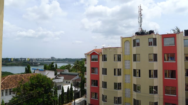
Tudor, Mombasa
Kizingo: Considered the prime residential area of Mombasa. The State House of Mombasa, Provincial Headquarters, The Mombasa Law Courts, and the Municipal Council are located in Kizingo. The Aga Khan Academy, Aga Khan High School, Serani Primary School, Serani High School, Santokben Nursery School, Coast Academy, Jaffery Academy, Mombasa Primary School, Loreto Convent, Mama Ngina Girls' High School and the Government Training Institute (GTI) Mombasa are all in Kizingo as well.
Kibokoni: Part of Old Town with Swahili architecture. Fort Jesus is in Baghani.
Englani: Part of Old town between Kibokoni and Makadara.
Kuze: Part of Old Town with Swahili culture and architecture. Originally flourishing with Swahili people but currently becoming a more cosmopolitan neighbourhood.
Makadara: Part of Old Town consisting of a high number of descendants of Baluchi former soldiers who settled within this area before it developed into a town. The name is derived from the Arabic word Qadr-ur-Rahman meaning fate of God.
Ganjoni: Primarily a middle class residential, home of second biggest dry dock of Africa after the one in South Africa.
Tudor: Another middle class residential area with homes and shops. The Technical University of Mombasa (TUM) is situated in this neighbourhood.
North Coast
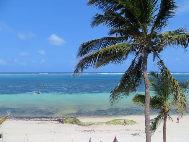
Seafront of Nyali Beach, north coast (from the Voyager Resort).
Nyali, also considered a prime and up-market residential area, it is on the mainland north of the island and is linked by the New Nyali Bridge. It has numerous beach front hotels in the area known as the "North Coast". Nyali has two distinct sections – the posh Old Nyali and the upcoming New Nyali. For many residents, Nyali has now become a self-contained residential area, with two Nakumatts, a multiplex cinema, shopping malls, banks, schools and post offices. This often eliminates the need for residents to cross the bridge and to go into the congested Mombasa city centre. Nyali is home for the Nyali Cinemax complex, Mamba Village, the Nyali Golf Club, and some of the most prestigious academic institutions of the Coast Province.
Kongowea is a densely populated area with 15 villages, two sub-locations and an estimated population of 106,180 residents.[18] Kongowea is a cosmopolitan settlement mainly inhabited by people from mainland who migrated into the city in search of employment, mainly in service and manufacturing sector. The area is adjacent to the rich suburb of Nyali which employs a portion of the village residents. They are mainly hired as cheap labour as watchmen, gardeners, masons for up coming houses and house help. The most well known villages inside Kongowea include Kisumu Ndogo, Shauri Yako and Mnazi Mmoja, despite being located in this prime area, many residents live under extreme conditions – poor sanitation, high crime rate and lack of basic essential amenities like schools, hospitals and tap water. Kongowea is also home to one of the largest open-air markets in the African Great Lakes.
Bamburi is an outlying township (fifteen minutes drive) along the Malindi road. Bamburi is the location of Bamburi Portland Cement Company. Other notable features in the area are the Mijikenda public beach, commonly known as Pirates, and Haller Park, a nature trail and wildlife conservatory. Kiembeni Estate, also in the Bamburi area, hosts around 100,000 residents. The estate has its own supermarket, several retail shops, salons and boutiques, and a number of licensed drinking dens. The establishments include The Shilla Bar, Turkey Base, Stars Garden and Sensera pub. Kiembeni is arguably the largest estate in Mombasa, and growing even faster.
Other areas include, Shanzu, Mkomani, Bombolulu, Kisauni and, across the Mtwapa creek, the popular area of Mtwapa[2] [55] , which is already located in Kilifi county.
The North Coast has an entertainment industry which attracts locals and tourists.
South Coast
Likoni: is a lower income and lower-middle-class neighbourhood connected to Mombasa Island by ferry. It is south of Mombasa Island and made up of mostly non-Swahili Bantu tribes. The ferry was the target of the Likoni Riots of 1997.[19]
Diani Beach[3] [56] : a beach resort area situated over the Likoni Ferry on the south coast of Mombasa. It is located some 36 km (22 miles) south of Mombasa city on the mainland coast and is a prime resort for many local and international tourists. Diani Beach has an airport at Ukunda town to cater for tourists who fly there directly from Nairobi Wilson or any other airports and airfields in the country.
Mombasa Mainland
Magongo: is an outlying township 20 minutes driving distance northwest of Mombasa Island, situated on the Nairobi Highway. This fringe community lacks any effective electricity, water or sewer systems, with a general lack of infrastructure. Poverty, lack of sanitation, and unemployment continue to be the greatest issues for the Mikindani Township, which have ensured low health and safety standards for its residents. Poor, lower class housing is widespread, ranging from simple stone, two-storey structures to mud and earth homes fitted with corrugated iron roofs. Much of the community works outside of the township, within Mombasa Island itself as there is a lack of employment and industry. There are number of small health clinics, shops, and a few public primary schools: Nazarene primary is one school, which is known in particular as being staffed by a revolving volunteer teacher base from Western, and predominately English speaking nations. This small town serves as a link between the city and Moi International Airport. Magongo is also home to the Akamba Handicraft Cooperative.
Mikindani, a suburban area: This is an outlying township on the mainland along the Nairobi Highway. It is built in the heavy industrial sections of Changamwe and mainly accommodate the working class who either work in the industries, the town centre on the Island and the Port at Kilindini harbour.
Miritini: outlying township on the Mombasa Nairobi Highway which is first growing as a suburban area.
Changamwe: Industrial area which contains the Kipevu power generation projects, the Kenya Oil Refinery Company facility and housing estates such as Chaani and is the gateway to the Moi International Airport. The area has administrative offices of the D.O and the chiefs who serve the administrative division.
Migadini & Chaani: They are two adjacent estate that are located east of Airport road and east of Kenya Port Authority. They are bordered by Port Reitz, Magongo and KPA
Port Reitz: Is a suburb on the mainland which contains a beach, oil refineries, housing estates etc. Moi International Airport and the Port Reitz District Hospital are in Port Reitz.
Mombasa county sub-divisions
Mombasa is also a county and divided into six constituencies and thirty wards.[20]
| Constituency | Wards |
|---|---|
| Changamwe |
|
| Jomvu |
|
| Kisauni |
|
| Nyali |
|
| Likoni |
|
| Mvita |
|
Demography
Mombasa city has a population of about 939,000[21][22] per the 2009 census. It is located on Mombasa Island and sprawls to the surrounding mainlands. The island is separated from the mainland by two creeks: Tudor Creek and Kilindini Harbour. It is connected to the mainland to the north by the Nyali Bridge, to the south by the Likoni Ferry, and to the west by the Makupa Causeway, alongside which runs the Kenya-Uganda Railway. The port serves both Kenya and countries of the interior, linking them to the ocean. The city is served by Moi International Airport located in the northwest mainland suburb of Chaani.
Mombasa has a cosmopolitan population, with the Swahili people and Mijikenda predominant. Other communities include the Akamba and Taita Bantus as well as a significant population of Luo and Luhya peoples from Western Kenya. The major religions practised in the city are Islam, Christianity and Hinduism.[23] Over the centuries, many immigrants and traders have settled in Mombasa, particularly from the Middle East, Somalia, and the Indian sub-continent, who came mainly as traders and skilled craftsmen.
| Historical population | ||
|---|---|---|
| Year | Pop. | ±% |
| 1969 | 247,073 | — |
| 1979 | 341,148 | +38.1% |
| 1989 | 461,753 | +35.4% |
| 1999 | 665,018 | +44.0% |
| 2009 | 915,101 | +37.6% |
| source:[24] | ||
Economy
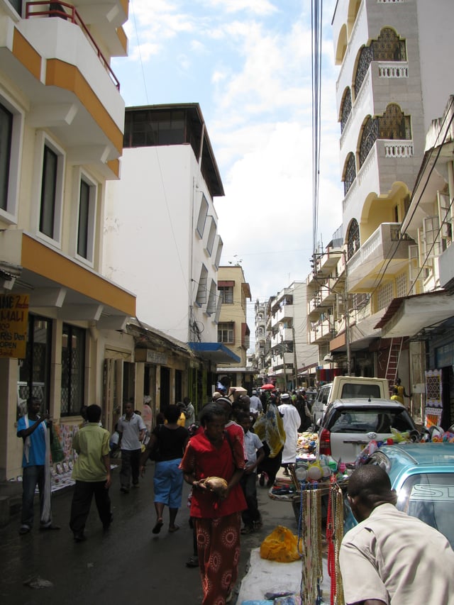
Biashara Street, Mombasa
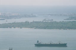
Mombasa is a major trade centre and home to Kenya's only large seaport, the Kilindini Harbour.[25] Kilindini is an old Swahili term meaning "deep". The port is so-called because the channel is naturally very deep. Kilindini Harbor is an example of a natural geographic phenomenon called a ria, formed at the end of the last glacial period when the sea level rose and engulfed a river that was flowing from the mainland.
Mombasa is a centre of coastal tourism in Kenya. Mombasa Island itself is not a main attraction, although many people visit the Old Town and Fort Jesus. The Nyali, Bamburi, and Shanzu beaches are located north of the city. The Shelly, Tiwi, and Diani beaches are located south of Mombasa. Several luxury hotels exist on these beaches, while the less expensive hotels are located further away.
Mombasa's northern shoreline is renowned for its vibrant 24-hour entertainment offers, including both family entertainment (water parks, cinemas, bowling, etc.), sports (watersports, mountain biking and gokarting), culinary offers (restaurants offering a wide range of specialties from Kenya, China, Japan, India, Italy, Germany and other countries) and nightlife (bars, pubs, clubs, discothèques, etc.).
Other local industries include an oil refinery with a capacity of 80,000 barrels a day,[26] and a cement factory capable of producing over 1.1 million tons per year.[27] The major intercontinental undersea telecom cables reach shore next to Mombasa, connecting the African Great Lakes to the rest of the world and supporting a fast-growing call centre business in the area. The estimated real GDP growth for Kenya in 2016 is 5.7-6.0%. This growth will be in response to the construction of a railway system from Nairobi to Mombasa which will aid in trade and transportation between Kenya's two major cities.[28]
Mombasa will become a Special Economic Zone (SEZ) in which certain industries such as tea, garments, and footwear will be exempt from certain taxes to promote domestic growth. This is in response to the deficiencies in Export Processing Zones (EPZ).[28]
The Kenyan Dock Worker's Union is situated in Mombasa and has roughly 5,000 members.[28]
President Kenyatta has made it a priority to deepen economic ties with Asia at the onset of his presidency. Japan has played a role in financially sponsoring the expansion of the Mombasa port in phase one and two of the expansion project.[28]
At 44%, the rate of youth unemployment in Mombasa is more than double the national average of 21% (2016).[29]
Transport
Air
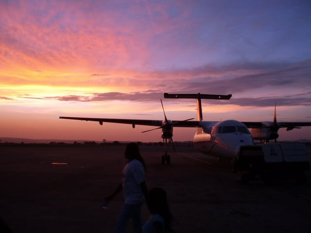
Sunrise at Moi International Airport
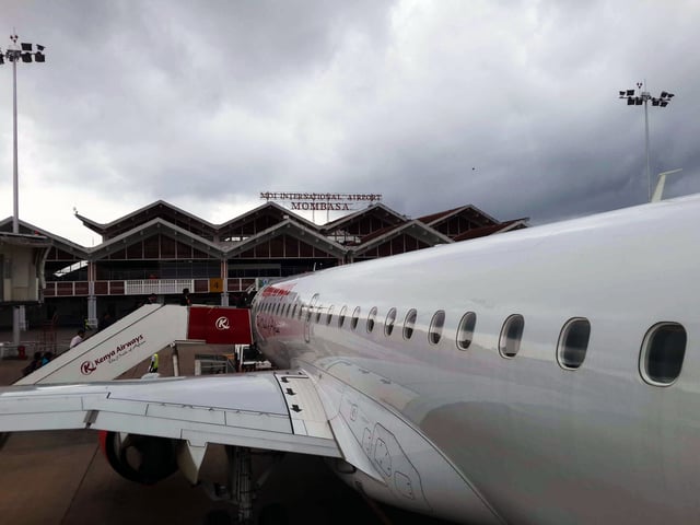
Moi International Airport
Moi International Airport serves the city of Mombasa. It is located in Port Reitz area, also known locally as Chaani area on the mainland metropolitan area. Flights to Nairobi and other Kenyan, European and Middle Eastern destinations depart from the airport each day. Mombasa is connected to Nairobi by dozens of scheduled flights.
Train
Mombasa currently has a modern railway station on the Mombasa–Nairobi Standard Gauge Railway that replaced the century-old station built by the British. Completed in 2017 and located at Miritini, the Mombasa Terminus station links Mombasa to Nairobi. The station, situated about 20 kilometers from the city center, is accessible through the newly built (2018) highway, being the first phase of the larger Dongo Kundu bypass. Kenya Railways transports passengers and cargo through the Standard Gauge Railway between Nairobi to Mombasa. The journey takes approximately five hours between the two cities.
Road
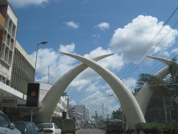
Moi Avenue in Mombasa
Driving in Mombasa is straightforward and the majority of the roads are tarmacked. Main roads include Jomo Kenyatta Avenue, Digo Road, Nyerere Road, Nkurumah Road, Moi Avenue, Mama Ngina Drive, Barack Obama Road, Nairobi Highway and Nyali Road.
Highways connect Mombasa to Nairobi, Dar es Salaam while northward road link to Malindi and Lamu, which also extends towards the border with Somalia.
Within Mombasa, most local people use matatus (mini-buses) which are extremely common in Kenya, to move around the city and its suburbs. The tuk-tuk—a motor vehicle with three wheels—is widely used as transport around the city and its suburbs. No more than three passengers may be carried. A boda-boda is originally a bicycle taxi but have long since been replaced by motorcycles.
Sea
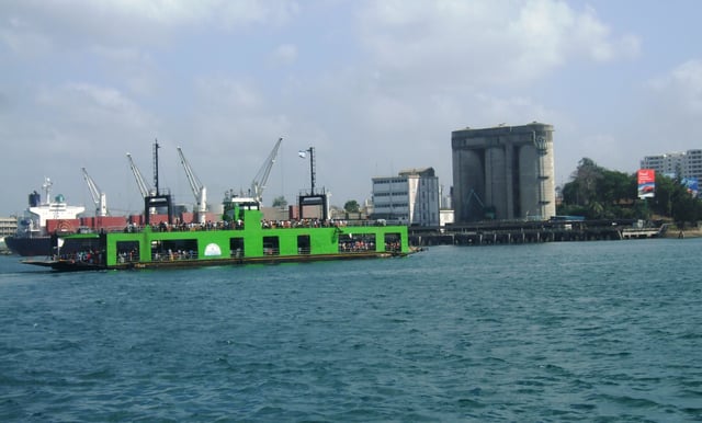
Mombasa Waterfront with ferry
Ferry
There is no bridge between Mombasa Island and south coast, instead the distance is served by ferries operated by the Kenya Ferry Service from Kilindini and Mtongwe to Likoni in the south coast of Mombasa. The last major accident occurred in 1994 when a ferry serving Mtongwe route sank killing more than 270 people.[31]
As a result of increases in more luxurious hotels at the South Coast and a lack of a direct bridge linking the South Coast to Mombasa island, visiting tourists have the option of flying directly from Nairobi into the South Coast airstrip at Ukunda.
The Dongo Kundu Bypass Highway is currently (2018) under construction. With a total of three bridges, it will finally connect the mainland to the south coast easing the burden on the ferry services.
Education
The city has a campus of Kenyatta University.
Places of worship
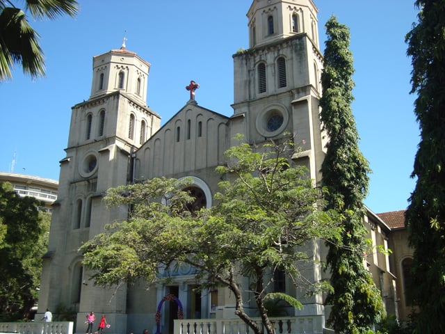
Holy Ghost Cathedral, Roman Catholic Archdiocese of Mombasa
Among the places of worship, they are predominantly Christian churches and temples : Roman Catholic Archdiocese of Mombasa (Catholic Church), Anglican Church of Kenya (Anglican Communion), Presbyterian Church of East Africa (World Communion of Reformed Churches), Baptist Convention of Kenya (Baptist World Alliance), Assemblies of God.[32] There are also Muslim mosques. [33][34]
Culture
A major cultural hub in Kenya and the African Great Lakes, Mombasa's proximity to Zanzibar, Nairobi and the Indian subcontinent, as well as its large shipping and maritime industries gives it a diverse mosaic of cultures. Music is a main feature of Mombasa's culture.
Music
Taarab music, which originates from Zanzibar, has a prominent local presence.[35] Styles of music native to Mombasa include the smooth and mellow Bango, fast-paced Chakacha and traditional Mwanzele.
Musicians of note are Mombasa Roots, Safari Sounds, Them Mushrooms, Anwar Juma Bhalo and Princess Farida. Mombasa has been the home or base for former greats like Fundi Konde, known for his song "Tausi"; Fadhili Williams and Grand Charo, famous for the song "Malaika"; Sal Davies; Malika Mohammed; Stara Butte; Juma Bhalo. Contemporary hip-hop fusion artistes are Susumila, Majizee, Nyota Ndogo, Cannibal (musician), Sharama and Ukoo Flani super group which once could boast up to 40 rappers.
Recently, hip hop, reggae, soul, blues, salsa and (among the Indian community) bhangra have become popular, especially amongst the youth. Mombasa is mainly a tourism centre populated by hundreds of entertainment spots of all categories from night clubs, bars, hotels, fancy restaurants and many more. It has the most vibrant night life in Kenya catering to the mainly tourist population.
Sports
Currently, Mombasa is represented in the Kenyan Premier League by Bandari F.C, which plays at the Mbaraki Sports Grounds. Also, the Congo United FC, Promoted and dropped in 2011, are in the second tier Nationwide Super League with 4 other hometown clubs – Admiral F.C.; Magongo Rangers; Sparki Youth and Coast United.[36] Derbies between Mombasa teams have become intriguing affairs recently.[37] Another team, Coast Stars, was relegated several years ago from the league. The only Mombasa-based team to win the league is Feisal F.C., the 1965 champions. Kiziwi leopards was a popular team in the 1980s as was Mombasa Wanderers decades before. There are several cricket teams in Mombasa. One of them is Mombasa Sports Club (MSC), whose ground was given ODI status in 2006. MSC has also a rugby union team playing in the Kenya Cup League, the premier rugby competition in Kenya. Mvita XI men and MSC ladies represent Mombasa in Kenyan field hockey leagues.
Mombasa is represented in the nationwide rugby league by Mombasa RFC. The city is also host to a leg of the national rugby sevens circuit, being one of only six city hosts. The Mombasa leg is referred to as the Driftwood sevens, and the annual tournament is extremely popular, attracting thousands of fans from across the country.
The 2007 World Cross Country Championships were held in Mombasa. Mombasa Marathon is competed annually in Mombasa. The town also hosts the biennial classic edition of Safari Rally and annually a Kenya National Rally Championship round.
Scuba diving takes place mostly within the Mombasa Marine National Park and Reserve, which is managed and maintained by Kenya Wildlife Service. The park has a length of about 8 km (5.0 mi).
Twin towns – sister cities
| Country | City | County/district/province/region/state | Date |
|---|---|---|---|
| Seattle | Washington | 6 April 1981[39] | |
| Long Beach | California | 20 November 2007 | |
| Charlotte Amalie**** | United States Virgin Islands | unknown | |
| Honolulu | Hawaii | 2008 | |
| eThekwini | KwaZulu-Natal | 20 February 2012 | |
| Bergen | Hordaland | unknown | |
| Lianyungang | Jiangsu | unknown | |
| Fuzhou | Fujian | unknown |
Notable residents
During its history, Mombasa was visited by numerous pioneers of the maritime exploration, such as the Arabs Al Idrissi (1151) and Ibn Battuta (1330), the Chinese Zheng He (1413) or the Portuguese Vasco da Gama (1498), Pedro Álvares Cabral (1500) João da Nova (1505) and Afonso de Albuquerque (1507).
Abdilatif Abdalla, writer, university professor and political protestor
Karen Blixen, Danish novelist
Mercedes Iman Diamonds, drag queen and contestant on the eleventh season of RuPaul's Drag Race
Timothy R. McClanahan, marine ecologist who lived and has worked in Mombasa since 1991[40]
Swaleh Nguru, Arab businessman, conservationist and philanthropist
Thomas Risley Odhiambo, entomologist[41]
Ayub Ogada, musician, singer and composer known for having composed two songs for the movie The Constant Gardener[42]
Fadhili William, musician, singer, and composer[43]

