Hardine
Hardine

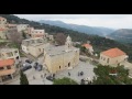
YouTube - Drone shot of Hardine (credit G.E.G.

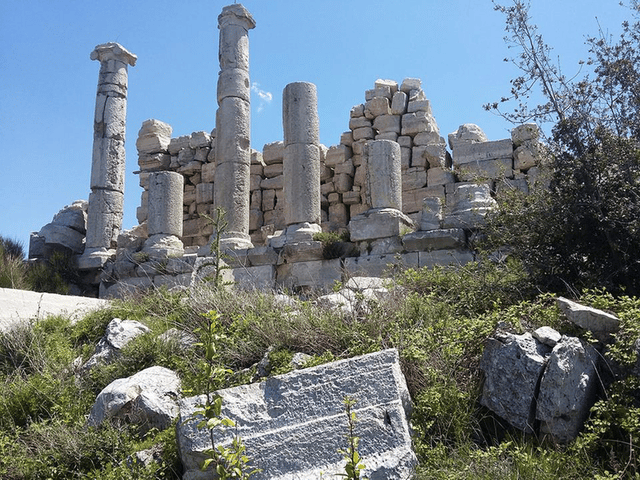
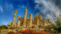
Temple of Mercury, Hardine (credit Lebanon Untravelled)

Hardine Mercury Temple (credit Lebanon Untravelled)

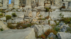
Hardine temple foundations (credit Lebanon Untravelled)
The terrain around Hardine is mainly hilly, but east it is mountainous.
[4] [a] The highest point nearby is Qornet Maaboûr el Hdîd, 1,870 meters above sea level, 4.0 kilometers southeast.
[4] [b] The nearest larger community is Zgharta, 18.1 kilometers north.
In the area around there are unusually many named water springs, caves and rock formations.
[4] [c] The surroundings around Hardine are essentially an open bush landscape.
[5] Around Hardine, it is quite densely populated, with 172 inhabitants per square kilometer.
[6] Mediterranean climate prevails in the area.
[7] The annual average temperature is 11 ° C. The warmest month is July, when the average temperature is 25 ° C and the coldest is January at -4 ° C. [8] The average annual average is 807 millimeters.
The most rainy month is January, with an average of 195 mm rainfall, and the driest is August, with 1 mm rainfall.
Archaeology
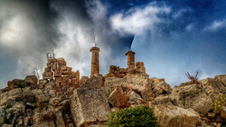
On a peak in Hardine, there is an ancient temple dedicated to Mercury, known as Hardine temple (known locally as Qasr Bint el Malek, Qasr Bint al Malek, Qasr Bent el Malek, Kasr Benet el Malek and other variations, meaning "Citadel of the Princess" or "Palace of the King's daughter" ) that is considered to have been dedicated to Mercury with a wider complex of archaeological sites surrounding.
Ghadban studied an epigraphical inscription from the southwest quarries in 1978
with the initials "MER" and a star.
Julien Aliquot noted the site as a "Romanesque shrine" a summit and ancient quarr.ies to the southeast and southwest, on the right bank of the Nahr el-Jaouz on the spur of Qorn Hardine (or Qorn Niha) with other, unidentified, undated constructions around the site.
In the northwest corner, a walll passes under the southwest side of the perbola that could belong to an anterior building of the Roman temple and enclosure.
Buildings in the southeast corner that were attributed to a medieval church or monastery have been cleared.
200 meters south, there is a hill facing the site with a 5.7 x 5 meter, rectangular plan, that has arbitrarily been identified as an altar dating to the Hellenistic period.
Aliquot further recorded the peribolus wall of the sanctuary preserved on the southwest and southeast sides, delineating a temenos that opens to the southwest.
The temenos measures 60 x 63 meters with a median axis following a direction northeast / southwest.
The southeast corner merges with a rock on the edge of the precipice.
The podium was 16.8 x 27.9 meters and had a peripteral, pseudo-dipteran and iconic plan that was surrounded by a double row of six columns on the front, six on the back and eleven columns on the sides.
The platform of the adyton has an integrated staircase to the cella.
Lebanon Untravelled suggest Hardine means "Pious" in Syriac and understood the meaning to be "Witness of justice, ardent in faith and square of religion", “Hardine, the Rock of faith and religion”, “The first village to know Christianity in the Mount of Lebanon” and “The first to be mentioned among the villages”. Lebanon Untravelled suggest the temple is known as the "Roman Palace of Hardine" and dates to the time of Emperor Hadrian (117-138 AD).