Johannesburg
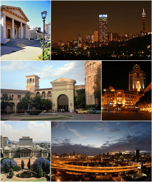
Johannesburg

Johannesburg eGoli(Zulu, Xhosa) | |
|---|---|
| City of Johannesburg | |
| Nickname(s): Jo'burg; Jozi;Muḓi Mulila Ngoma(Venda version),Joni(Tsonga version); Egoli ("Place of Gold");[1] Gauteng ("Place of Gold") | |
| Motto(s): "Unity in development"[2] | |
| Coordinates:26°12′16″S 28°2′44″E [125] | |
| Country | South Africa |
| Province | Gauteng |
| Municipality | City of Johannesburg |
| Established | 1886[3] |
| Government | |
| • Type | Metropolitan municipality |
| • Mayor | Herman Mashaba (DA) |
| Area | |
| • City | 334.81 km2(129.27 sq mi) |
| • Urban | 3,357 km2(1,296 sq mi) |
| Elevation | 1,753 m (5,751 ft) |
| Population (2019)[6] | |
| • City | 5,635,127 |
| • Density | 17,000/km2(44,000/sq mi) |
| • Urban | 8,000,000 |
| • Urban density | 2,400/km2(6,200/sq mi) |
| • Metro | 10,500,500 |
| Racial makeup (2019) | |
| • Black African | 76.4% |
| • Coloured | 5.3% |
| • Indian/Asian | 4.9% |
| • White | 13.7% |
| • Other | 0.8% |
| First languages (2011) | |
| • English | 31.1% |
| • Zulu | 19.6% |
| • Afrikaans | 12.1% |
| • Xhosa | 5.2% |
| • Other | 31.9% |
| Time zone | UTC+2 (SAST) |
| Postal code (street) | 2001 |
| PO box | 2000 |
| Area code | 011 |
| HDI | |
| GDP | US$76 billion (2014)[9] |
| GDP per capita | US$16,370 (2014)[9] |
| Website | www.joburg.org.za [126] |
Johannesburg (/dʒoʊˈhænɪsbɜːrɡ/, also US: /-ˈhɑːn-/, Afrikaans: [jʊəˈɦanəsbœrχ]; Zulu and Xhosa: eGoli), informally known as Jozi or Jo'burg, is the largest city in South Africa and one of the 50 largest urban areas in the world.[10] It is the provincial capital and largest city of Gauteng, which is the wealthiest province in South Africa.[11] While Johannesburg is not one of South Africa's three capital cities, it is the seat of the Constitutional Court. The city is located in the mineral-rich Witwatersrand range of hills and is the centre of large-scale gold and diamond trade.
The metropolis is an alpha global city as listed by the Globalization and World Cities Research Network. In 2019, the population of the city of Johannesburg was 5,635,127, making it the most populous city in South Africa.[6] In the same year, the population of Johannesburg's urban agglomeration was put at 8,000,000.[6] land area of the municipal city (1,645 km2 or 635 sq mi) is large in comparison with those of other major cities, resulting in a moderate population density of 2,364 per square kilometre (6,120/sq mi).
The city was established in 1886 following the discovery of gold on what had been a farm. The city is commonly interpreted as the modern-day El Dorado due to the extremely large gold deposit found along the Witwatersrand.[12] Within ten years, the population had grown to 100,000 inhabitants.
A separate city from the late 1970s until 1994, Soweto is now part of Johannesburg. Originally an acronym for "South-Western Townships", Soweto originated as a collection of settlements on the outskirts of Johannesburg, populated mostly by native African workers from the gold mining industry. Soweto, although eventually incorporated into Johannesburg, had been separated as a residential area for Blacks, who were not permitted to live in Johannesburg proper. Lenasia is predominantly populated by English-speaking South Africans of Indian descent. These areas were designated as non-white areas in accordance with the segregationist policies of the South African government known as Apartheid.
Johannesburg eGoli(Zulu, Xhosa) | |
|---|---|
| City of Johannesburg | |
| Nickname(s): Jo'burg; Jozi;Muḓi Mulila Ngoma(Venda version),Joni(Tsonga version); Egoli ("Place of Gold");[1] Gauteng ("Place of Gold") | |
| Motto(s): "Unity in development"[2] | |
| Coordinates:26°12′16″S 28°2′44″E [125] | |
| Country | South Africa |
| Province | Gauteng |
| Municipality | City of Johannesburg |
| Established | 1886[3] |
| Government | |
| • Type | Metropolitan municipality |
| • Mayor | Herman Mashaba (DA) |
| Area | |
| • City | 334.81 km2(129.27 sq mi) |
| • Urban | 3,357 km2(1,296 sq mi) |
| Elevation | 1,753 m (5,751 ft) |
| Population (2019)[6] | |
| • City | 5,635,127 |
| • Density | 17,000/km2(44,000/sq mi) |
| • Urban | 8,000,000 |
| • Urban density | 2,400/km2(6,200/sq mi) |
| • Metro | 10,500,500 |
| Racial makeup (2019) | |
| • Black African | 76.4% |
| • Coloured | 5.3% |
| • Indian/Asian | 4.9% |
| • White | 13.7% |
| • Other | 0.8% |
| First languages (2011) | |
| • English | 31.1% |
| • Zulu | 19.6% |
| • Afrikaans | 12.1% |
| • Xhosa | 5.2% |
| • Other | 31.9% |
| Time zone | UTC+2 (SAST) |
| Postal code (street) | 2001 |
| PO box | 2000 |
| Area code | 011 |
| HDI | |
| GDP | US$76 billion (2014)[9] |
| GDP per capita | US$16,370 (2014)[9] |
| Website | www.joburg.org.za [126] |
Etymology
Controversy surrounds the origin of the name. There was quite a number of people with the name "Johannes" who were involved in the early history of the city. Among them is the principal clerk attached to the office of the surveyor-general Hendrik Dercksen, Christiaan Johannes Joubert, who was a member of the Volksraad and was Republic's chief of mining. Another was Stephanus Johannes Paulus Kruger (better known as Paul Kruger), president of the South African Republic (ZAR) from 1883–1900. Johannes Meyer, the first government official in the area is another possibility.
Precise records for the choice of name were lost. Johannes Rissik and Johannes Joubert were members of a delegation sent to England to obtain mining rights for the area. Joubert had a park in the city named after him and Rissik has his name for one of the main streets in the city where the historically important albeit dilapidated Rissik Street Post Office is located.[13][14] The City Hall is also located on Rissik Street.
History
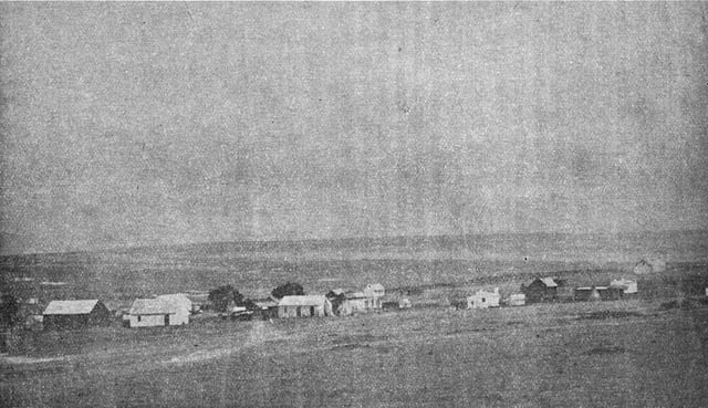
The farm where gold was first discovered in 1886
The region surrounding Johannesburg was originally inhabited by San hunter-gatherers who used stone tools. There is evidence that they lived there up to ten centuries ago.[15] Stone-walled ruins of Sotho–Tswana towns and villages are scattered around the parts of the former Transvaal in which Johannesburg is situated.[16]
By the mid-18th century, the broader region was largely settled by various Sotho–Tswana communities (one linguistic branch of Bantu-speakers), whose villages, towns, chiefdoms and kingdoms stretched from what is now Botswana in the west, to present day Lesotho in the south, to the present day Pedi areas of the Northern Province. More specifically, the stone-walled ruins of Sotho–Tswana towns and villages are scattered around the parts of the former Transvaal province in which Johannesburg is situated.
Many Sotho–Tswana towns and villages in the areas around Johannesburg were destroyed and their people driven away during the wars emanating from Zululand during the late 18th and early 19th centuries (the mfecane or difaqane wars),[17] and as a result, an offshoot of the Zulu kingdom, the Ndebele (often referred to as the Matabele, the name given them by the local Sotho–Tswana), set up a kingdom to the northwest of Johannesburg around modern-day Rustenburg.
Gold rush and naming of the city
The main Witwatersrand gold reef was discovered in June 1884 on the farm Vogelstruisfontein by Jan Gerritse Bantjes that triggered the Witwatersrand Gold Rush and the founding of Johannesburg in 1886. The discovery of gold rapidly attracted people to the area, making necessary a name and governmental organisation for the area. Jan, Johann and Johannes were common male names among the Dutch of that time; two men involved in surveying the area for the best location of the city, Christian Johannes Joubert and Johann Rissik, are considered the source of the name by some. Johannes Meyer, the first government official in the area is another possibility. Precise records for the choice of name were lost.[18] Within ten years, the city of Johannesburg included 100,000 people.[19]
In September 1884, the Struben brothers discovered the Confidence Reef on the farm Wilgespruit near present-day Roodepoort, which further boosted excitement over gold prospects.[20] [] The first gold to be crushed on the Witwatersrand was the gold-bearing rock from the Bantjes mine crushed using the Struben brothers stamp machine. Also, news of the discovery soon reached Kimberley and directors Cecil Rhodes with Sir Joseph Robinson rode up to investigate rumours for themselves. They have guided to the Bantjes camp with its tents strung out over several kilometres and stayed with Bantjes for two nights.
In 1884, they purchased the first pure refined gold from Bantjes for £3,000. Incidentally, Bantjes had since 1881 been operating the Kromdraai Gold Mine in the Cradle of Humankind together with his partner Johannes Stephanus Minnaar where they first discovered gold in 1881, and which also offered another kind of discovery - the early ancestors of all mankind. Some report Australian George Harrison as the first to make a claim for gold in the area that became Johannesburg, as he found gold on a farm in July 1886. He did not stay in the area.[21]
Gold was earlier discovered some 400 kilometres (249 miles) to the east of present-day Johannesburg, in Barberton. Gold prospectors soon discovered the richer gold reefs of the Witwatersrand offered by Bantjes. The original miners' camp, under the informal leadership of Col Ignatius Ferreira, was located in the Fordsburg dip, possibly because the water was available there, and because of the site's proximity to the diggings. Following upon the establishment of Johannesburg, the area was taken over by the Transvaal government who had it surveyed and named it Ferreira's Township, today the suburb of Ferreirasdorp. The first settlement at Ferreira's Camp was established as a tented camp and which soon reached a population of 3,000 by 1887.[19] The government took over the camp, surveyed it and named it Ferreira's Township.[22] By 1896, Johannesburg was established as a city of over 100,000 inhabitants, one of the fastest growth cities ever.[19]
Mines near Johannesburg are among the deepest in the world, with some as deep as 4,000 metres (13,000 ft).[23]
Rapid growth, Jameson Raid and the Second Boer War
Like many late 19th-century mining towns, Johannesburg was a rough and disorganised place, populated by white miners from all continents, African tribesmen recruited to perform unskilled mine work, African women beer brewers who cooked for and sold beer to the black migrant workers, a very large number of European prostitutes, gangsters, impoverished Afrikaners, tradesmen, and Zulu "AmaWasha", Zulu men who surprisingly dominated laundry work.[24] As the value of control of the land increased, tensions developed between the Boer-dominated Transvaal government in Pretoria and the British, culminating in the Jameson Raid that ended in fiasco at Doornkop in January 1896. In the Second Boer War (1899–1902) saw British forces under Field Marshal Frederick Sleigh Roberts, 1st Earl Roberts, occupy the city on 30 May 1900 after a series of battles to the south-west of its then-limits, near present-day Krugersdorp.
During the war, many African mineworkers left Johannesburg creating a labour shortage, which the mines ameliorated by bringing in labourers from China, especially southern China. After the war, they were replaced by black workers, but many Chinese stayed on, creating Johannesburg's Chinese community, which during the apartheid era, was not legally classified as "Asian", but as "Coloured". The population in 1904 was 155,642, of whom 83,363 were Whites.[27]
Post-Union history
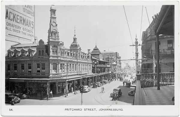
Pritchard Street c. 1940
In 1917, Johannesburg became the headquarters of the Anglo-American Corporation founded by Ernest Oppenheimer which ultimately became one of the world's largest corporations, dominating both gold-mining and diamond-mining in South Africa. Major building developments took place in the 1930s, after South Africa went off the gold standard. In the late 1940s and early 1950s, Hillbrow went high-rise. In the 1950s and early 1960s, the apartheid government constructed the massive agglomeration of townships that became known as Soweto. New freeways encouraged massive suburban sprawl to the north of the city. In the late 1960s and early 1970s, tower blocks (including the Carlton Centre and the Southern Life Centre) filled the skyline of the central business district.
Under the system of apartheid (Afrikaans for "apartness"), a comprehensive system of racial segregation was imposed on South Africa starting in 1948. The economy of Johannesburg depended upon hundreds of thousands of cheap black workers who performed most of the semi-skilled and unskilled work, and which forced the government to make some exceptions to apartheid in order to keep Johannesburg functioning as South Africa's economic capital.[28] In the 1950s, the government began a policy of building townships for blacks outside of Johannesburg to provide workers for Johannesburg.[28] Soweto, a township founded for black workers coming to work in the gold mines of Johannesburg, was intended to house 50,000 people, but soon was the home of ten times that number as thousands of rural blacks came to Johannesburg.[29] It was estimated in 1989 that the population of Soweto was equal to that of Johannesburg, if not greater.[29]
In March 1960, Johannesburg witnessed widespread demonstrations against apartheid in response to the Sharpeville massacre.[30] In July 1963, the South African Police raided a house in the Johannesburg suburb of Rivonia where nine members of the banned African National Congress (ANC) were arrested on charges of planning sabotage.[29] The nine arrested included one Indo-South African, two whites and six blacks, one of whom was the future president Nelson Mandela.[31] At their trial, the accused freely admitted that they were guilty of what they were charged with, namely of planning to blow up the hydro-electric system of Johannesburg to shut down the gold mines, but Mandela argued to the court that the ANC had tried non-violent resistance to apartheid and failed, leaving him with no other choice.[31] The trial made Mandela into a national figure and a symbol of resistance to apartheid.[31]
On 16 June 1976, demonstrations broke out in Soweto over a government decree that black school-children be educated in Afrikaans instead of English, and after the police fired on the demonstrations, rioting against apartheid began in Soweto and spread into the greater Johannesburg area.[32] About 575 people, the majority of whom were black, were killed in the Soweto uprising of 1976.[30] Between 1984–86, South Africa was in turmoil as a series of nationwide protests, strikes and riots took place against apartheid, and the black townships around Johannesburg were scenes of some of the fiercest struggles between the police and anti-apartheid demonstrators.[33]
The central area of the city underwent something of a decline in the 1980s and 1990s, due to the high crime rate and when property speculators directed large amounts of capital into suburban shopping malls, decentralised office parks, and entertainment centres. Sandton City was opened in 1973, followed by Rosebank Mall in 1976, and Eastgate in 1979.[34]
On 12 May 2008, a series of riots started in the township of Alexandra, in the north-eastern part of Johannesburg, when locals attacked migrants from Mozambique, Malawi and Zimbabwe, killing two people and injuring 40 others. These riots sparked the xenophobic attacks of 2008.[35]
A completely refurbished Soccer City stadium in Johannesburg hosted the 2010 FIFA World Cup final.
Redevelopment of industrial heritage
The redevelopment of Newtown was inevitable and part of the reason why the City and heritage bodies decided to keep the façades of the old buildings and apportion new meaning to it was that part of the identity of the area was forged in the old buildings. It was known throughout its redevelopment as the Newtown cultural precinct it was therefore important to stage, old renovated buildings as the setting of the new precinct. Demolishing the old structures and replacing them with new buildings would not have achieved the same effect. Everyone played their part in the marketing, branding and the new identity of the precinct, the City, heritage bodies, heritage practitioners, private companies all played a part. The old warehouse industrial buildings that once lay decaying in Newtown are now synonymous with culture and flair.
Like many cities around the world, there is an increasing focus on the rejuvenation of the inner city of Johannesburg. One of these initiatives is the Maboneng District located on the south-eastern side of the CBD. Originally a hub for art, it has expanded to include restaurants, entertainment venues and retail stores as well as accommodation and hotels. Maboneng calls itself "a place of inspiration – a creative hub, a place to do business, a destination for visitors and a safe, integrated community for residents. A beacon of strength in Africa's most economically prosperous city".[36]
After being destroyed in 2008 to make way for a motor showroom by Imperial Holdings, the iconic Rand Steam Laundries are now being redeveloped as an exact replica, by the order of the Johannesburg Heritage Council. Apart from one filtration shed, there is nothing left on the site after being destroyed. The site will consist of a 5,000 m2 (54,000 sq ft) precinct.[37][38]
Geography
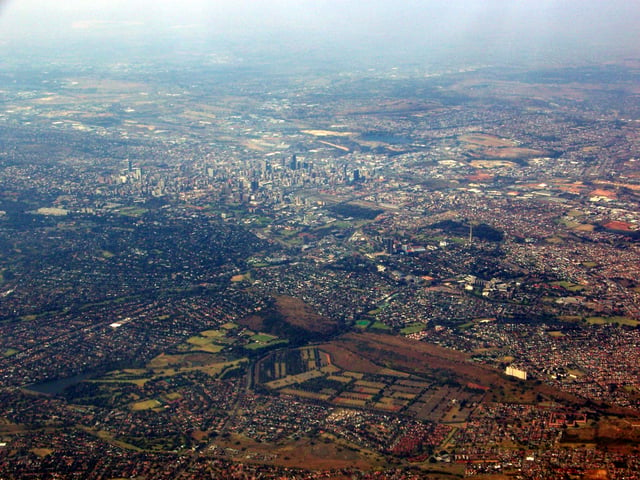
January 2008 Johannesburg aerial view looking towards the south-east
Johannesburg is located in the eastern plateau area of South Africa known as the Highveld, at an elevation of 1,753 metres (5,751 ft). The former Central Business District is located on the southern side of the prominent ridge called the Witwatersrand (English: White Water's Ridge) and the terrain falls to the north and south. By and large the Witwatersrand marks the watershed between the Limpopo and Vaal rivers as the northern part of the city is drained by the Jukskei River while the southern part of the city, including most of the Central Business District, is drained by the Klip River. The north and west of the city has undulating hills while the eastern parts are flatter.
Johannesburg may not be built on a river or harbour, but its streams contribute to two of southern Africa's mightiest rivers – the Limpopo and the Orange. Most of the springs from which many of these streams emanate are now covered in concrete and canalised, accounting for the fact that the names of early farms in the area often end with "fontein", meaning "spring" in Afrikaans. Braamfontein, Rietfontein, Zevenfontein, Doornfontein, Zandfontein and Randjesfontein are some examples. When the first white settlers reached the area that is now Johannesburg, they noticed the glistening rocks on the ridges, running with trickles of water, fed by the streams – giving the area its name, the Witwatersrand, "the ridge of white waters". Another explanation is that the whiteness comes from the quartzite rock, which has a particular sheen to it after rain.[39]
The site was not chosen solely for its streams, however. One of the main reasons the city was founded where it stands today was because of the gold. Indeed, the city once sat near massive amounts of gold, given that at one point the Witwatersrand gold industry produced forty per cent of the planet's gold.[40]
Climate
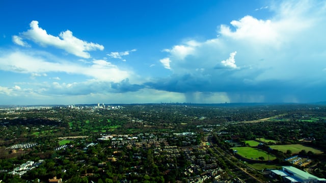
An aerial photograph of summer rain clouds over Johannesburg. The city's climate experiences regular daily thunderstorms from November to March in the afternoons.
Johannesburg is situated on the highveld plateau, and has a subtropical highland climate (Köppen Cwb). The city enjoys a sunny climate, with the summer months (October to April) characterised by hot days followed by afternoon thundershowers and cool evenings, and the winter months (May to September) by dry, sunny days followed by cold nights.[41] Temperatures in Johannesburg are usually fairly mild due to the city's high elevation, with an average maximum daytime temperature in January of 25.6 °C (78.1 °F), dropping to an average maximum of around 16 °C (61 °F) in June. The UV index for Johannesburg in summers is extreme, often reaching 14–16 due to the high elevation and its location in the subtropics.[42]
Winter is the sunniest time of the year, with mild days and cool nights, dropping to 4.1 °C (39.4 °F) in June and July. The temperature occasionally drops to below freezing at night, causing frost. Snow is a rare occurrence, with snowfall having been experienced in the twentieth century during May 1956, August 1962, June 1964 and September 1981. In the 21st century, there was light sleet in 2006, as well as snow proper on 27 June 2007 (accumulating up to 10 centimetres or 4 inches in the southern suburbs)[43] and 7 August 2012.[44]
Regular cold fronts pass over in winter bringing very cold southerly winds but usually clear skies. The annual average rainfall is 713 millimetres (28.1 in), which is mostly concentrated in the summer months. Infrequent showers occur through the course of the winter months. The lowest nighttime minimum temperature ever recorded in Johannesburg is −8.2 °C (17.2 °F), on 13 June 1979. The lowest daytime maximum temperature recorded is 1.5 °C (34.7 °F), on 19 June 1964.[45]
| Climate data for Johannesburg (1961–1990. extremes 1951–1990) | |||||||||||||
|---|---|---|---|---|---|---|---|---|---|---|---|---|---|
| Month | Jan | Feb | Mar | Apr | May | Jun | Jul | Aug | Sep | Oct | Nov | Dec | Year |
| Record high °C (°F) | 41.4 (106.5) | 33.5 (92.3) | 31.9 (89.4) | 29.3 (84.7) | 26.4 (79.5) | 23.1 (73.6) | 24.4 (75.9) | 26.2 (79.2) | 30.0 (86.0) | 32.2 (90.0) | 38.5 (101.3) | 39.4 (102.9) | 41.4 (106.5) |
| Mean maximum °C (°F) | 30.2 (86.4) | 29.1 (84.4) | 28.0 (82.4) | 25.5 (77.9) | 23.0 (73.4) | 20.4 (68.7) | 21.1 (70.0) | 24.4 (75.9) | 28.4 (83.1) | 29.4 (84.9) | 29.5 (85.1) | 29.8 (85.6) | 31.4 (88.5) |
| Average high °C (°F) | 25.6 (78.1) | 25.1 (77.2) | 24.0 (75.2) | 21.1 (70.0) | 18.9 (66.0) | 16.0 (60.8) | 16.7 (62.1) | 19.4 (66.9) | 22.8 (73.0) | 23.8 (74.8) | 24.2 (75.6) | 25.2 (77.4) | 21.9 (71.4) |
| Daily mean °C (°F) | 19.5 (67.1) | 19.0 (66.2) | 18.0 (64.4) | 15.3 (59.5) | 12.6 (54.7) | 9.6 (49.3) | 10.0 (50.0) | 12.5 (54.5) | 15.9 (60.6) | 17.1 (62.8) | 17.9 (64.2) | 19.0 (66.2) | 15.5 (59.9) |
| Average low °C (°F) | 14.7 (58.5) | 14.1 (57.4) | 13.1 (55.6) | 10.3 (50.5) | 7.2 (45.0) | 4.1 (39.4) | 4.1 (39.4) | 6.2 (43.2) | 9.3 (48.7) | 11.2 (52.2) | 12.7 (54.9) | 13.9 (57.0) | 10.1 (50.2) |
| Mean minimum °C (°F) | 11.0 (51.8) | 10.3 (50.5) | 8.5 (47.3) | 4.7 (40.5) | 1.6 (34.9) | −1.9 (28.6) | −1.9 (28.6) | −0.6 (30.9) | 1.8 (35.2) | 4.7 (40.5) | 7.3 (45.1) | 9.5 (49.1) | −3.1 (26.4) |
| Record low °C (°F) | 7.2 (45.0) | 6.0 (42.8) | 2.1 (35.8) | 0.5 (32.9) | −2.5 (27.5) | −8.2 (17.2) | −5.1 (22.8) | −5.0 (23.0) | −3.3 (26.1) | 0.2 (32.4) | 1.5 (34.7) | 3.5 (38.3) | −8.2 (17.2) |
| Average precipitation mm (inches) | 125 (4.9) | 90 (3.5) | 91 (3.6) | 54 (2.1) | 13 (0.5) | 9 (0.4) | 4 (0.2) | 6 (0.2) | 27 (1.1) | 72 (2.8) | 117 (4.6) | 105 (4.1) | 713 (28.1) |
| Average precipitation days(≥ 0.1 mm) | 15.9 | 11.2 | 11.9 | 8.6 | 2.9 | 2.0 | 1.0 | 2.1 | 3.8 | 9.8 | 15.2 | 14.9 | 99.3 |
| Average relative humidity (%) | 69 | 70 | 68 | 65 | 56 | 53 | 49 | 46 | 47 | 56 | 65 | 66 | 59 |
| Mean monthly sunshine hours | 250.1 | 224.8 | 238.8 | 236.9 | 276.0 | 266.9 | 283.9 | 284.1 | 280.8 | 269.5 | 248.7 | 263.9 | 3,124.4 |
| Source #1: World Meteorological Organization,[46] NOAA[47] | |||||||||||||
| Source #2: South African Weather Service[48] | |||||||||||||
Demographics

Geographical distribution of home languages in Johannesburg Afrikaans English Ndebele Xhosa Zulu Northern Sotho Sotho Tswana Venda Tsonga No language dominant
According to the 2011 South African National Census, the population of Johannesburg is 4,434,827 people,[53] making it the most populous city in South Africa (it has been the most populous city in South Africa since at least the 1950s).[54][55] From the 2001 census, the people live in 1,006,930 formal households, of which 86% have a flush or chemical toilet, and 91% have refuse removed by the municipality at least once a week. 81% of households have access to running water, and 80% use electricity as the main source of energy. 29% of Johannesburg residents stay in informal dwellings.[56] 66% of households are headed by one person.
Blacks account for 73% of the population, followed by whites at 18%, coloureds at 6% and Asians at 4%. 42% of the population is under the age of 24, while 6% of the population is over 60 years of age. 37% of city residents are unemployed. 91% of the unemployed are Black African. Women comprise 43% of the working population. 19% of economically active adults work in wholesale and retail sectors, 18% in financial, real estate and business services, 17% in the community, social and personal services and 12% are in manufacturing. Only 0.7% work in mining.
32% of Johannesburg residents speak Nguni languages at home, 24% speak Sotho languages, 18% speak English, 7% speak Afrikaans and 6% speak Tshivenda. 29% of adults have graduated from high school. 14% have higher education (University or Technical school). 7% of residents are completely illiterate. 15% have primary education.
34% use public transportation to commute to work or school. 32% walk to work or school. 34% use private transportation to travel to work or school.
53% belong to mainstream Christian churches, 24% are not affiliated with any organised religion, 14% are members of African Independent Churches, 3% are Muslim, 1% are Jewish and 1% are Hindu.
2011 demographic statistics:[59]
Area: 334.81 square kilometres (129.27 sq mi)
Population: 957,441: 2,859.68 inhabitants per square kilometre (7,406.5/sq mi)
Households: 300,199: 896.63 per square kilometre (2,322.3/sq mi)
| Gender | Population | % |
|---|---|---|
| Female | 473,148 | 49.42 |
| Male | 484,293 | 50.58 |
| Race | Population | % |
|---|---|---|
| Black African | 614,793 | 64.21 |
| White | 133,379 | 13.93 |
| Coloured | 133,029 | 13.89 |
| Asian | 63,918 | 6.68 |
| Other | 12,320 | 1.29 |
| First language | Population | % |
|---|---|---|
| Zulu | 178,775 | 19.60 |
| Sotho | 41,113 | 4.51 |
| Xhosa | 47,714 | 5.23 |
| Afrikaans | 110,430 | 12.11 |
| Tswana | 37,405 | 4.10 |
| Sepedi | 40,562 | 4.45 |
| English | 284,094 | 31.14 |
| Tsonga | 29,922 | 3.28 |
| Swazi | 7,720 | 0.85 |
| Venda | 17,603 | 1.93 |
| Ndebele | 45,192 | 4.95 |
| Other | 68,185 | 7.47 |
Johannesburg's urban agglomeration spreads well beyond the administrative boundary of the municipality. The population of the whole area has been estimated to be variously at 7,860,781 in 2011 by "citypopulation.de",[5] or 9,115,000 in 2018 by Demographia (for "Johannesburg-East Rand", 41st highest in the world).[60]
The area of this urban agglomeration was put by Demographia to be 2,590 km², 31st largest in the world.[60]
Suburbs
Johannesburg's suburbs are the product of urban sprawl and are regionalised into north, south, east and west, and they generally have different personalities.[62] While the Central Business District and the immediate surrounding areas were formerly desirable living areas, the spatial accommodation of the suburbs has tended to see a flight from the city and immediate surrounds. The inner city buildings have been let out to the lower income groups and illegal immigrants and as a result abandoned buildings and crime have become a feature of inner city life. The immediate city suburbs include Yeoville, a hot spot for black nightlife despite its otherwise poor reputation. The suburbs to the south of the city are mainly blue collar neighbourhoods and situated closer to some townships.
The suburbs to the west have in recent years floundered with the decline of the mining industry but have in some cases experienced some revival with properties being bought up by the local African middle class. The biggest sprawl lies to the east and north. The eastern suburbs are relatively prosperous and close to various industrial zones. The northern suburbs have been the recipient of most of the flight from the inner city with the city starting to sprawl northwards and multiple secondary CBDs forming in the north towards Pretoria.
Traditionally the northern and north-western suburbs have been the centre for the wealthy, containing the high-end retail shops as well as several upper-class residential areas such as Hyde Park, Sandhurst, Northcliff, Hurlingham, Bryanston and Houghton, where Nelson Mandela made his home. The north-western area, in particular, is vibrant and lively, with the mostly black suburb of Sophiatown once the centre of political activity and the Bohemian-flavoured Melville featuring restaurants and nightlife. Auckland Park is home to the headquarters of the South African Broadcasting Corporation, AFDA (The South African School of Motion Picture and Live Performance) and the University of Johannesburg.
To the southwest of the city centre is Soweto, a township constructed during apartheid for housing displaced black South Africans then living in areas designated for white settlement. To the south of Johannesburg is Lenasia, a predominantly Asian neighbourhood which was constructed during apartheid specifically to house Asians. Closer to Alexandria communities like Glenazel and Norwood have been integral in the urban landscape of Johannesburg.
Places of worship
Among the places of worship, they are predominantly Christian churches and temples : Zion Christian Church, Apostolic Faith Mission of South Africa, Assemblies of God, Baptist Union of Southern Africa (Baptist World Alliance), Methodist Church of Southern Africa (World Methodist Council), Anglican Church of Southern Africa (Anglican Communion), Presbyterian Church of Africa (World Communion of Reformed Churches), Roman Catholic Archdiocese of Johannesburg (Catholic Church).[63] There are also Muslim mosques and Hindu temples.
Cityscape
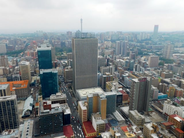
Johannesburg Central Business District
The city is often described as Africa's economic powerhouse, and contentiously as a modern and prosperous African city.[64] Johannesburg, like many metropolises, has more than one central business district (CBD), including, but not limited to, Sandton, Rosebank and Roodepoort in addition to the original CBD. Some tend to include Benoni and Germiston as well.
Due to its many different central districts, Johannesburg would fall under the multiple nuclei model in human geography terms. It is the hub of South Africa's commercial, financial, industrial, and mining undertakings. Johannesburg is part of a larger urban region. It is closely linked with several other satellite towns. Randburg and Sandton form part of the northern area. The east and west ridges spread out from central Johannesburg. The Central Business District covers an area of 6 square kilometres (2 sq mi). It consists of closely packed skyscrapers such as the Carlton Centre, Marble Towers, Trust Bank Building, Ponte City Apartments, Southern Life Centre and 11 Diagonal Street.[65]
Johannesburg's city centre retains its elements of a rectangular grid pattern that was first officially recorded in 1886.[40] Streets are narrow and filled with high rises built in the mid- to late 1900s. Old Victorian-era buildings first built in the late 1800s have been torn down long ago.[40] The 1900s brought along with it the introduction of many different architectural styles and structures. The Johannesburg Art Gallery and Supreme Court Building being two examples. These were important Beaux-Arts structures, with the style put in place by (at the time) colonial parent, the British Empire.[40] South Africa didn't borrow architectural techniques exclusively from Britain, however. They were also inspired by American models and styles, having built several structures like the ESKOM Building and the Corner House to emulate the prowess of New York City, located in the United States.[40]
Architecture
Johannesburg is home to some of Africa's tallest structures, such as the Sentech Tower, Hillbrow Tower, the Carlton Centre and Ponte City Apartments. The Johannesburg city skyline has most of the tallest buildings on the continent and contains most international organisations such as IBM, Absa, BHP Billiton, Willis Group, First National Bank, Nedbank and Standard Bank. Many of the city's older buildings have been demolished and more modern ones built in their place. North of the CBD is Hillbrow, the most densely populated residential area in southern Africa. Northwest of the CBD is Braamfontein, a secondary CBD housing many offices and business premises. The CBD is predominated by four styles of architecture, being Victorian Colonial, Edwardian Baroque, Art Deco and Modernism.
Parks and gardens
Parks and gardens in Johannesburg are maintained by Johannesburg City Parks and Zoo.[66] City Parks is also responsible for planting the city's many green trees, making Johannesburg one of the 'greenest' cities in the world. It has been estimated that there are six million trees in the city with the number growing every year – 1.2 million on pavements and sidewalks, and a further 4.8 million in private gardens.[67] City Parks continues to invest in planting trees, particularly those previously disadvantaged areas of Johannesburg which were not positive beneficiaries of apartheid Johannesburg's urban planning.
Johannesburg Botanical Garden, located in the suburb of Emmarentia, is a popular recreational park.
Transport
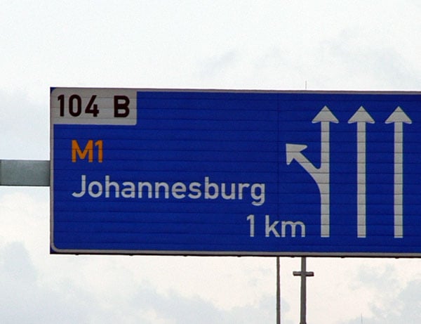
A board on the N3 indicating the exit for Johannesburg. The M1 is one of the busiest highways in Johannesburg.
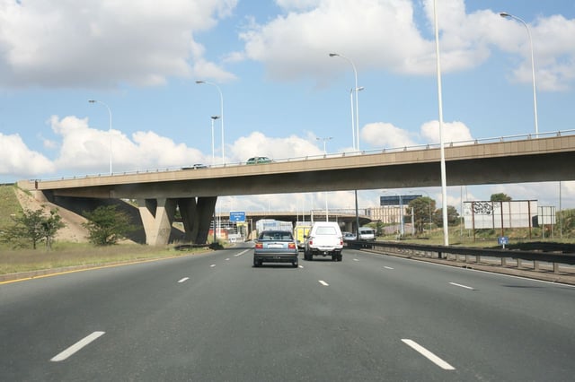
The M2 in the afternoon as it passes through the Central Business District
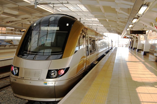
Gautrain station at OR Tambo Airport
Johannesburg is a young and sprawling city, with its public transportation built in its infancy, geared towards private motorists, and lacks a convenient public transportation system. The City though has invested a large percentage of its budget toward an effective integrated public transportation system. A significant number of the city's residents are dependent on the city's informal minibus taxis.
Johannesburg is served principally by OR Tambo International Airport (formerly Johannesburg International Airport and before that Jan Smuts Airport) for both domestic and international flights. Lanseria Airport, located to the north-west of the city and closer to the business hub of Sandton, is used for commercial flights to Cape Town, Durban, Port Elizabeth, Botswana, and Sun City. Other airports include Rand Airport and Grand Central Airport. Rand Airport, located in Germiston, is a small airfield used mostly for private aircraft and the home of South African Airways's first Boeing 747 Classic, the Lebombo, which is now an aviation museum. Grand Central is located in Midrand and also caters to small, private aircraft.
Johannesburg shares a network of metropolitan routes with Krugersdorp and Ekurhuleni.
Johannesburg has two kinds of taxis, metered taxis and minibus taxis. Unlike many cities, metered taxis are not allowed to drive around the city looking for passengers and instead must be called and ordered to a destination. The Gauteng Provincial Government has launched a new metered taxi programme in an attempt to increase the use of metered taxis in the city.
The minibus "taxis" are the de facto standard and essential form of transport for the majority of the population. Since the 1980s The minibus taxi industry has been severely affected by turf wars.[68]
The Metrorail Gauteng commuter rail system connects central Johannesburg to Soweto, Pretoria, and most of the satellite towns along the Witwatersrand. The railways transport huge numbers of commuters every day. However, the Metrorail infrastructure was built in Johannesburg's infancy and covers only the older areas in the city's south. The northern areas, including the business districts of Sandton, Midrand, Randburg, and Rosebank, are served by the rapid rail link Gautrain.
A part of the Gauteng Provincial Government's Blue IQ Project, Gautrain has made provision for a rapid rail link, running north to south, between Johannesburg and Pretoria, and west to east between Sandton and the OR Tambo International Airport. Construction of the Gautrain Rapid Rail started in October 2006 and was completed in June 2012. It consists of a number of underground stations, as well as above-ground stations. Stations on the North-South line include Johannesburg's Park Station (underground), Rosebank (underground), Sandton (underground), Marlboro (above-ground and raised), Midrand, Pretoria Station and Hatfield. There is also a line from the O.R. Tambo International Airport (above-ground and raised) travelling to Sandton via Rhodesfield (raised) and Marlboro. A 200-kilometre expansion is underway and will consist of 3 new lines and 18 new stations, this may sound like an insignificant amount however it is expected to cost R18 billion and one-lines (Soweto Mamalodi) could take 4 years to build, most of the new stations will be in Johannesburg.
The east-west line from the airport to Sandton opened in June 2010 in time for the 2010 FIFA World Cup, while the north–the south line opened on 2 August 2011, except for Park Station, which opened in 2012.
The rail system was designed to alleviate traffic on the N1 freeway between Johannesburg and Pretoria, which records vehicle loads of up to 300,000 per week day.[69] An extensive bus feeder system has also been implemented, which allows access to the main stations from the outer suburbs, but is limited to a five-kilometre radius, which neglects the rest of the suburbs. This is the first new major railway system that has been laid in South Africa since 1977.[70]
Johannesburg is served by a bus fleet operated by Metrobus [127] , a corporate unit of the City of Johannesburg. It has a fleet consisting of approximately 550 single and double-decker buses, plying 84 different routes in the city. This total includes 200 modern buses (150 double-deckers and 50 single-deckers), made by Volvo, Scania AB and Marcopolo/Brasa in 2002. Metrobus' fleet carries approximately 20 million passengers per annum. In addition, there are a number of private bus operators, though most focus on the inter-city routes, or on bus charters for touring groups. The city's main bus terminus is situated in Gandhi Square, where passengers can also obtain information regarding the Metrobus service from the walk-in customer information desk.
In 2010, in order to create an efficient public transport system the Rea Vaya bus rapid system was developed/built. The buses run on their own dedicated bus lanes on the main trunk and complementary routes. The buses also have large feeder routes that run on ordinary roads. The Rea Vaya works on a smartcard payment system, on entering the station or bus the passenger taps his/her smartcard onto the validator/scanner and taps out at the next station with the calculated amount ( calculated according to distance approx $0.5 per 5 km). The routes cover both the southern and northern suburbs with the main trunk route running from Soweto to Sandton and Rosebank, and the feeder and complementary routes covering most of Johannesburg, with the notable exceptions of Midrand and Centurion. A subsequent expansion (phase 1-C;1-D) will cover these areas. In 2017, the Rea Vaya bus rapid transit was recorded to be making huge losses recovering only about 40 per cent of the operating costs and relying heavily on government subsidies.[72]
Roads
The fact that Johannesburg is not near a large navigable body of water has meant that ground transportation has been the most important method of transporting people and goods in and out of the city. One of Africa's most famous "beltways" or ring roads/orbitals is the Johannesburg Ring Road. The road is composed of three freeways that converge on the city, forming a 80-kilometre (50 mi) loop around it: the N3 Eastern Bypass, which links Johannesburg with Durban; the N1 Western Bypass, which links Johannesburg with Pretoria and Cape Town; and the N12 Southern Bypass, which links Johannesburg with Witbank and Kimberley. The N3 was built exclusively with asphalt, while the N12 and N1 sections were made with concrete, hence the nickname given to the N1 Western Bypass, "The Concrete Highway". In spite of being up to 12 lanes wide in some areas, the Johannesburg Ring Road is frequently clogged with traffic. The Gillooly's Interchange, built on an old farm and the point at which the N3 Eastern Bypass and the R24 Airport Freeway intersect, is the busiest interchange in the Southern Hemisphere.[73] It is claimed[73][74] that the N1 is the busiest road in South Africa.
Johannesburg has the most freeways connected to it. It has the N1, N3, N12, N14, N17, R21, R24 and the R59, all leading to Johannesburg. The M1 and M2 freeways were built to direct traffic towards the city centre. These two freeways are congested due to mass urbanisation.
Culture
Johannesburg is home to the National School of Arts, The University of Witwatersrand's School of the Arts and the South African Ballet Theatre,[75][76] as well as the Johannesburg Art Gallery[77] and other prominent cultural landmarks, such as the Mary Fitzgerald Square[75] and numerous other museums, theatres, galleries and libraries.[75]
The Johannesburg City Library is located in the Central Business District of Johannesburg.[78]
Museums and galleries
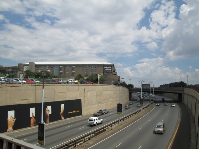
The Origins Centre museum at the University of the Witwatersrand viewed from across the M1
Specialist museums cover subjects such as Africana, costume, design, fossils, geology, military history, medical, pharmacy, photography and transportation networks such as railways. Gold Reef City, a living museum, was originally part of the Crown Mines Complex, where gold was mined to a depth of 3,000 metres (9,800 ft). The Market Theatre stages plays, comedy shows, and musical performances.
The following is a list of some of the museums and galleries that can be found in Johannesburg.[79]
AECI Dynamite Factory Museum
- The AECI Dynamite Factory Museum, housed in the 1895 residence of a mining official, records the history of explosives, with particular emphasis on their use in the mining industry.
Adler Museum of Medicine
- History of Medicine, brainchild of Dr Cyril Adler, was formally inaugurated 1962. The museum's role was to collect and preserve for posterity all material that would illustrate the history of medicine in general and of South Africa in particular.
Apartheid Museum
Constitution Hill, Johannesburg.
Hector Pieterson Museum
James Hall Transport Museum
Johannesburg Art Gallery.
Madiba Freedom Museum
- Named after the former President Mandela's clan, the museums' theme is Mzabalazo and charts South Africa's journey to democracy.
MuseuMAfricA.
Origins Centre Museum
- Located on the campus of theUniversity of the WitwatersrandinBraamfontein,[80] this museum contains some excellent examples of southern African rock art and the origins of humankind.
Bernberg Fashion Museum
- Bernberg Fashion Museum is primarily a museum collection, consisting of objects, and explains why and how clothing has changed and how the fashions of the past influence those of today.
South African National Museum of Military History
Zoology Museum
- The Zoology Museum is the only natural history museum in Johannesburg which is unusual because all the other major cities in South Africa have large public natural history museums. It has retained a unique character as the display specimens are exhibited in finely crafted teak cabinets which allow the viewer to engage directly with scores of objects at close range.
Entertainment and performing arts
Johannesburg hosts many of South Africa's premier music events, such as RAMFest's Johannesburg leg,[81][82][83][84] In The City[85] and many international tours.[86][87][88][89][90][91][92][93] Several critically acclaimed musical acts come from Johannesburg, such as Kongos, Johnny Clegg, Zebra & Giraffe, Man As Machine, The Parlotones, and ShortStraw. The Civic Theatre complex hosts drama, opera and ballet.
Public art
Johannesburg is home to an extensive portfolio of public art. A diverse and evolving city, Johannesburg boasts a vibrant art scene and a variety of works that range from sculptures to murals to pieces by internationally renowned artists like William Kentridge and Gerhard Marx's Fire Walker. Many pieces are developed through community workshops, such as the Vilakazi Street sculptures. Others are functional, such as street furniture found in Hillbrow and the city centre.
Crime
After the Group Areas Act was scrapped in 1991, Johannesburg was affected by urban blight. Thousands of poor black people, who had been forbidden to live in the city proper, moved into the city from surrounding black townships like Soweto and many immigrants from economically beleaguered and war torn African nations flooded into South Africa. Many buildings were abandoned by landlords, especially in high-density areas, such as Hillbrow. Many corporations and institutions, including the stock exchange, moved their headquarters away from the city centre, to suburbs like Sandton.[96]
Reviving the city centre is one of the main aims of the municipal government of Johannesburg. Drastic measures have been taken to reduce crime in the city. These measures include closed-circuit television on street corners. As of 11 December 2008, every street corner in Johannesburg central is under high-tech CCTV surveillance.[97] The CCTV system, operated by the Johannesburg Metropolitan Police Department (JMPD), is also able to detect stolen or hijacked vehicles by scanning the number plates of every vehicle travelling through the Central business district (CBD), then comparing them to the eNaTIS database. The JMPD claims that the average response time by police for crimes committed in the CBD is 60 seconds.[97]
Urban renewal has taken place in once no go zones such as Braamfontein, Newtown, and the CBD. An example is the once gangster paradise Braamfontein now hosting the best rated coffeehouse in the world and Newtown hosting an interactive science museum.
Crime levels in Johannesburg have dropped as the economy has stabilised and begun to grow.[98] Between 2001 and 2006, R9-billion (US$1.2 billion) has been invested in the city centre. Further investment of around R10-billion (US$1.5 billion) is expected in the city centre alone by 2010. This excludes development directly associated with the 2010 FIFA World Cup.[99] In an effort to prepare Johannesburg for the 2010 FIFA World Cup, local government enlisted the help of Rudy Giuliani, former Mayor of New York City, to help bring down the crime rate, as the opening and closing matches of the tournament were played in the city.[100]
Murders in the Johannesburg municipality amounted to 1,697 in 2007 according to the South African Medical Research Council, a rate of 43 per 100.000 inhabitants.[101] In 2016 that number had sharply declined to 29.4 per 100.000 inhabitants, placing the murder rate at more than half of that of Cape Town and even below national average.[102]
Sports
Johannesburg's most popular sports by participation are association football, cricket, rugby union, and running. Early each Sunday morning, tens of thousands of runners gather to take part in informal runs organised by several athletic clubs.
Football
The city has several football clubs in the Premier Soccer League (PSL) and the National First Division. In the PSL, the top Johannesburg teams are all fierce rivals and include Kaizer Chiefs (nicknamed Amakhosi), Orlando Pirates (nicknamed the Buccaneers), Moroka Swallows and Wits University (nicknamed the Clever Boys). They are based at the city's FNB, Orlando, Dobsonville and Bidvest stadiums. Several large-scale league and cup games are played at Soccer City the venue of the 2010 FIFA World Cup final. First Division teams are Jomo Cosmos and FC AK. Katlehong City and Alexandra United, play at Alexandra and Reiger Park stadium respectively.
Cricket
Cricket is one of the more popular sports. In cricket, the Highveld Lions represent Johannesburg, the rest of Gauteng as well as the North West Province at the Wanderers Stadium which was the venue for the 2003 Cricket World Cup Final in which Australia successfully defended their title against India. Wanderers Stadium hosted what many cricket fans consider the greatest ever ODI match in which South Africa successfully chased down 434 runs. They take part in the first class SuperSport Series, the one-day MTN Domestic Championship and the Twenty20 Ram Slam T20 Challenge. Johannesburg also hosted matches from and the final of the 2007 ICC World Twenty20, in which India beat Pakistan in the final.
Rugby
The Lions, formerly the Cats, represent Johannesburg, North West and Mpumalanga in the Southern Hemisphere's Super Rugby competition, which includes teams from South Africa, Australia, Argentina, Japan and New Zealand. The Golden Lions compete in the Currie Cup, which they have won on ten occasions. They are housed at the Ellis Park Stadium, which also hosted the IRB 1995 Rugby World Cup Final, which the South African Springboks defeated the New Zealand All Blacks.
Economy
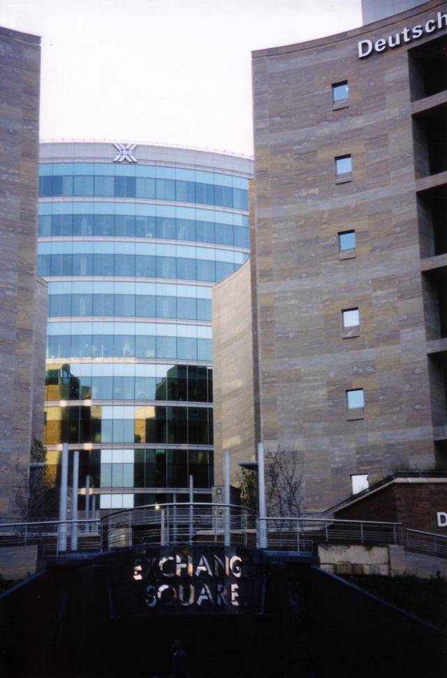
The JSE
Johannesburg is the economic and financial hub of South Africa, producing 16% of South Africa's gross domestic product, and accounts for 40% of Gauteng's economic activity. In a 2008 survey conducted by MasterCard, Johannesburg ranked 47 out of 50 top cities in the world as a worldwide centre of commerce (the only city in Africa).[103]
Mining was the foundation of the Witwatersrand's economy, but its importance is gradually declining due to dwindling reserves and service and manufacturing industries have become more significant to the city's economy. While gold mining no longer takes place within the city limits, most mining companies still have their headquarters in Johannesburg. The city's manufacturing industries extend across a range of areas and there is still a reliance on heavy industries including steel and cement plants. The service and other industries include banking, IT, real estate, transport, broadcast and print media, private health care, transport and a vibrant leisure and consumer retail market. Johannesburg has Africa's largest stock exchange, the JSE although it has moved out of the central business district. Due to its commercial role, the city is the seat of the provincial government and the site of a number of government branch offices, as well as consular offices and other institutions.
The Witwatersrand urban complex is a major consumer of water in a dry region. Its continued economic and population growth has depended on schemes to divert water from other regions of South Africa and from the highlands of Lesotho, the biggest of which is the Lesotho Highlands Water Project, but additional sources will be needed early in the 21st century.
Retail
Johannesburg's largest shopping centres, measured by gross leasable area (GLA, the uniform measure of centre size as determined by the International Council of Shopping Centers) are Sandton City, Eastgate, Mall of Africa, Westgate and Cresta. Melrose Arch is one of its most prestigious. Other centres include Hyde Park Corner, Rosebank, Southgate, The Glen Shopping Centre, Johannesburg South, and Clearwater Mall. There were also plans to build a large shopping centre, known as the Zonk'Izizwe Shopping Resort, in Midrand, but these have been indefinitely delayed due to the opening of Mall of Africa. "Zonk'Izizwe" means "All Nations" in Zulu language, indicating that the centre will cater to the city's diverse mix of peoples and races. Also a complex named Greenstone in Modderfontein has been opened.[104] Cradlestone Mall is a new mall named for its location which is close to the Cradle of Humankind, a World Heritage Site.
Communications and media
The city is home to several media groups which own a number of newspaper and magazine titles. The two main print media groups are Independent Newspapers and Naspers (Media24). The country's electronic media is also headquartered in the greater metropolitan region. Beeld is a leading Afrikaans newspaper for the city and the country, while the Sunday newspaper City Press is the third largest selling newspaper in South Africa.
The Sowetan is one of a number of titles catering for the black market although in recent years it competes against newly arrived tabloids. The Mail & Guardian is an investigative liberal newspaper while The Citizen is a tabloid-style paper, and The Star is a local newspaper that mostly covers Gauteng-related issues. The Sunday Times is the most widely read national Sunday newspaper. True Love is the most widely read women's magazine, catering primarily to the up-and-coming middle class black female market, and published by Media 24. The Times is a national newspaper that covers current issues.
Media ownership is relatively complicated, with a number of cross shareholdings which have been rationalised in recent years, resulting in the movement of some ownership into the hands of black shareholders. This has been accompanied by a growth in black editorship and journalism. Johannesburg has a number of regional radio stations such as YFM, Metro FM, Phalaphala FM, Talk Radio 702, Highveld Stereo now known as 947, 5FM, UJ FM and Kaya FM and Classic FM. The number of radio stations has increased in recent years as the government has sold off frequencies to private companies. Johannesburg is also the headquarters of state-owned broadcaster South African Broadcasting Corporation and pay-broadcast network Multichoice which distributes M-Net and DStv a digital satellite service, while eTV also has a presence in the city. The city has two television towers, the Hillbrow Tower and the Sentech Tower.
Johannesburg has 4 major cellular telecommunications operators: Vodacom, MTN, Cell C, and Telkom Mobile. Vodacom's global headquarters is located in Midrand. It was formed in 1994, just after the South African elections of 1994.[105]
Government
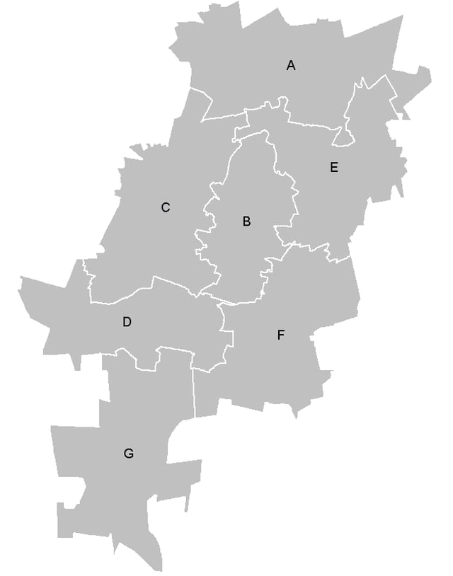
The seven regions of the city
Upon the creation of the Metropolitan Municipality in 2000 the city was subdivided into eleven regions, simply named Region 1 to Region 11. These were reorganized in 2006 into the current seven regions named alphabetically Region A to Region G, as shown on the map (left).[106]
As of 2006 the seven regions are:
Region A: Diepsloot, Kya Sand;
Region B: Randburg, Rosebank, Emmarentia, Greenside, Melville, Northcliff, Rosebank, Parktown, Parktown North;
Region C: Roodepoort, Constantia Kloof, Northgate;
Region D: Doornkop, Soweto, Dobsonville, Protea Glen;
Region E: Alexandra, Wynberg, Sandton;
Region F: Inner City;
Region G: Orange Farm, Ennerdale, Lenasia.
In the 2016 municipal elections, the ruling party, the ANC, lost their majority in Johannesburg for the first time since taking power in 1994, claiming only 44.12% of the vote. The Economic Freedom Fighters and Democratic Alliance both agreed to vote for the DA mayoral candidate, Herman Mashaba, who was sworn into power as the first Democratic Alliance mayor of Johannesburg on 22 August 2016.[107]
Education
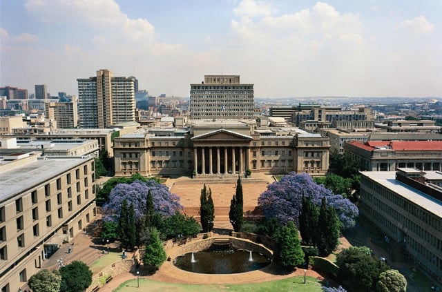
The University of the Witwatersrand
Johannesburg has a well-developed higher education system of both private and public universities. Johannesburg is served by the public universities University of the Witwatersrand and the University of Johannesburg.
University of Johannesburg was formed on 1 January 2005, when three separate universities and campuses—Rand Afrikaans University, Technikon Witwatersrand, and the Johannesburg campuses of Vista University—were merged. The new university offers education primarily in English and Afrikaans, although courses may be taken in any of South Africa's official languages.
The University of Pretoria's business school the Gordon Institute of Business Science is located in Illovo, Johannesburg.
Many private colleges are also situated in Johannesburg, such as Damelin,[109] CTI,[110] Lyceum College[111] and the South African campus[112] of Monash University (six of the other campuses are in Australia, while the eighth is in Malaysia), as well as the Midrand Graduate Institute[113] which is located in Midrand.
Johannesburg also has one of several film schools in the country, one of which has won an Academy Award for Best Foreign Student Film in 2006.[114] The South African School of Motion Picture and Live Performance, or AFDA for short, is situated in Auckland Park.
Johannesburg also has three teacher-training colleges and a technical college. There are numerous kindergartens, primary schools and high schools in the region.
Tourism
Johannesburg has not traditionally been known as a tourist destination, but the city is a transit point for connecting flights to Cape Town, Durban, and the Kruger National Park. Consequently, most international visitors to South Africa pass through Johannesburg at least once, which has led to the development of several attractions for tourists. Recent additions have centred on history museums, such as the Apartheid Museum (with related visits to Constitution Hill) and the Hector Pieterson Museum. There is also a large industry around visiting former townships, such as Soweto and Alexandra. Most visitors to Soweto see the Mandela Museum, which is located in the former home of Nelson Mandela.
Visitors can get a feeling for the layout of the city by visiting the Carlton Centre, in the south-eastern area of the CBD, which has an observation deck on the 50th floor. At 223 metres (732 feet), it is the highest office building in Africa, however soon to be eclipsed by The Leonardo (Sandton), and affords sweeping vistas of the city and surrounds. The nearby Museum Africa covers the history of the city of Johannesburg, as well as housing a large collection of rock art. Also a large draw for tourists is Gold Reef City, a theme park which offers a depiction of mining life at the turn of the nineteenth century, including an underground mine tour; other attractions include a large amusement park and a popular tribal dancing show.
On the culture front, the city has several art museums, such as the Johannesburg Art Gallery, which featured South African and European landscape and figurative paintings. The Market Theatre complex attained notoriety in the 1970s and 1980s by staging anti-apartheid plays and has now become a centre for modern South African playwriting. The Joburg Theatre is South Africa's foremost "receiving house" of live entertainment—presenting world class theatre, both local and international. The suburbs of Melville, Newtown, Parkhurst, Norwood, Rosebank and Greenside are popular for their bohemian atmosphere, street life, and many restaurants and bars.
Shopping is often popular with tourists, as the city offers a range of venues and experiences, from numerous upmarket shopping malls such as Sandton City, Mall of Africa, and Nelson Mandela Square, to various markets and flea markets, such as the Oriental Plaza and the Rosebank Flea Market; the latter are popular for souvenirs and African art. See above. (Cultural) tourists also visit the "Mai Mai Market"[115] ("Ezinyangeni" – the place of healers; located on the eastern wing of the city centre) dedicated to traditional herbs and traditional healers.
The Cradle of Humankind a UNESCO World Heritage Site is 25 kilometres (16 mi) to the northwest of the city. The Sterkfontein fossil site is famous for being the world's richest hominid site and produced the first adult Australopithecus africanus and the first near-complete skeleton of an early Australopithecine. Other attractions in this area include the Lesedi Cultural Village, while Magaliesburg and the Hartbeespoort Dam are popular weekend (and holiday) destinations for Johannesburg residents. The Origins Centre Museum, see below, covers the origins of humankind in Africa, and houses an extensive collection of rock art.
Johannesburg and environs offer various options to visitors wishing to view wildlife. The Johannesburg Zoo is one of the largest in South Africa. The Lion Park nature reserve, next to Lesedi Cultural Village, is home to over 80 lions and various other game, while the Krugersdorp Nature Reserve, a 1500 ha game reserve, is a forty-minute drive from the city centre. The De Wildt Cheetah Centre[116] in the Magaliesberg runs a successful breeding program for cheetah, wild dog and other endangered species. The Rhino & Lion Nature Reserve,[117] situated in the "Cradle of Humankind" on 1200 ha of "the typical highveld of Gauteng" also runs a breeding programme for endangered species including Bengal tigers, Siberian tigers and the extremely rare white lion. To the south, 11 kilometres (6.8 miles) from the city centre, is the Klipriviersberg Nature Reserve home to large mammals and hiking trails.
Twin towns and sister cities
Johannesburg is twinned with:
[[INLINE_IMAGE|//upload.wikimedia.org/wikipedia/commons/thumb/1/19/Flag_of_Ghana.svg/23px-Flag_of_Ghana.svg.png|//upload.wikimedia.org/wikipedia/commons/thumb/1/19/Flag_of_Ghana.svg/35px-Flag_of_Ghana.svg.png 1.5x, //upload.wikimedia.org/wikipedia/commons/thumb/1/19/Flag_of_Ghana.svg/45px-Flag_of_Ghana.svg.png 2x|Ghana|h15|w23|thumbborder flagicon-img flagicon-img]] Accra[118]
[[INLINE_IMAGE|//upload.wikimedia.org/wikipedia/commons/thumb/7/71/Flag_of_Ethiopia.svg/23px-Flag_of_Ethiopia.svg.png|//upload.wikimedia.org/wikipedia/commons/thumb/7/71/Flag_of_Ethiopia.svg/35px-Flag_of_Ethiopia.svg.png 1.5x, //upload.wikimedia.org/wikipedia/commons/thumb/7/71/Flag_of_Ethiopia.svg/46px-Flag_of_Ethiopia.svg.png 2x|Ethiopia|h12|w23|thumbborder flagicon-img flagicon-img]] Addis Ababa[118]
[[INLINE_IMAGE|//upload.wikimedia.org/wikipedia/en/thumb/a/ae/Flag_of_the_United_Kingdom.svg/23px-Flag_of_the_United_Kingdom.svg.png|//upload.wikimedia.org/wikipedia/en/thumb/a/ae/Flag_of_the_United_Kingdom.svg/35px-Flag_of_the_United_Kingdom.svg.png 1.5x, //upload.wikimedia.org/wikipedia/en/thumb/a/ae/Flag_of_the_United_Kingdom.svg/46px-Flag_of_the_United_Kingdom.svg.png 2x|United Kingdom|h12|w23|thumbborder flagicon-img flagicon-img]] Birmingham[118]
[[INLINE_IMAGE|//upload.wikimedia.org/wikipedia/commons/thumb/6/6f/Flag_of_the_Democratic_Republic_of_the_Congo.svg/20px-Flag_of_the_Democratic_Republic_of_the_Congo.svg.png|//upload.wikimedia.org/wikipedia/commons/thumb/6/6f/Flag_of_the_Democratic_Republic_of_the_Congo.svg/31px-Flag_of_the_Democratic_Republic_of_the_Congo.svg.png 1.5x, //upload.wikimedia.org/wikipedia/commons/thumb/6/6f/Flag_of_the_Democratic_Republic_of_the_Congo.svg/40px-Flag_of_the_Democratic_Republic_of_the_Congo.svg.png 2x|Democratic Republic of the Congo|h15|w20|thumbborder flagicon-img flagicon-img]] Kinshasa[118]
[[INLINE_IMAGE|//upload.wikimedia.org/wikipedia/en/thumb/a/ae/Flag_of_the_United_Kingdom.svg/23px-Flag_of_the_United_Kingdom.svg.png|//upload.wikimedia.org/wikipedia/en/thumb/a/ae/Flag_of_the_United_Kingdom.svg/35px-Flag_of_the_United_Kingdom.svg.png 1.5x, //upload.wikimedia.org/wikipedia/en/thumb/a/ae/Flag_of_the_United_Kingdom.svg/46px-Flag_of_the_United_Kingdom.svg.png 2x|United Kingdom|h12|w23|thumbborder flagicon-img flagicon-img]] London[118]
[[INLINE_IMAGE|//upload.wikimedia.org/wikipedia/commons/thumb/d/d0/Flag_of_Mozambique.svg/23px-Flag_of_Mozambique.svg.png|//upload.wikimedia.org/wikipedia/commons/thumb/d/d0/Flag_of_Mozambique.svg/35px-Flag_of_Mozambique.svg.png 1.5x, //upload.wikimedia.org/wikipedia/commons/thumb/d/d0/Flag_of_Mozambique.svg/45px-Flag_of_Mozambique.svg.png 2x|Mozambique|h15|w23|thumbborder flagicon-img flagicon-img]] Matola[118]
[[INLINE_IMAGE|//upload.wikimedia.org/wikipedia/en/thumb/a/a4/Flag_of_the_United_States.svg/23px-Flag_of_the_United_States.svg.png|//upload.wikimedia.org/wikipedia/en/thumb/a/a4/Flag_of_the_United_States.svg/35px-Flag_of_the_United_States.svg.png 1.5x, //upload.wikimedia.org/wikipedia/en/thumb/a/a4/Flag_of_the_United_States.svg/46px-Flag_of_the_United_States.svg.png 2x|United States|h12|w23|thumbborder flagicon-img flagicon-img]] New York City[118][119]
[[INLINE_IMAGE|//upload.wikimedia.org/wikipedia/commons/thumb/7/72/Flag_of_the_Republic_of_China.svg/23px-Flag_of_the_Republic_of_China.svg.png|//upload.wikimedia.org/wikipedia/commons/thumb/7/72/Flag_of_the_Republic_of_China.svg/35px-Flag_of_the_Republic_of_China.svg.png 1.5x, //upload.wikimedia.org/wikipedia/commons/thumb/7/72/Flag_of_the_Republic_of_China.svg/45px-Flag_of_the_Republic_of_China.svg.png 2x|Taiwan|h15|w23|thumbborder flagicon-img flagicon-img]] Taipei
[[INLINE_IMAGE|//upload.wikimedia.org/wikipedia/en/thumb/c/c3/Flag_of_France.svg/23px-Flag_of_France.svg.png|//upload.wikimedia.org/wikipedia/en/thumb/c/c3/Flag_of_France.svg/35px-Flag_of_France.svg.png 1.5x, //upload.wikimedia.org/wikipedia/en/thumb/c/c3/Flag_of_France.svg/45px-Flag_of_France.svg.png 2x|France|h15|w23|thumbborder flagicon-img flagicon-img]] Val de Marne (south east area of Paris)[118]
[[INLINE_IMAGE|//upload.wikimedia.org/wikipedia/commons/thumb/0/00/Flag_of_Namibia.svg/23px-Flag_of_Namibia.svg.png|//upload.wikimedia.org/wikipedia/commons/thumb/0/00/Flag_of_Namibia.svg/35px-Flag_of_Namibia.svg.png 1.5x, //upload.wikimedia.org/wikipedia/commons/thumb/0/00/Flag_of_Namibia.svg/45px-Flag_of_Namibia.svg.png 2x|Namibia|h15|w23|thumbborder flagicon-img flagicon-img]] Windhoek[118]
[[INLINE_IMAGE|//upload.wikimedia.org/wikipedia/commons/thumb/1/17/Flag_of_Rwanda.svg/23px-Flag_of_Rwanda.svg.png|//upload.wikimedia.org/wikipedia/commons/thumb/1/17/Flag_of_Rwanda.svg/35px-Flag_of_Rwanda.svg.png 1.5x, //upload.wikimedia.org/wikipedia/commons/thumb/1/17/Flag_of_Rwanda.svg/45px-Flag_of_Rwanda.svg.png 2x|Rwanda|h15|w23|thumbborder flagicon-img flagicon-img]] Kigali


