Las Vegas
Las Vegas
| Etymology:Spanish:Las vegas(The meadows) | |
| Nickname(s): | |
| Coordinates: | |
| Country | |
|---|---|
| State | Nevada |
| County | Clark |
| Founded | May 15, 1905 |
| Incorporated | March 16, 1911 |
| Government | |
| • Type | Council–manager |
| •Mayor | Carolyn Goodman(I) |
| •City Council | |
| •City manager | Scott D. Adams |
| Area | |
| • City | 135.8 sq mi(352 km) |
| • Land | 135.8 sq mi (352 km) |
| • Water | 0.05 sq mi (0.1 km) |
| Elevation | 2,001 ft (610 m) |
| Population | |
| • City | 583,756 |
| • Estimate | 644,644 |
| • Density | 4,300/sq mi (1,700/km) |
| •Urban | 2,211,315 |
| •Metro | 2,227,053 |
| •CSA | 2,462,015 (US:26th) |
| Demonym(s) | Las Vegan |
| Time zone | UTC−8(PST) |
| UTC−7(PDT) | |
| Area code(s) | 702 & 725 |
| FIPS code | 32-40000 |
| GNISfeature ID | 0847388 |
| Major airport | LAS |
| Interstate Highways | I-15,I-515 |
| Other major highways | US 93,US 95,NV 159,NV 599,NV 604,CC 215 |
| Website | |
Las Vegas (/lɑːs ˈveɪɡəs/,[7] Spanish for "The Meadows"; Spanish: [laz ˈβeɣas]), officially the City of Las Vegas and often known simply as Vegas, is the 28th-most populated city in the United States, the most populated city in the state of Nevada, and the county seat of Clark County. The city anchors the Las Vegas Valley metropolitan area and is the largest city within the greater Mojave Desert.[8] Las Vegas is an internationally renowned major resort city, known primarily for its gambling, shopping, fine dining, entertainment, and nightlife. The Las Vegas Valley as a whole serves as the leading financial, commercial, and cultural center for Nevada.
The city bills itself as The Entertainment Capital of the World, and is famous for its mega casino–hotels and associated activities. It is a top three destination in the United States for business conventions and a global leader in the hospitality industry, claiming more AAA Five Diamond hotels than any other city in the world.[9][10][11] Today, Las Vegas annually ranks as one of the world's most visited tourist destinations.[12][13] The city's tolerance for numerous forms of adult entertainment earned it the title of "Sin City",[14] and has made Las Vegas a popular setting for literature, films, television programs, and music videos.
Las Vegas was settled in 1905 and officially incorporated in 1911.
At the close of the 20th century, it was the most populated American city founded within that century (a similar distinction earned by Chicago in the 1800s). Population growth has accelerated since the 1960s, and between 1990 and 2000 the population nearly doubled, increasing by 85.2%. Rapid growth has continued into the 21st century, and according to estimates from the U.S. Census Bureau, the city had 648,224 residents in 2018,[5] with a metropolitan population of 2,227,053.[5]
As with most major metropolitan areas, the name of the primary city ("Las Vegas" in this case) is often used to describe areas beyond official city limits.
In the case of Las Vegas, this especially applies to the areas on and near the Las Vegas Strip, which is actually located within the unincorporated communities of Paradise and Winchester.[16][17]
| Etymology:Spanish:Las vegas(The meadows) | |
| Nickname(s): | |
| Coordinates: | |
| Country | |
|---|---|
| State | Nevada |
| County | Clark |
| Founded | May 15, 1905 |
| Incorporated | March 16, 1911 |
| Government | |
| • Type | Council–manager |
| •Mayor | Carolyn Goodman(I) |
| •City Council | |
| •City manager | Scott D. Adams |
| Area | |
| • City | 135.8 sq mi(352 km) |
| • Land | 135.8 sq mi (352 km) |
| • Water | 0.05 sq mi (0.1 km) |
| Elevation | 2,001 ft (610 m) |
| Population | |
| • City | 583,756 |
| • Estimate | 644,644 |
| • Density | 4,300/sq mi (1,700/km) |
| •Urban | 2,211,315 |
| •Metro | 2,227,053 |
| •CSA | 2,462,015 (US:26th) |
| Demonym(s) | Las Vegan |
| Time zone | UTC−8(PST) |
| UTC−7(PDT) | |
| Area code(s) | 702 & 725 |
| FIPS code | 32-40000 |
| GNISfeature ID | 0847388 |
| Major airport | LAS |
| Interstate Highways | I-15,I-515 |
| Other major highways | US 93,US 95,NV 159,NV 599,NV 604,CC 215 |
| Website | |
History
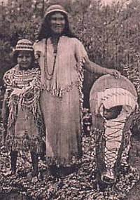
Southern Paiutes at Moapa wearing traditional Paiute basket hats with Paiute cradleboard and rabbit robe
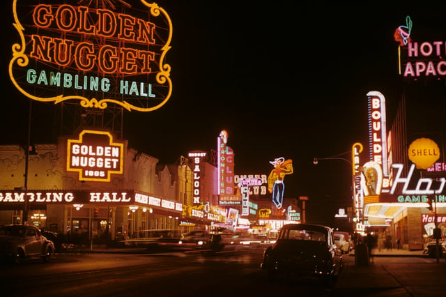
Golden Nugget and Pioneer Club along Fremont Street in 1952

This view of downtown Las Vegas shows a mushroom cloud in the background. Scenes such as this were typical during the 1950s. From 1951 to 1962 the government conducted 100 atmospheric tests at the nearby Nevada Test Site.[26]
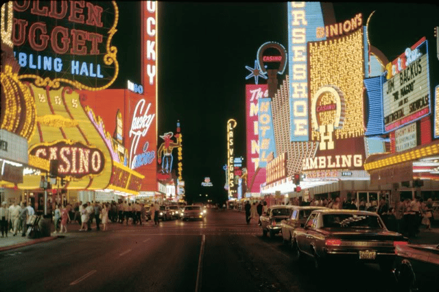
Fremont Street in the late 1960s
Perhaps the earliest visitors to the Las Vegas area were nomadic Paleo-Indians, who traveled there 10,000 years ago, leaving behind petroglyphs.
Anasazi and Paiute tribes followed at least 2,000 years ago.
A young Mexican scout named Rafael Rivera is credited as the first non-Native American to encounter the valley, in 1829.[18][19][20][21] Trader Antonio Armijo led a 60-man party along the Spanish Trail to Los Angeles, California in 1829.[22][23] The area was named Las Vegas, which is Spanish for "the meadows," as it featured abundant wild grasses, as well as the desert spring waters needed by westward travelers.[24] The year 1844 marked the arrival of John C. Frémont, whose writings helped lure pioneers to the area. Downtown Las Vegas's Fremont Street is named after him.
Eleven years later members of The Church of Jesus Christ of Latter-day Saints chose Las Vegas as the site to build a fort halfway between Salt Lake City and Los Angeles, where they would travel to gather supplies. The fort was abandoned several years afterward. The remainder of this Old Mormon Fort can still be seen at the intersection of Las Vegas Boulevard and Washington Avenue.
Las Vegas was founded as a city in 1905, when 110 acres (45 ha) of land adjacent to the Union Pacific Railroad tracks were auctioned in what would become the downtown area.
In 1911, Las Vegas was incorporated as a city.[25]
1931 was a pivotal year for Las Vegas.
At that time, Nevada legalized casino gambling and reduced residency requirements for divorce to six weeks.
This year also witnessed the beginning of construction on nearby Hoover Dam. The influx of construction workers and their families helped Las Vegas avoid economic calamity during the Great Depression. The construction work was completed in 1935.
In 1941, the Las Vegas Army Air Corps Gunnery School was established.
Currently known as Nellis Air Force Base, it is home to the aerobatic team called the Thunderbirds.
Following World War II, lavishly decorated hotels, gambling casinos, and big-name entertainment became synonymous with Las Vegas.
In the 1950s the Moulin Rouge opened and became the first racially integrated casino-hotel in Las Vegas.
In 1951, nuclear weapons testing began at the Nevada Test Site, 65 miles (105 km) northwest of Las Vegas. During this time the city was nicknamed the "Atomic City". Residents and visitors were able to witness the mushroom clouds (and were exposed to the fallout) until 1963, when the limited Test Ban Treaty required that nuclear tests be moved underground.[27][28]
The iconic "Welcome to Las Vegas" sign, which has never been located within municipal limits, was created in 1959 by Betty Willis.[29]
During the 1960s, corporations and business powerhouses such as Howard Hughes were building and buying hotel-casino properties.
Gambling was referred to as "gaming" which transitioned into legitimate business.
The year 1995 marked the opening of the Fremont Street Experience in Las Vegas's downtown area. This canopied five-block area features 12.5 million LED lights and 550,000 watts of sound from dusk until midnight during shows held on the top of each hour.
Due to the realization of many revitalization efforts, 2012 was dubbed "The Year of Downtown."
Hundreds of millions of dollars' worth of projects made their debut at this time.
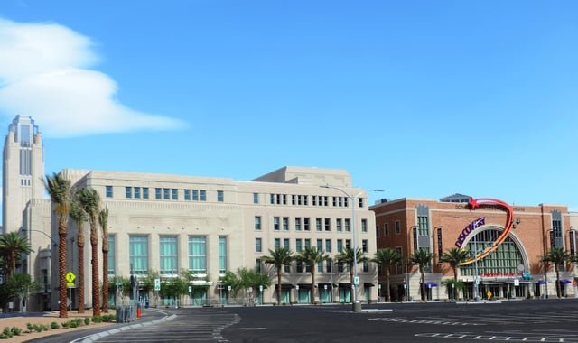
They included The Smith Center for the Performing Arts and DISCOVERY Children's Museum, Mob Museum, Neon Museum, a new City Hall complex and renovations for a new Zappos.com corporate headquarters in the old City Hall building.[24][30]
Geography
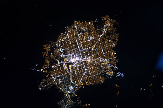
Astronaut photograph of Las Vegas at night
Las Vegas is situated within Clark County in a basin on the floor of the Mojave Desert[31] and is surrounded by mountain ranges on all sides. Much of the landscape is rocky and arid with desert vegetation and wildlife. It can be subjected to torrential flash floods, although much has been done to mitigate the effects of flash floods through improved drainage systems.[32]
The peaks surrounding Las Vegas reach elevations of over 10,000 feet (3,000 m), and act as barriers to the strong flow of moisture from the surrounding area.
The elevation is approximately 2,030 ft (620 m) above sea level.
According to the United States Census Bureau, the city has a total area of 135.86 sq mi (351.9 km2), of which 135.81 sq mi (351.7 km2) is land and 0.05 sq mi (0.13 km2) (0.03%) is water.
Nevada is the third most seismically active state in the U.S. (after Alaska and California); it has been estimated by the United States Geological Survey (USGS) that over the next 50 years there is a 10–20% chance of a M6.0 or greater earthquake occurring within 50 km (31 mi) of Las Vegas.[33]
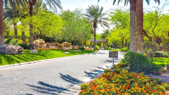
Within the city there are many lawns, trees and other greenery.
Due to water resource issues, there has been a movement to encourage xeriscapes. Another part of conservation efforts is scheduled watering days for residential landscaping. A U.S. Environmental Protection Agency grant in 2008 funded a program that analyzed and forecast growth and environmental impacts through the year 2019.
Climate
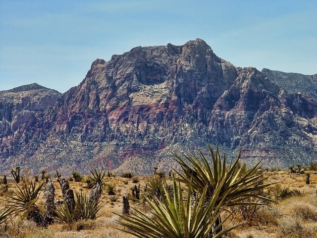
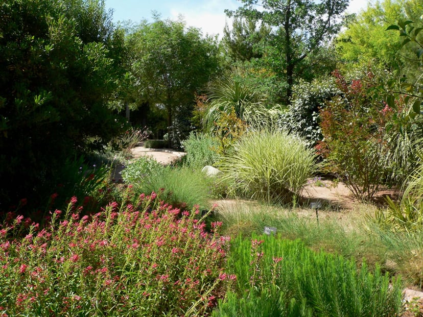
Desert scene at the Red Rock Canyon National Conservation Area in the Las Vegas area
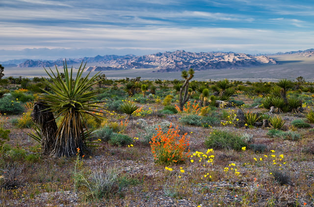
Spring flowers at the Red Rock Canyon National Conservation Area in the Las Vegas area
Las Vegas has a subtropical hot desert climate (Köppen climate classification: BWh), typical of the Mojave Desert in which it lies. This climate is typified by long, hot summers; warm transitional seasons; and short, mild to chilly winters. There is abundant sunshine throughout the year, with an average of 310 sunny days and bright sunshine during 86% of all daylight hours.[34] Rainfall is scarce, with an average of 4.2 in (110 mm) dispersed between roughly 26 to 27 total rainy days per year.[35] Las Vegas is among the sunniest, driest, and least humid locations in North America,[36] with exceptionally low dew points and humidity that sometimes remains below 10%.
The summer months of June through September are very hot, though moderated by extremely low humidity.
July is the hottest month, with an average daytime high of 104.2 °F (40.1 °C).
On average, 134 days per year reach or exceed 90 °F (32 °C), of which 74 days reach 100 °F (38 °C) and 7 days reach 110 °F (43 °C).
During the peak intensity of summer, overnight lows frequently remain above 80 °F (27 °C) and occasionally above 85 °F (29 °C).[34] While most summer days are consistently hot, dry, and cloudless, the North American Monsoon sporadically interrupts this pattern and brings more cloud cover, thunderstorms, lightning, increased humidity, and brief spells of heavy rain. The window of opportunity for the monsoon to affect Las Vegas usually falls between July and August, although this is inconsistent and varies considerably in its impact from year to year. Summer in Las Vegas is marked by a significant diurnal variation; while less extreme than other parts of the state, nighttime lows in Las Vegas are often 30 °F (16.7 °C) or more lower than daytime highs.[37]
Las Vegas winters are short and generally very mild, with chilly (but rarely cold) daytime temperatures.
Like all seasons, sunshine is abundant.
December is both the year's coolest and cloudiest month, with an average daytime high of 56.6 °F (13.7 °C) and sunshine occurring during 78% of its daylight hours.
Winter evenings are defined by clear skies and swift drops in temperature after sunset, with overnight minima averaging around 39 °F (3.9 °C) in December and January.
Owing to its elevation that ranges from 2,000 feet to 3,000 feet, Las Vegas experiences markedly cooler winters than other areas of the Mojave Desert and the adjacent Sonoran Desert that are closer to sea level. Consequently, the city records freezing temperatures an average of 16 nights per winter. However, it is exceptionally rare for temperatures to fall to or below 25 °F (−4 °C), or for temperatures to remain below 45 °F (7 °C) for an entire day.[34] Most of the annual precipitation falls during the winter months, but even the wettest month (February) averages only four days of measurable rain. The mountains immediately surrounding the Las Vegas Valley accumulate snow every winter, but significant accumulation within the city is rare, although moderate accumulations do occur every few years. The most recent accumulations occurred on February 18, 2019 when parts of the city received about 1 to 2 inches (2.5 to 5.1 cm) of snow[38] and on February 20 when the city received almost 0.5 inches (1.3 cm).[39] Other recent significant accumulations occurred on December 25, 2015 and December 17, 2008.[40] Unofficially Las Vegas' largest snowfall on record was 12 inches (30 cm) that fell in 1909.[41]
The highest temperature officially observed for Las Vegas, as measured at McCarran International Airport, is 117 °F (47 °C), reached on 3 days: July 24, 1942, July 19, 2005 and June 20, 2017.[42][34] Conversely, the lowest was 8 °F (−13 °C) recorded on 2 days: January 13, 1963 and January 25, 1937.[34] However, the highest temperature ever measured within the city of Las Vegas was 118 °F (48 °C) on July 26, 1931.[43]
| Climate data forMcCarran International Airport(Paradise, Nevada), 1981–2010 normals,[1]extremes 1937–present | |||||||||||||
|---|---|---|---|---|---|---|---|---|---|---|---|---|---|
| Month | Jan | Feb | Mar | Apr | May | Jun | Jul | Aug | Sep | Oct | Nov | Dec | Year |
| Record high °F (°C) | 77(25) | 87(31) | 92(33) | 99(37) | 109(43) | 117(47) | 117(47) | 116(47) | 113(45) | 103(39) | 87(31) | 78(26) | 117(47) |
| Mean maximum °F (°C) | 68.2(20.1) | 74.5(23.6) | 83.4(28.6) | 93.0(33.9) | 101.4(38.6) | 109.4(43.0) | 112.4(44.7) | 109.7(43.2) | 104.6(40.3) | 93.7(34.3) | 79.7(26.5) | 66.9(19.4) | 112.9(44.9) |
| Average high °F (°C) | 58.0(14.4) | 62.5(16.9) | 70.3(21.3) | 78.3(25.7) | 88.9(31.6) | 98.7(37.1) | 104.2(40.1) | 102.0(38.9) | 94.0(34.4) | 80.6(27.0) | 66.3(19.1) | 56.6(13.7) | 80.1(26.7) |
| Average low °F (°C) | 39.4(4.1) | 43.4(6.3) | 49.4(9.7) | 56.1(13.4) | 65.8(18.8) | 74.6(23.7) | 80.9(27.2) | 79.3(26.3) | 71.1(21.7) | 58.5(14.7) | 46.5(8.1) | 38.7(3.7) | 58.7(14.8) |
| Mean minimum °F (°C) | 28.0(−2.2) | 30.6(−0.8) | 36.6(2.6) | 43.5(6.4) | 51.7(10.9) | 59.8(15.4) | 70.4(21.3) | 69.1(20.6) | 58.4(14.7) | 45.8(7.7) | 32.8(0.4) | 26.8(−2.9) | 24.7(−4.1) |
| Record low °F (°C) | 8(−13) | 16(−9) | 19(−7) | 31(−1) | 38(3) | 48(9) | 56(13) | 54(12) | 43(6) | 26(−3) | 15(−9) | 11(−12) | 8(−13) |
| Averageprecipitationinches (mm) | 0.54(14) | 0.76(19) | 0.44(11) | 0.15(3.8) | 0.12(3.0) | 0.07(1.8) | 0.40(10) | 0.33(8.4) | 0.25(6.4) | 0.27(6.9) | 0.36(9.1) | 0.50(13) | 4.19(106) |
| Average precipitation days(≥ 0.01 in) | 3.1 | 4.0 | 2.9 | 1.6 | 1.2 | 0.6 | 2.5 | 2.6 | 1.6 | 1.7 | 1.7 | 3.0 | 26.5 |
| Averagerelative humidity(%) | 45.1 | 39.6 | 33.1 | 25.0 | 21.3 | 16.5 | 21.1 | 25.6 | 25.0 | 28.8 | 37.2 | 45.0 | 30.3 |
| Mean monthlysunshine hours | 245.2 | 246.7 | 314.6 | 346.1 | 388.1 | 401.7 | 390.9 | 368.5 | 337.1 | 304.4 | 246.0 | 236.0 | 3,825.3 |
| Percentpossible sunshine | 79 | 81 | 85 | 88 | 89 | 92 | 88 | 88 | 91 | 87 | 80 | 78 | 86 |
| Source: NOAA (relative humidity and sun 1961–1990)[34][undefined][undefined] | |||||||||||||
Nearby communities
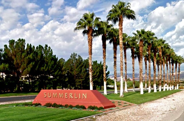
The entrance to the community of Summerlin.
Affluent neighborhoods are located throughout the Las Vegas Valley. Above is the entrance to MacDonald Highlands.
Boulder City, incorporated
Enterprise, unincorporated
Henderson, incorporated
Lone Mountain, unincorporated
North Las Vegas, incorporated
Paradise, unincorporated
Spring Valley, unincorporated
Summerlin South, unincorporated
Sunrise Manor, unincorporated
Whitney, unincorporated
Winchester, unincorporated
Neighborhoods
Downtown
The Lakes
Summerlin
West Las Vegas
Demographics
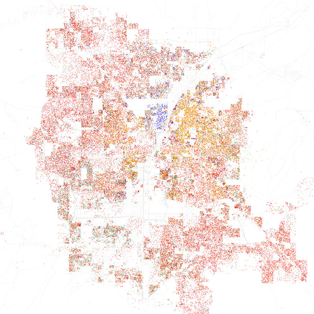
Map of racial distribution in Las Vegas, 2010 U.S.
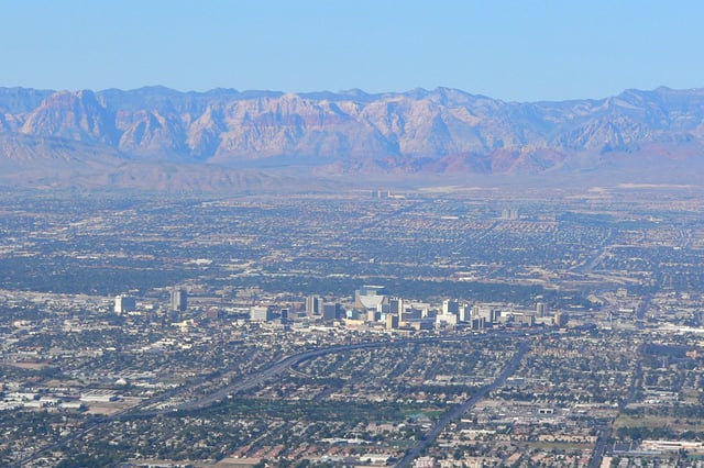
Downtown Las Vegas with Red Rock Canyon in the background.
| Demographic profile | 2010[49] | 2000[50] | 1990[51] | 1970[51] |
|---|---|---|---|---|
| White | 62.1% | 69.9% | 78.4% | 87.6% |
| —Non-Hispanic | 47.9% | 58.0% | 72.1% | 83.1%[52] |
| Black or African American | 11.1% | 10.4% | 11.4% | 11.2% |
| Hispanic or Latino(of any race) | 31.5% | 23.6% | 12.5% | 4.6%[52] |
| Asian | 6.1% | 4.8% | 3.6% | 0.7% |
According to the 2010 Census, the racial composition of Las Vegas was as follows:[53]
White: 62.1% (Non-Hispanic Whites: 47.9%; Hispanic Whites: 14.2%)
Black or African American: 11.1%
Asian: 6.1% (3.3% Filipino, 0.7% Chinese, 0.5% Korean, 0.4% Japanese, 0.4% Indian, 0.2% Vietnamese, 0.2% Thai)
Two or more races: 4.9%
Native American: 0.7%
Native Hawaiian and Other Pacific Islander: 0.6%
Source:[54]
The city's most populous ethnic group, non-Hispanic Whites,[49] have proportionally declined from 72.1% of the population in 1990 to 47.9% in 2010, even as total numbers of all ethnicities have increased with the population.
Hispanics or Latinos of any race make up 31.5% of the population.
Of those 24.0% are of Mexican, 1.4% of Salvadoran, 0.9% of Puerto Rican, 0.9% of Cuban, 0.6% of Guatemalan, 0.2% of Peruvian, 0.2% of Colombian, 0.2% of Honduran and 0.2% of Nicaraguan descent.
According to research by demographer William H. Frey using data from the 2010 United States Census, Las Vegas has the second lowest level of black-white segregation of any of the 100 largest metropolitan areas in the United States after Tucson, Arizona.[55]
Hawaiians and Las Vegans sometimes refer to Las Vegas as the "ninth island of Hawaii" because so many Hawaiians have moved to the city.[56]
As of the census[5] of 2010, there were 583,756 people, 211,689 households, and 117,538 families residing in the city.
The population density was 4,222.5/sq mi (1,630.3/km2).
There are 190,724 housing units at an average density of 1,683.3/sq mi (649.9/km2).
As of 2006, there were 176,750 households, out of which 31.9% had children under the age of 18 living with them, 48.3% were married couples living together, 12.2% had a female householder with no husband present, and 33.5% were non-families.
25.0% of all households were made up of individuals and 7.5% had someone living alone who was 65 years of age or older.
The average household size was 2.66 and the average family size was 3.20.
In the city, the population was spread out with 25.9% under the age of 18, 8.8% from 18 to 24, 32.0% from 25 to 44, 21.7% from 45 to 64, and 11.6% who were 65 years of age or older.
The median age was 34 years.
For every 100 females, there were 103.3 males.
For every 100 females age 18 and over, there were 102.5 males.
The median income for a household in the city was $53,000 and the median income for a family was $58,465.[58] Males had a median income of $35,511 versus $27,554 for females. The per capita income for the city was $22,060. About 6.6% of families and 8.9% of the population were below the poverty line, including 5.4% of those under age 18 and 6.3% of those age 65 or over.
According to a 2004 study, Las Vegas has one of the highest divorce rates.[59][60] The city's high divorce rate is not wholly due to Las Vegans themselves getting divorced. Since divorce is easier in Nevada than most other states, many people come from across the country for the easier process. Similarly, Nevada marriages are notoriously easy to get. Las Vegas has one of the highest marriage rates of U.S. cities, with many licenses issued to people from outside the area (see Las Vegas weddings).
Economy
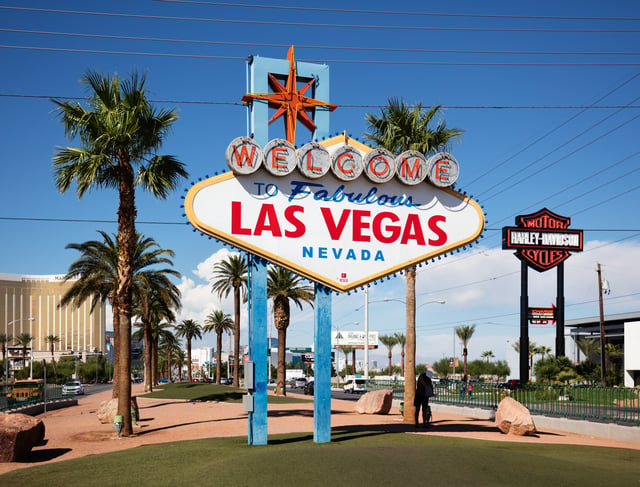
Welcome to Fabulous Las Vegas Sign, welcoming tourists to the city
The primary drivers of the Las Vegas economy are tourism, gaming and conventions, which in turn feed the retail and restaurant industries.
Tourism
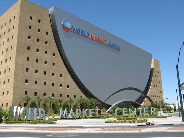
World Market Center Building A
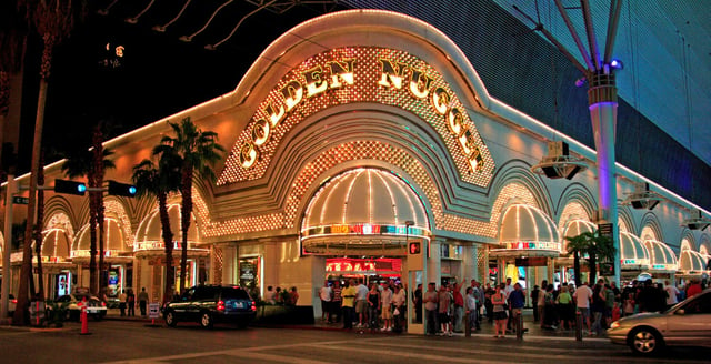
Golden Nugget Las Vegas
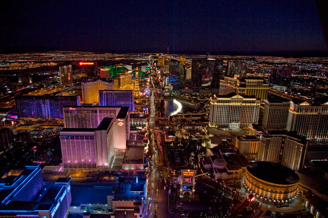
The Las Vegas Strip, primarily located in Paradise.
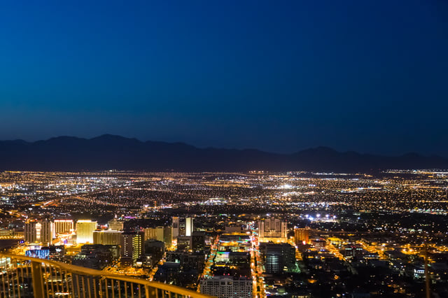
A view of the Las Vegas Valley looking north from the Stratosphere Tower
The major attractions in Las Vegas are the casinos and the hotels, although in recent years other new attractions have begun to emerge.
Most casinos in the downtown area are located on Fremont Street, with The Stratosphere being one of the exceptions. Fremont East, adjacent to the Fremont Street Experience, was granted variances to allow bars to be closer together, similar to the Gaslamp Quarter of San Diego, the goal being to attract a different demographic than the Strip attracts.
Downtown casinos
The Golden Gate Hotel and Casino, located downtown along the Fremont Street Experience, is the oldest continuously operating hotel and casino in Las Vegas; it opened in 1906 as the Hotel Nevada.
Boyd Gaming has a major presence downtown operating the California Hotel & Casino, Fremont Hotel & Casino and the Main Street Casino. Other casinos operations include the Four Queens Hotel & Casino, Las Vegas Club (currently undergoing renovation) and Mermaid's Casino, which are also located downtown along the Fremont Street Experience.
Downtown casinos that have undergone major renovations and revitalization in recent years include the Golden Nugget Hotel & Casino, The D Las Vegas Hotel Casino (formerly Fitzgerald's), Downtown Grand (formerly Lady Luck), El Cortez Hotel & Casino and The Plaza Hotel & Casino.[63]
Las Vegas Strip
The center of the gambling and entertainment industry is located on the Las Vegas Strip, outside the city limits in the surrounding unincorporated communities of Paradise and Winchester in Clark County. The largest and most notable casinos and buildings are located there.[64]
Development
When The Mirage opened in 1989, it started a trend of major resort development on the Las Vegas Strip outside of the city. This resulted in a drop in tourism in the downtown area, but many recent projects have increased the number of visitors to downtown.
An effort has been made by city officials to diversify the economy by attracting health-related, high-tech and other commercial interests.
No state tax for individuals or corporations, as well as a lack of other forms of business-related taxes,[65] have aided the success of these efforts.
The Fremont Street Experience was built in an effort to draw tourists back to the area, and has been popular since its startup in 1995.
The city purchased 61 acres (25 ha) of property from the Union Pacific Railroad in 1995 with the goal of creating a better draw for more people to the downtown area. In 2004, Las Vegas Mayor Oscar Goodman announced plans for Symphony Park, which could include a mixture of offerings, such as residential space and office buildings.
Already operating in Symphony Park is the Cleveland Clinic Lou Ruvo Center for Brain Health (opened in 2010), The Smith Center for the Performing Arts (opened in 2012) and the DISCOVERY Children's Museum (opened in 2013).[66]
On land across from Symphony Park, the World Market Center Las Vegas opened in 2005. It currently encompasses three large buildings with a total of 5.1 million square feet. Trade shows for the furniture and furnishing industries are held there semiannually.
Also located nearby is the Las Vegas North Premium Outlets.
A second expansion was completed in May 2015, with the mall currently offering 175 stores.[67]
A new Las Vegas City Hall opened in February 2013 on downtown's Main Street. The former City Hall building is now occupied by the corporate headquarters for the major online retailer, Zappos.com, which opened downtown in 2013. Zappos CEO Tony Hsieh has taken an interest in the urban area and has contributed $350 million toward a revitalization effort called the Downtown Project.[68][69] Projects funded include Las Vegas's first independent bookstore, The Writer's Block.[70]
Other industries
A number of new industries have moved to Las Vegas in recent decades.
Online shoe retailer Zappos.com (now an Amazon subsidiary) was founded in San Francisco but by 2013 had moved its headquarters to downtown Las Vegas. Allegiant Air, a low-cost air carrier, launched in 1997 with its first hub at McCarran International Airport and headquarters in nearby Summerlin.
Culture
The Smith Center for the Performing Arts & Discovery Museum
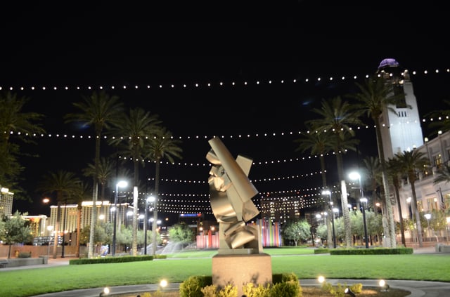
Symphony Park in Downtown Las Vegas.

A large mural by artist Shepard Fairey is seen in the Arts District.
The city is home to several museums, including the Neon Museum (the location for many of the historical signs from Las Vegas's mid-20th century heyday), The Mob Museum, the Las Vegas Natural History Museum, the DISCOVERY Children's Museum, the Nevada State Museum and the Old Las Vegas Mormon State Historic Park.
The city is home to an extensive Downtown Arts District, which hosts numerous galleries and events including the annual Las Vegas Film Festival. "First Friday" is a monthly celebration that includes arts, music, special presentations and food in a section of the city's downtown region called 18b, The Las Vegas Arts District.[73] The festival extends into the Fremont East Entertainment District as well.[74]
The Thursday prior to First Friday is known in the arts district as "Preview Thursday."
This evening event highlights new gallery exhibitions throughout the district.[75]
The Las Vegas Academy of International Studies, Performing and Visual Arts is a Grammy award-winning magnet school located in downtown Las Vegas.
The Smith Center for the Performing Arts is situated downtown in Symphony Park. The world-class performing arts center hosts Broadway shows and other major touring attractions, as well as orchestral, opera, ballet, choir, jazz, and dance performances.
Las Vegas had earned the moniker Gambling Capital of the World, as the city currently has the largest strip of land-based casinos in the world.[76]
Sports
The Las Vegas Valley is the home of two major professional teams, the Vegas Golden Knights of the National Hockey League, an expansion team that began play in the 2017–18 NHL season out of T-Mobile Arena in nearby Paradise.[77] In 2020, the Oakland Raiders of the National Football League will relocate to Allegiant Stadium, which is currently under construction.[78] In 2018, the Las Vegas Aces of the Women's National Basketball Association played their inaugural season at the Mandalay Bay Events Center.
There are two minor league sports teams that play in the Las Vegas area.
The Las Vegas Aviators of the Pacific Coast League, the AAA farm club of the Oakland Athletics play at Las Vegas Ballpark in nearby Summerlin.[79] The Las Vegas Lights FC[80] of the United Soccer League,[81] play out of Cashman Field in Downtown Las Vegas.
List of teams
Major professional teams
| Team | Sport | League | Venue (capacity) | Established | Titles |
|---|---|---|---|---|---|
| Las Vegas Raiders | Football | NFL | Allegiant Stadium(65,000) | 2020(planned) | 0 |
| Vegas Golden Knights | Ice Hockey | NHL | T-Mobile Arena(17,500) | 2017 | 0 |
| Las Vegas Aces | Women's basketball | WNBA | Mandalay Bay Events Center(12,000) | 2018 | 0 |
Minor professional teams
| Team | Sport | League | Venue (capacity) | Established | Titles |
|---|---|---|---|---|---|
| Las Vegas Aviators | Baseball | MiLB(AAA | Las Vegas Ballpark(10,000) | 1983 | 2 |
| Las Vegas Lights FC | Soccer | USLC | Cashman Field(9,334) | 2018 | 0 |
| Sin City Trojans | Women's football | WFA | Desert Pines High School(N/A) | 2008 | 0 |
| Las Vegas Knights SC | Indoor soccer | M2 | Las Vegas SportsPark (N/A) | 2017 | 0 |
Amateur teams
| Team | Sport | League | Venue (capacity) | Established | Titles |
|---|---|---|---|---|---|
| Las Vegas Jesters | Ice hockey | MWHL | City National Arena(600) | 2012 | 0 |
| Las Vegas Thunderbirds | WSHL | SoBe Ice Arena (1,400) | 2019 | 0 |
College teams
| School | Team | League | Division | Primary Conference |
|---|---|---|---|---|
| University of Nevada, Las Vegas(UNLV) | UNLV Rebels | NCAA | NCAA Division I | Mountain West |
| College of Southern Nevada(CSN) | CSN Coyotes | NJCAA | NJCAA Division I | Scenic West |
Parks and recreation
Las Vegas has 68 parks.
The city owns the land for, but does not operate, four golf courses: Angel Park Golf Club, Desert Pines Golf Club, Durango Hills Golf Club, and the Las Vegas Municipal Golf Course.
It is also responsible for 123 playgrounds, 23 softball fields, 10 football fields, 44 soccer fields, 10 dog parks, six community centers, four senior centers, 109 skates parks, six swimming pools, and more.[82]
Government

Las Vegas City Hall in downtown Las Vegas
The city of Las Vegas government operates as a council–manager government. The Mayor sits as a Council member-at-large and presides over all of the City council meetings. In the event that the Mayor cannot preside over a City Council meeting, the Mayor Pro-Tem is the presiding officer of the meeting until such time as the Mayor returns to his/her seat. The City Manager is responsible for the administration and the day-to-day operations of all municipal services and city departments. The City Manager maintains intergovernmental relationships with federal, state, county and other local governments.
Much of the Las Vegas metropolitan area is split into neighboring incorporated cities or unincorporated communities.
Approximately 700,000 people live in unincorporated areas governed by Clark County, and another 465,000 live in incorporated cities such as North Las Vegas, Henderson and Boulder City. Las Vegas and Clark County share a police department, the Las Vegas Metropolitan Police Department, which was formed after a 1973 merger of the Las Vegas Police Department and the Clark County Sheriff's Department. North Las Vegas, Henderson, Boulder City and some colleges have their own police departments.
A Paiute Indian reservation occupies about 1 acre (0.40 ha) in the downtown area.
Las Vegas, home to the Lloyd D. George Federal District Courthouse and the Regional Justice Center, draws numerous companies providing bail, marriage, divorce, tax, incorporation and other legal services.
City council
| Name | Position | Party | References | Notes |
|---|---|---|---|---|
| Carolyn Goodman | Mayor | Independent | [83] | Replaced her husband,Oscar Goodman, who was term-limited |
| Brian Knudsen | 1st Ward Council member | Democratic | [84][85] | |
| Victoria Seaman | 2nd Ward Council member | Republican | [86][85] | |
| Olivia Diaz | 3rd Ward Council member | Democratic | [87][85] | |
| Stavros S. Anthony | 4th Ward Council member | Republican | [88] | |
| Cedric Crear | 5th Ward Council member | Democratic | [89][90] | |
| Michele Fiore | 6th Ward Council member | Republican | [91] | Mayor Pro Tem |
Education
Primary and secondary schools
Primary and secondary public education is provided by the Clark County School District, which is the fifth most populous school district in the nation. Students totaled 314,653 in grades K-12 for school year 2013–2014.[92]
Colleges and universities
The College of Southern Nevada (the third largest community college in the United States by enrollment) is the main higher education facility in the city. Other institutions include the University of Nevada School of Medicine, with a campus in the city, and the for-profit private school Le Cordon Bleu College of Culinary Arts. Educational opportunities exist around the city; among them are the University of Nevada, Las Vegas and Nevada State College run by the Nevada System of Higher Education, Desert Research Institute, The International Academy of Design & Technology Las Vegas and Touro University Nevada.
Media
Newspapers
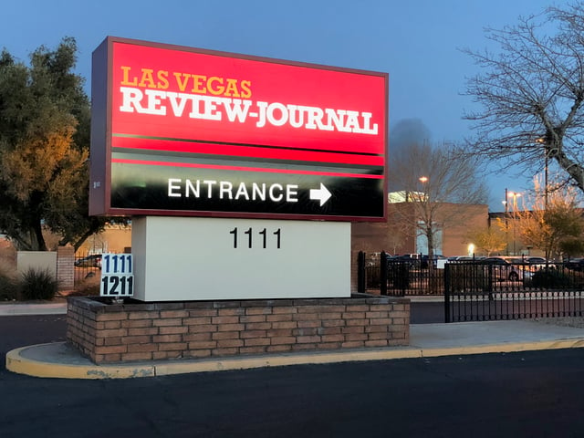
Las Vegas Review-Journal sign
Las Vegas Review-Journal, the area's largest daily newspaper, is published every morning. It was formed in 1909 but has roots back to 1905. It is the largest newspaper in Nevada and is ranked as one of the top 25 newspapers in the United States by circulation. In 2000, the Review-Journal installed the largest newspaper printing press in the world. It cost $40 million, weighs 910 tons and consists of 16 towers.[93] The newspaper is owned by casino magnate Sheldon Adelson, who purchased it for $140 million in December 2015. In 2018, the Review-Journal received the Sigma Delta Chi Award from the Society of Professional Journalists for reporting the Oct. 1 mass shooting on the Las Vegas Strip. In 2018, Editor and Publisher magazine named the Review-Journal as one of 10 newspapers in the United States "doing it right".[94] Las Vegas Sun, a daily 8-page newspaper independently published but the print edition distributed as a section inside the Review-Journal. The Sun is owned by the Greenspun family and is affiliated with Greenspun Media Group. It was founded independently in 1950 and in 1989 entered into a Joint Operating Agreement with the Review-Journal, which runs through 2040. The Sun has been described as "politically liberal."[95] In 2009, the Sun was awarded a Pulitzer Prize for Public Service for coverage of the high death rate of construction workers on the Las Vegas Strip amid lax enforcement of regulations.
Las Vegas Weekly is a free alternative weekly newspaper based in Henderson, Nevada. It covers Las Vegas arts, entertainment, culture and news. Las Vegas Weekly was founded in 1992 and is published by Greenspun Media Group.
Broadcast
Las Vegas is served by 22 television and 46 radio stations.
The area is also served by two NOAA Weather Radio transmitters (162.55 MHz located in Boulder City and 162.40 MHz located on Mount Potosi).
Radio stations in Las Vegas
Television stations in Las Vegas
Magazines
Desert Companion
Las Vegas Weekly
Luxury Las Vegas
Transportation
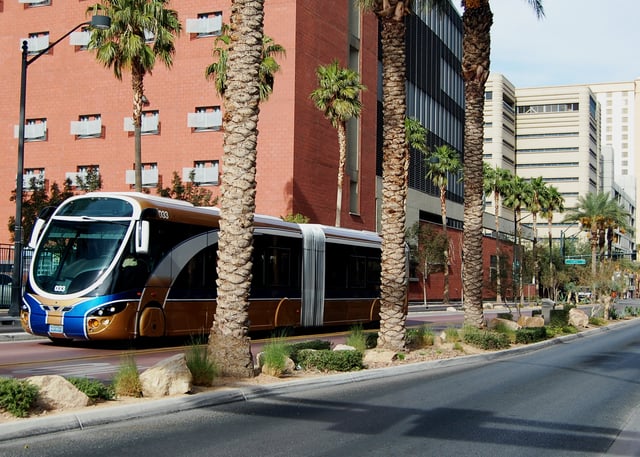
Regional Transportation Commission (RTC) provides public transportation
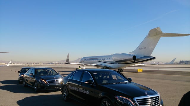
McCarran International Airport provides private and public aviation services to the city
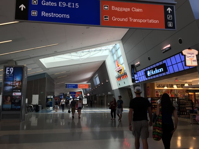
Inside Terminal 3 at McCarran International Airport in Paradise
RTC Transit is a public transportation system providing bus service throughout Las Vegas, Henderson, North Las Vegas and other areas of the valley. Inter-city bus service to and from Las Vegas is provided by Greyhound, BoltBus, Orange Belt Stages, Tufesa, and several smaller carriers.[96] Amtrak trains have not served Las Vegas since the service via the Desert Wind was discontinued in 1997, but Amtrak California operates Thruway Motorcoach dedicated service between the city and its passenger rail stations in Bakersfield, California, as well as Los Angeles Union Station via Barstow.[97]
A bus rapid-transit link in Las Vegas called the Strip & Downtown Express (previously ACE Gold Line[98]) with limited stops and frequent service was launched in March 2010, and connects downtown Las Vegas, the Strip and the Las Vegas Convention Center.
In 2016, 77.1 percent of working Las Vegas residents (those living in the city, but not necessarily working in the city) commuted by driving alone.
About 11 percent commuted via carpool, 3.9 percent used public transportation, and 1.4 percent walked.
About 2.3 percent of Las Vegas commuters used all other forms of transportation, including taxi, bicycle, and motorcycle.
About 4.3 of working Las Vegas residents worked at home.[99] In 2015, 10.2 percent of city of Las Vegas households were without a car, which increased slightly to 10.5 percent in 2016.
The national average was 8.7 percent in 2016.
Las Vegas averaged 1.63 cars per household in 2016, compared to a national average of 1.8 per household.[100]
With some exceptions, including Las Vegas Boulevard, Boulder Highway (SR 582) and Rancho Drive (SR 599), the majority of surface streets in Las Vegas are laid out in a grid along Public Land Survey System section lines. Many are maintained by the Nevada Department of Transportation as state highways. The street numbering system is divided by the following streets:
Westcliff Drive, US 95 Expressway, Fremont Street and Charleston Boulevard divide the north–south block numbers from west to east.
Las Vegas Boulevard divides the east–west streets from the Las Vegas Strip to near the Stratosphere, then Main Street becomes the dividing line from the Stratosphere to the North Las Vegas border, after which the Goldfield Street alignment divides east and west.
On the east side of Las Vegas, block numbers between Charleston Boulevard and Washington Avenue are different along Nellis Boulevard, which is the eastern border of the city limits.
Interstates 15, 515, and US 95 lead out of the city in four directions.
Two major freeways – Interstate 15 and Interstate 515/U.S. Route 95 – cross in downtown Las Vegas. I-15 connects Las Vegas to Los Angeles, and heads northeast to and beyond Salt Lake City. I-515 goes southeast to Henderson, beyond which US 93 continues over the Mike O'Callaghan–Pat Tillman Memorial Bridge towards Phoenix, Arizona. US 95 connects the city to northwestern Nevada, including Carson City and Reno. US 93 splits from I-15 northeast of Las Vegas and goes north through the eastern part of the state, serving Ely and Wells. US 95 heads south from US 93 near Henderson through far eastern California. A partial beltway has been built, consisting of Interstate 215 on the south and Clark County 215 on the west and north. Other radial routes include Blue Diamond Road (SR 160) to Pahrump and Lake Mead Boulevard (SR 147) to Lake Mead.
- East–west roads, north to south[101]
Ann Road
Craig Road (SR 573)
[[INLINE_IMAGE|//upload.wikimedia.org/wikipedia/commons/thumb/7/79/Nevada_574.svg/25px-Nevada_574.svg.png|//upload.wikimedia.org/wikipedia/commons/thumb/7/79/Nevada_574.svg/38px-Nevada_574.svg.png 1.5x, //upload.wikimedia.org/wikipedia/commons/thumb/7/79/Nevada_574.svg/50px-Nevada_574.svg.png 2x|Nevada 574.svg|h25|w25]] Cheyenne Avenue (SR 574)
Smoke Ranch Road
Washington Avenue (SR 578)
Summerlin Parkway
Bonanza Road (SR 579)
[[INLINE_IMAGE|//upload.wikimedia.org/wikipedia/commons/thumb/f/f0/Nevada_159.svg/25px-Nevada_159.svg.png|//upload.wikimedia.org/wikipedia/commons/thumb/f/f0/Nevada_159.svg/38px-Nevada_159.svg.png 1.5x, //upload.wikimedia.org/wikipedia/commons/thumb/f/f0/Nevada_159.svg/50px-Nevada_159.svg.png 2x|Nevada 159.svg|h25|w25]] Charleston Boulevard (SR 159)
Sahara Avenue (SR 589)
- North–south roads, west to east
Fort Apache Road
Durango Drive
Buffalo Drive
Rainbow Boulevard (SR 595)
[[INLINE_IMAGE|//upload.wikimedia.org/wikipedia/commons/thumb/f/fe/Nevada_596.svg/25px-Nevada_596.svg.png|//upload.wikimedia.org/wikipedia/commons/thumb/f/fe/Nevada_596.svg/38px-Nevada_596.svg.png 1.5x, //upload.wikimedia.org/wikipedia/commons/thumb/f/fe/Nevada_596.svg/50px-Nevada_596.svg.png 2x|Nevada 596.svg|h25|w25]] Jones Boulevard (SR 596)
Decatur Boulevard
Valley View Boulevard
Rancho Drive
Maryland Parkway
Eastern Avenue (SR 607)
Pecos Road
Lamb Boulevard (SR 610)
[[INLINE_IMAGE|//upload.wikimedia.org/wikipedia/commons/thumb/6/6d/Nevada_612.svg/25px-Nevada_612.svg.png|//upload.wikimedia.org/wikipedia/commons/thumb/6/6d/Nevada_612.svg/38px-Nevada_612.svg.png 1.5x, //upload.wikimedia.org/wikipedia/commons/thumb/6/6d/Nevada_612.svg/50px-Nevada_612.svg.png 2x|Nevada 612.svg|h25|w25]] Nellis Boulevard (SR 612)
McCarran International Airport handles international and domestic flights into the Las Vegas Valley. The airport also serves private aircraft and freight/cargo flights. Most general aviation traffic uses the smaller North Las Vegas Airport and Henderson Executive Airport.
The Union Pacific Railroad is the only Class I railroad providing rail freight service to the city. Until 1997, the Amtrak Desert Wind train service ran through Las Vegas using the Union Pacific Railroad tracks.
Notable people
See also
List of films set in Las Vegas
List of films shot in Las Vegas
List of Las Vegas casinos that never opened
List of mayors of Las Vegas
List of television shows set in Las Vegas
Radio stations in Las Vegas
Television stations in Las Vegas