Idaho

Idaho
Idaho | |
|---|---|
| State of Idaho | |
Flag  Seal | |
| Nickname(s): Gem State | |
| Motto(s): Esto perpetua (Latin for "Let it be perpetual") | |
| Anthem: "Here We Have Idaho" | |
 Map of the United States with Idaho highlighted | |
| Country | United States |
| Before statehood | Oregon Territory, Washington Territory, Idaho Territory |
| Admitted to the Union | July 3, 1890 (43rd) |
| Capital (and largest city) | Boise |
| Largest metro | Boise metropolitan area |
| Government | |
| • Governor | Brad Little (R) |
| • Lieutenant Governor | Janice McGeachin (R) |
| Area | |
| • Total | 83,797 sq mi (216,900 km2) |
| • Land | 87,471 sq mi (214,500 km2) |
| • Water | 823 sq mi (2,133 km2) 0.98% |
| Area rank | 14th |
| Dimensions | |
| • Length | 479 mi (771 km) |
| • Width | 305 mi (491 km) |
| Elevation | 5,000 ft (1,520 m) |
| Highest elevation | 12,662 ft (3,859 m) |
| Lowest elevation | 713 ft (217 m) |
| Population | |
| • Total | 1,754,208 (2,018) |
| • Rank | 39th |
| • Density | 20.9/sq mi (8.09/km2) |
| • Density rank | 44th |
| • Median household income | $52,225[4] |
| • Income rank | 41st |
| Demonym(s) | Idahoan |
| Language | |
| • Official language | English[5] |
| Time zones | |
| primary | UTC−07:00 (Mountain) |
| • Summer (DST) | UTC−06:00 (MDT) |
| Idaho Panhandle | UTC−08:00 (Pacific) |
| • Summer (DST) | UTC−07:00 (PDT) |
| USPS abbreviation | ID |
| ISO 3166 code | US-ID |
| Legislature | Legislature |
| • Upper house | Senate |
| • Lower house | House of Representatives |
| U.S. senators | Mike Crapo (R) Jim Risch (R) |
| U.S. House delegation |
|
| Latitude | 42° N to 49° N |
| Longitude | 111°03′ W to 117°15′ W |
| Website | www.idaho.gov [116] |
Idaho (/ˈaɪdəhoʊ/ (listen)) is a state in the northwestern region of the United States. It borders the state of Montana to the east and northeast, Wyoming to the east, Nevada and Utah to the south, and Washington and Oregon to the west. To the north, it shares a small portion of the Canadian border with the province of British Columbia. With a population of approximately 1.7 million and an area of 83,569 square miles (216,440 km2), Idaho is the 14th largest, the 12th least populous and the 7th least densely populated of the 50 U.S. states. The state's capital and largest city is Boise.
Idaho prior to European settlement was inhabited by Native American peoples, some of whom still live in the area. In the early 19th century, Idaho was considered part of the Oregon Country, an area disputed between the U.S. and the United Kingdom. It officially became U.S. territory with the signing of the Oregon Treaty of 1846, but a separate Idaho Territory was not organized until 1863, instead being included for periods in Oregon Territory and Washington Territory. Idaho was eventually admitted to the Union on July 3, 1890, becoming the 43rd state.
Forming part of the Pacific Northwest (and the associated Cascadia bioregion), Idaho is divided into several distinct geographic and climatic regions. The state's north, the relatively isolated Idaho Panhandle, is closely linked with Eastern Washington with which it shares the Pacific Time Zone – the rest of the state uses the Mountain Time Zone. The state's south includes the Snake River Plain (which has most of the population and agricultural land). The state's south-east incorporates part of the Great Basin. Idaho is quite mountainous, and contains several stretches of the Rocky Mountains. The United States Forest Service holds about 38% of Idaho's land, the most of any state.
Industries significant for the state economy include manufacturing, agriculture, mining, forestry, and tourism. A number of science and technology firms are either headquartered in Idaho or have factories there, and the state also contains the Idaho National Laboratory, which is the country's largest Department of Energy facility. Idaho's agricultural sector supplies many products, but the state is best known for its potato crop, which comprises around one-third of the nationwide yield. The official state nickname is the "Gem State", which references Idaho's natural beauty.[6]
Idaho | |
|---|---|
| State of Idaho | |
Flag Seal | |
| Nickname(s): Gem State | |
| Motto(s): Esto perpetua (Latin for "Let it be perpetual") | |
| Anthem: "Here We Have Idaho" | |
Map of the United States with Idaho highlighted | |
| Country | United States |
| Before statehood | Oregon Territory, Washington Territory, Idaho Territory |
| Admitted to the Union | July 3, 1890 (43rd) |
| Capital (and largest city) | Boise |
| Largest metro | Boise metropolitan area |
| Government | |
| • Governor | Brad Little (R) |
| • Lieutenant Governor | Janice McGeachin (R) |
| Area | |
| • Total | 83,797 sq mi (216,900 km2) |
| • Land | 87,471 sq mi (214,500 km2) |
| • Water | 823 sq mi (2,133 km2) 0.98% |
| Area rank | 14th |
| Dimensions | |
| • Length | 479 mi (771 km) |
| • Width | 305 mi (491 km) |
| Elevation | 5,000 ft (1,520 m) |
| Highest elevation | 12,662 ft (3,859 m) |
| Lowest elevation | 713 ft (217 m) |
| Population | |
| • Total | 1,754,208 (2,018) |
| • Rank | 39th |
| • Density | 20.9/sq mi (8.09/km2) |
| • Density rank | 44th |
| • Median household income | $52,225[4] |
| • Income rank | 41st |
| Demonym(s) | Idahoan |
| Language | |
| • Official language | English[5] |
| Time zones | |
| primary | UTC−07:00 (Mountain) |
| • Summer (DST) | UTC−06:00 (MDT) |
| Idaho Panhandle | UTC−08:00 (Pacific) |
| • Summer (DST) | UTC−07:00 (PDT) |
| USPS abbreviation | ID |
| ISO 3166 code | US-ID |
| Legislature | Legislature |
| • Upper house | Senate |
| • Lower house | House of Representatives |
| U.S. senators | Mike Crapo (R) Jim Risch (R) |
| U.S. House delegation |
|
| Latitude | 42° N to 49° N |
| Longitude | 111°03′ W to 117°15′ W |
| Website | www.idaho.gov [116] |
Etymology
The name's origin remains a mystery.[7] In the early 1860s, when the United States Congress was considering organizing a new territory in the Rocky Mountains, eccentric lobbyist George M. Willing suggested the name "Idaho", which he claimed was derived from a Shoshone language term meaning "the sun comes from the mountains" or "gem of the mountains". Willing later claimed he had invented the name.[8][9] Congress decided to name the area Colorado Territory when it was created in February 1861. Thinking they would get a jump on the name, locals named a community in Colorado "Idaho Springs".
However, the name "Idaho" did not fall into obscurity. The same year Congress created Colorado Territory, a county called Idaho County was created in eastern Washington Territory. The county was named after a steamship named Idaho, which was launched on the Columbia River in 1860. It is unclear whether the steamship was named before or after Willing's claim was revealed. Regardless, part of Washington Territory, including Idaho County, was used to create Idaho Territory in 1863.[10]
Despite this lack of evidence for the origin of the name, many textbooks well into the 20th century repeated as fact Willing's account the name "Idaho" derived from the Shoshone term "ee-da-how". A 1956 Idaho history textbook says:
"Idaho" is a Shoshoni Indian exclamation. The word consists of three parts. The first is "Ee", which in English conveys the idea of "coming down". The second is "dah" which is the Shoshoni stem or root for both "sun" and "mountain". The third syllable, "how", denotes the exclamation and stands for the same thing in Shoshoni that the exclamation mark (!) does in the English language. The Shoshoni word is "Ee-dah-how", and the Indian thought thus conveyed when translated into English means, "Behold! the sun coming down the mountain.[11]
An alternative etymology attributes the name to the Plains Apache word "ídaahę́" (enemy) that was used in reference to the Comanche.[12]
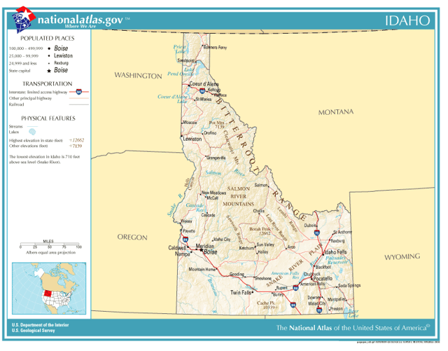
Geography
Map of Idaho
Idaho borders six U.S. states and one Canadian province. The states of Washington and Oregon are to the west, Nevada and Utah are to the south, and Montana and Wyoming are to the east. Idaho also shares a short border with the Canadian province of British Columbia to the north.
The landscape is rugged with some of the largest unspoiled natural areas in the United States. For example, at 2.3 million acres (930,000 ha), the Frank Church-River of No Return Wilderness Area is the largest contiguous area of protected wilderness in the continental United States. Idaho is a Rocky Mountain state with abundant natural resources and scenic areas. The state has snow-capped mountain ranges, rapids, vast lakes and steep canyons. The waters of the Snake River rush through Hells Canyon, the deepest gorge in the United States. Shoshone Falls plunges down rugged cliffs from a height greater than Niagara Falls.
The major rivers in Idaho are the Snake River, the Clark Fork/Pend Oreille River, the Clearwater River, and the Salmon River. Other significant rivers include the Coeur d'Alene River, the Spokane River, the Boise River, and the Payette River. The Salmon River empties into the Snake in Hells Canyon and forms the southern boundary of Nez Perce County on its north shore, of which Lewiston is the county seat. The Port of Lewiston, at the confluence of the Clearwater and the Snake Rivers is the farthest inland seaport on the West Coast at 465 river miles from the Pacific at Astoria, Oregon.[13]
Idaho's highest point is Borah Peak, 12,662 ft (3,859 m), in the Lost River Range north of Mackay. Idaho's lowest point, 710 ft (216 m), is in Lewiston, where the Clearwater River joins the Snake River and continues into Washington. The Sawtooth Range is often considered Idaho's most famous mountain range.[14] Other mountain ranges in Idaho include the Bitterroot Range, the White Cloud Mountains, the Lost River Range, the Clearwater Mountains, and the Salmon River Mountains.
Idaho has two time zones, with the dividing line approximately midway between Canada and Nevada. Southern Idaho, including the Boise metropolitan area, Idaho Falls, Pocatello, and Twin Falls, are in the Mountain Time Zone. A legislative error (15 U.S.C. ch. 6 [117] §264) theoretically placed this region in the Central Time Zone, but this was corrected with a 2007 amendment.[15] Areas north of the Salmon River, including Coeur d'Alene, Moscow, Lewiston, and Sandpoint, are in the Pacific Time Zone, which contains less than a quarter of the state's population and land area.
Climate

Köppen-Geiger climate types in Idaho
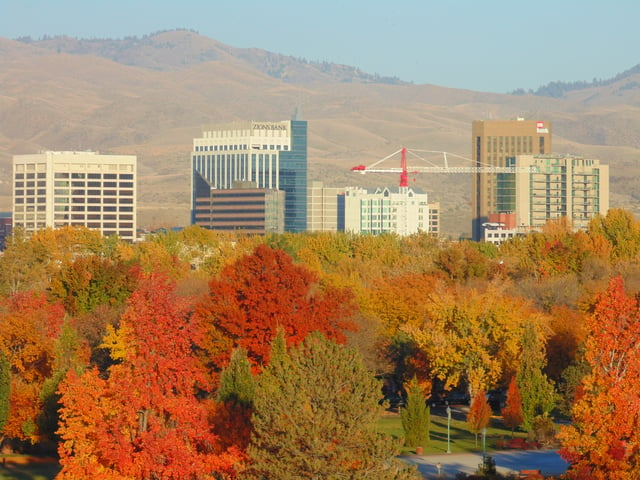
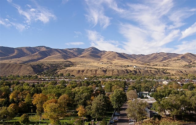
Autumn in Boise
Idaho's climate varies widely. Although the state's western border is about 350 miles (560 km) from the Pacific Ocean, the maritime influence is still felt in Idaho, especially in the winter when cloud cover, humidity, and precipitation are at their maximum extent. This influence has a moderating effect in the winter where temperatures are not as low as would otherwise be expected for a northern state with predominantly high elevations.[16] The maritime influence is least prominent in the state's eastern part where the precipitation patterns are often reversed, with wetter summers and drier winters, and seasonal temperature differences are more extreme, showing a more semi-arid continental climate.[17]
Idaho can be hot, although extended periods over 98 °F (37 °C) for the maximum temperature are rare, except for the lowest point in elevation, Lewiston, which correspondingly sees little snow. Hot summer days are tempered by the low relative humidity and cooler evenings during summer months since, for most of the state, the highest diurnal difference in temperature is often in the summer.[18] Winters can be cold, although extended periods of bitter cold weather below zero are unusual. Idaho's all-time highest temperature of 118 °F (48 °C) was recorded at Orofino on July 28, 1934; the all-time lowest temperature of −60 °F (−51 °C) was recorded at Island Park Dam on January 18, 1943.
| Monthly normal high and low temperatures for various Idaho cities. (°F) | ||||||||||||
| City | Jan | Feb | Mar | Apr | May | Jun | Jul | Aug | Sep | Oct | Nov | Dec |
|---|---|---|---|---|---|---|---|---|---|---|---|---|
| Boise | 38/24 | 45/27 | 55/33 | 62/38 | 72/46 | 81/53 | 91/59 | 90/59 | 79/50 | 65/40 | 48/31 | 38/23 |
| Lewiston | 42/30 | 47/31 | 55/36 | 62/41 | 71/47 | 79/54 | 89/60 | 89/60 | 78/51 | 63/41 | 48/34 | 40/28 |
| Pocatello | 33/16 | 38/19 | 49/27 | 59/33 | 68/40 | 78/46 | 88/52 | 88/51 | 76/42 | 62/33 | 45/24 | 33/16 |
| Orofino | 38/25 | 46/28 | 55/32 | 64/38 | 72/44 | 80/50 | 89/54 | 90/53 | 79/45 | 63/36 | 46/31 | 37/26 |
| [19] | ||||||||||||
Lakes/rivers
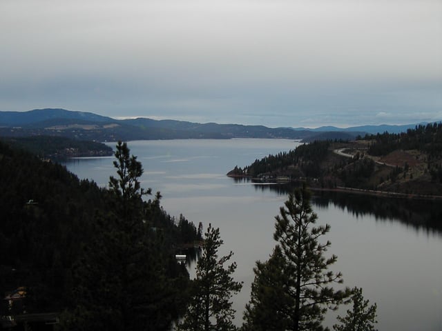
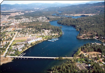
Lake Coeur d'Alene in North Idaho
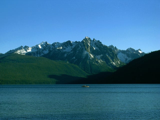
Redfish Lake in central Idaho
Priest River winding through Whitetail Butte
Alturas Lake
Brush Lake
Bear River
Bear Lake (Idaho-Utah)
Boise River
Clearwater River
Dawson Lake
Dierkes Lake
Hayden Lake
Henry's Lake
Hidden Lake
Kootenai River
Lake Cascade
Lake Cleveland
Lake Coeur d'Alene
Lake Lowell
Lake Walcott
Pend Oreille
Little Redfish Lake
Lucky Peak Lake
Moyie River
North Fork Clearwater River
Pack River
Payette Lake, (McCall)
Pettit Lake
Priest Lake
Perkins Lake
Portneuf River
Redfish Lake
River of No Return
Sawtooth Lake
Smith Lake
Snake River
Stanley Lake
Warm Lake
Williams Lake (Salmon)
History
Humans may have been present in the Idaho area as long as 14,500 years ago. Excavations at Wilson Butte Cave near Twin Falls in 1959 revealed evidence of human activity, including arrowheads, that rank among the oldest dated artifacts in North America. American Indian peoples predominant in the area included the Nez Percé in the north and the Northern and Western Shoshone in the south.
An early presence of French-Canadian trappers is visible in names and toponyms: Nez Percé, Cœur d'Alène, Boisé, Payette, some preexisting the Lewis and Clark and Astorian expeditions which themselves included significant numbers of French and Métis guides recruited for their familiarity with the terrain.
Idaho, as part of the Oregon Country, was claimed by both the United States and Great Britain until the United States gained undisputed jurisdiction in 1846. From 1843 to 1849, present-day Idaho was under the de facto jurisdiction of the Provisional Government of Oregon. When Oregon became a state, what is now Idaho was in what remained of the original Oregon Territory not part of the new state, and designated as the Washington Territory.
Between then and the creation of the Idaho Territory on March 4, 1863, at Lewiston, parts of the present-day state were included in the Oregon, Washington, and Dakota Territories. The new territory included present-day Idaho, Montana, and most of Wyoming. The Lewis and Clark expedition crossed Idaho in 1805 on the way to the Pacific and in 1806 on the return, largely following the Clearwater River both directions. The first non-indigenous settlement was Kullyspell House, established on the shore of Lake Pend Oreille for fur trading in 1809 by David Thompson of the North West Company.[20][21] In 1812 Donald Mackenzie, working for the Pacific Fur Company at the time, established a post on the lower Clearwater River near present-day Lewiston. This post, known as "MacKenzie's Post" or "Clearwater", operated until the Pacific Fur Company was bought out by the North West Company in 1813, after which it was abandoned.[22][23] The first attempts at organized communities, within the present borders of Idaho, were established in 1860.[24][25] The first permanent, substantial incorporated community was Lewiston in 1861.
After some tribulation as a territory, including the chaotic transfer of the territorial capital from Lewiston to Boise,[26] disenfranchisement of Mormon polygamists upheld by the U.S. Supreme Court in 1877,[27] and a federal attempt to split the territory between Washington Territory which gained statehood in 1889, a year before Idaho, and the state of Nevada which had been a state since 1864, Idaho achieved statehood in 1890.[28]
Idaho was one of the hardest hit of the Pacific Northwest states during the Great Depression.[29] Prices plummeted for Idaho's major crops: in 1932 a bushel of potatoes brought only $.10 compared to $1.51 in 1919, while Idaho farmers saw their annual income of $686 in 1929 drop to $250 by 1932.[30]
In recent years, Idaho has expanded its commercial base as a tourism and agricultural state to include science and technology industries. Science and technology have become the largest single economic center (over 25% of the state's total revenue) within the state and are greater than agriculture, forestry and mining combined.[31]
A Late Upper Paleolithic site was identified at Cooper’s Ferry in western Idaho near the town of Cottonwood by archaeologists in 2019. Based on evidence found at the site, first people lived in this area 15,300 to 16,600 years ago, predating the Beringia land bridge by about 1,000 years. The discoverers, anthropology professor Loren Davis and colleagues, emphasized that they possess similarities with tools and artifacts discovered in Japan that date from 16,000-13,000 years ago.[32][33][34][35][36] The discovery also showed that the first people might not have come to North America by land, as previously theorized. On the contrary, they probably came through the water, using a Pacific coastal road.[35]
The most parsimonious explanation we think is that people came down the Pacific Coast, and as they encountered the mouth of the Columbia River, they essentially found an off-ramp from this coastal migration and also found their first viable interior route to the areas that are south of the ice sheet— Davis
Demographics
Population
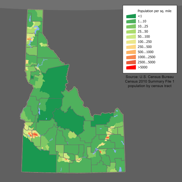
Idaho population density map
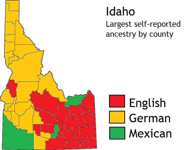
There are large numbers of Americans of German and English ancestry in Idaho.
| Historical population | |||
|---|---|---|---|
| Census | Pop. | %± | |
| 1870 | 14,999 | — | |
| 1880 | 32,610 | 117.4% | |
| 1890 | 88,548 | 171.5% | |
| 1900 | 161,772 | 82.7% | |
| 1910 | 325,594 | 101.3% | |
| 1920 | 431,866 | 32.6% | |
| 1930 | 445,032 | 3.0% | |
| 1940 | 524,873 | 17.9% | |
| 1950 | 588,637 | 12.1% | |
| 1960 | 667,191 | 13.3% | |
| 1970 | 712,567 | 6.8% | |
| 1980 | 943,935 | 32.5% | |
| 1990 | 1,006,749 | 6.7% | |
| 2000 | 1,293,953 | 28.5% | |
| 2010 | 1,567,582 | 21.1% | |
| Est. 2018 | 1,754,208 | 11.9% | |
| Source: 1910–2010[37] 2018 estimate[38] | |||
The United States Census Bureau estimates Idaho's population was 1,754,208 on July 1, 2018, an 11.91% increase since 2010.[38]
Idaho had an estimated population of 1,754,208 in 2018, which was an increase of 37,265, from the prior year and an increase of 186,626, or 11.91%, since 2010. This includes a natural increase since the last census of 58,884 people (that is, 111,131 births minus 52,247 deaths) and an increase due to net migration of 75,795 people into the state. There are large numbers of Americans of English and German ancestry in Idaho. Immigration from outside the United States resulted in a net increase of 14,522 people, and migration within the country produced a net increase of 61,273 people.
This made Idaho the tenth fastest-growing state after District of Columbia (+16.74%), Utah (+14.37%), Texas (+14.14%), Florida (+13.29%), Colorado (+13.25%), North Dakota (+13.01%), Nevada (+12.36%), Arizona (+12.20%) and Washington. From 2017 to 2018, Idaho grew the second-fastest, surpassed only by Nevada.
Nampa, about 20 miles (30 km) west of downtown Boise, became the state's second largest city in the late 1990s, passing Pocatello and Idaho Falls. Nampa's population was under 29,000 in 1990 and grew to over 81,000 by 2010. Located between Nampa and Boise, Meridian also experienced high growth, from under 10,000 residents in 1990 to over 75,000 in 2010 and is now Idaho's third largest city. Growth of 5% or more over the same period has also been observed in Caldwell, Coeur d'Alene, Post Falls, and Twin Falls.[39]
From 1990 to 2010, Idaho's population increased by over 560,000 (55%). The Boise Metropolitan Area (officially known as the Boise City-Nampa, ID Metropolitan Statistical Area) is Idaho's largest metropolitan area. Other metropolitan areas in order of size are Coeur d'Alene, Idaho Falls, Pocatello and Lewiston.
The table below shows the racial composition of Idaho's population as of 2016.
| Race | Population (2016 est.) | Percentage |
|---|---|---|
| Total population | 1,635,483 | 100% |
| White | 1,493,155 | 91.3% |
| Black or African American | 10,433 | 0.6% |
| American Indian and Alaska Native | 21,454 | 1.3% |
| Asian | 21,630 | 1.3% |
| Native Hawaiian and Other Pacific Islander | 2,003 | 0.1% |
| Some other race | 44,758 | 2.7% |
| Two or more races | 42,050 | 2.6% |
| Racial composition | 1970[41] | 1990[41] | 2000[42] | 2010[43] |
|---|---|---|---|---|
| White | 98.1% | 94.4% | 90.1% | 89.1% |
| Native | 0.9% | 1.4% | 1.4% | 1.4% |
| Asian | 0.5% | 0.9% | 0.9% | 1.2% |
| Black | 0.3% | 0.3% | 0.4% | 0.6% |
| Native Hawaiian and other Pacific Islander | – | – | 0.1% | 0.1% |
| Other race | 0.2% | 3.0% | 4.2% | 5.1% |
| Two or more races | – | – | 2.0% | 2.5% |
According to the 2016 American Community Survey, 12.0% of Idaho's population were of Hispanic or Latino origin (of any race): Mexican (10.4%), Puerto Rican (0.2%), Cuban (approx. 0.0%), and other Hispanic or Latino origin (1.3%).[40] The five largest ancestry groups were: German (17.5%), English (16.4%), Irish (9.3%), American (8.1%), and Scottish (3.2%).[44]
- Birth data
Note: Births in table don't add up, because Hispanics are counted both by their ethnicity and by their race, giving a higher overall number.
| Race | 2013[45] | 2014[46] | 2015[47] | 2016[48] | 2017[49] |
|---|---|---|---|---|---|
| White: | 21,246 (94.9%) | 21,696 (94.8%) | 21,618 (94.7%) | ... | ... |
Non-Hispanic White | 17,951 (80.2%) | 18,188 (79.5%) | 18,087 (79.2%) | 17,543 (78.0%) | 17,151 (77.3%) |
| Asian | 491 (2.2%) | 501 (2.2%) | 516 (2.3%) | 363 (1.6%) | 366 (1.7%) |
| American Indian | 421 (1.9%) | 429 (1.9%) | 406 (1.8%) | 261 (1.2%) | 337 (1.5%) |
| Black | 225 (1.0%) | 250 (1.1%) | 287 (1.2%) | 217 (1.0%) | 243 (1.1%) |
| Hispanic (of any race) | 3,422 (15.3%) | 3,651 (16.0%) | 3,645 (16.0%) | 3,614 (16.1%) | 3,598 (16.2%) |
| Total Idaho | 22,383 (100%) | 22,876 (100%) | 22,827 (100%) | 22,482 (100%) | 22,181 (100%) |
Since 2016, data for births of White Hispanic origin are not collected, but included in one Hispanic group; persons of Hispanic origin may be of any race.
Religion
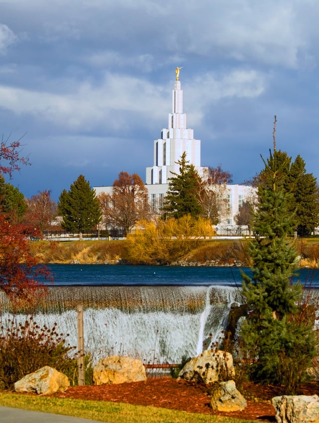
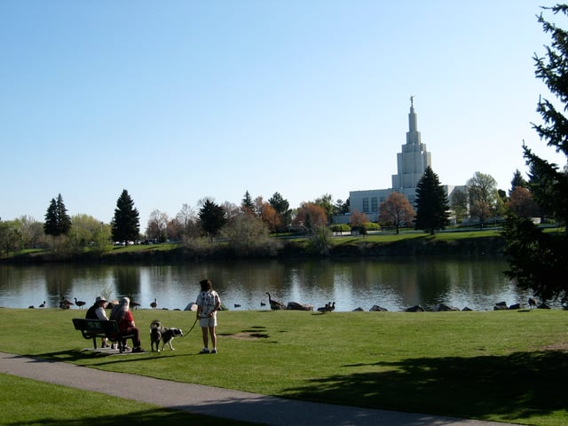
The Idaho Falls Idaho Temple of The Church of Jesus Christ of Latter-day Saints, November 2006
According to the Pew Research Center on Religion & Public Life, the self-identified religious affiliations of Idahoans over the age of 18 in 2008 and 2014 were:
| Denomination | 2008[51] | 2014[52][53] |
|---|---|---|
| Christian, including: | 81% | 67% |
| 22% | 21% |
| 16% | 16% |
| 18% | 10% | |
| < 0.5% | 1% |
| < 0.5% | < 1% |
| 23% | 19% | |
| 1% | < 1% | |
| < 0.5% | < 1% |
| Unaffiliated, including: | 18% | 27% |
| n/d | 22% |
| n/d | 3% |
| n/d | 2% |
| Non-Christian faiths, including: | n/d | 4% |
| < 0.5% | 1% |
| < 0.5% | < 1% |
| < 0.5% | < 1% |
| < 0.5% | < 1% | |
| < 0.5% | < 1% |
| n/d | 2% |
| Don't know/refused | < 0.5% | 1% |
According to the Association of Religion Data Archives, the largest denominations by number of members in 2010 were The Church of Jesus Christ of Latter-day Saints with 409,265; the Catholic Church with 123,400; the non-denominational Evangelical Protestant with 62,637; and the Assemblies of God with 22,183.[54]
Language
English is the state's predominant language. Minority languages include Spanish [1] [118] and various Native American languages.
Economy

Idaho state quarter
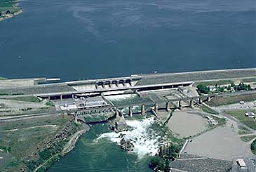
American Falls Dam
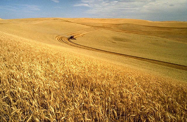
Wheat harvest on the Palouse
Important industries in Idaho are food processing, lumber and wood products, machinery, chemical products, paper products, electronics manufacturing, silver and other mining, and tourism. The world's largest factory for barrel cheese, the raw product for processed cheese is in Gooding, Idaho. It has a capacity of 120,000 metric tons per year of barrel cheese and belongs to the Glanbia group.[57] The Idaho National Laboratory (INL) is the largest Department of Energy facility in the country by area. INL is an important part of the eastern Idaho economy. Idaho also is home to three facilities of Anheuser-Busch which provide a large part of the malt for breweries across the nation.
A variety of industries are important. Outdoor recreation is a common example ranging from numerous snowmobile and downhill and cross-country ski areas in winter to the evolution of Lewiston as a retirement community based on mild winters, dry, year-round climate and one of the lowest median wind velocities anywhere, combined with the rivers for a wide variety of activities. Other examples would be ATK Corporation, which operates three ammunition and ammunition components plants in Lewiston. Two are sporting and one is defense contract. The Lewis-Clark valley has an additional independent ammunition components manufacturer and the Chipmunk rifle factory until it was purchased in 2007 by Keystone Sporting Arms and production was moved to Milton, Pennsylvania. Four of the world's six welded aluminum jet boat (for running river rapids) manufacturers are in the Lewiston-Clarkston, WA valley. Wine grapes were grown between Kendrick and Juliaetta in the Idaho Panhandle by the French Rothschilds until Prohibition. In keeping with this, while there are no large wineries or breweries in Idaho, there are numerous and growing numbers of award-winning boutique wineries and microbreweries in the northern part of the state.
Today, Idaho's largest industry is the science and technology sector. It accounts for over 25% of the state's revenue and over 70% of the state's exports. Idaho's industrial economy is growing, with high-tech products leading the way. Since the late 1970s, Boise has emerged as a center for semiconductor manufacturing. Boise is the home of Micron Technology, the only U.S. manufacturer of dynamic random-access memory (DRAM) chips. Micron at one time manufactured desktop computers, but with very limited success. Hewlett-Packard has operated a large plant in Boise since the 1970s, which is devoted primarily to LaserJet printers production.[58] Boise-based Clearwater Analytics is another rapidly growing investment accounting and reporting software firm, reporting on over $1 trillion in assets.[59] ON Semiconductor, whose worldwide headquarters is in Pocatello, is a widely recognized innovator of modern integrated mixed-signal semiconductor products, mixed-signal foundry services, and structured digital products. Coldwater Creek, a women's clothing retailer, is headquartered in Sandpoint. Sun Microsystems (now a part of Oracle Corporation) has two offices in Boise and a parts depot in Pocatello. Sun brings $4 million in annual salaries and over $300 million of revenue to the state each year.
A number of Fortune 500 companies started in or trace their roots to Idaho, including Safeway in American Falls, Albertsons in Boise, JR Simplot across southern Idaho, and Potlatch Corp. in Lewiston. Zimmerly Air Transport in Lewiston-Clarkston was one of the five companies in the merger centered around Varney Air Lines of Pasco, Washington, which became United Airlines and subsequently Varney Air Group that became Continental Airlines.
The state personal income tax ranges from 1.6% to 7.8% in eight income brackets. Idahoans may apply for state tax credits for taxes paid to other states, as well as for donations to Idaho state educational entities and some nonprofit youth and rehabilitation facilities.
The state sales tax is 6% with a very limited, selective local option up to 6.5%. Sales tax applies to the sale, rental or lease of tangible personal property and some services. Food is taxed, but prescription drugs are not. Hotel, motel, and campground accommodations are taxed at a higher rate (7% to 11%). Some jurisdictions impose local option sales tax.
In 2014, Idaho emerged as the second most small business friendly state, ranking behind Utah, based on a study drawing upon data from over 12,000 small business owners.[62]
Idaho has a state gambling lottery which contributed $333.5 million in payments to all Idaho public schools and Idaho higher education from 1990 to 2006.[63]
Energy
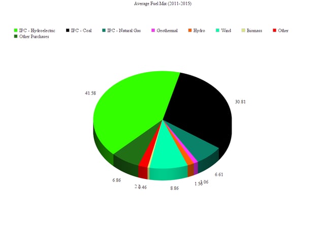
Average Fuel Mix (2011–2015)
As of 2017, the primary energy source in Idaho was hydropower, and the company had a total retail sales of 23,793,790 megawatthours (MWh).[64] As of 2017, Idaho had a regulated electricity market, with the Idaho Public Utilities Commission regulating the three major utilities of Avista Utilities, Idaho Power, and Rocky Mountain Power.[65]
Idaho's energy landscape is favorable to the development of renewable energy systems. The state is rich in renewable energy resources but has limited fossil fuel resources. The Snake River Plain and smaller river basins provide Idaho with some of the nation's best hydroelectric power resources and its geologically active mountain areas have significant geothermal power and wind power potential. These realities have shaped much of the state's energy landscape.
Idaho imports most of the energy it consumes. Imports account for more than 80% of energy consumption, including all of Idaho's natural gas and petroleum supplies and more than half of its electricity. Of the electricity consumed in Idaho in 2005, 48% came from hydroelectricity, 42% was generated by burning coal and 9% was generated by burning natural gas. The remainder came from other renewable sources such as wind.[66]
The state's numerous river basins allow hydroelectric power plants to provide 556,000 MWh, which amounts to about three-fourths of Idaho's electricity generated in the state. Washington State provides most of the natural gas used in Idaho through one of the two major pipeline systems supplying the state. Although the state relies on out-of-state sources for its entire natural gas supply, it uses natural gas-fired plants to generate 127,000 MWh, or about ten percent of its output. Coal-fired generation and the state's small array of wind turbines supplies the remainder of the state's electricity output. The state produces 739,000 MWh but still needs to import half of its electricity from out-of-state to meet demand.[67]
While Idaho's 515 trillion BTU total energy consumption is low compared with other states and represents just 0.5% of United States consumption, the state also has the nation's 11th smallest population, 1.5 million, so its per capita energy consumption of 352 million Btu is just above the national average of 333 million Btu.[67] As the 13th‑largest state in terms of land area (83,570 sq. mi=53,485,000ac), distance creates the additional problem of "line loss". When the length of an electrical transmission line is doubled, the resistance to an electric current passing through it is also doubled.
In addition, Idaho also has the 6th fastest growing population in the United States with the population expected to increase by 31% from 2008 to 2030.[68] This projected increase in population will contribute to a 42% increase in demand by 2030, further straining Idaho's finite hydroelectric resources.[69]
Idaho has an upper-boundary estimate of development potential to generate 44,320 GWh/year from 18,076 MW of wind power, and 7,467,000 GWh/year from solar power using 2,061,000 MW of photovoltaics (PV), including 3,224 MW of rooftop photovoltaics, and 1,267,000 MW of concentrated solar power.[70]
Transportation
The Idaho Transportation Department is the government agency responsible for Idaho's transportation infrastructure, including operations and maintenance as well as planning for future needs. The agency is also responsible for overseeing the disbursement of federal, state, and grant funding for the transportation programs of the state.[76]
Highways

I-15 shield

US-95 shield
Idaho is among the few states in the nation without a major freeway linking its two largest metropolitan areas, Boise in the south and Coeur d'Alene in the north. US-95 links the two ends of the state, but like many other highways in Idaho, it is badly in need of repair and upgrade. In 2007, the Idaho Transportation Department stated the state's highway infrastructure faces a $200 million per year shortfall in maintenance and upgrades. I-84 is the main highway linking the southeast and southwest portions of the state, along with I-86 and I-15. Major federal aid highways in Idaho:
Airports
Major airports include the Boise International Airport that serves the southwest region of Idaho and the Spokane International Airport (in Spokane, Washington) that serves northern Idaho. Other airports with scheduled service are the Pullman-Moscow Regional Airport serving the Palouse; the Lewiston-Nez Perce County Airport, serving the Lewis-Clark Valley and north central and west central Idaho; The Magic Valley Regional Airport in Twin Falls; the Idaho Falls Regional Airport; and the Pocatello Regional Airport.[77]
Railroads
Idaho is served by three transcontinental railroads. The Burlington Northern Santa Fe (BNSF) connects the Idaho Panhandle with Seattle, Portland, and Spokane to the west, and Minneapolis and Chicago to the east. The BNSF travels through Kootenai, Bonner, and Boundary counties. The Union Pacific Railroad crosses North Idaho entering from Canada through Boundary and Bonner, and proceeding to Spokane. Canadian Pacific Railway uses Union Pacific Railroad tracks in North Idaho carrying products from Alberta to Spokane and Portland, Oregon. Amtrak's Empire Builder crosses northern Idaho, with its only stop being in Sandpoint. Montana Rail Link also operates between Billings, Montana and Sandpoint, Idaho
The Union Pacific Railroad also crosses southern Idaho traveling between Portland, Oregon, Green River, Wyoming, and Ogden, Utah and serves Boise, Nampa, Twin Falls, and Pocatello.
Ports
The Port of Lewiston is the farthest inland Pacific port on the west coast. A series of dams and locks on the Snake River and Columbia River facilitate barge travel from Lewiston to Portland, where goods are loaded on ocean-going vessels.
Law and government
State constitution
The constitution of Idaho is roughly modeled on the national constitution with several additions. The constitution defines the form and functions of the state government, and may be amended through plebiscite. Notably, the state constitution presently requires the state government to maintain a balanced budget. As result, Idaho has limited debt (construction bonds, etc.).[78]
Idaho Code and Statutes
All of Idaho's state laws are contained in the Idaho Code and Statutes. The code is amended through the legislature with the approval of the governor. Idaho still operates under its original (1889) state constitution.[78]
State government
The constitution of Idaho provides for three branches of government: the executive, legislative and judicial branches. Idaho has a bicameral legislature, elected from 35 legislative districts, each represented by one senator and two representatives.
Since 1946, statewide elected constitutional officers have been elected to four-year terms. They include: Governor, Lieutenant Governor, Secretary of State, Idaho state controller (Auditor before 1994), Treasurer, Attorney General, and Superintendent of Public Instruction.
Last contested in 1966, Inspector of Mines was an originally elected constitutional office. Afterward it was an appointed position and ultimately done away with entirely in 1974.
Idaho's government has an alcohol monopoly.
Executive branch
The governor of Idaho serves a four-year term, and is elected during what is nationally referred to as midterm elections. As such, the governor is not elected in the same election year as the president of the United States. The current governor is Republican Brad Little, who was elected in 2018.
Legislative branch
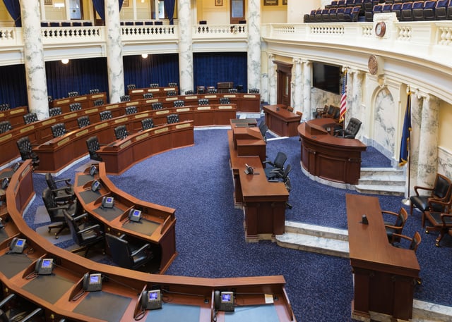
Chamber of the House of Representatives in 2018
Idaho's legislature is part-time. However, the session may be extended if necessary, and often is. Because of this, Idaho's legislators are considered "citizen legislators", meaning their position as a legislator is not their main occupation.
Terms for both the Senate and House of Representatives are two years. Legislative elections occur every even numbered year.
The Idaho Legislature has been continuously controlled by the Republican Party since the late 1950s, although Democratic legislators are routinely elected from Boise, Pocatello, Blaine County and the northern Panhandle.
See also List of Idaho senators and representatives
Judicial branch
The highest court in Idaho is the Idaho Supreme Court. There is also an intermediate appellate court, the Idaho Court of Appeals, which hears cases assigned to it from the Supreme Court. The state's District Courts serve seven judicial districts.[79]
Counties
Idaho is divided into political jurisdictions designated as counties. Since 1919 there are 44 counties in the state, ranging in size from 410 to 8,502 square miles (1,060 to 22,020 km2).
| County | County seat | License Plate Code | Year founded | Population (2017 est.) | Population Percentage | Area (sq. mi.) | Area % |
|---|---|---|---|---|---|---|---|
| Ada | Boise | 1A | 1864 | 456,849 | 25.00% | 1,060 | 1.21% |
| Adams | Council | 2A | 1911 | 4,147 | 0.23% | 1,370 | 1.57% |
| Bannock | Pocatello | 1B | 1893 | 85,269 | 05.30% | 1,147 | 1.31% |
| Bear Lake | Paris | 2B | 1893 | 6,028 | 00.38% | 1,049 | 1.20% |
| Benewah | St. Maries | 3B | 1915 | 9,184 | 00.61% | 784 | 0.90% |
| Bingham | Blackfoot | 4B | 1885 | 45,927 | 02.88% | 2,120 | 2.42% |
| Blaine | Hailey | 5B | 1895 | 22,024 | 01.43 % | 2,661 | 3.04% |
| Boise | Idaho City | 6B | 1864 | 7,290 | 00.49% | 1,907 | 2.18% |
| Bonner | Sandpoint | 7B | 1907 | 43,560 | 02.70% | 1,920 | 2.19% |
| Bonneville | Idaho Falls | 8B | 1911 | 114,595 | 06.51% | 1,901 | 2.17% |
| Boundary | Bonners Ferry | 9B | 1915 | 11,922 | 00.72 % | 1,278 | 1.46% |
| Butte | Arco | 10B | 1917 | 2,602 | 00.18% | 2,234 | 2.55% |
| Camas | Fairfield | 1C | 1917 | 1,102 | 00.07% | 1,079 | 1.23% |
| Canyon | Caldwell | 2C | 1891 | 216,699 | 12.07% | 604 | 0.69% |
| Caribou | Soda Springs | 3C | 1919 | 7,034 | 00.45% | 1,799 | 2.06% |
| Cassia | Burley | 4C | 1879 | 23,664 | 01.40% | 2,580 | 2.95% |
| Clark | Dubois | 5C | 1919 | 873 | 00.06% | 1,765 | 2.02% |
| Clearwater | Orofino | 6C | 1911 | 8,546 | 00.54% | 2,488 | 2.84% |
| Custer | Challis | 7C | 1881 | 4,172 | 00.28% | 4,937 | 5.64% |
| Elmore | Mountain Home | E | 1889 | 26,823 | 01.90% | 3,101 | 3.54% |
| Franklin | Preston | 1F | 1913 | 13,564 | 00.82% | 668 | 0.76% |
| Fremont | St. Anthony | 2F | 1893 | 13,094 | 00.82% | 1,896 | 2.17% |
| Gem | Emmett | 1G | 1915 | 17,379 | 01.08% | 566 | 0.65% |
| Gooding | Gooding | 2G | 1913 | 15,124 | 00.94% | 734 | 0.84% |
| Idaho | Grangeville | I | 1861/1864 | 16,369 | 01.01% | 8,502 | 9.71% |
| Jefferson | Rigby | 1J | 1913 | 28,446 | 01.57% | 1,106 | 1.26% |
| Jerome | Jerome | 2J | 1919 | 23,627 | 01.34% | 602 | 0.69% |
| Kootenai | Coeur d'Alene | K | 1864 | 157,637 | 09.02% | 1,316 | 1.50% |
| Latah | Moscow | 1L | 1888 | 39,333 | 02.36% | 1,077 | 1.23% |
| Lemhi | Salmon | 2L | 1869 | 7,875 | 00.51% | 4,570 | 5.22% |
| Lewis | Nezperce | 3L | 1911 | 3,887 | 00.24% | 480 | 0.55% |
| Lincoln | Shoshone | 4L | 1895 | 5,318 | 00.30% | 1,206 | 1.38% |
| Madison | Rexburg | 1M | 1914 | 39,141 | 02.46% | 473 | 0.54% |
| Minidoka | Rupert | 2M | 1913 | 20,729 | 01.22% | 763 | 0.87% |
| Nez Perce | Lewiston | N | 1861/1864 | 40,385 | 02.56% | 856 | 0.98% |
| Oneida | Malad City | 1O | 1864 | 4,427 | 00.27% | 1,202 | 1.37% |
| Owyhee | Murphy | 2O | 1863 | 11,628 | 00.71% | 7,697 | 8.79% |
| Payette | Payette | 1P | 1917 | 23,215 | 01.51% | 410 | 0.47% |
| Power | American Falls | 2P | 1913 | 7,600 | 00.50% | 1,443 | 1.65% |
| Shoshone | Wallace | S | 1861/64 | 12,542 | 0.85% | 2,636 | 3.01% |
| Teton | Driggs | 1T | 1915 | 11,381 | 0.58% | 451 | 0.52% |
| Twin Falls | Twin Falls | 2T | 1907 | 85,124 | 4.87% | 1,928 | 2.20% |
| Valley | Cascade | V | 1917 | 10,687 | 0.58% | 3,734 | 4.27% |
| Washington | Weiser | W | 1879 | 10,121 | 0.67% | 1,474 | 1.68% |
Total Counties: 44. Total 2018 Population Est.: 1,754,208. Total Area: 87,530 square miles (226,700 km2).
Three counties were first designated as such by the Washington Territorial Legislature in 1861;[80] they were subsequently redesignated as Idaho counties in 1864. The 1861 Nez Percé county has since been broken up into Nez Percé, Lewis, Boundary, Benewah, Latah, Kootenai, and Clearwater counties.
Idaho license plates begin with a county designation based on the first letter of the county's name. Where a letter is at the beginning of more than one name, a number accompanies precedingly in alphabetical order. This reflects an anomalous coincidental situation wherein 10 counties begin with B, seven with C and four with L, which is 21 of the 44 counties.
Politics

Party registration by county (December 2018): Republican >= 40% Republican >= 50% Republican >= 60% Republican >= 70% Republican >= 80% Unaffiliated>= 40% Unaffiliated>= 50%
| Party | Number of Voters | Percentage | |
|---|---|---|---|
| Republican | 403,771 | 49.86% | |
| Unaffiliated | 305,980 | 37.78% | |
| Democratic | 90,230 | 11.14% | |
| Libertarian | 6,733 | 0.83% | |
| Constitution | 3,006 | 0.37% | |
| Total | 809,720 | 100% | |
After the Civil War, many Midwestern and Southern Democrats moved to the Idaho Territory. As a result, the early territorial legislatures were solidly Democrat-controlled. In contrast, most of the territorial governors were appointed by Republican presidents and were Republicans. This led to sometimes-bitter clashes between the two parties, including a range war with the Democrats backing the sheepherders and the Republicans the cattlemen. That ended with the "Diamondfield" Jack Davis murder trial. In the 1880s, Republicans became more prominent in local politics.
In 1864, Clinton DeWitt Smith removed the territorial seal and the state constitution from a locked safe, and took them to Boise. This effectively moved the capital from where they were stored (Lewiston, Idaho) to the current capital Boise.[82]
Since statehood, the Republican Party has usually been the dominant party in Idaho. At one time, Idaho had two Democratic parties, one being the mainstream and the other called the Anti-Mormon Democrats, lasting into the early 20th century. In the 1890s and early 1900s, the Populist Party enjoyed prominence while the Democratic Party maintained a brief dominance in the 1930s during the Great Depression. Since World War II, most statewide elected officials have been Republicans. The last time the Democratic Party held a majority in either house of the state legislature was the House of Representatives in 1958 by one seat. However, Democrats did hold the governorship from 1971 to 1995, despite the state's Republican tilt.
Idaho Congressional delegations have also been generally Republican since statehood. Several Idaho Democrats have had electoral success in the House over the years, but the Senate delegation has been a Republican stronghold for decades. Several Idaho Republicans, including current Senator Mike Crapo, have won reelection to the Senate, but only Frank Church has won reelection as a Democrat. Church was the last Idaho Democrat to win a U.S. Senate race, in 1974. Walt Minnick's 2008 win in the First Congressional District was the state's first Democratic Congressional victory in 16 years.
In modern times, Idaho has been a reliably Republican state in presidential politics. It has not supported a Democrat for president since 1964. Even in that election, Lyndon Johnson defeated Barry Goldwater in the state by fewer than two percentage points, compared to a landslide nationally. In 2004, Republican George W. Bush carried Idaho by a margin of 38 percentage points and with 68.4% of the vote, winning in 43 of 44 counties. Only Blaine County, which contains the Sun Valley ski resort, supported John Kerry, who owns a home in the area. In 2008 Barack Obama's 36.1 percent[83] showing was the best for a Democratic presidential candidate in Idaho since 1976. However, Republican margins were narrower in 1992 and 1976.
In the 2006 elections, Republicans, led by gubernatorial candidate CL "Butch" Otter, won all the state's constitutional offices and retained both of the state's seats in the United States House of Representatives. However, Democrats picked up several seats in the Idaho Legislature, notably in the Boise area.[84]
Republicans lost one of the House seats in 2008 to Minnick, but Republican Jim Risch retained Larry Craig's Senate seat for the GOP by a comfortable margin.[85] Minnick lost his seat in the 2010 election to Republican State Rep. Raul Labrador.
Cities and towns

Sunset in Coeur d'Alene
Idaho Falls
Pocatello
Post Falls
- Population > 100,000 (urbanized area)
226,570 - Boise – state capital
99,926 - Meridian – suburb of Boise, fastest growing city in Idaho
- Population > 50,000 (urbanized area)
93,590 - Nampa – home of Northwest Nazarene University
61,076 - Idaho Falls – location of the main offices of the Idaho National Laboratory
55,193 - Pocatello – home of Idaho State University
54,660 - Caldwell – home of the College of Idaho
50,665 - Coeur d'Alene – home of North Idaho College, major tourist hub
49,202 - Twin Falls – home of College of Southern Idaho, BASE jumping
- Population > 30,000 (urbanized area)
33,290 - Post Falls
32,820 - Lewiston – home of Lewis-Clark State College, inland port
- Population > 10,000 (urbanized area)
28,337 - Rexburg – home of Brigham Young University–Idaho
26,089 - Eagle – suburb of Boise
25,146 - Moscow – home of the University of Idaho
19,200 - Kuna – suburb of Boise
15,540 - Ammon – suburb of Idaho Falls
14,869 - Chubbuck, Idaho – suburb of Pocatello
14,693 - Hayden
14,224 - Mountain Home – U.S. Air Force Base
11,922 - Blackfoot – home of the Idaho Potato Museum
11,890 - Garden City – suburb of Boise
11,636 - Jerome
10,474 - Burley
9,076 - Star, Idaho – suburb of Boise
- Smaller towns and cities
American Falls – first town to be entirely relocated
Arco – first city to be lit by electricity generated from a nuclear power plant
Bonners Ferry – northernmost major town in Idaho
Buhl – "trout capital of the world"
Bone – population 2, but still has a gas station
Cascade – Lake Cascade and dam
Craigmont
Cottonwood
Driggs – skiing (Grand Targhee)
Eden
Emmett
Grangeville – Idaho County seat
Greenleaf
Ferdinand
Firth
Fruitland
Filer – suburb of Twin Falls
Hazelton
Homedale – "gateway to the Owyhees"
Island Park – snowmobiling, world-class fishing
Kimberly – suburb of Twin Falls
Kellogg – skiing (Silver Mountain Ski Resort)
Lapwai – "Lep'wey" – business headquarters of the Nez Perce Tribe
Malad City – where Utah buys lottery tickets
Mackay
McCall – skiing (Brundage Mountain Resort) and recreation Payette Lake
Melba, Idaho – south of Nampa, Idaho
Middleton – small town
Montpelier – bank robbed by the Wild Bunch
Mullan – silver/lead/zinc mining
New Meadows – at the 45th parallel north
New Plymouth – first planned community in Idaho, third west of the Rocky Mountains
Nezperce – Lewis County seat
Notus
Oakley – famous pioneer town, home of many historic buildings
Orofino – site of Dworshak Dam, highest straight-axis dam in Western Hemisphere
Paris – Bear Lake County seat
Parma – site of Old Fort Boise
Payette – Payette County seat
Pierce – location of the first discovery of gold in Idaho
Plummer – CDA tribal headquarters
Preston – location of the 2004 film Napoleon Dynamite and the annual International Bed Races
Rigby – television birthplace
Riggins – near the Seven Devils Mountains
Reubens
Rupert – Minidoka County seat
Salmon – gateway to "River of No Return" (Salmon River)
Sandpoint – skiing (Schweitzer Mountain Ski Resort) and recreation Lake Pend Oreille
Shelley – home of the russet potato
Soda Springs – U.S.'s only captive geyser
St. Anthony – sand dunes and several lava tubes
St. Maries – Benewah County seat
Stanley, Idaho – heart of the Sawtooth mountains
Sun Valley – year-round resort with world-class skiing
Wallace – historic district and Shoshone County seat
Weippe – where the Lewis and Clark Expedition first met the Nez Perce tribe
Weiser – Washington County seat, home of the National Oldtime Fiddlers' Contest
Wilder – hometown of former governor Phil Batt
Winchester
Worley – casino
Protected areas
National parks, reserves, monuments and historic sites
[[INLINE_IMAGE|//upload.wikimedia.org/wikipedia/commons/thumb/a/a5/City_of_rocks_view_NPS.jpg/150px-City_of_rocks_view_NPS.jpg|//upload.wikimedia.org/wikipedia/commons/thumb/a/a5/City_of_rocks_view_NPS.jpg/225px-City_of_rocks_view_NPS.jpg 1.5x, //upload.wikimedia.org/wikipedia/commons/thumb/a/a5/City_of_rocks_view_NPS.jpg/300px-City_of_rocks_view_NPS.jpg 2x|City of Rocks National Reserve|h113|w150]] [[INLINE_IMAGE|//upload.wikimedia.org/wikipedia/commons/thumb/c/cc/Scoria_field_at_Craters_of_the_Moon_NM-750px.JPG/150px-Scoria_field_at_Craters_of_the_Moon_NM-750px.JPG|//upload.wikimedia.org/wikipedia/commons/thumb/c/cc/Scoria_field_at_Craters_of_the_Moon_NM-750px.JPG/225px-Scoria_field_at_Craters_of_the_Moon_NM-750px.JPG 1.5x, //upload.wikimedia.org/wikipedia/commons/thumb/c/cc/Scoria_field_at_Craters_of_the_Moon_NM-750px.JPG/300px-Scoria_field_at_Craters_of_the_Moon_NM-750px.JPG 2x|Craters of the Moon National Monument|h85|w150]]
California National Historic Trail
City of Rocks National Reserve
Craters of the Moon National Monument and Preserve
Hagerman Fossil Beds National Monument
Lewis and Clark National Historic Trail
Minidoka National Historic Site
Nez Perce National Historical Park
Oregon National Historic Trail
Yellowstone National Park
Pacific Northwest National Scenic Trail
National recreation areas
Hells Canyon National Recreation Area
Sawtooth National Recreation Area
National wildlife refuges and Wilderness Areas
Bear Lake National Wildlife Refuge
Camas National Wildlife Refuge
Deer Flat National Wildlife Refuge
Grays Lake National Wildlife Refuge
Kootenai National Wildlife Refuge
Minidoka National Wildlife Refuge
National conservation areas
Snake River Birds of Prey National Conservation Area
State parks
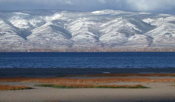
Bear Lake viewed from Bear Lake State Park
Bear Lake State Park
Bruneau Dunes State Park
Castle Rocks State Park
City of Rocks National Reserve
Coeur d'Alene Parkway State Park
Dworshak State Park
Eagle Island State Park
Farragut State Park
Harriman State Park
Hells Gate State Park
Henrys Lake State Park
Heyburn State Park
Lake Cascade State Park
Lake Walcott State Park
Land of the Yankee Fork State Park
Lucky Peak State Park
Massacre Rocks State Park
McCroskey State Park
Old Mission State Park
Ponderosa State Park
Priest Lake State Park
Round Lake State Park
Thousand Springs State Park
Three Island Crossing State Park
Trail of the Coeur d'Alenes
Winchester Lake State Park
Education
Colleges and universities
The Jacob Spori Building at Brigham Young University-Idaho in Rexburg
Idaho State University in Pocatello
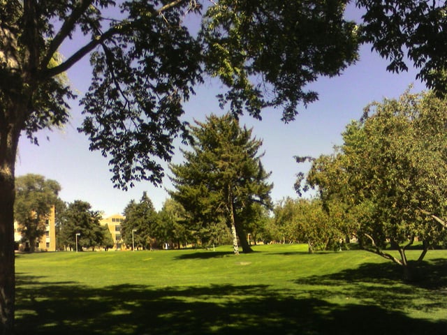
University of Idaho Arboretum in Moscow
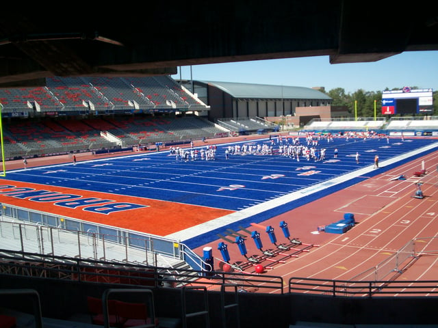
Albertsons Stadium at Boise State University in Boise
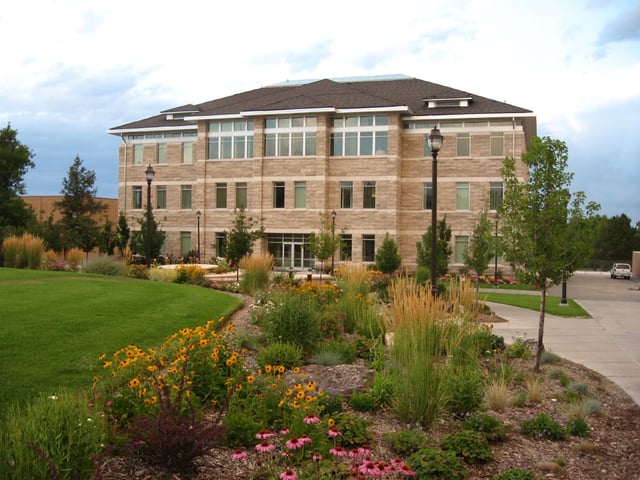
The Idaho State Board of Education oversees three comprehensive universities. The University of Idaho in Moscow was the first university in the state (founded in 1889). It opened its doors in 1892 and is the land-grant institution and primary research university of the state. Idaho State University in Pocatello opened in 1901 as the Academy of Idaho, attained four-year status in 1947 and university status in 1963. Boise State University is the most recent school to attain university status in Idaho. The school opened in 1932 as Boise Junior College and became Boise State University in 1974. Lewis-Clark State College in Lewiston is the only public, non-university 4-year college in Idaho. It opened as a normal school in 1893.
Idaho has four regional community colleges: North Idaho College in Coeur d'Alene; College of Southern Idaho in Twin Falls; College of Western Idaho in Nampa, which opened in 2009, College of Eastern Idaho in Idaho Falls, which transitioned from a technical college in 2017.
Private institutions in Idaho are Boise Bible College, affiliated with congregations of the Christian churches and churches of Christ; Brigham Young University-Idaho in Rexburg, which is affiliated with The Church of Jesus Christ of Latter-day Saints and a sister college to Brigham Young University; The College of Idaho in Caldwell, which still maintains a loose affiliation with the Presbyterian Church; Northwest Nazarene University in Nampa; and New Saint Andrews College in Moscow, of reformed Christian theological background. McCall College is a non-affiliated 2-year private college in McCall, which was founded in 2011 and later opened in 2013.
Boise Bible College
Boise State University
Brigham Young University-Idaho (formerly Ricks College)
College of Idaho (formerly Albertson College of Idaho)
College of Southern Idaho
College of Western Idaho
College of Eastern Idaho
Idaho State University
Lewis-Clark State College
McCall College
New Saint Andrews College
North Idaho College
Northwest Nazarene University
University of Idaho
Sports
Central Idaho is home to one of North America's oldest ski resorts, Sun Valley, where the world's first chairlift was installed in 1936.[87] Other noted outdoor sites include Hells Canyon, the Salmon River, and its embarkation point of Riggins.
The Boise Open professional golf tournament is played at Hillcrest Country Club since 1990 as part of the Web.com Tour.
High school sports are overseen by the Idaho High School Activities Association (IHSAA).
In 2016, Meridian's Michael Slagowski ran 800 meters in 1:48.70. That is one of the 35 fastest 800 meter times ever run by a high school boy in the United States.[88] Weeks later, he would become only the ninth high school boy to complete a mile in under 4 minutes, running 3:59.53.
Official state emblems
State amphibian: Idaho Giant Salamander (Dicamptodon aterrimus)[89]
State bird: mountain bluebird (Sialia currucoides)
State dance: square dance
State fish: cutthroat trout (Oncorhynchus clarkii)
State flower: syringa (Philadelphus lewisii)
State fossil: Hagerman horse (Equus simplicidens)
State fruit: huckleberry
State gem: star garnet
State horse: Appaloosa
State motto: Esto perpetua ("Let it be perpetual")[90]
State insect: monarch butterfly (Danaus plexippus)
State raptor: peregrine falcon (Falco peregrinus)
State song: "Here We Have Idaho"
State tree: western white pine (Pinus monticola)
State vegetable: potato
In popular culture
Judy Garland performed the elaborate song-and-dance routine "Born in a Trunk in the Princess Theater in Pocatello, Idaho" in the 1954 version of the film A Star is Born.[91]
The 1985 film Pale Rider was primarily filmed in the Boulder Mountains and the Sawtooth National Recreation Area in central Idaho, just north of Sun Valley.[92]
The 1988 film Moving, starring Richard Pryor, has the main character take a promotion in Idaho.[93]
River Phoenix and Keanu Reeves starred in the 1991 movie My Own Private Idaho, portions of which take place in Idaho.[94][95]
The 2004 cult film Napoleon Dynamite takes place in Preston, Idaho. The director, Jared Hess, attended Preston High School.[96]
See also
Outline of Idaho – organized list of topics about Idaho
Index of Idaho-related articles