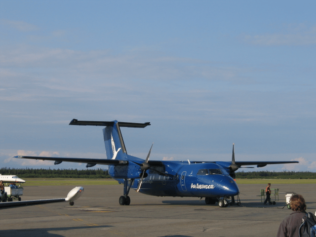
Sept-Îles Airport
474 VIEWS
Everipedia is now IQ.wiki - Join the IQ Brainlist and our Discord for early access to editing on the new platform and to participate in the beta testing.

Sept-Îles Airport
Sept-Îles Airport

Sept-Îles Airport Aéroport de Sept-Îles | |||||||||||||||
|---|---|---|---|---|---|---|---|---|---|---|---|---|---|---|---|
| |||||||||||||||
| Summary | |||||||||||||||
| Airport type | Public | ||||||||||||||
| Operator | Transport Canada | ||||||||||||||
| Location | Sept-Îles, Quebec | ||||||||||||||
| Time zone | EST (UTC−05:00) | ||||||||||||||
| • Summer (DST) | EDT (UTC−04:00) | ||||||||||||||
| Elevation AMSL | 180 ft / 55 m | ||||||||||||||
| Coordinates | 50°13′24″N 066°15′56″W [6] | ||||||||||||||
| Map | |||||||||||||||
| Runways | |||||||||||||||
| |||||||||||||||
| Statistics (2010/2011) | |||||||||||||||
| |||||||||||||||

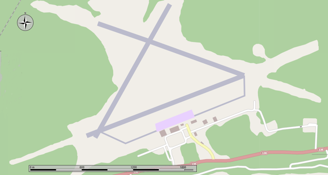
Map of the airport.
Sept-Îles Airport (IATA: YZV, ICAO: CYZV) is situated 4.5 nautical miles (8.3 km; 5.2 mi) east of the town of Sept-Îles, Quebec, Canada.
The airport is classified as an airport of entry by Nav Canada and is staffed by the Canada Border Services Agency (CBSA) on a call-out basis from the Quebec City Jean Lesage International Airport. CBSA officers at this airport can handle general aviation aircraft only, with no more than 15 passengers.[1]
Sept-Îles Airport Aéroport de Sept-Îles | |||||||||||||||
|---|---|---|---|---|---|---|---|---|---|---|---|---|---|---|---|
| |||||||||||||||
| Summary | |||||||||||||||
| Airport type | Public | ||||||||||||||
| Operator | Transport Canada | ||||||||||||||
| Location | Sept-Îles, Quebec | ||||||||||||||
| Time zone | EST (UTC−05:00) | ||||||||||||||
| • Summer (DST) | EDT (UTC−04:00) | ||||||||||||||
| Elevation AMSL | 180 ft / 55 m | ||||||||||||||
| Coordinates | 50°13′24″N 066°15′56″W [6] | ||||||||||||||
| Map | |||||||||||||||
| Runways | |||||||||||||||
| |||||||||||||||
| Statistics (2010/2011) | |||||||||||||||
| |||||||||||||||
Airlines and destinations
| Airlines | Destinations |
|---|---|
| Air Canada Express | Montréal–Trudeau, Quebec City, Wabush |
| Air Inuit | Kuujjuaq, Montréal–Trudeau, Quebec City, Schefferville |
| Air Liaison | Baie-Comeau, Havre Saint-Pierre, La Romaine, Port-Menier, Natashquan, Quebec City, Saint-Augustin, Blanc Sablon |
| PAL Airlines | Blanc Sablon, Chevery, Montréal–Trudeau, Natashquan, Quebec City, Saint-Augustin, Wabush |
| Pascan Aviation | Bagotville, Baie-Comeau, Mont-Joli, Montréal-Saint-Hubert, Quebec City, Wabush |
| Strait Air | Îles-de-la-Madeleine |
See also
Sept-Îles/Lac Rapides Water Aerodrome
References
[1]
Citation Linkopenlibrary.orgCanada Flight Supplement. Effective 0901Z 20 June 2019 to 0901Z 15 August 2019.
Sep 19, 2019, 7:44 AM
[3]
Citation Linkwww.statcan.gc.caTotal aircraft movements by class of operation — NAV CANADA flight service stations
Sep 19, 2019, 7:44 AM
[4]
Citation Linkwww.statcan.gc.caPassengers enplaned and deplaned on selected services — Top 50 airports - 2010
Sep 19, 2019, 7:44 AM
[8]
Citation Linkwww.statcan.gc.caTotal aircraft movements by class of operation — NAV CANADA flight service stations
Sep 19, 2019, 7:44 AM
[9]
Citation Linkwww.statcan.gc.caPassengers enplaned and deplaned on selected services — Top 50 airports - 2010
Sep 19, 2019, 7:44 AM
[11]
Citation Linken.wikipedia.orgThe original version of this page is from Wikipedia, you can edit the page right here on Everipedia.Text is available under the Creative Commons Attribution-ShareAlike License.Additional terms may apply.See everipedia.org/everipedia-termsfor further details.Images/media credited individually (click the icon for details).
Sep 19, 2019, 7:44 AM
