Harlem
Harlem
Harlem | |
|---|---|
Neighborhood of Manhattan | |
| Nickname(s): "Heaven", "Black mecca" | |
| Motto(s): "Making It!" | |
 Location in New York City | |
| Country | |
| State | |
| City | |
| Borough | |
| Community District | Manhattan 10[1] |
| Founded | 1658 |
| Named for | Haarlem, Netherlands |
| Area | |
| • Total | 3.63 km2(1.400 sq mi) |
| Population | |
| • Total | 116,345 |
| • Density | 32,000/km2(83,000/sq mi) |
| Economics | |
| • Median income | $49,059 |
| Time zone | UTC−5 (Eastern) |
| • Summer (DST) | UTC−4 (EDT) |
| ZIP codes | 10026, 10027, 10030, 10037, 10039 |
| Area code | 212, 332, 646, and 917 |
.tiff)
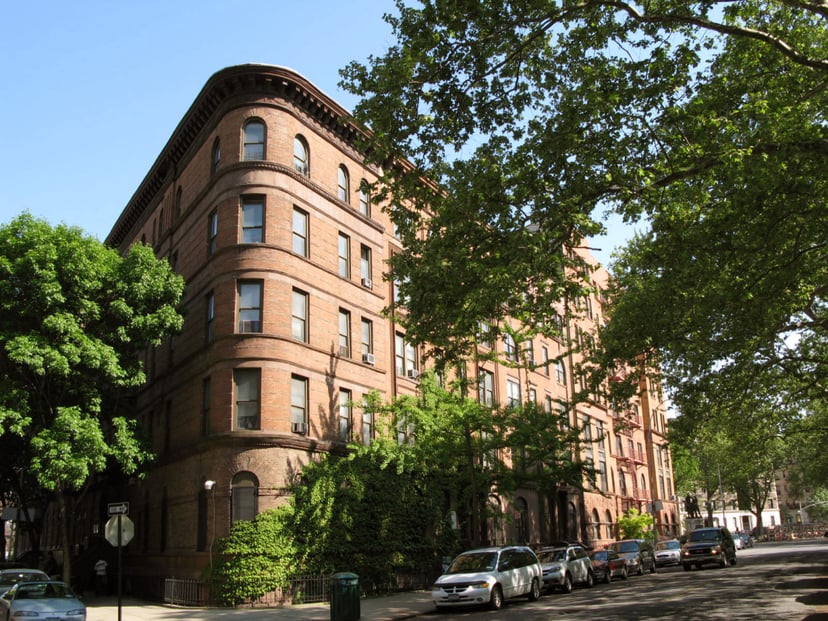
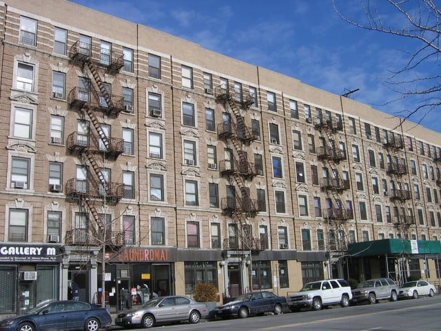
Harlem is a neighborhood in the northern section of the New York City borough of Manhattan. It is bounded roughly by Frederick Douglass Boulevard, St. Nicholas Avenue, and Morningside Park on the west; the Harlem River and 155th Street on the north; Fifth Avenue on the east; and Central Park North on the south. The greater Harlem area encompasses several other neighborhoods and extends west to the Hudson River, north to 155th Street, east to the East River, and south to 96th Street. Harlem is part of Manhattan Community District 10.
Originally a Dutch village, formally organized in 1658,[4] it is named after the city of Haarlem in the Netherlands. Harlem's history has been defined by a series of economic boom-and-bust cycles, with significant population shifts accompanying each cycle.[5] Harlem was predominantly occupied by Jewish and Italian Americans in the 19th century, but African-American residents began to arrive in large numbers during the Great Migration in the 20th century. In the 1920s and 1930s, Central and West Harlem were the focus of the "Harlem Renaissance", an outpouring of artistic work without precedent in the American-black community. However, with job losses during the Great Depression of 1929–1933 and the deindustrialization of New York City after World War II, rates of crime and poverty increased significantly, and from the second half of the 20th century to the early 2000s, most of greater Harlem's residents were black.[6] Since New York City's revival in the late 20th century, Harlem has been experiencing the effects of gentrification and new wealth.
Harlem | |
|---|---|
Neighborhood of Manhattan | |
| Nickname(s): "Heaven", "Black mecca" | |
| Motto(s): "Making It!" | |
Location in New York City | |
| Country | |
| State | |
| City | |
| Borough | |
| Community District | Manhattan 10[1] |
| Founded | 1658 |
| Named for | Haarlem, Netherlands |
| Area | |
| • Total | 3.63 km2(1.400 sq mi) |
| Population | |
| • Total | 116,345 |
| • Density | 32,000/km2(83,000/sq mi) |
| Economics | |
| • Median income | $49,059 |
| Time zone | UTC−5 (Eastern) |
| • Summer (DST) | UTC−4 (EDT) |
| ZIP codes | 10026, 10027, 10030, 10037, 10039 |
| Area code | 212, 332, 646, and 917 |
Geography

Map of Upper Manhattan, with Greater Harlem highlighted. Harlem proper is the neighborhood in the center.
Harlem is located in Upper Manhattan, often referred to as Uptown by locals. The three neighborhoods that comprise greater Harlem (composed of Community Districts 9, 10, and 11) stretch from the Harlem River and East River in the east, to the Hudson River to the west; and between 155th Street in the north, where it meets Washington Heights, and an uneven boundary along the south that runs along 96th Street east of Fifth Avenue, 110th Street between Fifth Avenue to Morningside Park, and 125th Street west of Morningside Park to the Hudson River.[7][8][9] These boundaries are also cited by Encyclopædia Britannica,[10] though the Encyclopedia of New York City takes a much more conservative view of Harlem's boundaries, only regarding central Harlem as part of Harlem proper.[11] []
Central Harlem is the name of Harlem proper. This section is bounded by Fifth Avenue on the east; Central Park on the south; Morningside Park, St. Nicholas Avenue and Edgecombe Avenue on the west; and the Harlem River on the north.[7] A chain of three large linear parks—Morningside Park, St. Nicholas Park and Jackie Robinson Park—are situated on steeply rising banks and form most of the district's western boundary. On the east, Fifth Avenue and Marcus Garvey Park, also known as Mount Morris Park, separate this area from East Harlem. This area falls under Manhattan Community District 10.[7] In the late 2000s, South Harlem, emerged from area redevelopment, running along Frederick Douglass Boulevard from West 110th to West 138th Streets.[12][13] Central Harlem includes the Mount Morris Park Historic District.
West Harlem is composed of Manhattanville and Hamilton Heights, which collectively comprise Manhattan Community District 9 and are not part of Harlem proper. The two neighborhoods' area is bounded by Cathedral Parkway/110th Street on the south; 155th Street on the north; Manhattan/Morningside Ave/St. Nicholas/Bradhurst/Edgecombe Avenues on the east; and Riverside Park/the Hudson River on the west. Manhattanville begins at roughly 123rd Street and extends northward to 135th Street. The northernmost section of West Harlem is Hamilton Heights.[8]
East Harlem, also called Spanish Harlem or El Barrio, within Manhattan Community District 11, is bounded by East 96th Street on the south, East 138th Street on the north, Fifth Avenue on the west, and the Harlem River on the east. It is not part of Harlem proper.[9]
SoHa controversy
Political representation
History
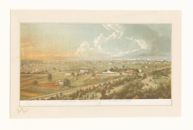
Harlem, from the old fort in the Central Park, New York Public Library [164]
Rowhouse built for the African-American population of Harlem in the 1930s
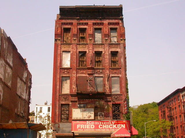
A condemned building in Harlem after the 1970s
Before the arrival of European settlers, the area that would become Harlem (originally Haarlem) was inhabited by the Manhattans, a native tribe, who along with other Native Americans, most likely Lenape,[26] occupied the area on a semi-nomadic basis. As many as several hundred farmed the Harlem flatlands.[27] Between 1637 and 1639, a few settlements were established.[28][29] During the American Revolution, the British burned Harlem to the ground.[30] It took a long time to rebuild, as Harlem grew more slowly than the rest of Manhattan during the late 18th century.[31] After the American Civil War, Harlem experienced an economic boom starting in 1868. The neighborhood continued to serve as a refuge for New Yorkers, but increasingly those coming north were poor and Jewish or Italian.[32] The New York and Harlem Railroad,[33] as well as the Interborough Rapid Transit and elevated railway lines,[34] helped Harlem's economic growth, as they connected Harlem to lower and midtown Manhattan.
The Jewish and Italian demographic decreased, while the black and Puerto Rican population increased in this time.[35] The early-20th century Great Migration of blacks to northern industrial cities was fueled by their desire to leave behind the Jim Crow South, seek better jobs and education for their children, and escape a culture of lynching violence; during World War I, expanding industries recruited black laborers to fill new jobs, thinly staffed after the draft began to take young men.[36] In 1910, Central Harlem was about 10% black. By 1930, it had reached 70%.[37] Starting around the time of the end of World War I, Harlem became associated with the New Negro movement, and then the artistic outpouring known as the Harlem Renaissance, which extended to poetry, novels, theater, and the visual arts. So many blacks came that it "threaten[ed] the very existence of some of the leading industries of Georgia, Florida, Tennessee and Alabama."[38] Many settled in Harlem. By 1920, central Harlem was 32.43% black. The 1930 census revealed that 70.18% of central Harlem's residents were black and lived as far south as Central Park, at 110th Street.[39]
However, by the 1930s, the neighborhood was hit hard by job losses in the Great Depression. In the early 1930s, 25% of Harlemites were out of work, and employment prospects for Harlemites stayed bad for decades. Employment among black New Yorkers fell as some traditionally black businesses, including domestic service and some types of manual labor, were taken over by other ethnic groups. Major industries left New York City altogether, especially after 1950. Several riots happened in this period, including in 1935 and 1943.
There were major changes following World War II. In the late 1950s and early 1960s, Harlem was the scene of a series of rent strikes by neighborhood tenants, led by local activist Jesse Gray, together with the Congress of Racial Equality, Harlem Youth Opportunities Unlimited (HARYOU), and other groups. These groups wanted the city to force landlords to improve the quality of housing by bringing them up to code, to take action against rats and roaches, to provide heat during the winter, and to keep prices in line with existing rent control regulations.[40] The largest public works projects in Harlem in these years were public housing, with the largest concentration built in East Harlem.[41] Typically, existing structures were torn down and replaced with city-designed and managed properties that would, in theory, present a safer and more pleasant environment than those available from private landlords. Ultimately, community objections halted the construction of new projects.[42] From the mid-20th century, the low quality of education in Harlem has been a source of distress. In the 1960s, about 75% of Harlem students tested under grade levels in reading skills, and 80% tested under grade level in math.[43] In 1964, residents of Harlem staged two school boycotts to call attention to the problem. In central Harlem, 92% of students stayed home.[44] In the post-World War II era, Harlem ceased to be home to a majority of the city's blacks,[45] but it remained the cultural and political capital of black New York, and possibly black America.[46][47]
By the 1970s, many of those Harlemites who were able to escape from poverty left the neighborhood in search of better schools and homes, and safer streets. Those who remained were the poorest and least skilled, with the fewest opportunities for success. Though the federal government's Model Cities Program spent $100 million on job training, health care, education, public safety, sanitation, housing, and other projects over a ten-year period, Harlem showed no improvement.[48] The city began auctioning its enormous portfolio of Harlem properties to the public in 1985. This was intended to improve the community by placing property in the hands of people who would live in them and maintain them. In many cases, the city would even pay to completely renovate a property before selling it (by lottery) below market value.[49]
After the 1990s, Harlem began to grow again. Between 1990 and 2006 the neighborhood's population grew by 16.9%, with the percentage of blacks decreasing from 87.6% to 69.3%,[39] then dropping to 54.4% by 2010,[50] and the percentage of whites increasing from 1.5% to 6.6% by 2006,[39] and to "almost 10%" by 2010.[50] A renovation of 125th Street and new properties along the thoroughfare[51][52] also helped to revitalize Harlem.[53]
Culture
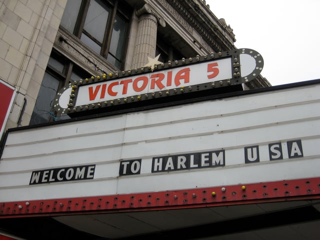
Welcome to Harlem sign above the now defunct Victoria 5 cinema theater on 125th st
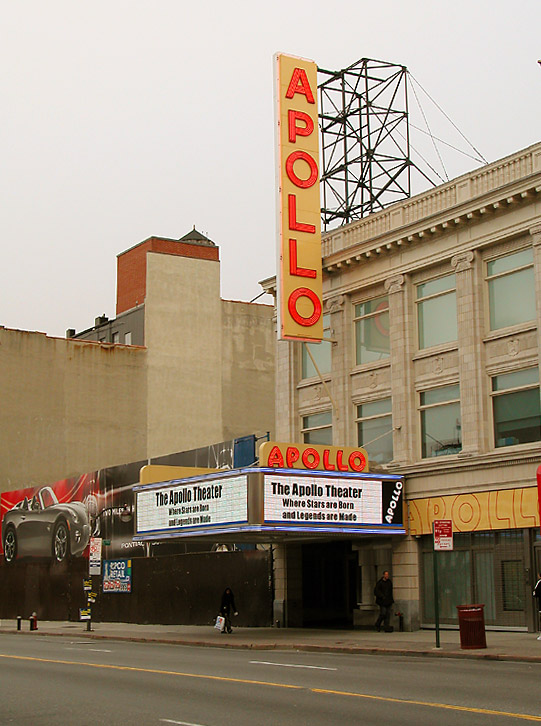
The Apollo Theater on 125th Street in November 2006
Spiritual African Drummer on 135th Street between Adam Clayton Powell Boulevard and Frederick Douglass Boulevard
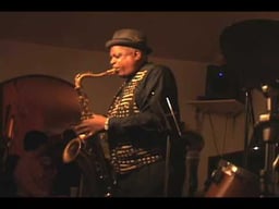
In the 1920s and 1930s, Central and West Harlem was the focus of the "Harlem Renaissance", an outpouring of artistic work without precedent in the American Black community. Though Harlem musicians and writers are particularly well remembered, the community has also hosted numerous actors and theater companies, including the New Heritage Repertory Theater,[54] National Black Theater, Lafayette Players, Harlem Suitcase Theater, The Negro Playwrights, American Negro Theater, and the Rose McClendon Players.[55]
The Apollo Theater opened on 125th Street on January 26, 1934, in a former burlesque house. The Savoy Ballroom, on Lenox Avenue, was a renowned venue for swing dancing, and was immortalized in a popular song of the era, "Stompin' At The Savoy". In the 1920s and 1930s, between Lenox and Seventh Avenues in central Harlem, over 125 entertainment venues were in operation, including speakeasies, cellars, lounges, cafes, taverns, supper clubs, rib joints, theaters, dance halls, and bars and grills.[56] 133rd Street, known as "Swing Street", became known for its cabarets, speakeasies and jazz scene during the Prohibition era, and was dubbed "Jungle Alley" because of "inter-racial mingling" on the street.[57][58] Some jazz venues, including the Cotton Club, where Duke Ellington played, and Connie's Inn, were restricted to whites only. Others were integrated, including the Renaissance Ballroom and the Savoy Ballroom.
In 1936, Orson Welles produced his black Macbeth at the Lafayette Theater in Harlem.[59] Grand theaters from the late 19th and early 20th centuries were torn down or converted to churches. Harlem lacked any permanent performance space until the creation of the Gatehouse Theater in an old Croton aqueduct building on 135th Street in 2006.[60]
Harlem is also home to the largest African American Day Parade, which celebrates the culture of African diaspora in America. The parade was started up in the spring of 1969 with Congressman Adam Clayton Powell, Jr. as the Grand Marshal of the first celebration.[63]
Arthur Mitchell, a former dancer with the New York City Ballet, established Dance Theatre of Harlem as a school and company of classical ballet and theater training in the late 1960s. The company has toured nationally and internationally. Generations of theater artists have gotten a start at the school.
Manhattan's contributions to hip-hop stems largely from artists with Harlem roots such as Big L, Kurtis Blow, The Diplomats, Mase or Immortal Technique. Harlem is also the birthplace of popular hip-hop dances such as the Harlem shake, toe wop, and Chicken Noodle Soup.
Harlem is currently experiencing a gourmet renaissance, with new dining hotspots popping up uptown around Frederick Douglass Boulevard.[64] At the same time, some residents are fighting back against the powerful waves of gentrification the neighborhood is experiencing. On October 17, 2013, residents staged a sidewalk sit-in to protest a five-days-a-week farmers market that would shut down Macombs Place at 150th Street.[65]
Religious life
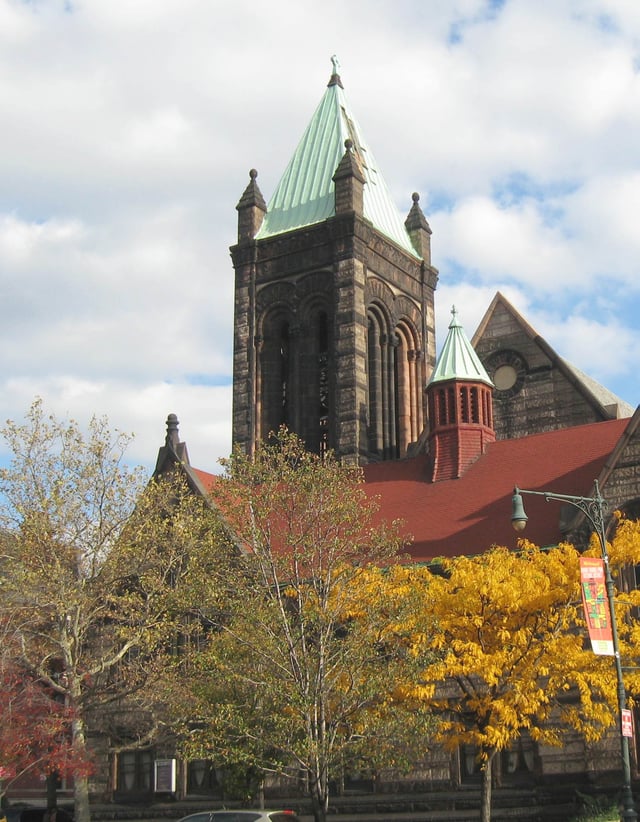
St. Andrew's Episcopal Church
Religious life has historically had a strong presence in Black Harlem. The area is home to over 400 churches.[68] Major Christian denominations include Baptists, Pentecostals, Methodists (generally African Methodist Episcopalian, or "AME"), Episcopalians, and Roman Catholic. The Abyssinian Baptist Church has long been influential because of its large congregation, and recently wealthy on account of its extensive real estate holdings. The Church of Jesus Christ of Latter-day Saints built a chapel on 128th Street in 2005. Previously, the Church had had a branch meeting around the corner in a former Jehovah's Witnesses Kingdom Hall. As of 2015, there are three LDS wards meeting at the Harlem Chapel.
Many of the area's churches are "storefront churches", which operate in an empty store, or a basement, or a converted brownstone townhouse. These congregations may have fewer than 30–50 members each, but there are hundreds of them.[69] Others are old, large, and designated landmarks. Especially in the years before World War II, Harlem produced popular Christian charismatic "cult" leaders, including George Wilson Becton and Father Divine.[70] Mosques in Harlem include the Malcolm Shabazz Mosque No. 7 (formerly Mosque No. 7 Nation of Islam, and the location of the 1972 Harlem Mosque incident), the Mosque of Islamic Brotherhood and Masjid Aqsa. Judaism, too, maintains a presence in Harlem through the Old Broadway Synagogue. A non-mainstream synagogue of Black Hebrews, known as Commandment Keepers, was based in a synagogue at 1 West 123rd Street until 2008.
Landmarks
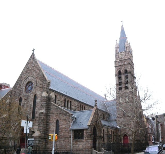
St Martin's Episcopal Church, at Lenox Avenue and 122nd Street
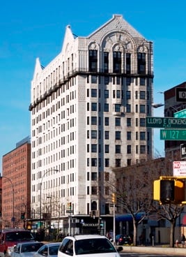
Hotel Theresa building at the corner of Adam Clayton Powell Jr. Boulevard and 125th Street
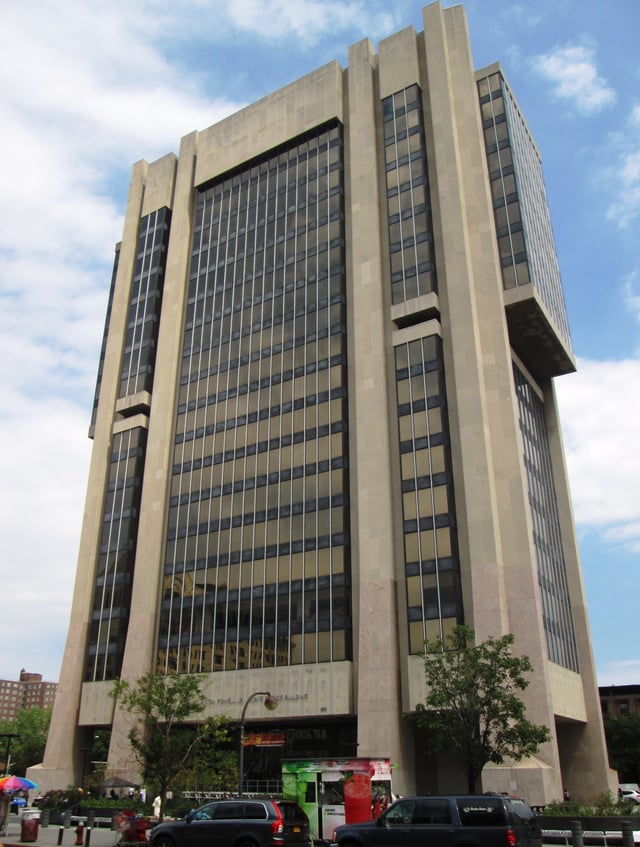
Adam Clayton Powell Jr. State Office Building, at the same intersection as the Hotel Theresa
Many places in Harlem are New York City Landmarks, listed on the National Register of Historic Places, or are otherwise prominent:
155th Street Viaduct leading to Macombs Dam Bridge
Abyssinian Baptist Church
Adam Clayton Powell Jr. State Office Building
All Saints Church
Apollo Theater
Atlah Worldwide Church
Schomburg Center for Research in Black Culture
Astor Row
Blockhouse No. 1
Bushman Steps Stairway that led baseball fans from the subway to The Polo Grounds ticket booth.[71]
City College of New York
Cotton Club
Duke Ellington Circle
Dunbar Apartments designed by architect Andrew J. Thomas. former home to W. E. B. Du Bois, Paul Robeson, Asa Philip Randolph, Bill “Bojangles” Robinson and explorer Matthew Henson
First Corinthian Baptist Church
Fort Clinton, Central Park and Nutter's Battery
Frederick Douglass Circle
Graham Court
Hamilton Grange
Hamilton Heights
Harbor Conservatory for the Performing Arts
Harlem Children's Zone
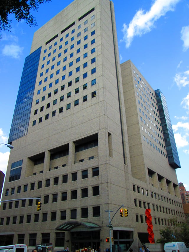
Harlem Hospital Center
Harlem River Houses
The Harlem School of the Arts
Harlem Stage
Harlem YMCA
Harlem Hellfighters Monument / 369th Infantry Regiment Memorial
Hooper Fountain
Hotel Theresa
James Bailey House
Jumel Terrace and Morris-Jumel Mansion in modern-day Washington Heights.
Langston Hughes House
La Marqueta
Lenox Lounge
Manhattan Avenue-West 120th-123rd Streets Historic District
Mink Building
Minton's Playhouse
Morningside Park
Mount Morris Bank Building
Mount Morris Park Historic District
Icahn School of Medicine at Mount Sinai and Mount Sinai Hospital, New York
El Museo Del Barrio
Museum of the City of New York
National Black Theater
New York College of Podiatric Medicine
Rucker Park
St. Martin's Episcopal Church (formerly Trinity Church) designed by William Appleton Potter[72]
Savoy Ballroom, marked by a plaque on Lenox.
St. Nicholas Historic District
St. Nicholas Houses
Strivers' Row
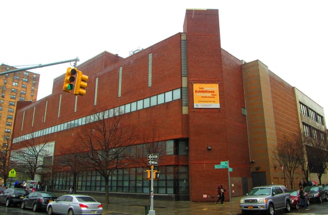
Studio Museum in Harlem
Swing Low Harriet Tubman Memorial
West 147th-149th Streets Historic District
Demographics
Like most neighborhoods in New York, the demographics of Harlem's communities have changed rapidly throughout the history of New York. In 1910, 10% of Harlem's population was black but by 1930, they had become a 70% majority.[6] The period between 1910 and 1930 marks a huge point in the great migration of African Americans from the South to New York. This point also marks an influx from downtown Manhattan neighborhoods where blacks were feeling less welcome, to the Harlem area.[6] The black population in Harlem peaked in 1950, with a 98% share of the population (population 233,000). As of 2000, central Harlem's black population comprised 77% of the total population of that area; however, the black population is declining as many African Americans move out and more immigrants move in.[73]
Harlem suffers from unemployment rates generally more than twice the citywide average, as well as high poverty rates.[74] and the numbers for men have been consistently worse than the numbers for women. Private and governmental initiatives to ameliorate unemployment and poverty have not been successful. During the Great Depression, unemployment in Harlem went past 20% and people were being evicted from their homes.[75] In the 1960s, uneducated blacks could find jobs more easily than educated ones could, confounding efforts to improve the lives of people who lived in the neighborhood through education.[76] Land owners took advantage of the neighborhood and offered apartments to the lower-class families for cheaper rent but in lower-class conditions.[77] By 1999 there were 179,000 housing units available in Harlem.[78] Housing activists in Harlem state that, even after residents were given vouchers for the Section 8 housing that was being placed, many were not able to live there and had to find homes elsewhere or become homeless.[78]
Harlem
In 2010, according to a regional census, the population of central Harlem was at 115,000. Central Harlem is the most famous section of greater Harlem, and thus is commonly referred to simply as Harlem.[79]
For census purposes, the New York City government classifies central Harlem into two neighborhood tabulation areas: Central Harlem North and Central Harlem South.[80] Based on data from the 2010 United States Census, the population of Central Harlem was 118,665, a change of 9,574 (8.1%) from the 109,091 counted in 2000. Covering an area of 926.05 acres (374.76 ha), the neighborhood had a population density of 128.1 inhabitants per acre (82,000/sq mi; 31,700/km2).[81] The racial makeup of the neighborhood was 9.5% (11,322) White, 63% (74,735) African American, 0.3% (367) Native American, 2.4% (2,839) Asian, 0% (46) Pacific Islander, 0.3% (372) from other races, and 2.2% (2,651) from two or more races. Hispanic or Latino of any race were 22.2% (26,333) of the population.[82]
The entirety of Community District 10, which comprises Central Harlem, had 116,345 inhabitants as of NYC Health's 2018 Community Health Profile, with an average life expectancy of 76.2 years.[2] [] This is lower than the median life expectancy of 81.2 for all New York City neighborhoods.[83] [] [84] Most inhabitants are children and middle-aged adults: 21% are between the ages of 0–17, while 35% are between 25–44, and 24% between 45–64. The ratio of college-aged and elderly residents was lower, at 10% and 11% respectively.[2] []
As of 2017, the median household income in Community District 10 was $49,059.[3] In 2018, an estimated 21% of Central Harlem residents lived in poverty, compared to 14% in all of Manhattan and 20% in all of New York City. One in eight residents (12%) were unemployed, compared to 7% in Manhattan and 9% in New York City. Rent burden, or the percentage of residents who have difficulty paying their rent, is 48% in Central Harlem, compared to the boroughwide and citywide rates of 45% and 51% respectively. Based on this calculation, as of 2018, Central Harlem is gentrifying.[2] []
Other subsections
In 2010, the population of East Harlem was at 120,000.[86] East Harlem originally formed as a predominantly Italian American neighborhood.[87] The area began its transition from Italian Harlem to Spanish Harlem when Puerto Rican migration began after World War II,[88] though in recent decades, many Dominican, Mexican and Salvadorean immigrants have also settled in East Harlem.[89] East Harlem is also known as is today predominantly Hispanic with a significant black presence.[88] The area suffers from the highest violent crime rate in Manhattan.[90]
Police and crime
NYPD Police Service Area 6, which serves NYCHA developments in greater Harlem
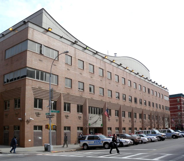
Central Harlem is patrolled by two precincts of the New York City Police Department (NYPD).[91] Central Harlem North is covered by the 28th Precinct, located at 250 West 135th Street,[92] while Central Harlem South is patrolled by the 32nd Precinct, located at 2271–2289 8th Avenue.[93] The 28th and 32nd Precincts ranked 54th safest out of 69 patrol areas for per-capita crime in 2010.[94] With a non-fatal assault rate of 116 per 100,000 people, Central Harlem's rate of violent crimes per capita is more than that of the city as a whole. The incarceration rate of 1,347 per 100,000 people is higher than that of the city as a whole.[2] []
The 28th Precinct has a lower crime rate than in the 1990s, with crimes across all categories having decreased by 74.1% between 1990 and 2018. The precinct saw 0 murders, 18 rapes, 156 robberies, 204 felony assaults, 102 burglaries, 445 grand larcenies, and 22 grand larcenies auto in 2018.[95] The 32nd Precinct also has a lower crime rate than in the 1990s, with crimes across all categories having decreased by 77% between 1990 and 2018. The precinct saw 5 murders, 20 rapes, 193 robberies, 314 felony assaults, 124 burglaries, 329 grand larcenies, and 41 grand larcenies auto in 2018.[96]
Crime
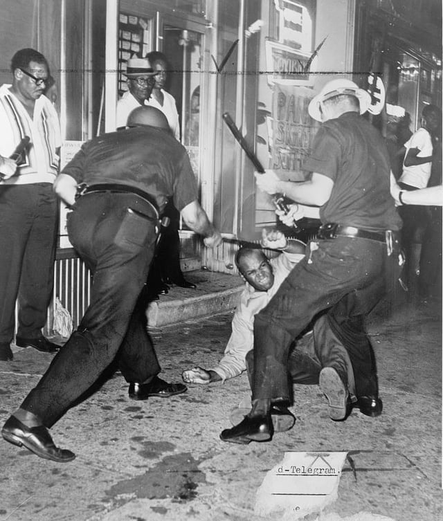
Harlem Riot of 1964
In the early 20th century, Harlem was a stronghold of the Italian Mafia. As the ethnic composition of the neighborhood changed, black criminals began to organize themselves similarly. However, rather than compete with the established mobs, gangs concentrated on the "policy racket", also called the numbers game, or bolita in East Harlem. This was a gambling scheme similar to a lottery that could be played, illegally, from countless locations around Harlem. According to Francis Ianni, "By 1925 there were thirty black policy banks in Harlem, several of them large enough to collect bets in an area of twenty city blocks and across three or four avenues."[97]
By the early 1950s, the total money at play amounted to billions of dollars, and the police force had been thoroughly corrupted by bribes from numbers bosses.[98] These bosses became financial powerhouses, providing capital for loans for those who could not qualify for them from traditional financial institutions, and investing in legitimate businesses and real estate. One of the powerful early numbers bosses was a woman, Madame Stephanie St. Clair, who fought gun battles with mobster Dutch Schultz over control of the lucrative trade.[99]
The popularity of playing the numbers waned with the introduction of the state lottery, which is legal but has lower payouts and has taxes collected on winnings.[100] The practice continues on a smaller scale among those who prefer the numbers tradition or who prefer to trust their local numbers bank to the state.
Statistics from 1940 show about 100 murders per year in Harlem, "but rape is very rare".[101] By 1950, essentially all of the whites had left Harlem and by 1960, much of the black middle class had departed. At the same time, control of organized crime shifted from Italian syndicates to local black, Puerto Rican, and Cuban groups that were somewhat less formally organized.[97] At the time of the 1964 riots, the drug addiction rate in Harlem was ten times higher than the New York City average, and twelve times higher than the United States as a whole. Of the 30,000 drug addicts then estimated to live in New York City, 15,000 to 20,000 lived in Harlem. Property crime was pervasive, and the murder rate was six times higher than New York's average. Half of the children in Harlem grew up with one parent, or none, and lack of supervision contributed to juvenile delinquency; between 1953 and 1962, the crime rate among young people increased throughout New York City, but was consistently 50% higher in Harlem than in New York City as a whole.[102]
Injecting heroin grew in popularity in Harlem through the 1950s and 1960s, though the use of this drug then leveled off. In the 1980s, use of crack cocaine became widespread, which produced collateral crime as addicts stole to finance their purchasing of additional drugs, and as dealers fought for the right to sell in particular regions, or over deals gone bad.[103]
With the end of the "crack wars" in the mid-1990s, and with the initiation of aggressive policing under mayors David Dinkins and his successor Rudy Giuliani, crime in Harlem plummeted. Compared to in 1981, when 6,500 robberies were reported in Harlem, reports of robberies dropped to 4,800 in 1990; to 1,700 in 2000; and to 1,100 in 2010.[104] Within the 28th and 32nd precincts, there have been similar changes in all categories of crimes tracked by the NYPD.[92][93]
Gangs
There are many gangs in Harlem, often based in housing projects; when one gang member is killed by another gang, revenge violence erupts which can last for years.[105] In addition, the East Harlem Purple Gang of the 1970s, which operated in East Harlem and surroundings, was an Italian American group of hitmen and heroin dealers.[106]
Harlem and its gangsters have a strong link to hip hop, rap and R&B culture in the United States, and many successful rappers in the music industry came from gangs in Harlem.[107] Gangster rap, which has its origins in the late 1980s, often has lyrics that are "misogynistic or that glamorize violence", glamorizing guns, drugs and easy women in Harlem and New York City.[108][107]
Fire safety
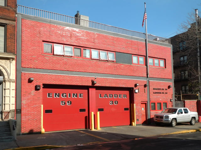
Engine Co. 59/Ladder Co. 30
Central Harlem is served by four New York City Fire Department (FDNY) fire stations:[109]
Five additional firehouses are located in West and East Harlem. West Harlem contains Engine Co. 47 and Engine Co. 80/Ladder Co. 23, while East Harlem contains Engine Co. 35/Ladder Co. 14/Battalion 12, Engine Co. 53/Ladder Co. 43, and Engine Co. 91.[109]
Health
Preterm and teenage births are more common in Central Harlem than in other places citywide. In Central Harlem, there were 103 preterm births per 1,000 live births (compared to 87 per 1,000 citywide), and 23 teenage births per 1,000 live births (compared to 19.3 per 1,000 citywide), though the teenage birth rate is based on a small sample size.[2] [] Central Harlem has a low population of residents who are uninsured. In 2018, this population of uninsured residents was estimated to be 8%, less than the citywide rate of 12%.[2] []
The concentration of fine particulate matter, the deadliest type of air pollutant, in Central Harlem is 0.0079 milligrams per cubic metre (7.9×10⁻⁹ oz/cu ft), slightly more than the city average.[2] [] Ten percent of Central Harlem residents are smokers, which is less than the city average of 14% of residents being smokers.[2] [] In Central Harlem, 34% of residents are obese, 12% are diabetic, and 35% have high blood pressure, the highest rates in the city—compared to the citywide averages of 24%, 11%, and 28% respectively.[2] [] In addition, 21% of children are obese, compared to the citywide average of 20%.[2] []
Eighty-four percent of residents eat some fruits and vegetables every day, which is less than the city's average of 87%. In 2018, 79% of residents described their health as "good," "very good," or "excellent," more than the city's average of 78%.[2] [] For every supermarket in Central Harlem, there are 11 bodegas.[2] []
Health problems
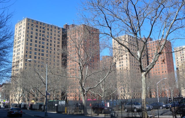
Drew Hamilton Houses, a large low-income NYCHA housing project in Central Harlem
Health outcomes for men have generally been worse for those for women. Infant mortality was 124 per thousand in 1928, meaning that 12.4% of infants would die.[116] By 1940, infant mortality in Harlem was 5%, and the death rate from disease generally was twice that of the rest of New York. Tuberculosis was the main killer, and four times as prevalent among Harlem citizens than among the rest of New York's population.[116]
A 1990 study of life expectancy of teenagers in Harlem reported that 15-year-old girls in Harlem had a 65% chance of surviving to the age of 65, about the same as women in Pakistan. Fifteen-year-old men in Harlem, on the other hand, had a 37% chance of surviving to 65, about the same as men in Angola; for men, the survival rate beyond the age of 40 was lower in Harlem than Bangladesh.[117] Infectious diseases and diseases of the circulatory system were to blame, with a variety of contributing factors, including consumption of the deep-fried foods traditional to the South, which may contribute to heart disease.
Post offices and ZIP codes
Icahn Medical Institute of the Mt. Sinai School of Medicine
Harlem is located within five primary ZIP Codes. From north to south, they are 10026 (from 110th to 120th Streets), 10027 (from 120th to 133rd Streets), 10037 (east of Lenox Avenue and north of 130th Street), 10030 (west of Lenox Avenue from 133rd to 145th Streets) and 10039 (from 145th to 155th Streets). Harlem also includes parts of ZIP Codes 10031, 10032, and 10035.[118] The United States Postal Service operates five post offices in Harlem:
Education
Central Harlem generally has a similar rate of college-educated residents to the rest of the city. While 42% of residents age 25 and older have a college education or higher, 19% have less than a high school education and 39% are high school graduates or have some college education. By contrast, 64% of Manhattan residents and 43% of city residents have a college education or higher.[2] [] The percentage of Central Harlem students excelling in math rose from 21% in 2000 to 48% in 2011, and reading achievement increased from 29% to 37% during the same time period.[124]
Central Harlem's rate of elementary school student absenteeism is higher than the rest of New York City. In Central Harlem, 25% of elementary school students missed twenty or more days per school year, more than the citywide average of 20%.[83] [] [2] [] Additionally, 64% of high school students in Central Harlem graduate on time, less than the citywide average of 75%.[2] []
Schools
The New York City Department of Education operates the following public elementary schools in Central Harlem:[125]
PS 76 A Phillip Randolph (grades PK-8)[126]
PS 92 Mary Mcleod Bethune (grades PK-5)[127]
PS 123 Mahalia Jackson (grades PK-8)[128]
PS 149 Sojourner Truth (grades PK-8)[129]
PS 154 Harriet Tubman (grades PK-5)[130]
PS 175 Henry H Garnet (grades PK-5)[131]
PS 185 the Early Childhood Discovery and Design Magnet School (grades PK-2)[132]
PS 194 Countee Cullen (grades PK-5)[133]
PS 197 John B Russwurm (grades PK-5)[134]
PS 200 The James Mccune Smith School (grades PK-5)[135]
PS 242 The Young Diplomats Magnet School (grades PK-5)[136]
Stem Institute of Manhattan (grades K-5)[137]
Thurgood Marshall Academy Lower School (grades K-5)[138]
The following middle and high schools are located in Central Harlem:[125]
Frederick Douglass Academy (grades 6-12)[139]
Frederick Douglass Academy II Secondary School (grades 6-12)[140]
Mott Hall High School (grades 9-12)[141]
Thurgood Marshall Academy For Learning And Social Change (grades 6-12)[142]
Wadleigh Secondary School for the Performing and Visual Arts (grades 6-12)[143]
As of May 2006, Harlem was the heart of the charter schools movement in Manhattan; of the 25 charter schools operating in Manhattan, 18 were in Harlem.[144] In 2010, approximately one age-eligible Harlem child in five was enrolled in charter schools.[145]
The CUNY Graduate School of Public Health and Health Policy, New York College of Podiatric Medicine, City College of New York, and Touro College of Osteopathic Medicine, in addition to a branch of College of New Rochelle, are all located in Harlem.
Libraries
New York Public Library, Schomburg Center for Research in Black Culture
The New York Public Library (NYPL) operates four circulating branches and one research branch in Harlem, as well as several others in adjacent neighborhoods.
The Schomburg Center for Research in Black Culture, a research branch, is located at 515 Malcolm X Boulevard. It is housed in a Carnegie library structure that opened in 1905, though the branch itself was established in 1925 based on a collection from its namesake, Arturo Alfonso Schomburg. The Schomburg Center is a National Historic Landmark, as well as a city designated landmark and a National Register of Historic Places (NRHP)-listed site.[146]
The Countee Cullen branch is located at 104 West 136th Street. It was originally housed in the building now occupied by the Schomburg Center. The current structure, in 1941, is an annex of the Schomburg building.[147]
The Harry Belafonte 115th Street branch is located at 203 West 115th Street. The three-story Carnegie library, built in 1908, is both a city designated landmark and an NRHP-listed site. It was renamed for the entertainer and Harlem resident Harry Belafonte in 2017.[148]
The Harlem branch is located at 9 West 124th Street. It is one of the oldest libraries in the NYPL system, having operated in Harlem since 1826. The current three-story Carnegie library building was built in 1909 and renovated in 2004.[149]
The Macomb's Bridge branch is located at 2650 Adam Clayton Powell, Jr. Boulevard, inside the Harlem River Houses. The branch opened in 1955 and is the smallest NYPL branch.[150]
Other nearby branches include the 125th Street and Aguilar branches in East Harlem; the Morningside Heights branch in Morningside Heights; and the George Bruce and Hamilton Grange branches in western Harlem.[151]
Transportation
Bridges
Harlem–125th Street station on the Metro-North Railroad
Bridges spanning the Harlem River between Harlem to the left and the Bronx to the right
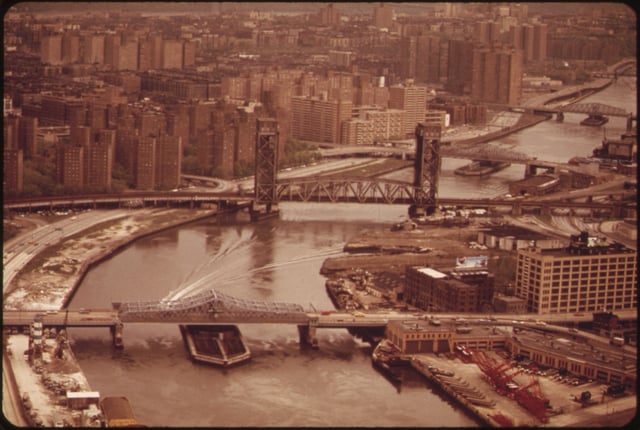
The Harlem River separates the Bronx and Manhattan, necessitating several spans between the two New York City boroughs. Five free bridges connect Harlem and the Bronx: the Willis Avenue Bridge (for northbound traffic only), Third Avenue Bridge (for southbound traffic only), Madison Avenue Bridge, 145th Street Bridge, and Macombs Dam Bridge. In East Harlem, the Wards Island Bridge, also known as the 103rd Street Footbridge, connects Manhattan with Wards Island. The Triborough Bridge is a complex of three separate bridges that offers connections between Queens, East Harlem, and the Bronx.[152]
Public transportation
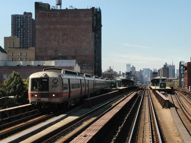
Public transportation service is provided by the Metropolitan Transportation Authority. This includes the New York City Subway and MTA Regional Bus Operations. Some Bronx local routes also serve Manhattan, providing customers with access between both boroughs.[153][154] Metro-North Railroad has a commuter rail station at Harlem–125th Street, serving trains to the Lower Hudson Valley and Connecticut.[155]
Subway
Harlem is served by the following subway lines:
In addition, several other lines stop nearby:
Bus
Harlem is served by numerous local bus routes operated by MTA Regional Bus Operations:[154]
Bx6 and Bx6 SBS along 155th Street
Bx19 along 145th Street
Bx33 along 135th Street
M1 along Fifth/Madison Avenues
M2 along Seventh Avenue, Central Park North, and Fifth/Madison Avenues
M3 along Manhattan Avenue, Central Park North, and Fifth/Madison Avenues
M4 along Broadway, Central Park North, and Fifth/Madison Avenues
M60 SBS, M100, M101 and Bx15 along 125th Street
M7 and M102 along Lenox Avenue and 116th Street
M10 along Frederick Douglass Boulevard
M116 along 116th Street
Routes that run near Harlem, but do not stop in the neighborhood, include:[154]
M5 along Riverside Drive
M11 along Amsterdam Avenue
M35 via Triborough Bridge
M98 and M103 along Third/Lexington Avenues
M104 along Broadway
See also
List of films shot in Harlem
List of people from Harlem