Győr-Moson-Sopron County
Győr-Moson-Sopron County

Győr-Moson-Sopron County Győr-Moson-Sopron megye | |
|---|---|
Counties of Hungary | |
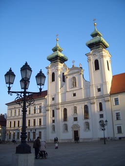
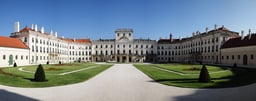
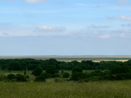
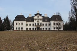
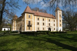
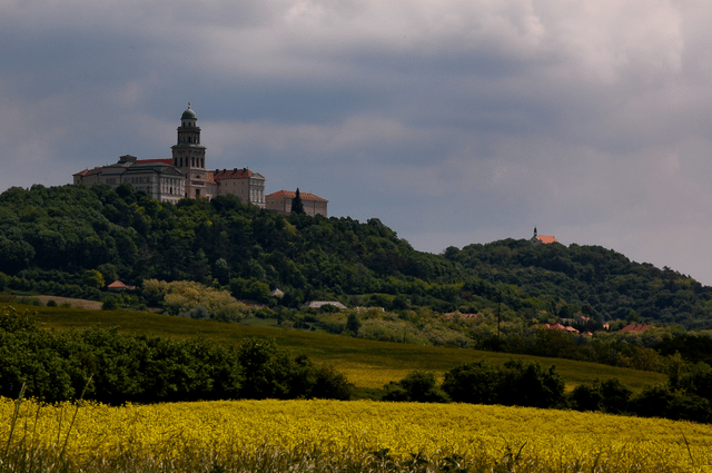
Descending, from top: Pannonhalma Archabbey, View of Lake Neusiedl in Fertőrákos, and Castle of Győr | |
 Győr-Moson-Sopron County within Hungary | |
| Country | |
| Region | Western Transdanubia |
| County seat | Győr |
| Districts | 7 districts
|
| Government | |
| • President of the General Assembly | Zoltán Németh (Fidesz-KDNP) |
| Area | |
| • Total | 4,208.05 km2(1,624.74 sq mi) |
| Area rank | 13th in Hungary |
| Population (2018) | |
| • Total | 463,201[1] |
| • Rank | 6th in Hungary |
| Postal code | 90xx – 94xx |
| Area code(s) | (+36) 96, 99 |
| ISO 3166 code | HU-GS |
| Website | www.gymsmo.hu [11] |
Győr-Moson-Sopron (Hungarian: Győr-Moson-Sopron megye, pronounced [ˈɟøːr ˈmoʃon ˈʃopron ˈmɛɟɛ]; German: Komitat Raab-Wieselburg-Ödenburg; Slovak: Rábsko-mošonsko-šopronská župa) is an administrative county (comitatus or megye) in north-western Hungary, on the border with Slovakia (Bratislava Region, Nitra Region and Trnava Region) and Austria (Burgenland). It shares borders with the Hungarian counties Komárom-Esztergom, Veszprém and Vas. The capital of Győr-Moson-Sopron county is Győr. The county is a part of the Centrope Project.
Győr-Moson-Sopron County Győr-Moson-Sopron megye | |
|---|---|
Counties of Hungary | |
Descending, from top: Pannonhalma Archabbey, View of Lake Neusiedl in Fertőrákos, and Castle of Győr | |
 Győr-Moson-Sopron County within Hungary | |
| Country | |
| Region | Western Transdanubia |
| County seat | Győr |
| Districts | 7 districts
|
| Government | |
| • President of the General Assembly | Zoltán Németh (Fidesz-KDNP) |
| Area | |
| • Total | 4,208.05 km2(1,624.74 sq mi) |
| Area rank | 13th in Hungary |
| Population (2018) | |
| • Total | 463,201[1] |
| • Rank | 6th in Hungary |
| Postal code | 90xx – 94xx |
| Area code(s) | (+36) 96, 99 |
| ISO 3166 code | HU-GS |
| Website | www.gymsmo.hu [11] |
History
Győr-Moson-Sopron county was created in 1950 from two counties: Győr-Moson and Sopron. Though formed as a result of the general Communist administrative reform of that year, it is the long-term result of the impact of earlier border changes on Hungary's western counties. In 1921 the counties of Moson and Sopron were each divided in two, with their western districts together forming the northern half of the Austrian province of Burgenland. Between 1921 and 1945, Győr and Moson became part of the "provisionally and administratively unified counties of Győr-Moson-Pozsony", renamed after 1945 as simply Győr-Moson. In 1947 the borders of this county were modified when Hungary lost three villages in the far north of Győr-Moson to Czechoslovakia as a consequence of the Hungarian peace treaty signed in that year. Though Győr is the capital, there is a strong rivalry between it and Sopron, historically an important cultural centre on its own right. The county also contains Hegyeshalom, Hungary's busiest international land border crossing point. Before 1990, it was officially called Győr-Sopron county.
Demographics
Győr-Moson-Sopron is the only county in Hungary whose population has been increasing according to the Központi Statisztikai Hivatal (KSH). The population density was 108/km².
| Year | County population[2] | Change |
|---|---|---|
| 1949 | 374,987 | n/a |
| 1960 | 7.17% | |
| 1970 | 3.13% | |
| 1980 | 5.65% | |
| 1990 | -1.31% | |
| 2001 | 1.54% | |
| 2011 | 2.10% | |
| 2015 | 1% | |
| 2016 | 1% | |
| 2017 | 1% | |
| 2018 | 1% |
Ethnicity
Besides the Hungarian majority, the main minorities are the Germans (approx. 5,000), Roma (3,500), Croats (3,000) and Slovaks (1,500).
| Ethnic groups (2011 census):[3] | |
|---|---|
| Total population | 447,985 |
| Identified themselves | 395,505 |
| Hungarians | 380,282 (96.15%) |
| Germans | 5,145 (1.30%) |
| Others and undefinable | 10,078 (2.55%) |
| Undeclared | Approx. 63,000 |
Ethnic composition according to the KSH
| Ethnicity in 2018 | % of the county |
|---|---|
| Hungarians | 94% |
| Germans | 3.5% |
| Gypsies | 0.4% |
| Others | 1.1% |
Religion
Religious adherence in the county according to 2011 census:[4]
| Roman Catholic | 243,196 |
| Greek Catholic | 1,066 |
| Total Catholic | 244,355 |
| Evangelical | 21,062 |
| Reformed | 14,741 |
| Other religions | 4,263 |
| Non-religious | 41,179 |
| Atheist | 4,683 |
| Undeclared | 117,702 |
Regional structure
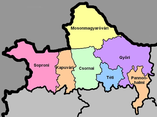
District of Győr-Moson-Sopron County
| № | English and Hungarian names | Area (km²) | Population (2011) | Density (pop./km²) | Seat | № of municipalities |
| 1 | Csorna District Csornai járás | 579.76 | 32,970 | 57 | Csorna | 33 |
| 2 | Győr District Győri járás | 903.40 | 190,146 | 210 | Győr | 35 |
| 3 | Kapuvár District Kapuvári járás | 372.14 | 23,778 | 64 | Kapuvár | 19 |
| 4 | Mosonmagyaróvár District Mosonmagyaróvári járás | 899.95 | 72,609 | 81 | Mosonmagyaróvár | 26 |
| 5 | Pannonhalma District Pannonhalmi járás | 312.34 | 15,227 | 49 | Pannonhalma | 17 |
| 6 | Sopron District Soproni járás | 867.71 | 98,841 | 114 | Sopron | 39 |
| 7 | Tét District Téti járás | 272.64 | 14,414 | 53 | Tét | 14 |
| Győr-Moson-Sopron County | 4,208.05 | 452,638 | 109 | Győr | 183 | |
|---|---|---|---|---|---|---|
Politics
The Győr-Moson-Sopron County Council, elected at the 2014 local government elections, is made up of 21 counselors, with the following party composition:[5]
| Party | Seats | Current County Assembly | ||||||||||||||
|---|---|---|---|---|---|---|---|---|---|---|---|---|---|---|---|---|
| Fidesz-KDNP | 14 | |||||||||||||||
| Movement for a Better Hungary (Jobbik) | 4 | |||||||||||||||
| Hungarian Socialist Party (MSZP) | 2 | |||||||||||||||
| Democratic Coalition (DK) | 1 | |||||||||||||||
Presidents of the General Assembly
| List of Presidents, from 1990[6] | |
|---|---|
| Zoltán Németh (Fidesz-KDNP) | 2014– |
Municipalities
Győr-Moson-Sopron County has 2 urban counties, 10 towns, 4 large villages and 167 villages.
- Cities with county rights
(ordered by population, as of 2011 census)
Győr (129,527) – county seat
Sopron (60,548)
- Towns
Mosonmagyaróvár (32,004)
Csorna (10,558)
Kapuvár (10,495)
Jánossomorja (5,921)
Tét (3,954)
Fertőszentmiklós (3,818)
Pannonhalma (3,691)
Fertőd (3,261)
Lébény (3,156)
Beled (2,633)
- Villages
Abda
Acsalag
Agyagosszergény
Ágfalva
Árpás
Ásványráró
Babót
Bágyogszovát
Bakonygyirót
Bakonypéterd
Bakonyszentlászló
Barbacs
Bezenye
Bezi
Bodonhely
Bogyoszló
Börcs
Bőny
Bősárkány [[INLINE_IMAGE|//upload.wikimedia.org/wikipedia/commons/thumb/0/0c/Red_pog.svg/8px-Red_pog.svg.png|//upload.wikimedia.org/wikipedia/commons/thumb/0/0c/Red_pog.svg/12px-Red_pog.svg.png 1.5x, //upload.wikimedia.org/wikipedia/commons/thumb/0/0c/Red_pog.svg/16px-Red_pog.svg.png 2x|Red pog.svg|h8|w8]]
Cakóháza
Cirák
Csáfordjánosfa
Csapod
Csér
Csikvánd
Darnózseli
Dénesfa
Dör
Dunakiliti
Dunaremete
Dunaszeg
Dunaszentpál
Dunasziget
Ebergőc
Edve
Egyed
Egyházasfalu
Enese
Écs
Farád
Fehértó
Feketeerdő
Felpéc
Fenyőfő
Fertőboz
Fertőendréd
Fertőhomok
Fertőrákos
Fertőszéplak
Gönyű
Gyalóka
Gyarmat
Gyóró
Gyömöre
Győrasszonyfa
Győrság
Győrladamér
Győrszemere
Győrsövényház
Győrzámoly
Győrújbarát
Győrújfalu
Halászi
Harka
Hegyeshalom [[INLINE_IMAGE|//upload.wikimedia.org/wikipedia/commons/thumb/0/0c/Red_pog.svg/8px-Red_pog.svg.png|//upload.wikimedia.org/wikipedia/commons/thumb/0/0c/Red_pog.svg/12px-Red_pog.svg.png 1.5x, //upload.wikimedia.org/wikipedia/commons/thumb/0/0c/Red_pog.svg/16px-Red_pog.svg.png 2x|Red pog.svg|h8|w8]]
Hegykő
Hédervár
Hidegség
Himod
Hövej
Ikrény
Iván
Jobaháza
Kajárpéc
Károlyháza
Kimle
Kisbabot
Kisbajcs
Kisbodak
Kisfalud
Koroncó
Kóny
Kópháza
Kunsziget
Lázi
Levél
Lipót
Lövő
Maglóca
Magyarkeresztúr
Máriakálnok
Markotabödöge
Mecsér
Mérges
Mezőörs
Mihályi
Mosonszentmiklós
Mosonszolnok
Mórichida
Nagybajcs
Nagycenk [[INLINE_IMAGE|//upload.wikimedia.org/wikipedia/commons/thumb/0/0c/Red_pog.svg/8px-Red_pog.svg.png|//upload.wikimedia.org/wikipedia/commons/thumb/0/0c/Red_pog.svg/12px-Red_pog.svg.png 1.5x, //upload.wikimedia.org/wikipedia/commons/thumb/0/0c/Red_pog.svg/16px-Red_pog.svg.png 2x|Red pog.svg|h8|w8]]
Nagylózs
Nagyszentjános
Nemeskér
Nyalka
Nyúl
Osli
Öttevény
Páli
Pásztori
Pázmándfalu
Pereszteg
Petőháza
Pér
Pinnye
Potyond
Pusztacsalád
Püski
Rajka
Ravazd
Rábacsanak
Rábacsécsény
Rábakecöl
Rábapatona
Rábapordány
Rábasebes
Rábaszentandrás
Rábaszentmihály
Rábaszentmiklós
Rábatamási
Rábcakapi
Répceszemere
Répcevis
Rétalap
Röjtökmuzsaj
Románd
Sarród
Sikátor
Sobor
Sokorópátka
Sopronhorpács
Sopronkövesd
Sopronköhida
Sopronnémeti
Szakony
Szany [[INLINE_IMAGE|//upload.wikimedia.org/wikipedia/commons/thumb/0/0c/Red_pog.svg/8px-Red_pog.svg.png|//upload.wikimedia.org/wikipedia/commons/thumb/0/0c/Red_pog.svg/12px-Red_pog.svg.png 1.5x, //upload.wikimedia.org/wikipedia/commons/thumb/0/0c/Red_pog.svg/16px-Red_pog.svg.png 2x|Red pog.svg|h8|w8]]
Szárföld
Szerecseny
Szil
Szilsárkány
Táp
Tápszentmiklós
Tarjánpuszta
Tárnokréti
Tényő
Töltéstava
Und
Újkér
Újrónafő
Vadosfa
Vág
Vámosszabadi
Várbalog
Vásárosfalu
Veszkény
Veszprémvarsány
Vének
Vitnyéd
Völcsej
Zsebeháza
Zsira
[[INLINE_IMAGE|//upload.wikimedia.org/wikipedia/commons/thumb/0/0c/Red_pog.svg/8px-Red_pog.svg.png|//upload.wikimedia.org/wikipedia/commons/thumb/0/0c/Red_pog.svg/12px-Red_pog.svg.png 1.5x, //upload.wikimedia.org/wikipedia/commons/thumb/0/0c/Red_pog.svg/16px-Red_pog.svg.png 2x|Red pog.svg|h8|w8]] municipalities are large villages.
References
- ÉVI NÉPSZÁMLÁLÁS, 3. Területi adatok, 3.8 Győr-Moson-Sopron megye, (in Hungarian) [1]


