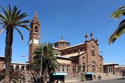
Eritrea
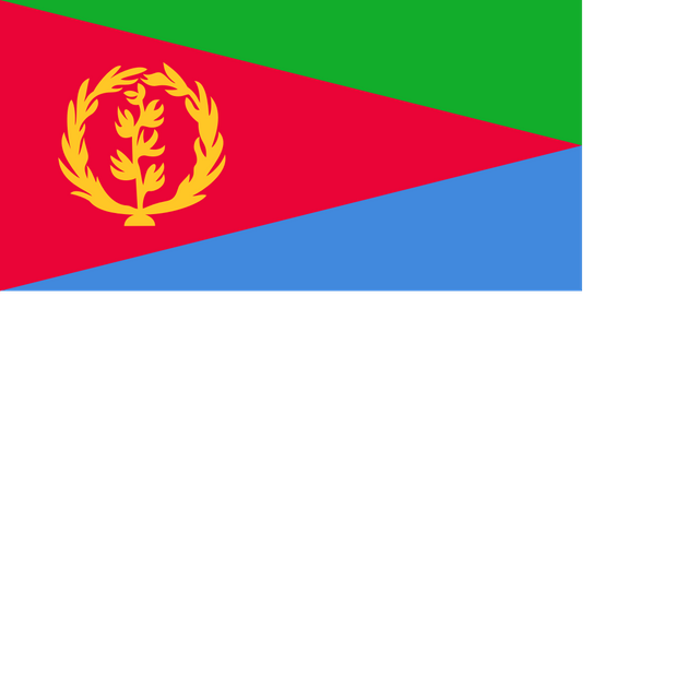
Eritrea

State of Eritrea | |
|---|---|
Anthem:"Ertra, Ertra, Ertra" (English:"Eritrea, Eritrea, Eritrea") | |
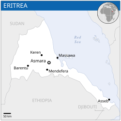
 Location of Eritrea (dark blue)– in Africa (light blue & dark grey) – in the African Union (light blue) | |
 | |
| Capital and largest city | Asmara 15°20′N 38°55′E [202] |
| Official languages | None[1] (see working languages) |
| Recognised national languages | |
| Working languages | |
| Other languages | Italian[4][5] |
| Ethnic groups (2012[6]) |
|
| Demonym(s) |
|
| Government | Unitary one-party presidential republic under a totalitarian dictatorship[7][8][9][10][11] |
• President | Isaias Afwerki |
| Legislature | National Assembly |
| Independence from Ethiopia | |
• De facto State of Eritrea | 24 May 1991 |
• De jure State of Eritrea | 24 May 1993 |
| Area | |
• Total | 117,600 km2(45,400 sq mi) (99th) |
• Water (%) | 0.14% |
| Population | |
• 2016 estimate | 4,954,645[12] (116th) |
• Density | 51.8/km2(134.2/sq mi) (154th) |
| GDP(PPP) | 2019 estimate |
• Total | $10.625 billion[13] (156th) |
• Per capita | $1,725[13] (180th) |
| GDP(nominal) | 2019 estimate |
• Total | $7.720 billion[13] (149th) |
• Per capita | $1,253[13] (160th) |
| HDI(2017) | low · 179th |
| Currency | Nakfa (ERN) |
| Time zone | UTC+3(EAT) |
• Summer (DST) | UTC+3(not observed) |
| Driving side | right |
| Calling code | +291 |
| ISO 3166 code | ER |
| Internet TLD | .er |
Eritrea (/ˌɛrɪˈtreɪə, ˌɛrɪˈtriːə/;[15] (listen); Tigrinya: ኤርትራ), officially the State of Eritrea,[16] is a country in the Horn of Africa, with its capital at Asmara. It is bordered by Sudan in the west, Ethiopia in the south, and Djibouti in the southeast. The northeastern and eastern parts of Eritrea have an extensive coastline along the Red Sea. The nation has a total area of approximately 117,600 km2 (45,406 sq mi), and includes the Dahlak Archipelago and several of the Hanish Islands. Its toponym Eritrea is based on the Greek name for the Red Sea (Ἐρυθρὰ Θάλασσα Erythra Thalassa), which was first adopted for Italian Eritrea in 1890.
Eritrea is a multi-ethnic country, with nine recognized ethnic groups in its population of around 5 million. Most residents speak languages from the Afroasiatic family, either of the Ethiopian Semitic languages or Cushitic branches. Among these communities, the Tigrinyas make up about 55% of the population, with the Tigre people constituting around 30% of inhabitants. In addition, there are a number of Nilo-Saharan-speaking Nilotic ethnic minorities. Most people in the territory adhere to Islam or Christianity.[17]
The Kingdom of Aksum, covering much of modern-day Eritrea and northern Ethiopia, was established during the first or second centuries AD.[18][19] It adopted Christianity around the middle of the fourth century.[20] In medieval times much of Eritrea fell under the Medri Bahri kingdom, with a smaller region being part of Hamasien.
The creation of modern-day Eritrea is a result of the incorporation of independent, distinct kingdoms and sultanates (for example, Medri Bahri and the Sultanate of Aussa) eventually resulting in the formation of Italian Eritrea. After the defeat of the Italian colonial army in 1942, Eritrea was administered by the British Military Administration until 1952. Following the UN General Assembly decision, in 1952, Eritrea would govern itself with a local Eritrean parliament but for foreign affairs and defense it would enter into a federal status with Ethiopia for a period of 10 years. However, in 1962 the government of Ethiopia annulled the Eritrean parliament and formally annexed Eritrea. But the Eritreans who had argued for complete Eritrean independence since the ouster of the Italians in 1941, anticipated what was coming and in 1960 organized the Eritrean Liberation Front in opposition. In 1991, after 30 years of continuous armed struggle for independence, the Eritrean liberation fighters entered the capital city, Asmara, in victory.
Eritrea is a one-party state in which national legislative elections have never been held since independence.[21] According to Human Rights Watch, the Eritrean government's human rights record is among the worst in the world.[22] The Eritrean government has dismissed these allegations as politically motivated.[23] The compulsory military service requires long, indefinite conscription periods, which some Eritreans leave the country to avoid.[24] Because all local media is state-owned, Eritrea was also ranked as having the second-least press freedom in the global Press Freedom Index, behind only North Korea.
The sovereign state of Eritrea is a member of the African Union, the United Nations, and the Intergovernmental Authority on Development, and is an observer in the Arab League alongside Brazil, Venezuela and India.[25]
State of Eritrea | |
|---|---|
Anthem:"Ertra, Ertra, Ertra" (English:"Eritrea, Eritrea, Eritrea") | |
 Location of Eritrea (dark blue)– in Africa (light blue & dark grey) – in the African Union (light blue) | |
 | |
| Capital and largest city | Asmara 15°20′N 38°55′E [202] |
| Official languages | None[1] (see working languages) |
| Recognised national languages | |
| Working languages | |
| Other languages | Italian[4][5] |
| Ethnic groups (2012[6]) |
|
| Demonym(s) |
|
| Government | Unitary one-party presidential republic under a totalitarian dictatorship[7][8][9][10][11] |
• President | Isaias Afwerki |
| Legislature | National Assembly |
| Independence from Ethiopia | |
• De facto State of Eritrea | 24 May 1991 |
• De jure State of Eritrea | 24 May 1993 |
| Area | |
• Total | 117,600 km2(45,400 sq mi) (99th) |
• Water (%) | 0.14% |
| Population | |
• 2016 estimate | 4,954,645[12] (116th) |
• Density | 51.8/km2(134.2/sq mi) (154th) |
| GDP(PPP) | 2019 estimate |
• Total | $10.625 billion[13] (156th) |
• Per capita | $1,725[13] (180th) |
| GDP(nominal) | 2019 estimate |
• Total | $7.720 billion[13] (149th) |
• Per capita | $1,253[13] (160th) |
| HDI(2017) | low · 179th |
| Currency | Nakfa (ERN) |
| Time zone | UTC+3(EAT) |
• Summer (DST) | UTC+3(not observed) |
| Driving side | right |
| Calling code | +291 |
| ISO 3166 code | ER |
| Internet TLD | .er |
Name
The name Eritrea is derived from the ancient Greek name for the Red Sea (Ἐρυθρὰ Θάλασσα Erythra Thalassa, based on the adjective ἐρυθρός erythros "red"). It was first formally adopted in 1890, with the formation of Italian Eritrea (Colonia Eritrea).[26] The name persisted over the course of subsequent British and Ethiopian occupation, and was reaffirmed by the 1993 independence referendum and 1997 constitution.[27]
History
Prehistory
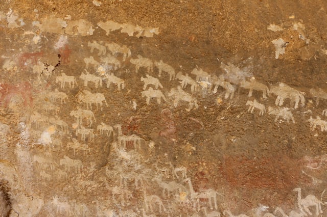
Neolithic rock art in a Qohaito canyon cave
At Buya in Eritrea, one of the oldest hominids representing a possible link between Homo erectus and an archaic Homo sapiens was found by Italian scientists. Dated to over 1 million years old, it is the oldest skeletal find of its kind and provides a link between hominids and the earliest anatomically modern humans.[28] It is believed that the section of the Danakil Depression in Eritrea was also a major player in terms of human evolution, and may contain other traces of evolution from Homo erectus hominids to anatomically modern humans.[29]
During the last interglacial period, the Red Sea coast of Eritrea was occupied by early anatomically modern humans.[30] It is believed that the area was on the route out of Africa that some scholars suggest was used by early humans to colonize the rest of the Old World.[30] In 1999, the Eritrean Research Project Team composed of Eritrean, Canadian, American, Dutch and French scientists discovered a Paleolithic site with stone and obsidian tools dated to over 125,000 years old near the Bay of Zula south of Massawa, along the Red Sea littoral. The tools are believed to have been used by early humans to harvest marine resources such as clams and oysters.[31]
According to linguists, the first Afroasiatic-speaking populations arrived in the region during the ensuing Neolithic era from the family's proposed urheimat ("original homeland") in the Nile Valley.[32][33] Other scholars propose that the Afroasiatic family developed in situ in the Horn, with its speakers subsequently dispersing from there.[34]
Antiquity
Punt
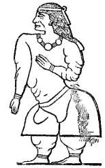
Queen Ati, wife of King Perahu of Punt, as depicted on Pharaoh Hatshepsut's temple at Deir el-Bahri
Together with Djibouti, Ethiopia, northern Somalia, and the Red Sea coast of Sudan,[35] Eritrea is considered the most likely location of the land which the ancient Egyptians called Punt, first mentioned in the 25th century BC.[36] The ancient Puntites had close relations with Ancient Egypt during the rule of Pharaoh Sahure and Queen Hatshepsut.
This is confirmed by genetic studies of mummified baboons. In 2010, a study was conducted on baboon mummies that were brought from Punt to Egypt as gifts by the ancient Egyptians. The scientists from the Egyptian Museum and the University of California used oxygen isotope analysis to examine hairs from two baboon mummies that had been preserved in the British Museum. One of the baboons had distorted isotopic data, so the other's oxygen isotope values were compared to those of present-day baboon specimens from regions of interest. The researchers initially found that the mummies most closely matched modern baboon specimens in Eritrea and Ethiopia, which suggested that Punt was likely a narrow region that included eastern Ethiopia and all of Eritrea.[37] In 2015, isotopic analysis of other ancient baboon mummies from Punt confirmed that the specimens likely originated from an area encompassing the Eritrea-Ethiopia corridor and eastern Somalia.[38]
Ona Culture
Excavations at Sembel found evidence of an ancient pre-Aksumite civilization in greater Asmara. This Ona urban culture is believed to have been among the earliest pastoral and agricultural communities in the Horn region. Artifacts at the site have been dated to between 800 BC and 400 BC, contemporaneous with other pre-Aksumite settlements in the Eritrean and Ethiopian highlands during the mid-first millennium BC.[39]
Additionally, the Ona culture may have had connections with the ancient Land of Punt. In a tomb in Thebes (Luxor) dated to the 18th dynasty reign of Pharaoh Amenophis II (Amenhotep II), long-necked pots similar to those that were made by the Ona people are depicted as part of the cargo in a ship from Punt.[40]
Gash Group
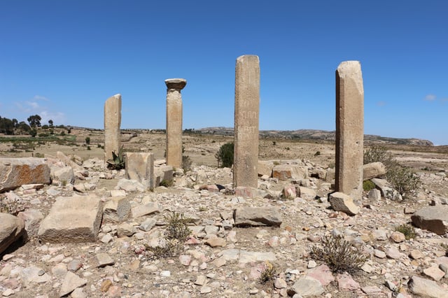
Pre-Axumite monolithic columns in Qohaito
Excavations in and near Agordat in central Eritrea yielded the remains of an ancient pre-Aksumite civilization known as the Gash Group.[41] Ceramics were discovered that were related to those of the C-Group (Temehu) pastoral culture, which inhabited the Nile Valley between 2500–1500 BC.[42] Some sources dating back to 3500 BC.[43] Shards akin to those of the Kerma culture, another community that flourished in the Nile Valley around the same period, were also found at other local archaeological sites in the Barka valley belonging to the Gash Group.[41] According to Peter Behrens (1981) and Marianne Bechaus-Gerst (2000), linguistic evidence indicates that the C-Group and Kerma peoples spoke Afroasiatic languages of the Berber and Cushitic branches, respectively.[44][45]
Kingdom of D'mt
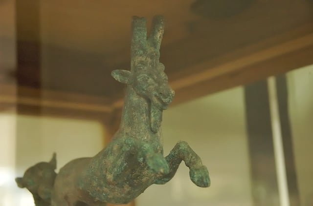
Bronze oil lamp excavated at Matara, dating from the Kingdom of Dʿmt (1st century BCE or earlier)
Dʿmt was a kingdom that encompassed most of Eritrea and the northern frontier of Ethiopia. The polity existed during the 10th to 5th centuries BC. Given the presence of a massive temple complex at Yeha, this area was most likely the kingdom's capital. Qohaito, often identified as the town of Koloe in the Periplus of the Erythraean Sea,[46] as well as Matara were important ancient Dʿmt kingdom cities in southern Eritrea.
The realm developed irrigation schemes, used plows, grew millet, and made iron tools and weapons. After the fall of Dʿmt in the 5th century BC, the plateau came to be dominated by smaller successor kingdoms. This lasted until the rise of one of these polities during the first century, the Kingdom of Aksum, which was able to reunite the area.[47]
Kingdom of Aksum
The Aksumites erected a number of large stelae, which served a religious purpose in pre-Christian times. One of these granite columns, the Obelisk of Aksum, is the largest such structure in the world, standing at 90 feet (27 metres).[50] Under Ezana (fl. 320–360), Aksum later adopted Christianity.[51]
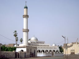
In the 7th century, early Muslims from Mecca, at least companions of the Islamic Nabī (Arabic: نَـبِي, Prophet) Muhammad, sought refuge from Qurayshi persecution by travelling to the kingdom, a journey known in Islamic history as the First Hijrah. They reportedly built the first African mosque, that is the Mosque of the Companions, Massawa.[52]
The kingdom is mentioned in the Periplus of the Erythraean Sea as an important market place for ivory, which was exported throughout the ancient world. Aksum was at the time ruled by Zoskales, who also governed the port of Adulis.[53] The Aksumite rulers facilitated trade by minting their own Aksumite currency. The state also established its hegemony over the declining Kingdom of Kush and regularly entered the politics of the kingdoms on the Arabian peninsula, eventually extending its rule over the region with the conquest of the Himyarite Kingdom. The country is also the alleged resting place of the Ark of the Covenant, and the purported home of the Queen of Sheba.[54]
Middle Ages
Medri Bahri
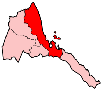
The Northern Red Sea Region, part of the Hamasien province of the medieval Medri Bahri kingdom
After the decline of Aksum, the Eritrean highlands were under the domain of Bahr Negash ruled by the Bahr Negus. The area was then known as Ma'ikele Bahr ("between the seas/rivers", i.e. the land between the Red Sea and the Mereb river).[55] It was later renamed under Emperor Zara Yaqob as the domain of the Bahr Negash, the Medri Bahri ("Sea land" in Tingrinya, although it included some areas like Shire on the other side of the Mereb, today in Ethiopia).[56] With its capital at Debarwa,[57] the state's main provinces were Hamasien, Serae and Akele Guzai.
Turks briefly occupied the highland parts of Baharnagash in 1559 and withdrew after they encountered resistance and were pushed back by the Bahrnegash and highland forces. In 1578 they tried to expand into the highlands with the help of Bahr Negash Yisehaq who had switched alliances due to power struggle, and by 1589 once again they were apparently compelled to withdraw their forces to the coast. After that Ottomans abandoned their ambitions to establish themselves on the highlands and remained in the lowlands until they left the region by 1872.[58][59]
The Scottish traveler James Bruce reported in 1770 that Medri Bahri was a distinct political entity from Abyssinia, noting that the two territories were frequently in conflict. The Bahre-Nagassi ("Kings of the Sea") alternately fought with or against the Abyssinians and the neighbouring Muslim Adal Sultanate depending on the geopolitical circumstances. Medri Bahri was thus part of the Christian resistance against Imam Ahmad ibn Ibrahim al-Ghazi of Adal's forces, but later joined the Adalite states and the Ottoman Empire front against Abyssinia in 1572. That 16th century also marked the arrival of the Ottomans, who began making inroads in the Red Sea area.[60]
James Bruce in his book published in 1805 reported Hadawi, the seat of Baharanagash, was part of the Tigré province of Abyssinia which was ruled by Ras Mikael Sehul at the time of his travel. The officer in Hadawi watched over the Naybe of Masawa (province of Turk's Habesh Eyalet), and starved him into obedience by intercepting his provisions, whenever the officer in Hadawi and the governor of Tigré found it necessary. Bruce also located Tigré between Red Sea and the river Tekezé and stated many large governments, such as Enderta and Antalow, and the great part of Baharhagash were on the eastern side of Tigré province.[61][62][63]
Aussa Sultanate

Flag of the Aussa Sultanate
At the end of the 16th century, the Aussa Sultanate was established in the Denkel lowlands of Eritrea.[64] The polity had come into existence in 1577, when Muhammed Jasa moved his capital from Harar to Aussa (Asaita) with the split of the Adal Sultanate into Aussa and the Sultanate of Harar. At some point after 1672, Aussa declined in conjunction with Imam Umar Din bin Adam's recorded ascension to the throne.[65] In 1734, the Afar leader Kedafu, head of the Mudaito clan, seized power and established the Mudaito Dynasty.[66][67] This marked the start of a new and more sophisticated polity that would last into the colonial period.[67]
Habesh Eyalet
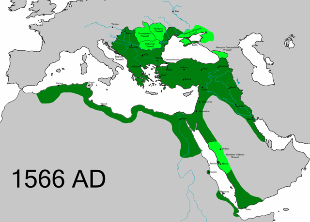
The Ottoman Empire in 1566, at its greatest extent in Eritrea
By 1517, the Ottomans had succeeded in conquering Medri Bahri. They occupied all of northeastern present-day Eritrea for the next two decades, an area which stretched from Massawa to Swakin in Sudan.[60]
The territory became an Ottoman governorate (eyalet), known as the Habesh Eyalet. Massawa served as the new province's first capital. When the city became of secondary economical importance, the administrative capital was soon moved across the Red Sea to Jeddah. Its headquarters remained there from the end of the 16th century to the early 19th century, with Medina temporarily serving as the capital in the 18th century.[68]
The Ottomans were eventually driven out in the last quarter of the 16th century. However, they retained control over the seaboard until the establishment of Italian Eritrea in the late 1800s.[60]
Modern history
Italian Eritrea
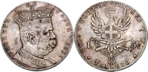
Eritrean tallero, coined in 1890 by the Italian government
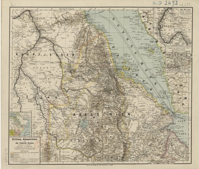
Map of Eritrea in 1896
The boundaries of the present-day Eritrea nation state were established during the Scramble for Africa. In 1869[69] or 1870, the ruling Sultan of Raheita sold lands surrounding the Bay of Assab to the Rubattino Shipping Company.[70] The area served as a coaling station along the shipping lanes introduced by the recently completed Suez Canal. It had long been part of the Ottoman Habesh Eyalet centered in Egypt.[71] The first Italian settlers arrived in 1880.[70]
In the vacuum that followed the 1889 death of Emperor Yohannes IV, Gen. Oreste Baratieri occupied the highlands along the Eritrean coast and Italy proclaimed the establishment of the new colony of Italian Eritrea, a colony of the Kingdom of Italy. In the Treaty of Wuchale (It. Uccialli) signed the same year, King Menelik of Shewa, a southern Ethiopian kingdom, recognized the Italian occupation of his rivals' lands of Bogos, Hamasien, Akkele Guzay, and Serae in exchange for guarantees of financial assistance and continuing access to European arms and ammunition. His subsequent victory over his rival kings and enthronement as Emperor Menelek II (r. 1889–1913) made the treaty formally binding upon the entire territory.[72]
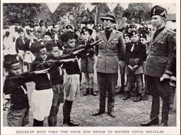
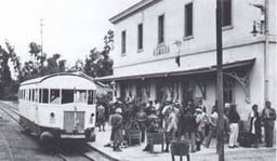
In 1888, the Italian administration launched its first development projects in the new colony. The Eritrean Railway was completed to Saati in 1888,[73] and reached Asmara in the highlands in 1911.[74] The Asmara–Massawa Cableway was the longest line in the world during its time, but was later dismantled by the British in World War II. Besides major infrastructural projects, the colonial authorities invested significantly in the agricultural sector. It also oversaw the provision of urban amenities in Asmara and Massawa, and employed many Eritreans in public service, particularly in the police and public works departments.[74] Thousands of Eritreans were concurrently enlisted in the army, serving during the Italo-Turkish War in Libya as well as the First and Second Italo-Abyssinian Wars.
Additionally, the Italian Eritrea administration opened a number of new factories, which produced buttons, cooking oil, pasta, construction materials, packing meat, tobacco, hide and other household commodities. In 1939, there were around 2,198 factories and most of the employees were Eritrean citizens. The establishment of industries also made an increase in the number of both Italians and Eritreans residing in the cities. The number of Italians residing in the territory increased from 4,600 to 75,000 in five years; and with the involvement of Eritreans in the industries, trade and fruit plantation was expanded across the nation, while some of the plantations were owned by Eritreans.[75]
In 1922, Benito Mussolini's rise to power in Italy brought profound changes to the colonial government in Italian Eritrea. After il Duce declared the birth of the Italian Empire in May 1936, Italian Eritrea (enlarged with northern Ethiopia's regions) and Italian Somaliland were merged with the just conquered Ethiopia in the new Italian East Africa (Africa Orientale Italiana) administrative territory. This Fascist period was characterized by imperial expansion in the name of a "new Roman Empire". Eritrea was chosen by the Italian government to be the industrial center of Italian East Africa.[76]
Asmara's architecture after 1935 was greatly improved to become a "modernist Art Deco city" (in 2017 has been declared a "UNESCO World City Heritage"[77]), featuring eclectic and rationalist built forms, well-defined open spaces, and public and private buildings, including cinemas, shops, banks, religious structures, public and private offices, industrial facilities, and residences (according to UNESCO's publications). The Italians designed more than 400 buildings in a construction boom that was only halted by Italy's involvement in WW2. These included art deco masterpieces like the worldwide famous Fiat Tagliero Building and the Cinema Impero[78]
British administration
Through the 1941 Battle of Keren, the British expelled the Italians,[79] and took over the administration of the country.
The British placed Eritrea under British military administration until Allied forces could determine its fate.
In the absence of agreement amongst the Allies concerning the status of Eritrea, British administration continued for the remainder of World War II and until 1950. During the immediate postwar years, the British proposed that Eritrea be divided along religious lines and annexed partly to the British colony of Sudan and partly to Ethiopia. The Soviet Union, anticipating a communist victory in the Italian polls, initially supported returning Eritrea to Italy under trusteeship or as a colony.
Federation with Ethiopia
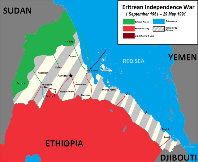
Eritrean War of Independence against Ethiopia 1961–1991
In the 1950s, the Ethiopian feudal administration under Emperor Haile Selassie sought to annex Eritrea and Italian Somaliland. He laid claim to both territories in a letter to Franklin D. Roosevelt at the Paris Peace Conference and at the First Session of the United Nations.[80] In the United Nations, the debate over the fate of the former Italian colonies continued. The British and Americans preferred to cede all of Eritrea except the Western province to the Ethiopians as a reward for their support during World War II.[81] The Independence Bloc of Eritrean parties consistently requested from the UN General Assembly that a referendum be held immediately to settle the Eritrean question of sovereignty.
Following the adoption of UN Resolution 390A(V) in December 1950, Eritrea was federated with Ethiopia under the prompting of the United States.[82] The resolution called for Eritrea and Ethiopia to be linked through a loose federal structure under the sovereignty of the Emperor. Eritrea was to have its own administrative and judicial structure, its own flag, and control over its domestic affairs, including police, local administration, and taxation.[80] The federal government, which for all practical purposes was the existing imperial government, was to control foreign affairs (including commerce), defense, finance, and transportation. The resolution ignored the wishes of Eritreans for independence, but guaranteed the population democratic rights and a measure of autonomy.
Independence
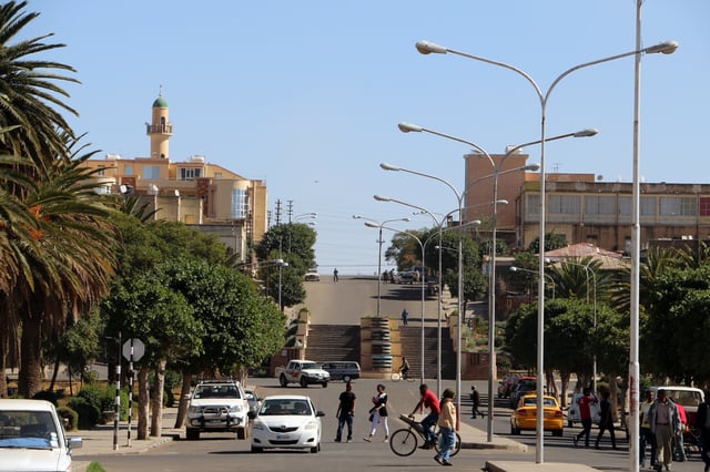
Asmara, Eritrea in 2015
In 1958, a group of Eritreans founded the Eritrean Liberation Movement (ELM). The organization mainly consisted of Eritrean students, professionals and intellectuals. It engaged in clandestine political activities intended to cultivate resistance to the centralizing policies of the imperial Ethiopian state.[83] On 1 September 1961, the Eritrean Liberation Front (ELF), under the leadership of Hamid Idris Awate, waged an armed struggle for independence. In 1962, Emperor Haile Selassie unilaterally dissolved the Eritrean parliament and annexed the territory. The ensuing Eritrean War for Independence went on for 30 years against successive Ethiopian governments until 1991, when the Eritrean People's Liberation Front (EPLF), a successor of the ELF, defeated the Ethiopian forces in Eritrea and helped a coalition of Ethiopian rebel forces take control of the Ethiopian capital Addis Ababa.
Following a UN-supervised referendum in Eritrea (dubbed UNOVER) in which the Eritrean people overwhelmingly voted for independence, Eritrea declared its independence and gained international recognition in 1993.[84] The EPLF seized power, established a one-party state along nationalist lines and banned further political activity. There have been no elections since.
Geography
Location and habitat
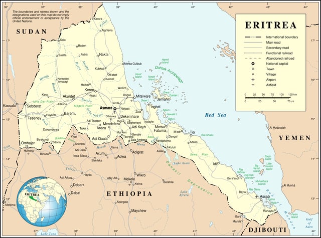
Map of Eritrea
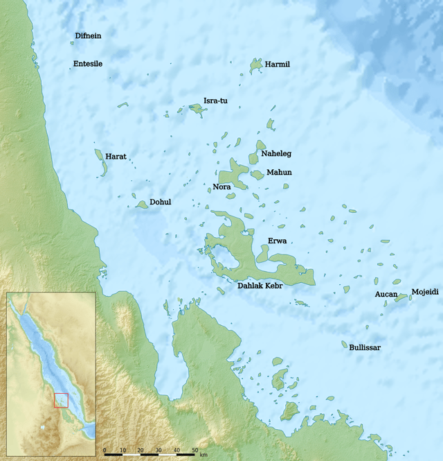
The Dahlak Archipelago

Highlands between Asmara and Massawa
Eritrea is located in the Horn of Africa in East Africa. It is bordered to the northeast and east by the Red Sea, Sudan to the west, Ethiopia to the south, and Djibouti to the southeast. Eritrea lies between latitudes 12° and 18°N, and longitudes 36° and 44°E.
The country is virtually bisected by a branch of the East African Rift. Eritrea, at the southern end of the Red Sea, is the home of the fork in the rift. The Dahlak Archipelago and its fishing grounds are situated off the sandy and arid coastline.
Eritrea can be split into three ecoregions. To the east of the highlands are the hot, arid coastal plains stretching down to the southeast of the country. The cooler, more fertile highlands, reaching up to 3000 m, have a different habitat. Habitats here vary from the sub-tropical rainforest at Filfil Solomona to the precipitous cliffs and canyons of the southern highlands.[85] The Afar Triangle or Danakil Depression of Eritrea is the probable location of a triple junction where three tectonic plates are pulling away from one another. The highest point of the country, Emba Soira, is located in the center of Eritrea, at 3,018 meters (9,902 ft) above sea level.
The main cities of the country are the capital city of Asmara and the port town of Asseb in the southeast, as well as the towns of Massawa to the east, the northern town of Keren, and the central town Mendefera.
Eritrea is part of a 14-nation constituency within the Global Environment Facility, which partners with international institutions, civil society organizations, and the private sector to address global environmental issues while supporting national sustainable development initiatives.[86] Local variability in rainfall patterns and/or reduced precipitation is known to occur, which may precipitate soil erosion, floods, droughts, land degradation and desertification.[87] In 2006, Eritrea also announced that it would become the first country in the world to turn its entire coast into an environmentally protected zone. The 1,347 km (837 mi) coastline, along with another 1,946 km (1,209 mi) of coast around its more than 350 islands, will come under governmental protection.
Wildlife
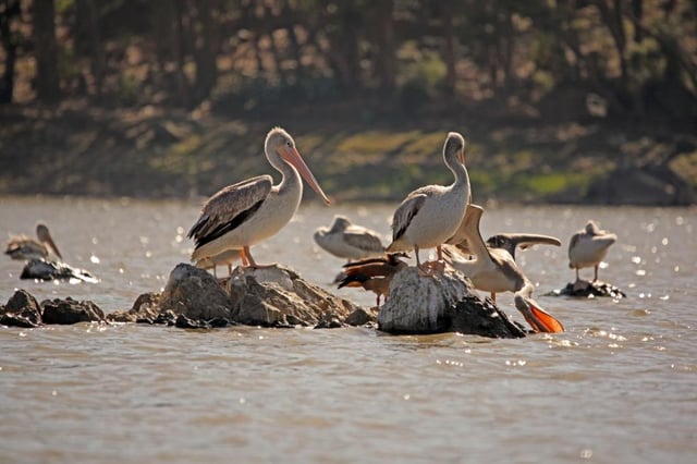
Pelicans in a pond near Asmara

A Precis pelarga butterfly species from Eritrea
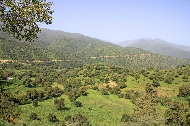
Eritrean landscape near road to Massawa
Eritrea has several species of mammals and a rich avifauna of 560 species of birds.[88]
Eritrea is home to an abundant amount of big game species. Enforced regulations have helped in steadily increasing their numbers throughout Eritrea.[89] Mammals commonly seen today include the Abyssinian hare, African wild cat, Black-backed jackal, African golden wolf, Genet, Ground squirrel, pale fox, Soemmerring's gazelle, warthog. Dorcas gazelle are common on the coastal plains and in Gash-Barka.
Lions are said to inhabit the mountains of the Gash-Barka Region. There is also a small population of African bush elephants that roam in some parts of the country. Dik-diks can also be found in many areas. The endangered African wild ass can be seen in Denakalia Region. Other local wildlife include bushbuck, duikers, greater kudu, Klipspringer, African leopards, oryx and crocodiles.[90][91] The spotted hyena is widespread and fairly common. Between 1955 and 2001 there were no reported sightings of elephant herds, and they are thought to have fallen victim to the war of independence. In December 2001 a herd of about 30, including 10 juveniles, was observed in the vicinity of the Gash River. The elephants seemed to have formed a symbiotic relationship with olive baboons, with the baboons using the water holes dug by the elephants, while the elephants use the tree-top baboons as an early warning system.
It is estimated that there are around 100 African bush elephant left in Eritrea, the most northerly of East Africa's elephants.[92] The endangered African wild dog (Lycaon pictus) was previously found in Eritrea, but is now deemed extirpated from the entire country.[93] In Gash-Barka, snakes like saw-scaled viper are common. Puff adder and red spitting cobra are widespread and can be found even in the highlands. In the coastal areas marine species that are common include dolphin, dugong, whale shark, turtles, marlin, swordfish, and manta ray.[91]
Climate
The climate of Eritrea is shaped by its diverse topographical features and its location within the tropics. The diversity in landscape and topography in the highlands and lowlands of Eritrea result in the diversity of climate across the country. The highlands have temperate climate throughout out the year. The climate of most lowland zones is arid and semiarid. The distribution of rainfall and vegetation types varies markedly throughout the country. Eritrean climate varies on the basis of seasonal and altitudinal differences.
Based on variations in temperature, Eritrea can be broadly divided into three major climate zones: the temperate zone, subtropical climate zone, and tropical climate zone.[94]
| Climate data for Eritrea in general, based on 14 cities | |||||||||||||
|---|---|---|---|---|---|---|---|---|---|---|---|---|---|
| Month | Jan | Feb | Mar | Apr | May | Jun | Jul | Aug | Sep | Oct | Nov | Dec | Year |
| Average high °C (°F) | 27.3 (81.1) | 28.3 (82.9) | 29.8 (85.6) | 32.3 (90.1) | 33.3 (91.9) | 33 (91) | 32 (90) | 31.5 (88.7) | 32.3 (90.1) | 31.8 (89.2) | 30 (86) | 28.3 (82.9) | 31 (88) |
| Daily mean °C (°F) | 20 (68) | 20.8 (69.4) | 22.5 (72.5) | 24.3 (75.7) | 25.6 (78.1) | 26 (79) | 25.1 (77.2) | 24.7 (76.5) | 24.4 (75.9) | 23.8 (74.8) | 22.1 (71.8) | 20.5 (68.9) | 23.3 (73.9) |
| Average low °C (°F) | 17.8 (64.0) | 17.3 (63.1) | 18.3 (64.9) | 21 (70) | 23.3 (73.9) | 24.4 (75.9) | 24.4 (75.9) | 24.5 (76.1) | 23.3 (73.9) | 22.3 (72.1) | 20 (68) | 18.3 (64.9) | 20.8 (69.4) |
| Average precipitation mm (inches) | 6.7 (0.26) | 6.9 (0.27) | 9 (0.4) | 14.8 (0.58) | 20.3 (0.80) | 26.5 (1.04) | 100 (3.9) | 99.7 (3.93) | 25.4 (1.00) | 8.6 (0.34) | 11.9 (0.47) | 9.4 (0.37) | 347 (13.7) |
| Source: weatherbase[95] | |||||||||||||
Government and politics

The National Assembly of Eritrea

The wreath with the upright olive-branch symbol derived from the 1952 flag, which had a light blue background to honour the United Nations. The green colour in the flag stands for the agriculture and livestock of the country, the blue stands for the sea, and the red for the blood shed in the fight for freedom.
The People's Front for Democracy and Justice (PFDJ) is the only legal party in Eritrea.[96] Other political groups are not allowed to organize, although the unimplemented Constitution of 1997 provides for the existence of multi-party politics. The National Assembly has 150 seats. National elections have been periodically scheduled and cancelled; none have ever been held in the country.[17] President Isaias Afwerki has been in office since independence in 1993. In 1993, seventy five representatives were elected to the National Assembly; the rest are appointed. As the report by the UN Human Rights Council explained: "No national elections have taken place since that time, and no presidential elections have ever taken place. Local or regional elections have not been held since 2003–2004." President Isaias Afwerki has regularly expressed his disdain for what he refers to as "western-style" democracy. In a 2008 interview with Al Jazeera, for example, the President stated that "Eritrea will wait three or four decades, maybe more, before it holds elections. Who knows?"[97]
National elections
Eritrean National elections were set for 2001 but it was then decided that because 20% of Eritrea's land was under occupation, elections would be postponed until the resolution of the conflict with Ethiopia. However, local elections have continued in Eritrea. The most recent round of local government elections were held in 2010 and 2011. On further elections, the President's Chief of Staff, Yemane Gebremeskel said,[98]
As yet, no national elections have been held since independence.[17]
Military
The Eritrean Defence Forces are now the official armed forces of the State of Eritrea. Eritrea's military is one of the largest in Africa.
Compulsory military service was instituted in 1995. Officially, conscripts, male and female, must serve for 18 months (although a human rights inquiry stated that it lasts for decades, and sometimes life[99]), which includes six months of military training and 12 months doing "national reconstruction". Thus around 5% of Eritreans live in barracks in the desert doing projects such as road building as part of their service. After regular service, reservists with skills, such as teachers, may be forced to work as professionals anywhere.
The National Service Proclamation of 1995 does not recognize the right to conscientious objection to military service. According to the 1957 Ethiopian penal code adopted by Eritrea during independence, failure to enlist in the military or refusal to perform military service are punishable with imprisonment terms of six months to five years and up to ten years, respectively.[100] National service enlistment times may be extended during times of "national crisis"; since 1998, everyone under the age of 50 is enlisted in national service for an indefinite period until released, which may depend on the arbitrary decision of a commander. In a study of 200 escaped conscripts, the average service was 6.5 years, and some had served more than 12 years.[24]
Legal profession
According to the NYU School of Law, the Legal Committee of the Ministry of Justice oversees the admission and requirements to practice law in Eritrea. Although the establishment of an independent bar association is not proscribed under Proclamation 88/96, among other domestic laws, there is no bar association. The community electorate in the local jurisdiction of the Community Court chooses the Court's judges. The Community Court's standing on women in the legal profession is unclear, but elected women judges have reserved seat.[101]
Foreign relations
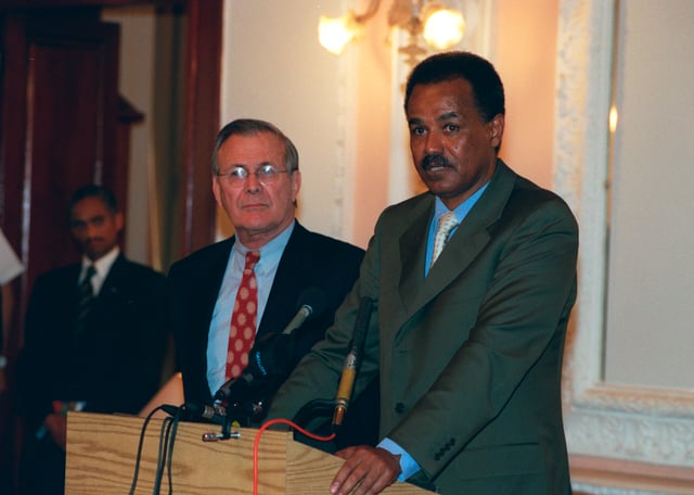
President Isaias Afewerki with U.S. Secretary of Defense Donald Rumsfeld, December 2002
Eritrea is a member of the United Nations, the African Union, and is an observing member of the Arab League alongside Brazil, Venezuela, India and Turkey.[25] The nation holds a seat on the United Nations' Advisory Committee on Administrative and Budgetary Questions (ACABQ). Eritrea also holds memberships in the International Bank for Reconstruction and Development, International Finance Corporation, International Criminal Police Organization (INTERPOL), Non-Aligned Movement, Organisation for the Prohibition of Chemical Weapons, Permanent Court of Arbitration, Port Management Association of Eastern and Southern Africa, and the World Customs Organization.
The Eritrean government previously withdrew its representative to the African Union to protest the AU's alleged lack of leadership in facilitating the implementation of a binding border decision demarcating the border between Eritrea and Ethiopia. The Eritrean government has since January 2011 appointed an envoy, Tesfa-Alem Tekle, to the AU.[102]
Eritrea maintains diplomatic ties with a number of other countries, including China, Denmark, Djibouti, Israel, the United States and Yemen. There are approximately 60,000 African refugees in Israel, mostly from Sudan and Eritrea.[103] Its relations with Djibouti and Yemen are tense due to territorial disputes over the Doumeira Islands and Hanish Islands, respectively.
On 28 May 2019, the United States removed Eritrea from the "Counterterror Non-Cooperation List" which also includes: Iran, North Korea, Syria and Venezuela.[104] Moreover, Eritrea was visited two months earlier by a US congressional delegation for the first time in 14 years.[105]
Relations with Ethiopia
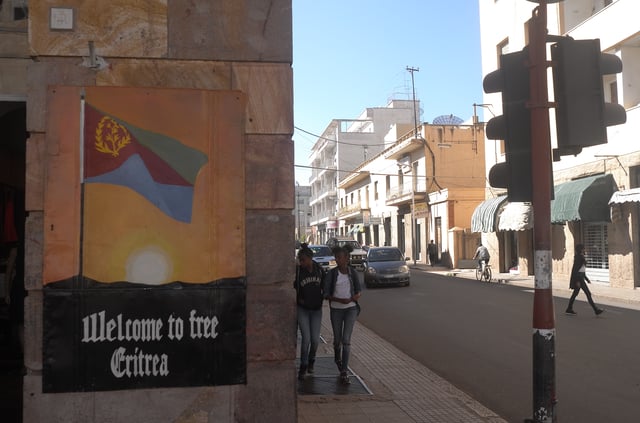
The Independence Day of Eritrea is one of the most important public holidays in the country.
The undemarcated border with Ethiopia is the primary external issue currently facing Eritrea. Eritrea's relations with Ethiopia turned from that of cautious mutual tolerance, following the 30-year war for Eritrean independence, to a deadly rivalry that led to the outbreak of hostilities from May 1998 to June 2000 which claimed approximately 70,000 lives from both sides.[106] The border conflict cost hundreds of millions of dollars.[107]
Disagreements following the war have resulted in stalemate punctuated by periods of elevated tension and renewed threats of war.[108][109][110] The stalemate led the President of Eritrea to urge the UN to take action on Ethiopia with the Eleven Letters penned by the President to the United Nations Security Council. The situation has been further escalated by the continued efforts of the Eritrean and Ethiopian leaders in supporting opposition in one another's countries. In 2011, Ethiopia accused Eritrea of planting bombs at an African Union summit in Addis Ababa, which was later supported by a UN report. Eritrea denied the claims.[111]
Administrative divisions
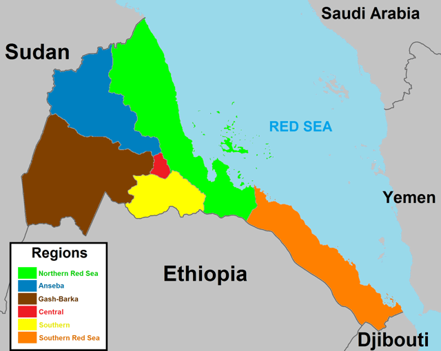
A map of Eritrea regions
Eritrea is divided into six administrative regions. These areas are further divided into 58 districts.
| Region | Area (km2) | Population | Capital |
|---|---|---|---|
| Central | 1,300 | 1,053,254 | Asmara |
| Anseba | 23,200 | 893,587 | Keren |
| Gash-Barka | 33,200 | 1,103,742 | Barentu |
| Southern | 8,000 | 1,476,765 | Mendefera |
| Northern Red Sea | 27,800 | 897,454 | Massawa |
| Southern Red Sea | 27,600 | 398,073 | Assab |
The regions of Eritrea are the primary geographical divisions through which the country is administered. Six in total, they include the Maekel/Central, Anseba, Gash-Barka, Debub/Southern, Northern Red Sea and Southern Red Sea regions. At the time of independence in 1993, Eritrea was arranged into ten provinces. These provinces were similar to the nine provinces operating during the colonial period. In 1996, these were consolidated into six regions (zobas). The boundaries of these new regions are based on catchment basins.
Largest cities
Transportation
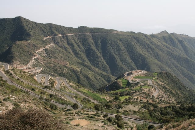
Eritrea mountain road
Transport in Eritrea includes highways, airports and seaports, in addition to various forms of public and private vehicular, maritime and aerial transportation. A railway formerly ran from Massawa to Bishia via Asmara, and is under re-construction.
As of 1999, there was a total of 317 kilometres of 950 mm (3 ft 1 3⁄8 in) (narrow gauge) rail line in Eritrea. The railway links Agordat and Asmara with the port of Massawa; however, it had been inoperative since 1978 except for about a 5 kilometre stretch that was reopened in Massawa in 1994. Rehabilitation of the remainder and of the rolling stock has occurred in recent years. By 2003, the line had been restored from Massawa all the way through to Asmara.
The Eritrean highway system is named according to the road classification. The three levels of classification are: primary (P), secondary (S), and tertiary (T). The lowest level road is tertiary and serves local interests. Typically they are improved earth roads which are occasionally paved. During the wet seasons these roads typically become impassable.
The next higher level road is a secondary road and typically is a single-layered asphalt road that connects district capitals together and those to the regional capitals. Roads that are considered primary roads are those that are fully asphalted (throughout their entire length) and in general they carry traffic between all the major cities and towns in Eritrea.
The Eritrean Railway was built between 1887 and 1932, and formerly ran from Massawa to Bishia via Asmara. Badly damaged during WWII and in later fighting, it was closed section by section, with the final closure coming in 1978. After independence, a rebuilding effort commenced, and the first rebuilt section was reopened in 2003. As of 2009, the section from Massawa to Asmara was fully rebuilt and available for service. Current service is very limited due to the extreme age of most of the railway equipment and its limited availability. Further rebuilding is planned.
Economy

Eritrea's main exports, 2013
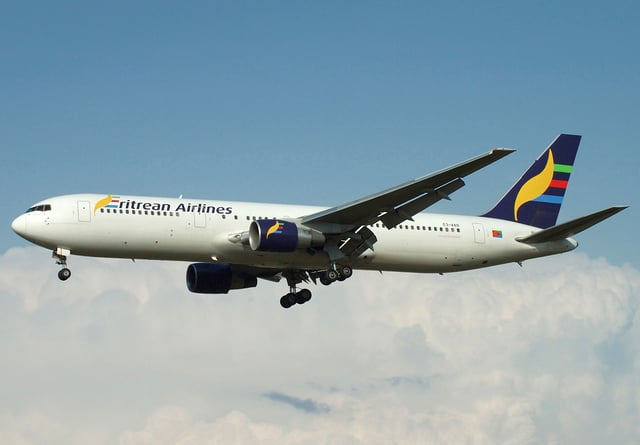
An Eritrean Airlines Boeing 767-366/ER aircraft. The national carrier is based in Asmara.
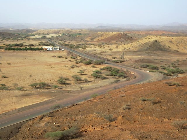
The Massawa-Asmara Highway, built as part of the Wefri Warsay Yika'alo program
The economy of Eritrea has experienced considerable growth in recent years, indicated by an improvement in gross domestic product (GDP) in October 2012 of 7.5% over 2011.[115] A big reason for the recent growth of the Eritrean economy is the commencement of full operations in the gold and silver Bisha mine and the production of cement from the cement factory in Massawa.[116]
Worker remittances from abroad are estimated to account for 32% of gross domestic product.[15] Eritrea has an extensive amount of resources such as copper, gold, granite, marble, and potash. The Eritrean economy has undergone extreme changes due to the War of Independence. In 2011, Eritrea's GDP grew by 8.7% making it one of the fastest growing economies in the world.[119]
The Eritrean–Ethiopian War severely hurt Eritrea's economy. GDP growth in 1999 fell to less than 1%, and GDP decreased by 8.2% in 2000. In May 2000, the war resulted in some $600 million in property damage and loss, including losses of $225 million in livestock and 55,000 homes.
Even during the war, Eritrea developed its transportation infrastructure by asphalting new roads, improving its ports, and repairing war-damaged roads and bridges as a part of the Wefri Warsay Yika'alo program. The most significant of these projects was the construction of a coastal highway of more than 500 km connecting Massawa with Asseb, as well as the rehabilitation of the Eritrean Railway. The rail line has been restored between the port of Massawa and the capital Asmara, although services are sporadic. Steam locomotives are sometimes used for groups of enthusiasts.
In theory, Eritrea has a national carrier, Eritrean Airlines, but services are intermittent.
Demographics
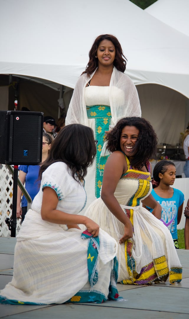
Tigrinyan women performing a traditional dance
| Year | Million |
|---|---|
| 1950 | 1.1 |
| 2000 | 3.4 |
| 2016 | 5 |
Ethnic composition
There are nine recognized ethnic groups according to the government of Eritrea.[17][123] Eritrean society is ethnically heterogeneous. An independent census has yet to be conducted, but the Tigrinya people make up about 55% and Tigre people make up about 30% of the population. A majority of the remaining ethnic groups belong to Afroasiatic-speaking communities of the Cushitic branch, such as the Saho, Hedareb, Afar and Bilen. There are also a number of Nilotic ethnic minorities, who are represented in Eritrea by the Kunama and Nara. Each ethnicity speaks a different native tongue but, typically, many of the minorities speak more than one language. The Rashaida represent about 2% of Eritrea's population.[6] They reside in the northern coastal lowlands of Eritrea as well as the eastern coasts of Sudan. The Rashaida first came to Eritrea in the 19th century from the Hejaz region.[124]
In addition, there exist Italian Eritrean (concentrated in Asmara) and Ethiopian Tigrayan communities. Neither is generally given citizenship unless through marriage or, more rarely, by having it conferred upon them by the State. Eritrea had about 760,000 inhabitants, including 70,000 Italians, in 1941.[125] Most Italians left after Eritrea became independent from Italy. It is estimated up to 100,000 Eritreans are Italian descent.[126][127]
Languages
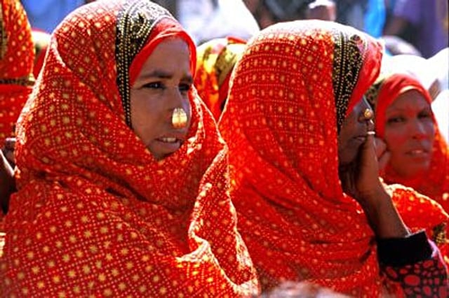
Saho women in traditional attire
Eritrea is a multilingual country. The nation has no official language, as the Constitution establishes the "equality of all Eritrean languages".[128] Tigrinya serves as the de facto language of national identity. With 2,540,000 total speakers of a population of 5,254,000 in 2006, it is the most widely spoken language, particularly in the southern and central parts of Eritrea. Other major national languages include Afar, Arabic, Beja, Bilen, Kunama, Nara, Saho and Tigre. Tigrinya alongside English serve as de facto working languages, with the latter used in university education and many technical fields. While Italian, the former colonial language, holds no government recognized status in Eritrea it is spoken by a few monolinguals and Asmara has Scuola Italiana di Asmara a long running Italian government-operated school.[2] Also, native Eritreans assimilated the language of the Italian Eritreans and spoke a version of the Italian mixed with many tigrinya words: the Eritrean Italian.[129]
Most of the languages spoken in Eritrea belong to the Ethiopian Semitic branch of the Afroasiatic family.[130] Other Afroasiatic languages belonging to the Cushitic branch are also widely spoken in the country.[130] The latter include Afar, Beja, Blin, and Saho. Smaller groups also speak other Afroasiatic languages, such as the newly recognized Dahlik and Arabic (the Hejazi and Hadhrami dialects spoken by the Rashaida and Hadhrami, respectively).
In addition, Nilo-Saharan languages (Kunama and Nara) are spoken as a native language by the Nilotic Kunama and Nara ethnic minority groups that live in the northern and northwestern part of the country.[130]
Religion
According to the Pew Research Center, as of 2010, 62.9% of the population of Eritrea adheres to Christianity, 36.6% follows Islam, and 0.4% practices folk religion. The remainder observes Judaism, Hinduism, Buddhism and other faiths (<0.1% each), or are religiously unaffiliated (0.1%).[132] The U.S. Department of State estimates that, as of 2011, 50% of the population of Eritrea adheres to Christianity, 48% follows Islam, and 2% observes other religions, including traditional faiths and animism.[131]
Since May 2002, the government of Eritrea has officially recognized the Eritrean Orthodox Tewahedo Church (Oriental Orthodox), Sunni Islam, the Eritrean Catholic Church (a Metropolitanate sui juris), and the Evangelical Lutheran church. All other faiths and denominations are required to undergo a registration process.[133] Among other things, the government's registration system requires religious groups to submit personal information on their membership to be allowed to worship.[133]
The Eritrean government is against what it deems as "reformed" or "radical" versions of its established religions. Therefore, alleged radical forms of Islam and Christianity, Jehovah's Witnesses, the Bahá'í Faith (though the Bahá'í Faith is neither Islamic nor Christian), the Seventh-day Adventist Church, and numerous other non-Protestant Evangelical denominations are not registered and cannot worship freely. Three named Jehovah's Witnesses are known to have been imprisoned since 1994 along with 51 others.[134][135][136]
In its 2017 religious freedom report, the U.S. State Department named Eritrea a Country of Particular Concern (CPC).[137]
Human rights
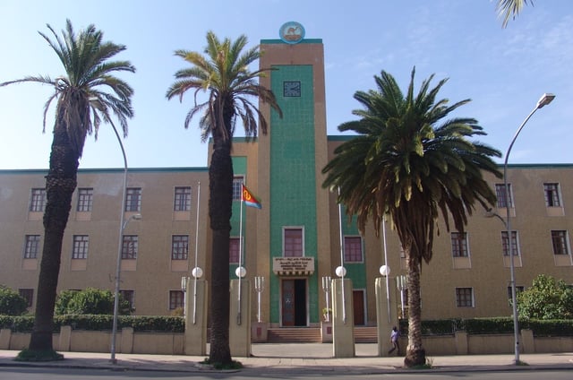
Building of regional administration in Asmara
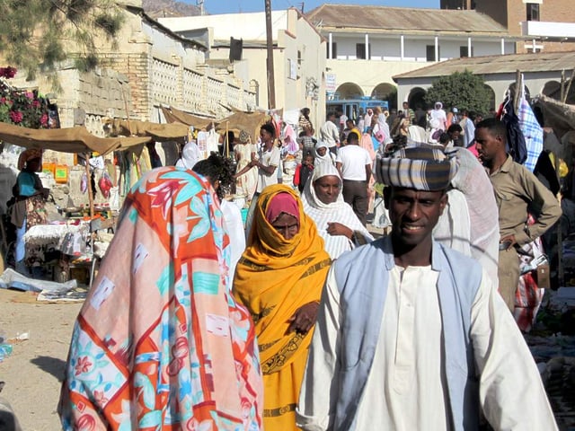
Women wearing hijab in Keren, Eritrea
Eritrea is a one-party state in which national legislative elections have been repeatedly postponed.[21] According to Human Rights Watch, the government's human rights record is considered among the worst in the world.[22] Most Western countries have accused the Eritrean authorities of arbitrary arrest and detentions, and of detaining an unknown number of people without charge for their political activism. However, the Eritrean government has continually dismissed the accusations as politically motivated.[23] Both male and female same-sex sexual activity is illegal in Eritrea.[138]
A prominent group of fifteen Eritreans, called the G-15, including three cabinet members, were arrested in September 2001 after publishing an open letter to the government and President Isaias Afewerki calling for democratic dialogue. This group and thousands of others who were alleged to be affiliated with them are imprisoned without legal charges, hearing, trial and judgment.[139][140]
Since Eritrea's conflict with Ethiopia in 1998–2001, the nation's human rights record has been criticized at the United Nations.[141] Human rights violations are allegedly often committed by the government or on behalf of the government. Freedom of speech, press, assembly, and association are limited. Those who practice "unregistered" religions, try to flee the nation, or escape military duty are arrested and put into prison.[141] During the Eritrean independence struggle and 1998 Eritrean-Ethiopian War, many atrocities were also committed by the Ethiopian authorities against unarmed Eritrean civilians.[142][143]
In June 2016, a 500-page United Nations Human Rights Council report accused Eritrea's government of extrajudicial executions, torture, indefinitely prolonged national service and forced labour, and indicated that sexual harassment, rape and sexual servitude by state officials are also widespread.[7][144] Barbara Lochbihler of the European Parliament Subcommittee on Human Rights said the report detailed 'very serious human rights violations', and asserted that EU funding for development would not continue as at present without change in Eritrea.[145] The Eritrean Foreign Ministry responded by describing the Commission's report as "wild allegations" which were "totally unfounded and devoid of all merit".[146] Several countries also disputed the report's language and accuracy, including the US and China.[147]
All Eritreans aged between 18 and 40 years must complete a mandatory national service, which includes military service. This requirement was implemented after Eritrea gained independence from Ethiopia, as a means to protect Eritrea's sovereignty, to instill national pride, and to create a disciplined populace.[24] Eritrea's national service requires long, indefinite conscription, which some Eritreans leave the country in order to avoid.[24][148][149]
In an attempt at reform, Eritrean government officials and NGO representatives in 2006 participated in many public meetings and dialogues. In these sessions they answered questions as fundamental as, "What are human rights?", "Who determines what are human rights?", and "What should take precedence, human or communal rights?"[150] In 2007, the Eritrean government also banned female genital mutilation.[151] In Regional Assemblies and religious circles, Eritreans themselves speak out continuously against the use of female circumcision. They cite health concerns and individual freedom as being of primary concern when they say this. Furthermore, they implore rural peoples to cast away this ancient cultural practice.[152][153] In 2009, a movement called Citizens for Democratic Rights in Eritrea formed to create dialogue between the government and political opposition. The group consists of ordinary citizens and some people close to the government.[154]
In July 2019, UN ambassadors of 37 countries, including Eritrea, have signed a joint letter to the UNHRC defending China's treatment of Uyghurs and other Muslim minority groups in the Xinjiang region.[155]
Media freedom
In its 2017 Press Freedom Index, Reporters Without Borders ranked the media environment in Eritrea at the bottom of a list of 180 countries.[156] According to the BBC, "Eritrea is the only African country to have no privately owned news media",[157] and Reporters Without Borders said of the public media, "[They] do nothing but relay the regime's belligerent and ultra-nationalist discourse. ... Not a single [foreign correspondent] now lives in Asmara."[158] The state-owned news agency censors news about external events.[159] Independent media have been banned since 2001.[159] The Eritrean authorities had reportedly imprisoned the fourth highest number of journalists after Turkey, China and Egypt.[160]
Health care
Eritrea has achieved significant improvements in health care and is one of the few countries to be on target to meet its Millennium Development Goals (MDG) for health, in particular child health.[161] Life expectancy at birth increased from 39.1 years in 1960 to 59.5 years in 2008; maternal and child mortality rates dropped dramatically and the health infrastructure expanded.[161] Due to Eritrea's relative isolation, information and resources are extremely limited and the World Health Organisation (WHO) in 2008 found average life expectancy to be slightly less than 63 years. Immunisation and child nutrition have been tackled by working closely with schools in a multi-sectoral approach; the number of children vaccinated against measles almost doubled in seven years, from 40.7% to 78.5% and the prevalence of underweight children decreased by 12% from 1995 to 2002 (severe underweight prevalence by 28%).[161] The National Malaria Protection Unit of the Ministry of Health registered reductions in malarial mortality by as much as 85% and in the number of cases by 92% between 1998 and 2006.[161] The Eritrean government has banned female genital mutilation (FGM), saying the practice was painful and put women at risk of life-threatening health problems.[162]
However, Eritrea still faces many challenges. Although the number of physicians increased from only 0.2 in 1993 to 0.5 in 2004 per 1000 people, this is still very low.[161] Malaria and tuberculosis are common.[163] HIV prevalence for ages 15 to 49 years exceeds 2%.[163] The fertility rate is about 5 births per woman.[163] Maternal mortality dropped by more than half from 1995 to 2002, but is still high.[161] Similarly, the number of births attended by skilled health personnel doubled from 1995 to 2002, but still is only 28.3%.[161] A major cause of death in newborns is severe infection.[163] Per-capita expenditure on health is low.[163]
Education
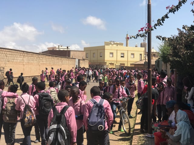
Eritrean pupils in uniform
There are five levels of education in Eritrea: pre-primary, primary, middle, secondary, and post-secondary. There are nearly 238,000 students in the primary, middle, and secondary levels of education. There are approximately 824 schools,[164] two universities (the University of Asmara and the Eritrea Institute of Technology) and several smaller colleges and technical schools.
Education in Eritrea is officially compulsory for children aged 7 to 13 years . However, the education infrastructure is inadequate to meet current needs. Statistics vary at the elementary level, suggesting that 65% to 70% of school-aged children attend primary school; Approximately 61% attend secondary school. Student-teacher ratios are high: 45:1 at the elementary level and 54:1 at the secondary level. Class sizes average 63 and 97 students per classroom at the elementary and secondary school levels, respectively. Learning hours at school are often less than six hours per day. However, the literacy rate is high: for ages 18 to 24 years, it is 92.6% for men and 87.7% for women (2008–2012)[165] Overall literacy is 81%.[166] Barriers to education in Eritrea include traditional taboos, school fees (for registration and materials), and the opportunity costs of low-income households.[167]
Culture
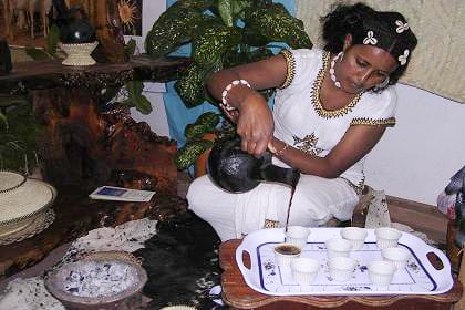
An Eritrean woman pouring traditionally brewed coffee from a jebena during a coffee ceremony
One of the most recognizable parts of Eritrean culture is the coffee ceremony.[168] Coffee (Ge'ez ቡን būn) is offered when visiting friends, during festivities, or as a daily staple of life. During the coffee ceremony, there are traditions that are upheld. The coffee is served in three rounds: the first brew or round is called awel in Tigrinya (meaning "first"), the second round is called kalaay (meaning "second"), and the third round is called bereka (meaning "to be blessed").
Traditional Eritrean attire is quite varied among the ethnic groups of Eritrea. In the larger cities, most people dress in Western casual dress such as jeans and shirts. In offices, both men and women often dress in suits. A common traditional clothing for Christian Tigrayan highlanders consists of bright white gowns called zurias for the women, and a white shirt accompanied by white pants for the men. In Muslim communities in the Eritrean lowland, the women traditionally dress in brightly colored clothes. Besides convergent culinary tastes, Eritreans share an appreciation for similar music and lyrics, jewelry and fragrances, and tapestry and fabrics as many other populations in the Horn region.[169]
Cuisine
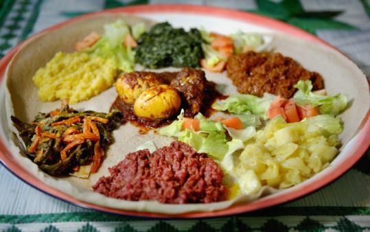
Eritrean injera with various stews
A typical traditional Eritrean dish consists of injera accompanied by a spicy stew, which frequently includes beef, chicken, lamb or fish.[170] Overall, Eritrean cuisine strongly resembles those of neighboring Ethiopia,[170][171] Eritrean cooking tend to feature more seafood than Ethiopian cuisine on account of their coastal location.[170] Eritrean dishes are also frequently "lighter" in texture than Ethiopian meals. They likewise tend to employ less seasoned butter and spices and more tomatoes, as in the tsebhi dorho delicacy.
Additionally, owing to its colonial history, cuisine in Eritrea features more Italian influences than are present in Ethiopian cooking, including more pasta and greater use of curry powders and cumin.The Italian Eritrean cuisine started to be practiced during the colonial times of the Kingdom of Italy, when a large number of Italians moved to Eritrea. They brought the use of "pasta" to Italian Eritrea, and it is one of the main food eaten in present-day Asmara. An Italian Eritrean cuisine emerged, and common dishes are 'Pasta al Sugo e Berbere', which means "Pasta with tomato sauce and berbere" (spice), but there are many more like "lasagna" and "cotoletta alla milanese" (milano cutlet).[172] Alongside sowa, people in Eritrea also tend to drink coffee.[170] Mies is another popular local alcoholic beverage, made out of honey.[173]
Music
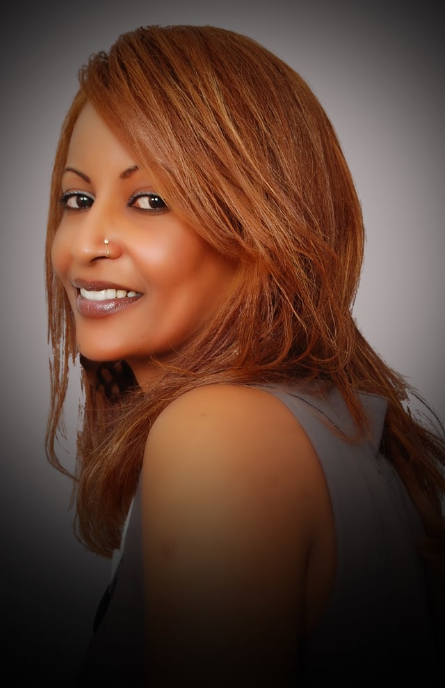
Eritrean artist Helen Meles
Eritrea's ethnic groups each have their own styles of music and accompanying dances. Amongst the Tigrinya, the best known traditional musical genre is the guaila. Traditional instruments of Eritrean folk music include the stringed krar, kebero, begena, masenqo and the wata (a distant/rudimentary cousin of the violin). A popular Eritrean artist is the Tigrinya singer Helen Meles, who is noted for her powerful voice and wide singing range.[174] Other prominent local musicians include the Kunama singer Dehab Faytinga, Ruth Abraha, Bereket Mengisteab, the late Yemane Ghebremichael, and the late Abraham Afewerki.
Sport

Cyclists competing in the Tour of Eritrea in Asmara
Football and cycling are the most popular sports in Eritrea. In recent years, Eritrean athletes have also seen increasing success in the international arena. Zersenay Tadese, an Eritrean athlete, formerly held the world record in the half marathon.[175] The Tour of Eritrea, a multi-stage international cycling event, is held annually throughout the country. The Eritrea national cycling team has experienced a lot of success, winning the continental cycling championship several years in a row. Six Eritrean riders have been signed to international cycling teams, including Natnael Berhane and Daniel Teklehaimanot. Berhane was named African Sportsman of the Year in 2013, while Teklehaimanot became the first Eritrean to ride the Vuelta a España in 2012.[176] In 2015, Teklehaimanot won the King of the Mountains classification in the Critérium du Dauphine. Teklehaimanot and fellow Eritrean Merhawi Kudus became the first black cyclists from Africa to compete in the Tour de France, when they were selected by the MTN–Qhubeka team for the 2015 edition of the race.[177] In July of the year, Teklehaimanot also became the first rider from an African team to wear the polka dot jersey at the Tour de France.[178] The Eritrean national cycling teams of both men and women are ranked first on the continent. In 2013, the women's team won the gold medal in the African Continental Cycling Championships for the first time, and for the second time in 2015.[179][180][181]
See also
Index of Eritrea-related articles
Outline of Eritrea

