Dorcheat Bayou

Dorcheat Bayou


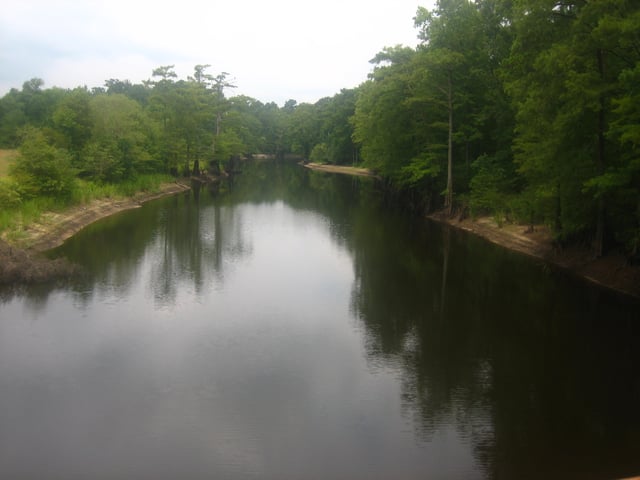
Another view of the calmness of Dorcheat Bayou taken from U.S. Highway 80 between Minden and Dixie Inn
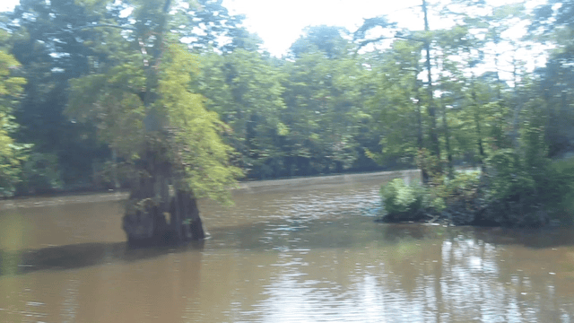
Dorcheat Bayou, also known as Bayou Dorcheat,[1] formerly Bayou Dauchite,[2] is a 115-mile-long (185 km)[3] stream in the US that extends from Nevada County in southwestern Arkansas through Columbia County and into Webster Parish in northwestern Louisiana before emptying into Lake Bistineau east of the village of Doyline.[4] To its south, Lake Bistineau joins Loggy Bayou to form a continuous passage of water into the Red River. Sometimes called the "heart of Webster Parish", Dorcheat is known for its "unending bounty of sights and sound" of nature.[5]
In the 19th century, Dorcheat was navigable for three to six months per year as far as Minden, the seat of Webster Parish.[4] Wharves and warehouses were built along the bayou, as steamboats brought supplies to the outlying areas and then returned with mainly cotton to the large market available in New Orleans. The land along the bayou was settled by the Caddo Indians. The names "Dorcheat" and "Bistineau" come from the Caddo and mean "people" and "big broth", respectively, the latter a reference to floating plant debris still found in the lake. In 1835, the Caddo signed a treaty with the United States government and left the Dorcheat country. A few white traders, trappers, and hunters had arrived in the area even before the Indians left. The early settlers used the Dorcheat because of log jams on the Red River, which were later eliminated by Captain Henry Miller Shreve, for whom Shreveport is named.[4]
Isaac Alden, who arrived from New Orleans prior to the War of 1812, was one of the first white settlers in the Dorcheat country. A decade later, John Murrell arrived from Tennessee. Newett Drew, a native of Virginia and an ancestor of Judges Richard Maxwell Drew, Richard Cleveland Drew, Harmon Caldwell Drew, R. Harmon Drew, Sr., and current Circuit Judge Harmon Drew, Jr., constructed a sawmill and gristmill at Dorcheat in 1821, from which appeared the settlement of the defunct Overton in south Webster Parish. The settlers were dependent on the connection with the Red River as a tributary of the Mississippi.[4]
Steamboats, including side-wheelers and stern-wheelers, sometimes encountered tragedies on Dorcheat Bayou. An early steamer caught fire as it returned south; a woman leaped from the vessel with a child under each arm. She but only one of the children were rescued. In 1850, the Shamrock also burned with the loss of one person. The ships carried cargo and passengers and often offered mostly musical entertainment. Among these ships were the Danube, the Jewel, and the Marie Louise,[4] a reference to the second wife of Napoleon I. The steamboat era on Dorcheat ended in 1892, with the enhanced access to railroads, one of which was the Sibley, Lake Bistineau, and Southern Railway. Passenger rail service along Dorcheat Bayou ended in 1969.[6]
Overton became the seat of government of Claiborne Parish. In 1871, Webster Parish was separated from Claiborne Parish. Plagued by epidemics, Overton was eventually abandoned. The Claiborne Parish seat of government was shifted east to Athens, and then the current location of Homer. Meanwhile, Charles H. Veeder, a New York native, established Minden in 1836, and the new community soon outgrew Overton. Veeder established the defunct Minden Female College, considered the oldest college in Louisiana. In time, farming declined along the Dorcheat, as petroleum and natural gas strikes occurred in Webster Parish during the 1920s.[4]
Historian Marietta M. LeBreton, who was affiliated with Northwestern State University in Natchitoches from 1963 until her death in 2009,[7] describes the modern Dorcheat as a "lazy stream winding through low, hilly farmland and catering to the fishermen and sportsmen of North Louisiana."[4] Calm-water canoeing is another sport popular on Dorcheat.[8]
The Nature Conservancy maintains 40 acres (160,000 m2) on Dorcheat Bayou donated by James W. Bransford, who will designate another 1,000 acres (4.0 km2) in the future. The preserve is not open to the public.[9]
The history of the Dorcheat country is revealed in certain exhibits at the Dorcheat Historical Association Museum at 116 Pearl Street in Minden. The $7.2 million Bayou Dorcheat Correctional Center, which opened in 2002 at the former Louisiana Army Ammunition Plant west of Minden, is named for the bayou. It was pushed to completion by then Webster Parish Sheriff Larkin T. Riser.[10] There is also the Dorcheat Soil Conservation District.
Location
- MouthLake Bistineau, Louisiana:32°30′31″N 93°21′01″W [12]SourceNevada County, Arkansas:33°27′26″N 93°21′37″W [13]