County (United States)

County (United States)
| County | |
|---|---|
| Also known as: Parish (Louisiana) Borough (Alaska) | |
| Category | Second-level administrative division |
| Location | States, federal district and territories of the United States of America |
| Number | 3,242 (including 135 county equivalents in the 50 states and the District of Columbia, and the 100 county equivalents in the U.S. territories) |
| Populations | Greatest: Los Angeles County, California—10,170,292 (2015) Least: Kalawao County, Hawaii—89 (2015) 8 entities[1] (county equivalents)—0 (2018) Average: 103,554 (2017) |
| Areas | Largest: San Bernardino County, California—20,057 sq mi (51,950 km2) Yukon-Koyukuk Census Area, Alaska (county equivalent)—145,505 sq mi (376,860 km2) Smallest: Kalawao County, Hawaii—12 sq mi (31 km2) Independent City of Falls Church, Virginia (county equivalent)—2 sq mi (5.2 km2) Smallest (including territories): Kingman Reef (county equivalent)—0.01 sq mi (0.026 km2)[22][23] Average: 1,208 sq mi (3,130 km2) |
| Government | County commission, Board of Supervisors (AZ, CA, IA, MS, VA, WI) County council (WA), Commissioners' Court (TX), Board of chosen freeholders (NJ), Fiscal Court (KY), Police Jury (LA) County executive, County mayor, County judge, County manager, Sole commissioner |
| Subdivisions | Township Hundred |
In the United States, a county is an administrative or political subdivision of a state that consists of a geographic region with specific boundaries and usually some level of governmental authority.[24] The term "county" is used in 48 U.S. states, while Louisiana and Alaska have functionally equivalent subdivisions called parishes and boroughs, respectively.[24]
Most counties have subdivisions which may include municipalities and unincorporated areas. Others have no further divisions, or may serve as a consolidated city-county. Some municipalities are in multiple counties; New York City is uniquely partitioned into five counties, referred to at the city government level as boroughs.
The United States Census Bureau uses the term "county equivalent" to describe places that are comparable to counties, but called by different names. Louisiana parishes; the organized boroughs of Alaska; the District of Columbia; and the independent cities of the states of Virginia, Maryland, Missouri, and Nevada are equivalent to counties for administrative purposes. Alaska's Unorganized Borough is divided into 10 census areas that are statistically equivalent to counties. As of 2018, there are currently 3,142 counties and county-equivalents in the 50 states and the District of Columbia.[25] If the 100 county equivalents in the U.S. territories are counted, then the total is 3,242 counties and county-equivalents in the United States.[26][27][28][29][2]
The number of counties per state ranges from the three counties of Delaware to the 254 counties of Texas.
The specific governmental powers of counties vary widely between the states. Counties have significant functions in all states except Rhode Island and Connecticut, where county governments have been abolished but the entities remain for administrative or statistical purposes. The Commonwealth of Massachusetts has removed most government functions from eight of its 14 counties.
The county with the largest population, Los Angeles County (10,170,292),[30] and the county with the largest land area, San Bernardino County, border each other in Southern California (however, four boroughs in Alaska are larger in area than San Bernardino).
Territories of the United States do not have counties;[3] instead, the United States Census Bureau divides them into county equivalents. The U.S. Census Bureau counts American Samoa's districts and atolls as county-equivalents.[28][29] American Samoa locally has places called "counties", but these entities are considered to be "minor civil divisions" (not true counties) by the U.S. Census Bureau.[29]
| County | |
|---|---|
| Also known as: Parish (Louisiana) Borough (Alaska) | |
| Category | Second-level administrative division |
| Location | States, federal district and territories of the United States of America |
| Number | 3,242 (including 135 county equivalents in the 50 states and the District of Columbia, and the 100 county equivalents in the U.S. territories) |
| Populations | Greatest: Los Angeles County, California—10,170,292 (2015) Least: Kalawao County, Hawaii—89 (2015) 8 entities[1] (county equivalents)—0 (2018) Average: 103,554 (2017) |
| Areas | Largest: San Bernardino County, California—20,057 sq mi (51,950 km2) Yukon-Koyukuk Census Area, Alaska (county equivalent)—145,505 sq mi (376,860 km2) Smallest: Kalawao County, Hawaii—12 sq mi (31 km2) Independent City of Falls Church, Virginia (county equivalent)—2 sq mi (5.2 km2) Smallest (including territories): Kingman Reef (county equivalent)—0.01 sq mi (0.026 km2)[22][23] Average: 1,208 sq mi (3,130 km2) |
| Government | County commission, Board of Supervisors (AZ, CA, IA, MS, VA, WI) County council (WA), Commissioners' Court (TX), Board of chosen freeholders (NJ), Fiscal Court (KY), Police Jury (LA) County executive, County mayor, County judge, County manager, Sole commissioner |
| Subdivisions | Township Hundred |
History
Counties were among the earliest units of local government established in the Thirteen Colonies that would become the United States. Virginia created the first counties in order to ease the administrative workload in Jamestown. The House of Burgesses divided the colony first into four "incorporations" in 1617 and finally into eight shires (or counties) in 1634: James City, Henrico, Charles City, Charles River, Warrosquyoake, Accomac, Elizabeth City, and Warwick River.[32] America's oldest intact county court records can be found at Eastville, Virginia, in Northampton (originally Accomac) County, dating to 1632.[33] Maryland established its first county, St. Mary's, in 1637, and Massachusetts followed in 1643. Pennsylvania and New York delegated significant power and responsibility from state government to county governments and thereby established a pattern for most of the United States, although counties remained relatively weak in New England.[34]
When independence came, "the framers of the Constitution did not provide for local governments. Rather, they left the matter to the states. Subsequently, early state constitutions generally conceptualized county government as an arm of the state." In the twentieth century, the role of local governments strengthened and counties began providing more services, acquiring home rule and county commissions to pass local ordinances pertaining to their unincorporated areas.[35]
In some states, these powers are partly or mostly devolved to the counties' smaller divisions usually called townships, though in New York, New England and Wisconsin they are called "towns". The county may or may not be able to override its townships on certain matters, depending on the state constitution.
The newest county in the United States is the city and county of Broomfield, Colorado, established in 2001 as a consolidated city-county, previously part of four counties.[36][37] The newest county-equivalents are the Alaskan boroughs of Skagway established in 2007, Wrangell established in 2008, and Petersburg established in 2013.[38]
County variations
Consolidated city-counties
A consolidated city-county is simultaneously a city, which is a municipality (municipal corporation), and a county, which is an administrative division of a state, having the powers and responsibilities of both types of entities. There are 40 consolidated city-counties in the U.S.,[24] including Augusta, Georgia; Denver, Colorado; Indianapolis, Indiana; Jacksonville, Florida; Louisville, Kentucky; Lexington, Kentucky; Kansas City, Kansas, Nashville, Tennessee; New Orleans, Louisiana; Philadelphia, Pennsylvania; and San Francisco, California.
Similarly, some of Alaska's boroughs have merged with their principal cities creating unified city-boroughs. Some such consolidations and mergers have created cities that rank among the geographically largest cities in the world, though often with population densities far below those of most urban areas.
County equivalents
The term county equivalents is used to describe divisions whose organization differs from that of most counties:
Alaska census areas: Most of the land area of Alaska is not contained within any of Alaska's 19 organized boroughs. This vast area, larger than France and Germany combined, is officially referred to by the Alaska state government as the Unorganized Borough and outside of other incorporated borough limits, has no independent "county" government, although several incorporated city governments exist within its boundaries; the majority of it is governed and run by the State of Alaska as an extension of state government.[4] The United States Census Bureau, in cooperation with the Alaska state government for census and electoral districting purposes, has divided the Unorganized Borough into 11 census areas for statistical purposes only.[5]
Louisiana parishes
Independent cities: These are cities that legally belong to no county. They differ from consolidated city-counties in that in the case of a consolidated city-county, the county at least nominally exists, whereas in the case of an independent city, no county even nominally exists. As of July 2013, there are 41 such cities in the United States, including Baltimore, Maryland; Carson City, Nevada; St. Louis, Missouri; and all 38 cities in Virginia, where any area incorporated as a city is outside of the county jurisdiction.[41][42]
District of Columbia,[43] outside the jurisdiction of any state, has a special status. The District of Columbia comprises the entirety of the District of Columbia, which, in accordance with Article 1, Section 8 of the U.S. Constitution, is under the jurisdiction of the U.S. Congress. When founded in 1801, the District consisted of two counties and three cities. In 1846, Alexandria County (which now forms Arlington County and a portion of the independent city of Alexandria)—including the then City of Alexandria—was given back to Virginia. In 1871, the three remaining entities—the City of Washington, City of Georgetown, and Washington County (which was coterminous with the District)—were merged into a consolidated government of District of Columbia by an act of Congress. Georgetown was abolished as a city by another act in 1895.
Consolidated city-counties are not designated county-equivalents for administrative purposes; since both the city and the county at least nominally exist, they are properly classified as counties in their own right. The same is true of the boroughs of New York City, each of which is coextensive with a county of New York State.
Territories
There are no counties technically in U.S. territories. American Samoa has its own counties, but the U.S. Census Bureau does not count them as counties (instead, the U.S. Census Bureau counts American Samoa's 3 districts and 2 atolls as county equivalents).[28][29] American Samoa's counties are treated as minor civil divisions.[29] Most territories are directly divided into municipalities or similar units, which are treated as equivalent of counties for statistical purposes:[28][23][29][44][45]
The 78 municipalities of Puerto Rico
The 3 main islands of the United States Virgin Islands
All of Guam
The 4 municipalities of the Northern Mariana Islands
The 3 districts of American Samoa
The 2 atolls of American Samoa
The 9 islands of the U.S. Minor Outlying Islands
The U.S. Census Bureau counts all of Guam as one county-equivalent (with the FIPS code 66010),[28][29] while the USGS counts Guam's election districts (villages) as county-equivalents.[46][47] The U.S. Census Bureau counts the 3 main islands in the U.S. Virgin Islands as county-equivalents, while the USGS counts the districts of the U.S. Virgin Islands (of which there are 2) as county-equivalents.[28][46]
Organization
The site of a county's administration, and often the county courthouse, is called the county seat ("parish seat" in Louisiana, or "borough seat" in Alaska). Several New England counties use the term "shire town" for the county seat.
Many counties are divided into smaller political or governmental units. In Northeastern and Midwestern states, counties are divided into civil townships (or "towns" in New England, New York, and Wisconsin), which may provide governmental or public services.
County names
Common sources of county names are names of people, geographic features, places in other states or countries, Native American tribes, and animals. Quite a few counties bear names of French or Spanish origin.[48]
Counties are most often named for people, often political figures or early settlers, with over 2,100 of the 3,144 total so named. The most common county name, with 31, is Washington County, for America's first president, George Washington. Up until 1871, there was a Washington County within the District of Columbia, but it was dissolved by the District of Columbia Organic Act. Jefferson County, for Thomas Jefferson, is next with 26. The most recent president to have a county named for him was Warren G. Harding, reflecting the slowing rate of county creation since New Mexico and Arizona became states in 1912. The most common names for counties not named after a president are Franklin (25), Clay (18), and Montgomery (18).
After people, the next most common source of county names are geographic features and locations, with some counties even being named after counties in other states, or for places in countries such as the United Kingdom. The most common geographic county name is Lake. Native American tribes and animals lend their names to some counties. Quite a few counties bear names of French or Spanish origin, including Marquette County being named after French missionary Father Jacques Marquette.[48]
The county's equivalent in the state of Louisiana, the parish (Fr. paroisse civile and Sp. parroquia) took its name during the state's French and Spanish colonial periods. Before the Louisiana Purchase and granting of statehood, government was often administered in towns where major church parishes were located. Of the original 19 civil parishes of Louisiana that date from statehood in 1807, nine were named after the Roman Catholic parishes from which they were governed.
County government
The powers of counties arise from state law and vary widely.[49] In Connecticut and Rhode Island,[50][51] counties are geographic entities, but not governmental jurisdictions. At the other extreme, Maryland counties and the county-equivalent City of Baltimore handle almost all services, including public education, although the state retains an active oversight authority with many of these services.[52]
In most Midwestern and Northeastern states, counties are further subdivided into townships or towns, which sometimes exercise local powers or administration. Throughout the United States, counties may contain other independent, self-governing municipalities.
Counties are usually governed by an elected body, variously called the county commission, board of supervisors, commissioners' court, county council, board of chosen freeholders, county court, or county Legislature. In some counties, there is a county executive. In cases in which a consolidated city-county or independent city exists, a City Council usually governs city/county or city affairs.
In many states, the board in charge of a county holds powers that transcend all three traditional branches of government. It has the legislative power to enact ordinances for the county; it has the executive power to oversee the executive operations of county government; and it has quasi-judicial power with regard to certain limited matters (such as hearing appeals from the planning commission if one exists).
The day-to-day operations of the county government are sometimes overseen by an elected county executive or by a chief administrative officer or county administrator who reports to the board, the mayor, or both.
In many states, several important officials are elected separately from the board of commissioners or supervisors and cannot be fired by the board. These positions may include county clerk, county treasurer, county surrogate, sheriff, and others.
District attorneys or state attorneys are usually state-level as opposed to county-level officials, but in many states, counties and state judicial districts have coterminous boundaries.
The structure and powers of a county government may be defined by the general law of the state or by a charter specific to that county. States may allow only general-law counties, only charter counties, or both. Generally, general-law local governments have less autonomy than chartered local governments.[53]
Scope of power
The power of county governments varies widely from state to state, as does the relationship between counties and incorporated cities. The government of the county usually resides in a municipality called the county seat. However, some counties may have multiple seats or no seat. In some counties with no incorporated municipalities, a large settlement may serve as the county seat.
Minimal scope
In New England, counties function at most as judicial court districts and sheriff's departments (presently, in Connecticut only as judicial court districts—and in Rhode Island, they have lost both those functions and all others), and most of the governmental authority below the state level is in the hands of towns and cities. In several of Maine's sparsely populated counties, small towns rely on the county for law enforcement, and in New Hampshire several social programs are administered at the state level. In Connecticut, Rhode Island, and parts of Massachusetts, counties are now only geographic designations, and they do not have any governmental powers. All government is either done at the state level or at the municipal level. In Connecticut and parts of Massachusetts, regional councils have been established to partially fill the void left behind by the abolished county governments.[6] The regional councils' authority is limited compared with a county government—they have authority only over infrastructure and land use planning, distribution of state and federal funds for infrastructure projects, emergency preparedness, and limited law enforcement duties.
Moderate scope
In the Mid-Atlantic and Midwest, counties typically provide, at a minimum, courts, public utilities, libraries, hospitals, public health services, parks, roads, law enforcement, and jails. There is usually a county registrar, recorder, or clerk (the exact title varies) who collects vital statistics, holds elections (sometimes in coordination with a separate elections office or commission), and prepares or processes certificates of births, deaths, marriages, and dissolutions (divorce decrees). The county recorder normally maintains the official record of all real estate transactions. Other key county officials include the coroner/medical examiner, treasurer, assessor, auditor, comptroller, and district attorney.
In most states, the county sheriff is the chief law enforcement officer in the county. However, except in major emergencies where clear chains of command are essential, the county sheriff normally does not directly control the police departments of city governments, but merely cooperates with them (e.g., under mutual aid pacts). Thus, the most common interaction between county and city law enforcement personnel is when city police officers deliver suspects to sheriff's deputies for detention or incarceration in the county jail.
In most states, the state courts and local law enforcement are organized and implemented along county boundaries, but nearly all of the substantive and procedural law adjudicated in state trial courts originates from the state legislature and state appellate courts. In other words, most criminal defendants are prosecuted for violations of state law, not local ordinances, and if they, the district attorney, or police seek reforms to the criminal justice system, they will usually have to direct their efforts towards the state legislature rather than the county (which merely implements state law). A typical criminal defendant will be arraigned and subsequently indicted or held over for trial before a trial court in and for a particular county where the crime occurred, kept in the county jail (if he is not granted bail or cannot make bail), prosecuted by the county's district attorney, and tried before a jury selected from that county. But long-term incarceration is rarely a county responsibility, execution of capital punishment is never a county responsibility, and the state's responses to prisoners' appeals is the responsibility of the state attorney general, who has to defend before the state appellate courts the prosecutions conducted by locally elected district attorneys in the name of the state. Furthermore, county-level trial court judges are officers of the judicial branch of the state government rather than county governments.
In many states, the county controls all unincorporated lands within its boundaries. In states with a township tier, unincorporated land is controlled by the townships. Residents of unincorporated land who are dissatisfied with county-level or township-level resource allocation decisions can attempt to vote to incorporate as a city, town, or village.
A few counties directly provide public transportation themselves, usually in the form of a simple bus system. However, in most counties, public transportation is provided by one of the following: a special-purpose district that is coterminous with the county (but exists separately from the county government), a multi-county regional transit authority, or a state agency.
Broad scope
In western and southern states, more populated counties provide many facilities, such as airports, convention centers, museums, recreation centers, beaches, harbors, zoos, clinics, law libraries, and public housing. They provide services such as child and family services, elder services, mental health services, welfare services, veterans assistance services, animal control, probation supervision, historic preservation, food safety regulation, and environmental health services. They have many additional officials like public defenders, arts commissioners, human rights commissioners, and planning commissioners. Finally, there may also be a county fire department and even a county police department (as distinguished from fire and police departments operated by individual cities, special districts, or the state government). For example, Gwinnett County, Georgia, and its county seat, the city of Lawrenceville, each have their own police departments. (A separate county sheriff's department is responsible for security of the county courts and administration of the county jail.) In several southern states, public school systems are organized and administered at the county level.
Statistics
As of 2016, there were 3,007 counties, 64 parishes, 19 organized boroughs, 10 census areas, 41 independent cities,[7] and the District of Columbia for a total of 3,142 counties and county-equivalents in the 50 states and District of Columbia.[25] There are an additional 100 county equivalents in the territories of the United States.[28][29][23] The average number of counties per state is 62, with a range from the three counties of Delaware to the 254 counties of Texas.
Southern and Midwestern states generally tend to have more counties than Western or Northeastern states, as many Northeastern states are not large enough in area to warrant a large number of counties, and many Western states were sparsely populated when counties were created. The five counties of Rhode Island, the eight counties of Connecticut, and eight of the 14 counties of Massachusetts no longer have functional county governments, but continue to exist as legal and census entities.
| State, federal district or territory | Total | Subdivisions[25] | Average | ||||
|---|---|---|---|---|---|---|---|
| 2016 population[25] | Land area[55] | Counties | Equivalents | Total | Population | Land area | |
| 4,863,300 | 50,645 sq mi 131,171 km2 | 67 | — | 67 | 72,587 | 756 sq mi 1,958 km2 | |
| 741,894 | 570,641 sq mi 1,477,953 km2 | — | 29 | 29 | 25,582 | 19,677 sq mi 50,964 km2 | |
| 6,931,071 | 113,594 sq mi 294,207 km2 | 15 | — | 15 | 462,071 | 7,573 sq mi 19,614 km2 | |
| 2,988,248 | 52,035 sq mi 134,771 km2 | 75 | — | 75 | 39,843 | 694 sq mi 1,797 km2 | |
| 39,250,017 | 155,779 sq mi 403,466 km2 | 58 | — | 58 | 676,724 | 2,686 sq mi 6,956 km2 | |
| 5,540,545 | 103,642 sq mi 268,431 km2 | 64 | — | 64 | 86,571 | 1,619 sq mi 4,194 km2 | |
| 3,576,452 | 4,842 sq mi 12,542 km2 | 8 | — | 8 | 447,057 | 605 sq mi 1,568 km2 | |
| 952,065 | 1,949 sq mi 5,047 km2 | 3 | — | 3 | 317,355 | 650 sq mi 1,682 km2 | |
| 681,170 | 61 sq mi 158 km2 | — | 1 | 1 | 681,170 | 61 sq mi 158 km2 | |
| 20,612,439 | 53,625 sq mi 138,887 km2 | 67 | — | 67 | 307,648 | 800 sq mi 2,073 km2 | |
| 10,310,371 | 57,513 sq mi 148,959 km2 | 159 | — | 159 | 64,845 | 362 sq mi 937 km2 | |
| 1,428,557 | 6,423 sq mi 16,635 km2 | 5 | — | 5 | 285,711 | 1,285 sq mi 3,327 km2 | |
| 1,683,140 | 82,643 sq mi 214,045 km2 | 44 | — | 44 | 38,253 | 1,878 sq mi 4,865 km2 | |
| 12,801,539 | 55,519 sq mi 143,793 km2 | 102 | — | 102 | 125,505 | 544 sq mi 1,410 km2 | |
| 6,633,053 | 35,826 sq mi 92,789 km2 | 92 | — | 92 | 72,098 | 389 sq mi 1,009 km2 | |
| 3,134,693 | 55,857 sq mi 144,669 km2 | 99 | — | 99 | 31,664 | 564 sq mi 1,461 km2 | |
| 2,907,289 | 81,759 sq mi 211,754 km2 | 105 | — | 105 | 27,688 | 779 sq mi 2,017 km2 | |
| 4,436,974 | 39,486 sq mi 102,269 km2 | 120 | — | 120 | 36,975 | 329 sq mi 852 km2 | |
| 4,681,666 | 43,204 sq mi 111,898 km2 | — | 64 | 64 | 73,151 | 675 sq mi 1,748 km2 | |
| 1,331,479 | 30,843 sq mi 79,883 km2 | 16 | — | 16 | 83,217 | 1,928 sq mi 4,993 km2 | |
| 6,016,447 | 9,707 sq mi 25,142 km2 | 23 | 1 | 24 | 250,685 | 404 sq mi 1,048 km2 | |
| 6,811,779 | 7,800 sq mi 20,202 km2 | 14 | — | 14 | 486,556 | 557 sq mi 1,443 km2 | |
| 9,928,300 | 56,539 sq mi 146,435 km2 | 83 | — | 83 | 119,618 | 681 sq mi 1,764 km2 | |
| 5,519,952 | 79,627 sq mi 206,232 km2 | 87 | — | 87 | 63,448 | 915 sq mi 2,370 km2 | |
| 2,988,726 | 46,923 sq mi 121,531 km2 | 82 | — | 82 | 36,448 | 572 sq mi 1,482 km2 | |
| 6,093,000 | 68,742 sq mi 178,040 km2 | 114 | 1 | 115 | 52,983 | 598 sq mi 1,548 km2 | |
| 1,042,520 | 145,546 sq mi 376,962 km2 | 56 | — | 56 | 18,616 | 2,599 sq mi 6,731 km2 | |
| 1,907,116 | 76,824 sq mi 198,974 km2 | 93 | — | 93 | 20,507 | 826 sq mi 2,140 km2 | |
| 2,940,058 | 109,781 sq mi 284,332 km2 | 16 | 1 | 17 | 172,945 | 6,458 sq mi 16,725 km2 | |
| 1,334,795 | 8,953 sq mi 23,187 km2 | 10 | — | 10 | 133,480 | 895 sq mi 2,319 km2 | |
| 8,944,469 | 7,354 sq mi 19,047 km2 | 21 | — | 21 | 425,927 | 350 sq mi 907 km2 | |
| 2,081,015 | 121,298 sq mi 314,161 km2 | 33 | — | 33 | 63,061 | 3,676 sq mi 9,520 km2 | |
| 19,745,289 | 47,126 sq mi 122,057 km2 | 62 | — | 62 | 318,472 | 760 sq mi 1,969 km2 | |
| 10,146,788 | 48,618 sq mi 125,920 km2 | 100 | — | 100 | 101,468 | 486 sq mi 1,259 km2 | |
| 757,952 | 69,001 sq mi 178,711 km2 | 53 | — | 53 | 14,301 | 1,302 sq mi 3,372 km2 | |
| 11,614,373 | 40,861 sq mi 105,829 km2 | 88 | — | 88 | 131,982 | 464 sq mi 1,203 km2 | |
| 3,923,561 | 68,595 sq mi 177,660 km2 | 77 | — | 77 | 50,955 | 891 sq mi 2,307 km2 | |
| 4,093,465 | 95,988 sq mi 248,608 km2 | 36 | — | 36 | 113,707 | 2,666 sq mi 6,906 km2 | |
| 12,784,227 | 44,743 sq mi 115,883 km2 | 67 | — | 67 | 190,809 | 668 sq mi 1,730 km2 | |
| 1,056,426 | 1,034 sq mi 2,678 km2 | 5 | — | 5 | 211,285 | 207 sq mi 536 km2 | |
| 4,961,119 | 30,061 sq mi 77,857 km2 | 46 | — | 46 | 107,850 | 653 sq mi 1,693 km2 | |
| 865,454 | 75,811 sq mi 196,350 km2 | 66 | — | 66 | 13,113 | 1,149 sq mi 2,975 km2 | |
| 6,651,194 | 41,235 sq mi 106,798 km2 | 95 | — | 95 | 70,013 | 434 sq mi 1,124 km2 | |
| 27,862,596 | 261,232 sq mi 676,587 km2 | 254 | — | 254 | 109,695 | 1,028 sq mi 2,664 km2 | |
| 3,051,217 | 82,170 sq mi 212,818 km2 | 29 | — | 29 | 105,214 | 2,833 sq mi 7,339 km2 | |
| 624,594 | 9,217 sq mi 23,871 km2 | 14 | — | 14 | 44,614 | 658 sq mi 1,705 km2 | |
| 8,411,808 | 39,490 sq mi 102,279 km2 | 95 | 38 | 133 | 63,247 | 295 sq mi 763 km2 | |
| 7,288,000 | 66,456 sq mi 172,119 km2 | 39 | — | 39 | 186,872 | 1,704 sq mi 4,413 km2 | |
| 1,831,102 | 24,038 sq mi 62,259 km2 | 55 | — | 55 | 33,293 | 437 sq mi 1,132 km2 | |
| 5,778,708 | 54,158 sq mi 140,268 km2 | 72 | — | 72 | 80,260 | 752 sq mi 1,948 km2 | |
| 585,501 | 97,093 sq mi 251,470 km2 | 23 | — | 23 | 25,457 | 4,221 sq mi 10,933 km2 | |
| United States (50 states and the District of Columbia) | 323,127,513 | 3,531,905 sq mi 9,147,592 km2 | 3,007 | 135 | 3,142 | 102,841 | 1,124 sq mi 2,910 km2 |
| 51,504 | 77 sq mi 199 km2 | — | 5 | 5 | 11,104 | 15 sq mi 40 km2 | |
| 162,742 | 210 sq mi 540 km2 | — | 1 | 1 | 162,742 | 210 sq mi 540 km2 | |
| 52,263 | 179 sq mi 464 km2 | — | 4 | 4 | 13,066 | 45 sq mi 116 km2 | |
| 3,337,177 | 3,515 sq mi 9,104 km2 | — | 78 | 78 | 42,784 | 45 sq mi 116 km2 | |
| 160 | 13 sq mi 34 km2 | — | 9 | 9 | 18 | 1 sq mi 4 km2 | |
| 104,901 | 134 sq mi 346 km2 | — | 3 | 3 | 34,967 | 45 sq mi 115 km2 | |
| United States (50 states, the District of Columbia, and territories) | 326,836,260 | 3,535,948 sq mi 9,158,064 km2 | 3,007 | 235 | 3,242 | 100,813 | 1,091 sq mi 2,825 km2 |
Population
The average U.S. county population was nearly 100,000 in 2015. The most populous county is Los Angeles County, California, with 10,170,292 residents in 2015.[56] This number is greater than the populations of 41 U.S. states. It also makes Los Angeles County 17.4 times as large as the least populous state, Wyoming.
The least populous county is Kalawao County, Hawaii, with 89 residents in 2015.[56] 8 county-equivalents in the U.S. territories have a population of 0: Rose Atoll, Northern Islands Municipality, Baker Island, Howland Island, Jarvis Island, Johnston Atoll, Kingman Reef, and Navassa Island.[23][57][58] The remaining 3 islands in the U.S. Minor Outlying Islands have small non-permanent human populations. The least populous county-equivalent with a permanent human population is Swains Island, American Samoa (17 residents).[59]
The most densely populated county or county-equivalent is New York County, New York (coextensive with the New York City Borough of Manhattan), with 72,033 persons per square mile (27,812/km2) in 2015. The Yukon-Koyukuk Census Area, Alaska, is both the most extensive and the least densely populated county or county-equivalent with 0.0380 persons per square mile (0.0147/km2) in 2015.[56]
In the 50 states (plus District of Columbia), a total of 981 counties have a population over 50,000; 592 counties have a population over 100,000; 137 counties have a population over 500,000; 45 counties have a population over 1,000,000; and 14 counties have a population over 2,000,000. At the other extreme, 35 counties have a population under 1,000; 307 counties have a population under 5,000; 709 counties have a population under 10,000; and 1,492 counties have a population between 10,000 and 50,000.[56]
Area
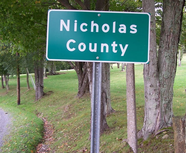
A highway sign designating the border between Nicholas and Greenbrier counties in West Virginia along a secondary road
At the 2000 U.S. Census, the median land area of U.S. counties was 622 sq mi (1,610 km2), which is two-thirds of the median land area of a ceremonial county of England, and a little more than a quarter of the median land area of a French département. Counties in the western United States typically have a much larger land area than those in the eastern United States. For example, the median land area of counties in Georgia is 343 sq mi (890 km2), whereas in Utah it is 2,427 sq mi (6,290 km2).
The most extensive county or county-equivalent is the Yukon-Koyukuk Census Area, Alaska, with a land area of 145,505 square miles (376,856 km2). All nine of the most extensive county-equivalents are in Alaska. The most extensive county is San Bernardino County, California, with a land area of 20,057 square miles (51,947 km2). The least extensive county is Kalawao County, Hawaii, with a land area of 11.991 square miles (31.058 km2). The least extensive county-equivalent in the 50 states is the independent City of Falls Church, Virginia, with a land area of 1.999 square miles (5.177 km2).[24] If U.S. territories are included, the least extensive county-equivalent is Kingman Reef, with a land area of 0.01 square miles (0.03 km2).[22]
Geographic relationships between cities and counties
In some states, a municipality may be in only one county and may not annex territory in adjacent counties, but in the majority of states, the state constitution or state law allows municipalities to extend across county boundaries. At least 32 states include municipalities in multiple counties. Dallas and Oklahoma City, for example, both contain portions of five counties. New York City is an unusual case because it encompasses multiple entire counties in one city. Each of those counties is coextensive with one of the five boroughs of the city: Manhattan (New York County), The Bronx (Bronx County), Queens (Queens County), Brooklyn (Kings County), and Staten Island (Richmond County).
See also
Lists of counties in the United States List of United States counties and county equivalents Index of U.S. counties List of former United States counties List of the most common U.S. county names
Flags of counties of the United States
List of FIPS codes