Christmas Island
Christmas Island

Territory of Christmas Island
| |
|---|---|
 | |
| Status | External Territory |
| Capital and largest city | Flying Fish Cove ("The Settlement") 10°25′18″S 105°40′41″E [96] |
| Official languages | English[1] |
| Native languages | Chinese, Malay, English |
| Ethnic groups | |
| Demonym(s) | Christmas Islander |
| Sovereign state | Australia |
| Government | Local authority under a federal constitutional monarchy |
• Monarch | Elizabeth II |
• Governor-General | David Hurley |
• Administrator | Natasha Griggs |
• Shire President | Gordon Thompson |
| Establishment | |
• Annexed by UK | 1888 |
• Transferred to Australia | 1957 |
| Area | |
• Total | 135 km2(52 sq mi) |
• Water (%) | 0 |
| Population | |
• 2016 census | 1,843 (2016)[2] |
• Density | 10.39/km2(26.9/sq mi) (n/a) |
| Currency | Australian dollar (AUD) |
| Time zone | UTC+7(CXT) |
| Driving side | left |
| Calling code | 61 |
| Internet TLD | .cx |
The Territory of Christmas Island (Chinese: 圣诞岛; Malay: Wilayah Pulau Krismas) is an Australian external territory comprising the island of the same name. Christmas Island is located in the Indian Ocean, around 350 kilometres (220 mi) south of Java and Sumatra and around 1,550 kilometres (960 mi) north-west of the closest point on the Australian mainland. It has an area of 135 square kilometres (52 sq mi).
Christmas Island had a population of 1,843 residents as of 2016,[2] the majority of whom live in settlements on the northern tip of the island. The main settlement is Flying Fish Cove. Around two-thirds of the island's population is estimated to have Malaysian Chinese or Singaporean Chinese origin (though just 21.2% of the population declared a Chinese ancestry in 2016[2]), with significant numbers of Malays and European Australians as well as smaller numbers of Malaysian Indians and Eurasians. Several languages are in use, including English, Malay, and various Chinese dialects. Islam and Buddhism are major religions on the island, though a vast majority of the population does not declare a formal religious affiliation and may be involved in ethnic Chinese religion.
The first European to sight the island was Richard Rowe of the Thomas in 1615. The island was later named on Christmas Day (25 December) 1643 by Captain William Mynors but only settled in the late 19th century.[3] Its geographic isolation and history of minimal human disturbance has led to a high level of endemism among its flora and fauna, which is of interest to scientists and naturalists.[4] The majority (63 percent) of the island is included in the Christmas Island National Park, which features several areas of primary monsoonal forest. Phosphate, deposited originally as guano, has been mined on the island since 1899.
Territory of Christmas Island
| |
|---|---|
 | |
| Status | External Territory |
| Capital and largest city | Flying Fish Cove ("The Settlement") 10°25′18″S 105°40′41″E [96] |
| Official languages | English[1] |
| Native languages | Chinese, Malay, English |
| Ethnic groups | |
| Demonym(s) | Christmas Islander |
| Sovereign state | Australia |
| Government | Local authority under a federal constitutional monarchy |
• Monarch | Elizabeth II |
• Governor-General | David Hurley |
• Administrator | Natasha Griggs |
• Shire President | Gordon Thompson |
| Establishment | |
• Annexed by UK | 1888 |
• Transferred to Australia | 1957 |
| Area | |
• Total | 135 km2(52 sq mi) |
• Water (%) | 0 |
| Population | |
• 2016 census | 1,843 (2016)[2] |
• Density | 10.39/km2(26.9/sq mi) (n/a) |
| Currency | Australian dollar (AUD) |
| Time zone | UTC+7(CXT) |
| Driving side | left |
| Calling code | 61 |
| Internet TLD | .cx |
History
First visits by Europeans, 1643
The first European to sight the island was Richard Rowe of the Thomas in 1615.[5] Captain William Mynors of the Royal Mary, an English East India Company vessel, named the island when he sailed past it on Christmas Day, in 1643.[6] The island was included on English and Dutch navigation charts as early as the beginning of the 17th century, but it was not until 1666 that a map published by Dutch cartographer Pieter Goos included the island. Goos labelled the island "Mony" or "Moni",[7] the meaning of which is unclear.[8]
English navigator William Dampier, aboard the English ship Cygnet, made the earliest recorded visit to the sea around the island in March 1688.[7] He found it uninhabited.[9][7] Dampier gave an account of the visit which can be found in his Voyages.[10] Dampier was trying to reach Cocos from New Holland. His ship was blown off course in an easterly direction, arriving at Christmas Island twenty-eight days later. Dampier landed at the Dales (on the west coast). Two of his crewmen became the first Europeans to set foot on Christmas Island.[11]
Captain Daniel Beeckman of the Eagle passed the island on 5 April 1714, chronicled in his 1718 book, A Voyage to and from the Island of Borneo, in the East-Indies.[12]
Exploration and annexation

Poon Saan in the evening
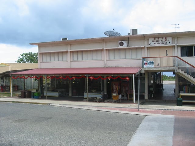
Poon Saan shops
The first attempt at exploring the island was in 1857 by the crew of the Amethyst. They tried to reach the summit of the island but found the cliffs impassable.
During the 1872–76 Challenger expedition to Indonesia, naturalist John Murray carried out extensive surveys.[13]
In 1886, Captain John Maclear of HMS Flying Fish, having discovered an anchorage in a bay that he named "Flying Fish Cove", landed a party and made a small collection of the flora and fauna.[7] In the next year, Pelham Aldrich, on board HMS Egeria, visited the island for ten days, accompanied by J. J. Lister, who gathered a larger biological and mineralogical collection.[7]
Among the rocks then obtained and submitted to Murray for examination were many of nearly pure phosphate of lime. This discovery led to annexation of the island by the British Crown on 6 June 1888.[13]
Settlement and exploitation
Soon afterwards, a small settlement was established in Flying Fish Cove by G. Clunies Ross, the owner of the Cocos (Keeling) Islands some 900 kilometres (560 mi) to the southwest, to collect timber and supplies for the growing industry on Cocos.
In 1897 the island was visited by Charles W. Andrews, who did extensive research on the natural history of the island, on behalf of the British Museum.[14]
Phosphate mining began in 1899 using indentured workers from Singapore, Malaya, and China. John Davis Murray, a mechanical engineer and recent graduate of Purdue University, was sent to supervise the operation on behalf of the Phosphate Mining and Shipping Company. Murray was known as the "King of Christmas Island" until 1910, when he married and settled in London.[15][16]
The island was administered jointly by the British Phosphate commissioners and district officers from the United Kingdom Colonial Office through the Straits Settlements, and later the Crown Colony of Singapore. Hunt (2011) provides a detailed history of Chinese indentured labor on the island during those years. In 1922, scientists attempted unsuccessfully to view a solar eclipse from the island to test Einstein's Theory of Relativity.[17]
Japanese invasion
From the outbreak of the South-East Asian theatre of World War II in December 1941, Christmas Island was a target for Japanese occupation because of its rich phosphate deposits.[18] A naval gun was installed under a British officer and four NCOs and 27 Indian soldiers.[18] The first attack was carried out on 20 January 1942, by Japanese submarine I-59, which torpedoed a Norwegian freighter, the Eidsvold.[19] The vessel drifted and eventually sank off West White Beach. Most of the European and Asian staff and their families were evacuated to Perth.
In late February and early March 1942, there were two aerial bombing raids. Shelling from a Japanese naval group on 7 March led the district officer to hoist the white flag.[18] But after the Japanese naval group sailed away, the British officer raised the Union Flag once more.[18] During the night of 10–11 March, a mutiny of the Indian troops, abetted by Sikh policemen, led to the killing of the five British soldiers and the imprisonment of the remaining 21 Europeans.[18]
At dawn on 31 March 1942, a dozen Japanese bombers launched the attack, destroying the radio station. The same day, a Japanese fleet of nine vessels arrived, and the island was surrendered. About 850 men of the Japanese 21st and 24th Special Base Forces and 102nd Construction Unit came ashore at Flying Fish Cove and occupied the island.[18] They rounded up the workforce, most of whom had fled to the jungle. Sabotaged equipment was repaired and preparations were made to resume the mining and export of phosphate. Only twenty men from the 21st Special Base Force were left as a garrison.[18]
Isolated acts of sabotage and the torpedoing of the Nissei Maru at the wharf on 17 November 1942[20] meant that only small amounts of phosphate were exported to Japan during the occupation. In November 1943, over 60% of the island's population was evacuated to Surabayan prison camps, leaving a total population of just under 500 Chinese and Malays and 15 Japanese to survive as best they could. In October 1945, HMS Rother re-occupied Christmas Island.[21][22][23][24]
After the war, seven mutineers were traced and prosecuted by the Military Court in Singapore. In 1947, five of them were sentenced to death. However, following representations made by the newly independent government of India, their sentences were reduced to penal servitude for life.[18]
Transfer to Australia
At Australia's request, the United Kingdom transferred sovereignty to Australia, with a $20 million payment from the Australian government to Singapore as compensation for the loss of earnings from the phosphate revenue.[25] The United Kingdom's Christmas Island Act was given royal assent on 14 May 1958, enabling Britain to transfer authority over Christmas Island from Singapore to Australia by an order-in-council.[26] Australia's Christmas Island Act was passed in September 1958 and the island was officially placed under the authority of the Commonwealth of Australia on 1 October 1958.[27]
Under Commonwealth Cabinet Decision 1573 of 9 September 1958, D. E. Nickels was appointed the first official representative of the new territory.[28] In a media statement on 5 August 1960, the minister for territories, Paul Hasluck, said, among other things, that, "His extensive knowledge of the Malay language and the customs of the Asian people... has proved invaluable in the inauguration of Australian administration... During his two years on the island he had faced unavoidable difficulties... and constantly sought to advance the island's interests."
John William Stokes succeeded him and served from 1 October 1960, to 12 June 1966. On his departure, he was lauded by all sectors of the island community. In 1968, the official secretary was retitled an administrator and, since 1997, Christmas Island and the Cocos (Keeling) Islands together are called the Australian Indian Ocean Territories and share a single administrator resident on Christmas Island. Recollections of the island's history and lifestyle, and lists and timetables of the island's leaders and events since its settlement are at the World Statesmen site[29] and in Neale (1988), Bosman (1993), Hunt (2011) and Stokes (2012).
The settlement of Silver City was built in the 1970s, with aluminium-clad houses that were supposed to be cyclone-proof.[30] The 2004 Indian Ocean earthquake and tsunami centred off the western shore of Sumatra in Indonesia, resulted in no reported casualties, but some swimmers were swept some 150 metres (490 ft) out to sea for a time before being swept back in.[31]
Refugee and immigration detention
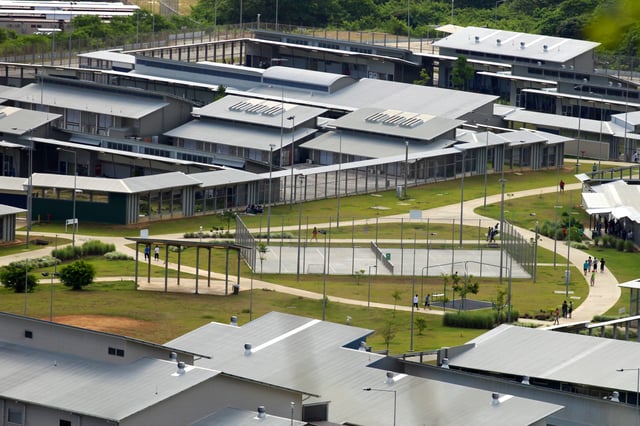
Immigration Detention Centre
From the late 1980s and early 1990s, boats carrying asylum seekers, mainly departing from Indonesia, began landing on the island. In 2001, Christmas Island was the site of the Tampa controversy, in which the Australian government stopped a Norwegian ship, MV Tampa, from disembarking 438 rescued asylum-seekers. The ensuing standoff and the associated political reactions in Australia were a major issue in the 2001 Australian federal election.[32]
The Howard government operated the "Pacific Solution" from 2001 to 2007, excising Christmas Island from Australia's migration zone so that asylum seekers on the island could not apply for refugee status. Asylum seekers were relocated from Christmas Island to Manus Island and Nauru. In 2006, an immigration detention centre, containing approximately 800 beds, was constructed on the island for the Department of Immigration and Multicultural Affairs. Originally estimated to cost A$276 million,[33] the final cost was over $400 million.[34]
In 2007, the Rudd government decommissioned Manus Regional Processing Centre and Nauru detention centre; processing would then occur on Christmas Island itself.[35]
In the case Plaintiff M61/2010E v Commonwealth of Australia, the High Court of Australia ruled, in a 7–0 joint judgment, that asylum seekers detained on Christmas Island were entitled to the protections of the Migration Act. Accordingly, the Commonwealth was obliged to afford asylum seekers a minimum of procedural fairness when assessing their claims.[38]
As of 20 June 2013, after the interception of four boats in six days, carrying 350 people, the Immigration Department stated that there were 2,960 "irregular maritime arrivals" being held in the island's five detention facilities, which exceeded not only the "regular operating capacity" of 1,094 people, but also the "contingency capacity" of 2,724.[39]
Geography
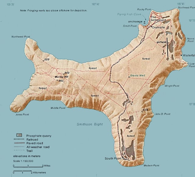
Christmas Island
The island is about 19 kilometres (12 mi) in greatest length and 14.5 km (9.0 mi) in breadth. The total land area is 135 square kilometres (52 sq mi), with 138.9 km (86.3 mi) of coastline. The island is the flat summit of an underwater mountain more than 4,500 metres (14,800 ft) high,[42] which rises from about 4,200 m (13,780 ft) below the sea and only about 300 m (984 ft) above it.[43]
The mountain was originally a volcano, and some basalt is exposed in places such as The Dales and Dolly Beach, but most of the surface rock is limestone accumulated from coral growth. The karst terrain supports numerous anchialine caves.[44] The summit of this mountain peak is formed by a succession of Tertiary limestones ranging in age from the Eocene or Oligocene up to recent reef deposits, with intercalations of volcanic rock in the older beds.[45]
Steep cliffs along much of the coast rise abruptly to a central plateau. Elevation ranges from sea level to 361 m (1,184 ft) at Murray Hill. The island is mainly tropical rainforest, 63% of which is national parkland. The narrow fringing reef surrounding the island poses a maritime hazard.
Christmas Island lies 2,600 kilometres (1,600 mi) northwest of Perth, Western Australia, 350 km (220 mi) south of Indonesia, 975 km (606 mi) ENE of the Cocos (Keeling) Islands, and 2,748 km (1,708 mi) west of Darwin, Northern Territory. Its closest point to the Australian mainland is 1,560 km (970 mi) from the town of Exmouth, Western Australia.[46]
Beaches
Christmas Island has 80 kilometres (50 mi) of shoreline but only small parts of the shoreline are easily accessible. The island's perimeter is embodied by sharp cliff faces, making many of the island's beaches difficult to get to. Some of the easily accessible beaches include Flying Fish Cove (main beach), Lily Beach, Ethel Beach, and Isabel Beach, while the more difficult beaches to access include Greta Beach, Dolly Beach, Winifred Beach, Merrial Beach, and West White Beach, which all require a vehicle with four wheel drive and a difficult walk through dense rainforest.[47]
Climate
Christmas Island is located towards the southern edge of the equatorial region. Climate is tropical and temperatures vary little throughout the year. The highest temperature is usually around 29 °C (84 °F) in March and April, while the lowest temperature is 23 °C (73 °F) and occurs in August. There is a dry season from July to October with only occasional showers. The wet season is between November and June, and includes monsoons, with downpours of rain at random times of the day. Tropical cyclones also occur in the wet season, bringing very strong winds, rain and enormous seas.
| Climate data for Christmas Island Airport | |||||||||||||
|---|---|---|---|---|---|---|---|---|---|---|---|---|---|
| Month | Jan | Feb | Mar | Apr | May | Jun | Jul | Aug | Sep | Oct | Nov | Dec | Year |
| Record high °C (°F) | 30.7 (87.3) | 31.5 (88.7) | 31.5 (88.7) | 31.4 (88.5) | 30.5 (86.9) | 29.8 (85.6) | 29.3 (84.7) | 29.5 (85.1) | 30.9 (87.6) | 31.4 (88.5) | 31.8 (89.2) | 31.2 (88.2) | 31.8 (89.2) |
| Average high °C (°F) | 28.0 (82.4) | 28.0 (82.4) | 28.3 (82.9) | 28.3 (82.9) | 27.8 (82.0) | 27.1 (80.8) | 26.3 (79.3) | 26.1 (79.0) | 26.3 (79.3) | 26.9 (80.4) | 27.3 (81.1) | 27.8 (82.0) | 27.4 (81.3) |
| Average low °C (°F) | 22.7 (72.9) | 22.7 (72.9) | 23.1 (73.6) | 23.5 (74.3) | 23.8 (74.8) | 23.3 (73.9) | 22.6 (72.7) | 22.2 (72.0) | 22.3 (72.1) | 22.7 (72.9) | 22.9 (73.2) | 22.6 (72.7) | 22.9 (73.2) |
| Record low °C (°F) | 18.8 (65.8) | 18.4 (65.1) | 18.6 (65.5) | 18.3 (64.9) | 19.3 (66.7) | 14.1 (57.4) | 16.2 (61.2) | 17.7 (63.9) | 16.7 (62.1) | 18.2 (64.8) | 18.0 (64.4) | 18.0 (64.4) | 14.1 (57.4) |
| Average rainfall mm (inches) | 297.2 (11.70) | 344.5 (13.56) | 302.7 (11.92) | 227.5 (8.96) | 186.7 (7.35) | 172.3 (6.78) | 99.7 (3.93) | 42.3 (1.67) | 57.4 (2.26) | 78.5 (3.09) | 156.8 (6.17) | 222.1 (8.74) | 2,183 (85.94) |
| Source: Australian Bureau of Meteorology[48] | |||||||||||||
Demographics
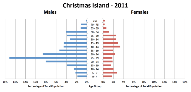
Christmas Island's population pyramid, from a census in 2011, showing a large proportion of males over females.
As of the 2016 Australian census, the population of Christmas Island is 1,843.[2] 21.2% of the population had Chinese ancestry (up from 18.3% in 2001), 12.7% had generic Australian ancestry (11.7% in 2001), 12% had Malay ancestry (9.3% in 2001), 10% had English ancestry (8.9% in 2001), and 2.3% of the population was of Irish origin (the same share as in 2001). 48.1% of the population has undetermined ancestry. as of 2016, most of them are people born in Christmas Island and many are of Chinese and Malay origin.[2] 38.5% of people were born in Australia. The next most common country of birth was Malaysia at 20.1%. 27.8% of the population spoke English as their family language, while 17.2% spoke Mandarin Chinese, 17.2% spoke Malay, 3.7% Cantonese, 1.5% Southern Min, and 1% Tagalog.[2] Additionally, there are small local populations of Malaysian Indians and Eurasians.[49][50]
Government
Christmas Island is a non-self-governing external territory of Australia, as of March 2019 administered by the Department of Infrastructure, Regional Development and Cities (from 29 November 2007 until 14 September 2010, administration was carried out by the Attorney-General's Department,[51][52] and prior to this by the Department of Transport and Regional Services).[53]
The legal system is under the authority of the Governor-General of Australia and Australian law. An administrator appointed by the Governor-General represents the monarch and Australia and lives on the island. The territory falls under no formal state jurisdiction, but the Western Australian Government provides many services through agreements with Canberra.
The Australian government provides services through the Christmas Island Administration and the Department of Infrastructure and Regional Development. Under the federal government's Christmas Island Act 1958, Western Australian laws are applied to Christmas Island; non-application or partial application of such laws is at the discretion of the federal government.[54] The act also gives Western Australian courts judicial power over Christmas Island. Christmas Island remains constitutionally distinct from Western Australia, however; the power of the state to legislate for the territory is delegated by the federal government. The kind of services typically provided by a state government elsewhere in Australia are provided by departments of the Western Australian government, and by contractors, with the costs met by the federal government. A unicameral Shire of Christmas Island with nine seats provides local government services and is elected by popular vote to serve four-year terms. Elections are held every two years, with four or five of the members standing for election.
Federal politics
Christmas Island residents who are Australian citizens also vote in federal elections. Christmas Island residents are represented in the House of Representatives by the Division of Lingiari in the Northern Territory and in the Senate by Northern Territory senators.[57] At the 2019 federal election, the Labor Party received absolute majorities from Christmas Island electors in both the House of Representatives and the Senate. [55][56]
Residents' views
Residents find the system of administration frustrating, with the island run by bureaucrats in the federal government, but subject to the laws of Western Australia and enforced by federal police. There is a feeling of resignation that any progress on local issues is prolongated by the confusing governance system. A number of islanders support self-governance, including shire president Gordon Thompson, who also believes that a lack of news media to cover local affairs had contributed to political apathy among residents.[58]
Flag
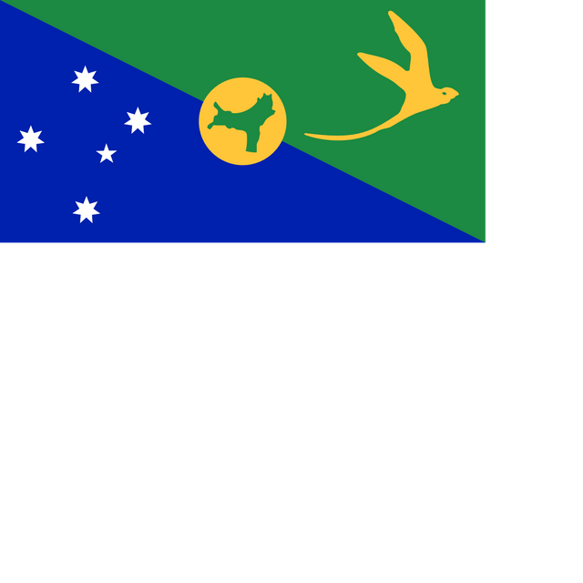
In early 1986, the Christmas Island Assembly held a design competition for an island flag; the winning design was adopted as the informal flag of the territory for over a decade, and in 2002 it was made the official flag of Christmas Island.
Economy
Phosphate mining had been the only significant economic activity, but in December 1987 the Australian government closed the mine. In 1991, the mine was reopened by a consortium which included many of the former mine workers as shareholders. With the support of the government, the $34 million Christmas Island Casino and Resort opened in 1993 but was closed in 1998. As of 2011, the resort has re-opened without the casino.
The Australian government in 2001 agreed to support the creation of a commercial spaceport on the island, however, this has not yet been constructed and appears that it will not proceed. The Howard government built a temporary immigration detention centre on the island in 2001 and planned to replace it with a larger, modern facility at North West Point until Howard's defeat in the 2007 elections.
Culture
The culture of Christmas Island is unique, for people of many different ethnicities inhabit the area. Historically, the majority of Christmas Islanders were those of Chinese, Malay and Indian origins, the initial permanent settlers, and as a result, they have significantly influenced the local culture.[59] Today, the majority of residents are Chinese, with significant numbers of European Australians and Malays as well as smaller Indian and Eurasian communities too. The main languages of Christmas Island are English and Chinese. Dress is usually modest, and tourists should keep a wrap, such as a sarong or pareo, on hand to cover shorts, bathing suits, and tank tops. It is common to remove shoes when entering a house and to also avoid touching anyone's head.
| Religion | 2011 | 2016 |
|---|---|---|
| Islam | 14.8% | 19.4% |
| Buddhism | 16.8% | 18.1% |
| Christianity | 10.8% | 8.9% |
| Not religious | 9.2% | 15.2% |
| Other religion | 48.4% | 38.4% |
Religion
Religious beliefs are diverse, but people are very tolerant of each other's religions. The religions practised include Buddhism, Taoism, Confucianism, Islam, and Christianity. There is a Mosque in Flying Fish Cove. With all of these religions, there are many religious festivals, such as Spring Festival, Hari Raya, Christmas and Easter.[60] Additionally, there is a Bahá'í centre on the island.[61]
Attractions
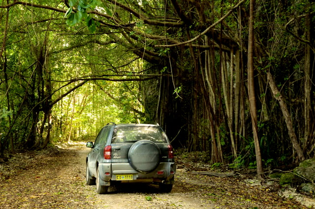
Car moving across the backroads of Christmas Island
Christmas Island is well known for its biological diversity. There are many rare species of animals and plants on the island, making nature-walking a popular activity. Along with the diversity of species, many different types of caves exist, such as plateau caves, coastal caves, raised coastal caves and alcoves, sea caves, fissure caves, collapse caves, and basalt caves; most of these are near the sea and have been formed by the action of water. Altogether, there are approximately 30 caves on the island,[62] with Lost Lake Cave, Daniel Roux Cave, and Full Frontal Cave being the most well-known. The many freshwater springs include Hosnies Spring Ramsar, which also has a mangrove stand.
The Dales is a rainforest in the western part of the island and consists of seven deep valleys, all of which were formed by spring streams. Hugh's Dale waterfall is part of this area and is a popular attraction. The annual breeding migration of the Christmas Island red crabs is a popular event.
Fishing is another common activity. There are many distinct species of fish in the oceans surrounding Christmas Island. Snorkeling and swimming in the ocean are two other activities that are extremely popular. Walking trails are also very popular, for there are many beautiful trails surrounded by extravagant flora and fauna. 63% of the island is national park making it one of the main attractions to experience when visiting.
Flora and fauna
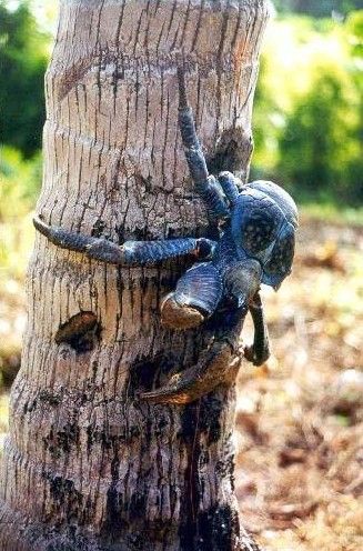
Robber Crab (Coconut crab)
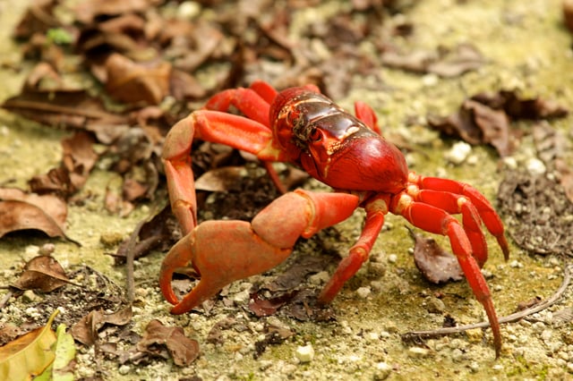
Christmas Island red crab
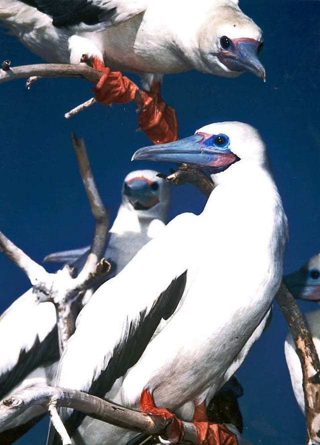
Red-footed boobies
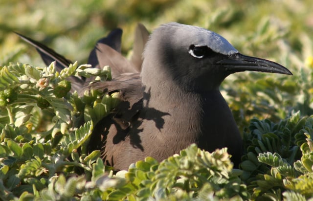
Common noddy
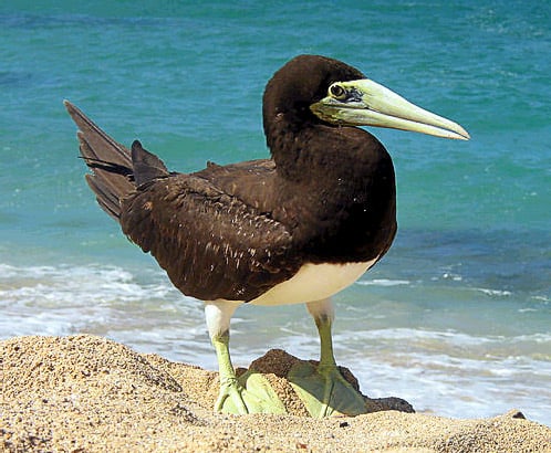
Brown booby
Christmas Island was uninhabited until the late 19th century, allowing many species to evolve without human interference. Two-thirds of the island has been declared a National Park, which is managed by the Australian Department of Environment and Heritage through Parks Australia. Christmas Island contains unique species, both of flora and fauna, some of which are threatened with, or have become, extinct.
Flora
The dense rainforest has grown in the deep soils of the plateau and on the terraces. The forests are dominated by 25 tree species. Ferns, orchids and vines grow on the branches in the humid atmosphere beneath the canopy. The 135 plant species include at least 18 that are found nowhere else. The rainforest is in great condition despite the mining activities over the last 100 years. Areas that have been damaged by mining are now a part of an ongoing rehabilitation project. The island is small and covers 135 square kilometres of land which 63% of that land has been declared National park.[63]
Christmas Island's endemic plants include the trees Arenga listeri, Pandanus elatus and Dendrocnide peltata var. murrayana; the shrubs Abutilon listeri, Colubrina pedunculata, Grewia insularis and Pandanus christmatensis; the vines Hoya aldrichii and Zehneria alba; the herbs Asystasia alba, Dicliptera maclearii and Peperomia rossii; the grass Ischaemum nativitatis; the fern Asplenium listeri; and the orchids Brachypeza archytas, Flickingeria nativitatis, Phreatia listeri and Zeuxine exilis.[64]
Fauna
Two species of native rats, the Maclear's and bulldog rats, have become extinct since the island was settled, while the Javan rusa has been introduced. The endemic Christmas Island shrew has not been seen since the mid-1980s and may be already extinct, while the Christmas Island pipistrelle (a small bat) is presumed to be extinct.[65]
The fruit bat (flying fox) species Pteropus natalis is only found on Christmas Island, its epithet natalis is a reference to that name. The species is probably the last native mammal, and an important pollinator and rainforest seed-disperser; the population is also in decline and under increasing pressure from land clearing and introduced pest species. The flying fox's low rate of reproduction (one pup each year) and high infant mortality rate makes it especially vulnerable and the conservation status is as critically endangered.[66] Flying foxes are an 'umbrella' species helping forests regenerate and other species survive in stressed environments.
The land crabs and seabirds are the most noticeable fauna on the island. Christmas Island has been identified by BirdLife International as both an Endemic Bird Area and an Important Bird Area because it supports five endemic species and five subspecies as well as over one percent of the world populations of five other seabirds.[67]
Twenty terrestrial and intertidal species of crab have been described here, of which thirteen are regarded as true land crabs, being dependent on the ocean only for larval development. Robber crabs, known elsewhere as coconut crabs, also exist in large numbers on the island. The annual red crab mass migration (around 100 million animals) to the sea to spawn has been called one of the wonders of the natural world.[68] This takes place each year around November – after the start of the wet season and in synchronisation with the cycle of the moon. Once at the ocean, the mothers release the embryos where they can survive and grow until they are able to live on land.
The island is a focal point for seabirds of various species. Eight species or subspecies of seabirds nest on it. The most numerous is the red-footed booby, which nests in colonies, using trees on many parts of the shore terrace. The widespread brown booby nests on the ground near the edge of the seacliff and inland cliffs. Abbott's booby (listed as endangered) nests on tall emergent trees of the western, northern and southern plateau rainforest, the only remaining nesting habitat for this bird in the world.
Another endangered and endemic bird, the Christmas frigatebird, has nesting areas on the northeastern shore terraces. The more widespread great frigatebirds nest in semi-deciduous trees on the shore terrace, with the greatest concentrations being in the North West and South Point areas. The common noddy and two species of bosun or tropicbirds, with their brilliant gold or silver plumage and distinctive streamer tail feathers, also nest on the island.
Of the ten native land birds and shorebirds, seven are endemic species or subspecies. This includes the Christmas thrush and the Christmas imperial pigeon. Some 86 migrant bird species have been recorded as visitors to the island.
Six species of butterfly are known to occur on Christmas Island. These are the Christmas swallowtail (Papilio memnon), striped albatross (Appias olferna), Christmas emperor (Polyura andrewsi), king cerulean (Jamides bochus), lesser grass-blue (Zizina otis), and Papuan grass-yellow (Eurema blanda).[69]
Insect species include the yellow crazy ant (Anoplolepis gracilipes), introduced to the island and since subjected to attempts to destroy the supercolonies that emerged with aerial spraying of the insecticide Fipronil.[70]
Media
Christmas Island has access to a range of modern communication services.
Radio broadcasts from Australia include ABC Radio National, ABC Kimberley, Triple J and Red FM. All services are provided by satellite links from the mainland. Broadband internet became available to subscribers in urban areas in mid-2005 through the local internet service provider, CIIA (formerly dotCX).
Christmas Island, due to its close proximity to Australia's northern neighbors, falls within many of the satellite footprints throughout the region. This results in ideal conditions for receiving various Asian broadcasts, which locals sometimes refer to those emanating from Western Australia. Additionally, ionospheric conditions are conducive to terrestrial radio transmissions, from HF through VHF and sometimes into UHF. The island plays home to a small array of radio equipment that spans a good chunk of the usable spectrum. A a variety of government-owned and operated antenna systems are employed on the island to take advantage of this.
Television
Free-to-air digital television stations from Australia are broadcast in the same time zone as Perth, and are broadcast from three separate locations:[71]
| Broadcaster | Drumsite | Phosphate Hill | Rocky Point |
|---|---|---|---|
| ABC | ABC 6 | ABC 34 | ABC 40 |
| SBS | SBS 7 | SBS 35 | SBS 41 |
| WAW | WAW 8 | WAW 36 | WAW 42 |
| WOW | WOW 10 | WOW 36 | WOW 43 |
| WDW | WDW 11 | WDW 38 | WDW 44 |
Cable television from Australia, Malaysia, Singapore and the United States commenced in January 2013.
Telecommunications
Telephone services are provided by Telstra and are a part of the Australian network with the same prefix as Western Australia, South Australia and the Northern Territory (08). A GSM mobile telephone system on the 900 MHz band[72] replaced the old analogue network in February 2005.
Postage stamps
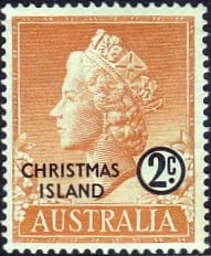
Postage stamp with portrait of Queen Elizabeth II, 1958
A postal agency was opened on the island in 1901 and sold stamps of the Strait Settlements.[73]
After the Japanese occupation (1942–45), postage stamps of the British Military Administration in Malaya were in use, then stamps of Singapore.[74]
In 1958, the island received its own postage stamps after being put under Australian custody. It had a large philatelic and postal independence, managed first by the Phosphate Commission (1958–1969) and then by the island's administration (1969–93).[73] This ended on 2 March 1993 when Australia Post became the island's postal operator; Christmas Island stamps may be used in Australia and Australian stamps may be used on the island.[74]
Transport
A container port exists at Flying Fish Cove with an uncompleted alternative container-unloading point to the east of the island at Norris Point, intended for use during the December-to-March "swell season" of rough seas.
The standard gauge 18 km (11 mi) Christmas Island Phosphate Co.'s Railway from Flying Fish Cove to the phosphate mine was constructed in 1914. It was closed in December 1987, when the Australian government closed the mine, and since has been recovered as scrap, leaving only earthworks in places.
Virgin Australia Regional Airlines provides two weekly flights to Christmas Island Airport from Perth, Western Australia, Garuda Indonesia conduct weekly open-charter flights from/to Jakarta with bookings done through Christmas Island Travel Exchange and Malindo Air operate fortnightly open-charter flights from/to Kuala Lumpur with bookings done through Evercrown Air Services.
Hire cars are available from the airport however no franchised companies are represented. CI Taxi Service also operates most days.
The road network covers most of the island and is of generally good quality, although four-wheel drive vehicles are needed to reach some of the more distant parts of the rainforest or the more isolated beaches on the rough dirt roads.
Education
The island-operated crèche is in the Recreation Centre.[75] Christmas Island District High School, catering to students in grades P-12, is run by the Western Australian Education Department. There are no universities on Christmas Island.
The island has one public library.[76]
Sport
Rugby league is growing in the island: the first game was played in 2016, and a local committee, with the support of NRL Western Australia, is willing to organize matches with nearby Cocos Islands and to create a Rugby League Competition in the Indian Ocean area.[77]
See also
Outline of Christmas Island
Index of Christmas Island-related articles
.cx
Cocos (Keeling) Islands
Norfolk Island