Caribbean

Caribbean
| Area | 2,754,000 km2(1,063,000 sq mi) |
|---|---|
| Population | 43,601,839[2] |
| Population density | 151.5/km2(392/sq mi) |
| Ethnic groups | Afro-Caribbean, European, Indo-Caribbean, Latino or Hispanic (Spanish, Portuguese, Mestizo, Mulatto, Pardo, and Zambo), Chinese Caribbean, Jewish, Arab, Amerindian, Javanese,[3] Hmong, Multiracial |
| Religions | Christianity, Hinduism, Islam, Judaism, Buddhism, Rastafarianism, Native American religion, Bahá'í Faith, Chinese folk religion (including Taoism and Confucianism), Kebatinan, Afro-American religion, Traditional African religion, and others |
| Demonym | Caribbean, West Indian |
| Countries | 13 sovereign states |
| Dependencies | 17 dependent territories |
| Languages | Spanish, English, French, Dutch, French Creoles, English Creoles, Caribbean Hindustani, among others |
| Time zones | UTC−5 to UTC−4 |
| Internet TLD | Multiple |
| Calling code | Multiple |
| Largest cities | List of metropolitan areas in the Caribbean Santo Domingo Havana Port-au-Prince San Juan Kingston Santiago de Cuba Santiago de los Caballeros Nassau Camagüey Cap-Haïtien Spanish Town Chaguanas Georgetown Paramaribo |
| UN M49 code | 029– Caribbean419– Latin America019– Americas001– World |


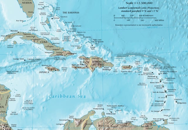
The Caribbean (/ˌkærɪˈbiːən, kəˈrɪbiən/, locally /ˈkærɪbiæn/)[4] is a region of the Americas that consists of the Caribbean Sea, its islands (some surrounded by the Caribbean Sea[5] and some bordering both the Caribbean Sea and the North Atlantic Ocean)[6] and the surrounding coasts. The region is southeast of the Gulf of Mexico and the North American mainland, east of Central America, and north of South America.
Situated largely on the Caribbean Plate, the region has more than 700 islands, islets, reefs and cays (see the list of Caribbean islands). Island arcs delineate the eastern and northern edges of the Caribbean Sea:[7] The Greater Antilles and the Lucayan Archipelago on the north and the Lesser Antilles and the on the south and east (which includes the Leeward Antilles). The Lucayan Archipelago (the Bahamas and Turks and Caicos Islands), do not border the Caribbean Sea, but are still within the boundaries of the Caribbean region. On the mainland, Belize, Nicaragua, the Caribbean region of Colombia, Cozumel, the Yucatán Peninsula, Margarita Island, and the Guyanas (Guyana, Suriname, French Guiana, Guayana Region in Venezuela, and Amapá in Brazil) are often included due to their political and cultural ties with the region.[8]
Geopolitically, the islands of the Caribbean (the West Indies) are often regarded as a region of North America, though sometimes they are included in Central America or left as a region of their own.[9][10] and are organized into 30 territories including sovereign states, overseas departments, and dependencies. From December 15, 1954, to October 10, 2010, there was a country known as the Netherlands Antilles composed of five states, all of which were Dutch dependencies.[11] From January 3, 1958, to May 31, 1962, there was also a short-lived political union called the West Indies Federation composed of ten English-speaking Caribbean territories, all of which were then British dependencies. The West Indies cricket team continues to represent many of those nations.
| Area | 2,754,000 km2(1,063,000 sq mi) |
|---|---|
| Population | 43,601,839[2] |
| Population density | 151.5/km2(392/sq mi) |
| Ethnic groups | Afro-Caribbean, European, Indo-Caribbean, Latino or Hispanic (Spanish, Portuguese, Mestizo, Mulatto, Pardo, and Zambo), Chinese Caribbean, Jewish, Arab, Amerindian, Javanese,[3] Hmong, Multiracial |
| Religions | Christianity, Hinduism, Islam, Judaism, Buddhism, Rastafarianism, Native American religion, Bahá'í Faith, Chinese folk religion (including Taoism and Confucianism), Kebatinan, Afro-American religion, Traditional African religion, and others |
| Demonym | Caribbean, West Indian |
| Countries | 13 sovereign states |
| Dependencies | 17 dependent territories |
| Languages | Spanish, English, French, Dutch, French Creoles, English Creoles, Caribbean Hindustani, among others |
| Time zones | UTC−5 to UTC−4 |
| Internet TLD | Multiple |
| Calling code | Multiple |
| Largest cities | List of metropolitan areas in the Caribbean Santo Domingo Havana Port-au-Prince San Juan Kingston Santiago de Cuba Santiago de los Caballeros Nassau Camagüey Cap-Haïtien Spanish Town Chaguanas Georgetown Paramaribo |
| UN M49 code | 029– Caribbean419– Latin America019– Americas001– World |
Etymology and pronunciation
The region takes its name from that of the Caribs, an ethnic group present in the Lesser Antilles and parts of adjacent South America at the time of the Spanish conquest of the Americas.[12]
The two most prevalent pronunciations of "Caribbean" outside the Caribbean are /ˌkærɪˈbiːən/ (KARR-ə-BEE-ən), with the primary stress on the third syllable, and /kəˈrɪbiən/ (kə-RIB-ee-ən), with the stress on the second. Most authorities of the last century preferred the stress on the third syllable.[13] This is the older of the two pronunciations, but the stressed-second-syllable variant has been established for over 75 years.[14] It has been suggested that speakers of British English prefer /ˌkærɪˈbiːən/ (KARR-ə-BEE-ən) while North American speakers more typically use /kəˈrɪbiən/ (kə-RIB-ee-ən),[15] but major American dictionaries and other sources list the stress on the third syllable as more common in American English too.[16][17][18][19] According to the American version of Oxford Online Dictionaries, the stress on the second syllable is becoming more common in UK English and is increasingly considered "by some" to be more up to date and more "correct".[20]
The Oxford Online Dictionaries claim that the stress on the second syllable is the most common pronunciation in the Caribbean itself, but according to the Dictionary of Caribbean English Usage, the most common pronunciation in Caribbean English stresses the first syllable instead, /ˈkærɪbiæn/ (KARR-ih-bee-an).[4][20]
Definition
Map of the Caribbean
The word "Caribbean" has multiple uses. Its principal ones are geographical and political. The Caribbean can also be expanded to include territories with strong cultural and historical connections to Africa, slavery, European colonisation and the plantation system.
The United Nations geoscheme for the Americas presents the Caribbean as a distinct region within the Americas.
Physiographically, the Caribbean region is mainly a chain of islands surrounding the Caribbean Sea. To the north, the region is bordered by the Gulf of Mexico, the Straits of Florida and the Northern Atlantic Ocean, which lies to the east and northeast. To the south lies the coastline of the continent of South America.
Politically, the "Caribbean" may be centred by considering narrower and wider socio-economic groupings: At its core is the Caribbean Community (CARICOM), whose full members include the Commonwealth of the Bahamas in the Atlantic, the Co-operative Republic of Guyana and the Republic of Suriname in South America, and Belize in Central America; its associate members include Bermuda and the Turks and Caicos Islands in the Atlantic Ocean. Most expansive is the Association of Caribbean States (ACS), which includes almost every nation in the region surrounding the Caribbean and also El Salvador on the Pacific Ocean. According to the ACS, the total population of its member states is 227 million people.[21]
Geography and geology
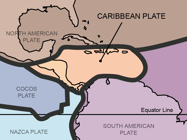
The Caribbean Plate
The geography and climate in the Caribbean region varies: Some islands in the region have relatively flat terrain of non-volcanic origin. These islands include Aruba (possessing only minor volcanic features), Curaçao, Barbados, Bonaire, the Cayman Islands, Saint Croix, the Bahamas, and Antigua. Others possess rugged towering mountain-ranges like the islands of Saint Martin, Cuba, Hispaniola, Puerto Rico, Jamaica, Dominica, Montserrat, Saba, Sint Eustatius, Saint Kitts, Saint Lucia, Saint Thomas, Saint John, Tortola, Grenada, Saint Vincent, Guadeloupe, Martinique and Trinidad and Tobago.
Definitions of the terms Greater Antilles and Lesser Antilles often vary. The Virgin Islands as part of the Puerto Rican bank are sometimes included with the Greater Antilles. The term Lesser Antilles is often used to define an island arc that includes Grenada but excludes Trinidad and Tobago and the Leeward Antilles.
The waters of the Caribbean Sea host large, migratory schools of fish, turtles, and coral reef formations. The Puerto Rico Trench, located on the fringe of the Atlantic Ocean and Caribbean Sea just to the north of the island of Puerto Rico, is the deepest point in all of the Atlantic Ocean.[22]
The region sits in the line of several major shipping routes with the Panama Canal connecting the western Caribbean Sea with the Pacific Ocean.
Climate
Tropical monsoon climate in San Andrés island, Caribbean, Colombia.

Köppen climate map of the islands of the Caribbean.
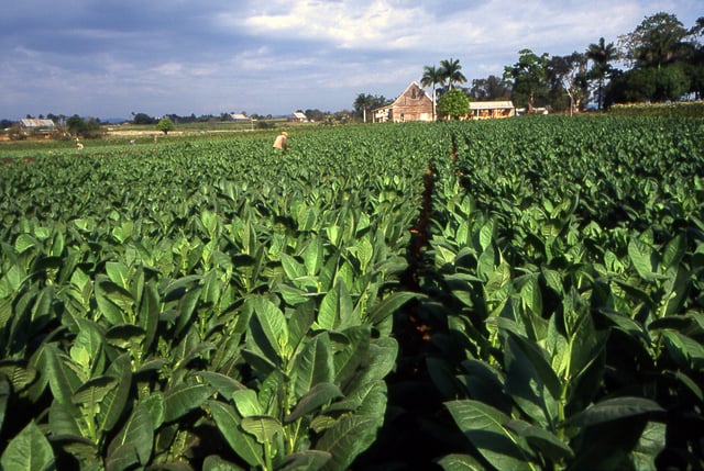
A field in Pinar del Rio planted with Cuban tobacco
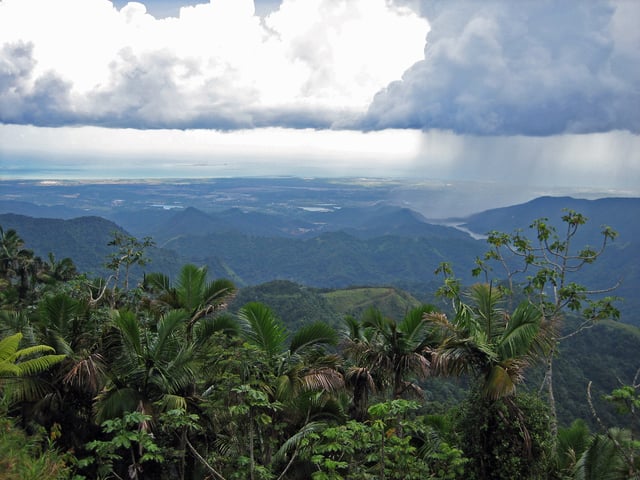
Puerto Rico's south shore, from the mountains of Jayuya
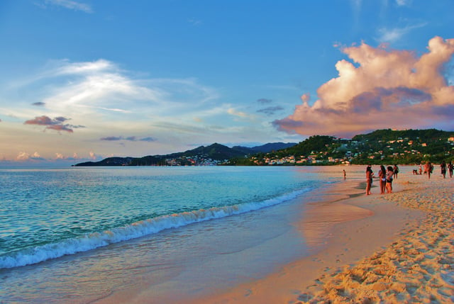
Grand Anse beach, St. George's, Grenada
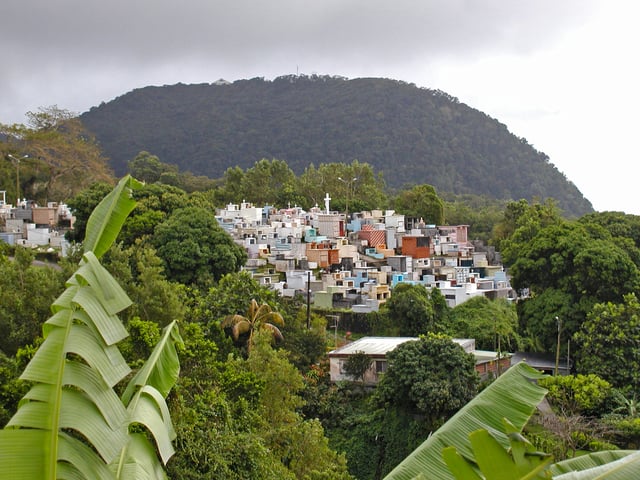
A church cemetery perched in the mountains of Guadeloupe
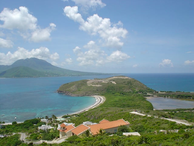
A view of Nevis island from the southeastern peninsula of Saint Kitts
The climate of the area is tropical, varying from tropical rainforest in some areas to tropical monsoon and tropical savanna in others. There are also some locations that are arid climates with considerable drought in some years, and the peaks of mountains tend to have cooler temperate climates.
Rainfall varies with elevation, size and water currents, such as the cool upwellings that keep the ABC islands arid. Warm, moist trade winds blow consistently from the east, creating both rain forest and semi arid climates across the region. The tropical rainforest climates include lowland areas near the Caribbean Sea from Costa Rica north to Belize, as well as the Dominican Republic and Puerto Rico, while the more seasonal dry tropical savanna climates are found in Cuba, northern Colombia and Venezuela, and southern Yucatán, Mexico. Arid climates are found along the extreme northern coast of Venezuela out to the islands including Aruba and Curacao, as well as the northwestern tip of Yucatán.
While the region generally is sunny much of the year, the wet season from May through November sees more frequent cloud cover (both broken and overcast), while the dry season from December through April is more often clear to mostly sunny. Seasonal rainfall is divided into 'dry' and 'wet' seasons, with the latter six months of the year being wetter than the first half. The air temperature is hot much of the year, varying from 25 to 33 C (77 F to 90 F) between the wet and dry seasons. Seasonally, monthly mean temperatures vary from only about 5 C (7 F) in the northern most regions, to less than 3 C in the southernmost areas of the Caribbean.
Hurricane season is from June to November, but they occur more frequently in August and September and more common in the northern islands of the Caribbean. Hurricanes that sometimes batter the region usually strike northwards of Grenada and to the west of Barbados. The principal hurricane belt arcs to northwest of the island of Barbados in the Eastern Caribbean. A great example being recent events of Hurricane Irma devastating the island of Saint Martin during the 2017 hurricane season.
Sea surface temperatures change little annually, normally running from 30 °C (87 °F) in the warmest months to 26 °C (76 °F) in the coolest months. The air temperature is warm year round, in the 70s, 80s and 90s, and only varies from winter to summer about 2–5 degrees on the southern islands and about a 10–20 degrees difference on the northern islands of the Caribbean. The northern islands, like the Bahamas, Cuba, Puerto Rico and the Dominican Republic, may be influenced by continental masses during winter months, such as cold fronts.
Aruba: Latitude 12°N
| Climate data for Oranjestad, Aruba (1981–2010, extremes 1951–2010) | |||||||||||||
|---|---|---|---|---|---|---|---|---|---|---|---|---|---|
| Month | Jan | Feb | Mar | Apr | May | Jun | Jul | Aug | Sep | Oct | Nov | Dec | Year |
| Record high °C (°F) | 32.5 (90.5) | 33.0 (91.4) | 33.9 (93.0) | 34.4 (93.9) | 34.9 (94.8) | 35.2 (95.4) | 35.3 (95.5) | 36.1 (97.0) | 36.5 (97.7) | 35.4 (95.7) | 35.0 (95.0) | 34.8 (94.6) | 36.5 (97.7) |
| Average high °C (°F) | 30.0 (86.0) | 30.4 (86.7) | 30.9 (87.6) | 31.5 (88.7) | 32.0 (89.6) | 32.2 (90.0) | 32.0 (89.6) | 32.6 (90.7) | 32.7 (90.9) | 32.1 (89.8) | 31.3 (88.3) | 30.4 (86.7) | 31.5 (88.7) |
| Daily mean °C (°F) | 26.7 (80.1) | 26.8 (80.2) | 27.2 (81.0) | 27.9 (82.2) | 28.5 (83.3) | 28.7 (83.7) | 28.6 (83.5) | 29.1 (84.4) | 29.2 (84.6) | 28.7 (83.7) | 28.1 (82.6) | 27.2 (81.0) | 28.1 (82.6) |
| Average low °C (°F) | 24.5 (76.1) | 24.7 (76.5) | 25.0 (77.0) | 25.8 (78.4) | 26.5 (79.7) | 26.7 (80.1) | 26.4 (79.5) | 26.8 (80.2) | 26.9 (80.4) | 26.4 (79.5) | 25.8 (78.4) | 25.0 (77.0) | 25.9 (78.6) |
| Record low °C (°F) | 21.3 (70.3) | 20.6 (69.1) | 21.4 (70.5) | 21.5 (70.7) | 21.8 (71.2) | 22.7 (72.9) | 21.2 (70.2) | 21.3 (70.3) | 22.1 (71.8) | 21.9 (71.4) | 22.0 (71.6) | 20.5 (68.9) | 20.5 (68.9) |
| Average precipitation mm (inches) | 39.3 (1.55) | 20.6 (0.81) | 8.7 (0.34) | 11.6 (0.46) | 16.3 (0.64) | 18.7 (0.74) | 31.7 (1.25) | 25.8 (1.02) | 45.5 (1.79) | 77.8 (3.06) | 94.0 (3.70) | 81.8 (3.22) | 471.8 (18.58) |
| Source: DEPARTAMENTO METEOROLOGICO ARUBA,[23] (extremes)[24] | |||||||||||||
Puerto Rico: Latitude 18°N
| Climate data for San Juan, Puerto Rico | |||||||||||||
|---|---|---|---|---|---|---|---|---|---|---|---|---|---|
| Month | Jan | Feb | Mar | Apr | May | Jun | Jul | Aug | Sep | Oct | Nov | Dec | Year |
| Record high °C (°F) | 33 (92) | 36 (96) | 36 (96) | 36 (97) | 36 (96) | 36 (97) | 35 (95) | 35 (95) | 36 (97) | 36 (97) | 37 (98) | 36 (96) | 34 (94) |
| Average high °C (°F) | 28 (83) | 29 (84) | 29 (85) | 30 (86) | 31 (87) | 32 (89) | 31 (88) | 31 (88) | 32 (89) | 31 (88) | 30 (86) | 29 (84) | 30 (86) |
| Average low °C (°F) | 22 (72) | 22 (72) | 23 (73) | 23 (74) | 24 (76) | 26 (78) | 26 (78) | 26 (78) | 26 (78) | 25 (77) | 24 (75) | 23 (73) | 24 (75) |
| Record low °C (°F) | 16 (61) | 17 (62) | 16 (60) | 18 (64) | 18 (64) | 19 (66) | 21 (69) | 20 (68) | 21 (69) | 19 (67) | 18 (65) | 17 (62) | 16 (61) |
| Average precipitation mm (inches) | 95 (3.7) | 60 (2.4) | 49 (1.9) | 118 (4.6) | 150 (5.9) | 112 (4.4) | 128 (5.0) | 138 (5.4) | 146 (5.7) | 142 (5.6) | 161 (6.3) | 126 (5.0) | 1,431 (56.3) |
| Source: The National Weather Service [25] | |||||||||||||
Cuba: at Latitude 22°N
| Climate data for Havana | |||||||||||||
|---|---|---|---|---|---|---|---|---|---|---|---|---|---|
| Month | Jan | Feb | Mar | Apr | May | Jun | Jul | Aug | Sep | Oct | Nov | Dec | Year |
| Record high °C (°F) | 32.5 (90.5) | 33.0 (91.4) | 35.9 (96.6) | 36.4 (97.5) | 36.9 (98.4) | 37.2 (99.0) | 38.0 (100.4) | 36.1 (97.0) | 37.5 (99.5) | 35.4 (95.7) | 35.0 (95.0) | 34.8 (94.6) | 38.0 (100.4) |
| Average high °C (°F) | 25.8 (78.4) | 26.1 (79.0) | 27.6 (81.7) | 28.6 (83.5) | 29.8 (85.6) | 30.5 (86.9) | 31.3 (88.3) | 31.6 (88.9) | 31.0 (87.8) | 29.2 (84.6) | 27.7 (81.9) | 26.5 (79.7) | 28.8 (83.8) |
| Daily mean °C (°F) | 22.2 (72.0) | 22.4 (72.3) | 23.7 (74.7) | 24.8 (76.6) | 26.1 (79.0) | 27.0 (80.6) | 27.6 (81.7) | 27.9 (82.2) | 27.4 (81.3) | 26.1 (79.0) | 24.5 (76.1) | 23.0 (73.4) | 25.2 (77.4) |
| Average low °C (°F) | 18.6 (65.5) | 18.6 (65.5) | 19.7 (67.5) | 20.9 (69.6) | 22.4 (72.3) | 23.4 (74.1) | 23.8 (74.8) | 24.1 (75.4) | 23.8 (74.8) | 23.0 (73.4) | 21.3 (70.3) | 19.5 (67.1) | 21.6 (70.9) |
| Record low °C (°F) | 5.1 (41.2) | 5.6 (42.1) | 5.4 (41.7) | 11.5 (52.7) | 16.8 (62.2) | 19.7 (67.5) | 18.2 (64.8) | 19.3 (66.7) | 19.1 (66.4) | 11.9 (53.4) | 10.0 (50.0) | 7.5 (45.5) | 5.1 (41.2) |
| Average rainfall mm (inches) | 64.4 (2.54) | 68.6 (2.70) | 46.2 (1.82) | 53.7 (2.11) | 98.0 (3.86) | 182.3 (7.18) | 105.6 (4.16) | 99.6 (3.92) | 144.4 (5.69) | 180.5 (7.11) | 88.3 (3.48) | 57.6 (2.27) | 1,189.2 (46.84) |
| Source: World Meteorological Organisation (UN),[26] Climate-Charts.com[27] | |||||||||||||
Island groups
Lucayan Archipelago[1]
Turks and Caicos Islands (United Kingdom)
Greater Antilles
Cayman Islands (United Kingdom)
Cuba
Hispaniola Haiti Dominican Republic
Puerto Rico (U.S. Commonwealth) Spanish Virgin Islands
Lesser Antilles
Leeward Islands United States Virgin Islands (U.S.) Saint Croix Saint Thomas Saint John Water Island British Virgin Islands (United Kingdom) Tortola Virgin Gorda Anegada Jost Van Dyke Anguilla (United Kingdom) Antigua and Barbuda Antigua Barbuda Redonda Saint Martin, politically divided between Saint Martin (France) Sint Maarten (Kingdom of the Netherlands) Saba (Caribbean Netherlands, Netherlands) Sint Eustatius (Caribbean Netherlands, Netherlands) Saint Barthélemy (French Antilles, France) Saint Kitts and Nevis Saint Kitts Nevis Montserrat (United Kingdom) Guadeloupe (French Antilles, France) including Les Saintes Marie-Galante La Désirade
Windward Islands Dominica Martinique (French Antilles, France) Saint Lucia Saint Vincent and the Grenadines Saint Vincent The Grenadines Grenada Grenada Carriacou and Petite Martinique Barbados Trinidad and Tobago Tobago Trinidad
Leeward Antilles Aruba (Kingdom of the Netherlands) Curaçao (Kingdom of the Netherlands) Bonaire (Caribbean Netherlands, Netherlands)
Historical groupings
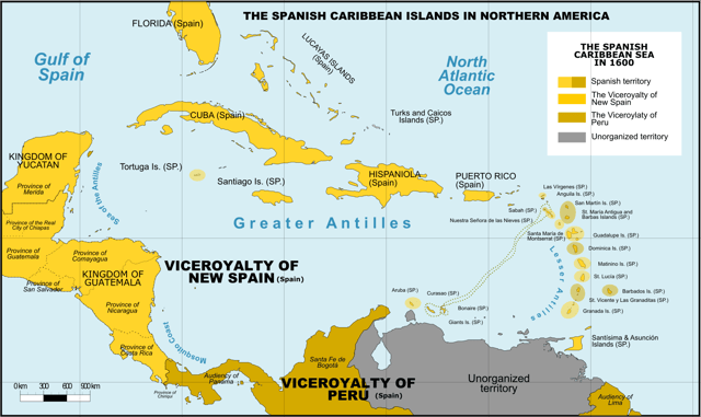
Spanish Caribbean Islands in the American Viceroyalties 1600
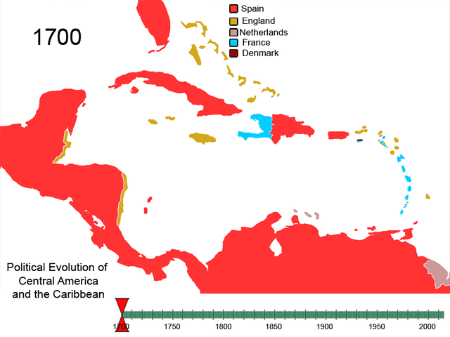
Political evolution of Central America and the Caribbean from 1700 to present
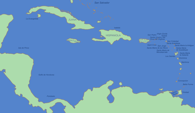
The mostly Spanish-controlled Caribbean in the 16th century
All islands at some point were, and a few still are, colonies of European nations; a few are overseas or dependent territories:
British West Indies/Anglophone Caribbean – Anguilla, Antigua and Barbuda, Bahamas, Barbados, Bay Islands, Guyana, Belize, British Virgin Islands, Cayman Islands, Dominica, Grenada, Jamaica, Montserrat, Saint Croix (briefly), Saint Kitts and Nevis, Saint Lucia, Saint Vincent and the Grenadines, Trinidad and Tobago (from 1797) and the Turks and Caicos Islands
Danish West Indies – Possession of Denmark-Norway before 1814, then Denmark, present-day United States Virgin Islands
Dutch West Indies – Aruba, Bonaire, Curaçao, Saba, Sint Eustatius, Sint Maarten, Bay Islands (briefly), Saint Croix (briefly), Tobago, Surinam and Virgin Islands
French West Indies – Anguilla (briefly), Antigua and Barbuda (briefly), Dominica, Dominican Republic (briefly), Grenada, Haiti (formerly Saint-Domingue), Montserrat (briefly), Saint Lucia, Saint Vincent and the Grenadines, Sint Eustatius (briefly), Sint Maarten, St. Kitts (briefly), Tobago (briefly), Saint Croix, the current French overseas départements of French Guiana, Martinique and Guadeloupe (including Marie-Galante, La Désirade and Les Saintes), the current French overseas collectivities of Saint Barthélemy and Saint Martin
Portuguese West Indies – present-day Barbados, known as Os Barbados in the 16th century when the Portuguese claimed the island en route to Brazil. The Portuguese left Barbados abandoned years before the British arrived.
Spanish West Indies – Cuba, Hispaniola (present-day Dominican Republic, Haiti (until 1659 to France), Puerto Rico, Jamaica (until 1655 to Great Britain), the Cayman Islands (until 1670 to Great Britain) Trinidad (until 1797 to Great Britain) and Bay Islands (until 1643 to Great Britain), coastal islands of Central America (except Belize), and some Caribbean coastal islands of Panama, Colombia, Mexico, and Venezuela.
Swedish West Indies – present-day French Saint-Barthélemy, Guadeloupe (briefly) and Tobago (briefly).
Courlander West Indies – Tobago (until 1691)
The British West Indies were united by the United Kingdom into a West Indies Federation between 1958 and 1962. The independent countries formerly part of the B.W.I. still have a joint cricket team that competes in Test matches, One Day Internationals and Twenty20 Internationals. The West Indian cricket team includes the South American nation of Guyana, the only former British colony on the mainland of that continent.
In addition, these countries share the University of the West Indies as a regional entity. The university consists of three main campuses in Jamaica, Barbados and Trinidad and Tobago, a smaller campus in the Bahamas and Resident Tutors in other contributing territories such as Trinidad.
Countries and territories of the Caribbean today

Maritime boundaries between the Caribbean (island) nations
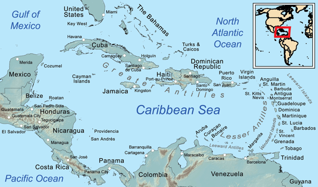
Islands in and near the Caribbean
| Flag | Country or territory[28][29][30] | Sovereignty | Status | Area (km2)[31] | Population (2016 est.)[2] | Density (people per km2) | Capital |
|---|---|---|---|---|---|---|---|
| Anguilla | United Kingdom | British overseas territory | 91 | 14,764 | 164.8 | The Valley | |
| Antigua and Barbuda | Independent | Constitutional monarchy | 442 | 100,963 | 199.1 | St. John's | |
| Aruba | Kingdom of the Netherlands | Constituent kingdom | 180 | 104,822 | 594.4 | Oranjestad | |
| The Bahamas[32] | Independent | Constitutional monarchy | 13,943 | 391,232 | 24.5 | Nassau | |
| Barbados | Independent | Constitutional monarchy | 430 | 284,996 | 595.3 | Bridgetown | |
| Bonaire | Kingdom of the Netherlands | Special Municipality | 294 | 12,093[33] | 41.1 | Kralendijk | |
| British Virgin Islands | United Kingdom | British overseas territory | 151 | 30,661 | 152.3 | Road Town | |
| Cayman Islands | United Kingdom | British overseas territory | 264 | 60,765 | 212.1 | George Town | |
| Cuba | Independent | Republic | 109,886 | 11,475,982 | 102.0 | Havana | |
| Curaçao | Kingdom of the Netherlands | Constituent kingdom | 444 | 159,371 | 317.1 | Willemstad | |
| Dominica | Independent | Republic | 751 | 73,543 | 89.2 | Roseau | |
| Dominican Republic | Independent | Republic | 48,671 | 10,648,791 | 207.3 | Santo Domingo | |
| Federal Dependencies of Venezuela | Venezuela | Territories | 342 | 2,155 | 6.3 | Gran Roque | |
| Grenada | Independent | Constitutional monarchy | 344 | 107,317 | 302.3 | St. George's | |
| Guadeloupe | France | Overseas department | 1,628 | 449,975 | 246.7 | Basse-Terre | |
| Haiti | Independent | Republic | 27,750 | 10,847,334 | 361.5 | Port-au-Prince | |
| Jamaica | Independent | Constitutional monarchy | 10,991 | 2,881,355 | 247.4 | Kingston | |
| Martinique | France | Overseas department | 1,128 | 385,103 | 352.6 | Fort-de-France | |
| Montserrat | United Kingdom | British overseas territory | 102 | 5,152 | 58.8 | Plymouth (Brades)[34] | |
| Navassa Island | United States | Territory (uninhabited) | 5 | 0 | 0.0 | ||
| Nueva Esparta | Venezuela | State | 1,151 | 491,610 | La Asunción | ||
| Puerto Rico | United States | Commonwealth | 8,870 | 3,667,903 | 448.9 | San Juan | |
| Saba | Kingdom of the Netherlands | Special municipality | 13 | 1,537[33] | 118.2 | The Bottom | |
| San Andrés and Providencia | Colombia | Department | 52.5 | 75,167 | 1431 | San Andrés | |
| Saint Barthélemy | France | Overseas collectivity | 21 | 7,448 | 354.7 | Gustavia | |
| Saint Kitts and Nevis | Independent | Constitutional monarchy | 261 | 54,821 | 199.2 | Basseterre | |
| Saint Lucia | Independent | Constitutional monarchy | 539 | 178,015 | 319.1 | Castries | |
| Saint Martin | France | Overseas collectivity | 54 | 29,820 | 552.2 | Marigot | |
| Saint Vincent and the Grenadines | Independent | Constitutional monarchy | 389 | 109,643 | 280.2 | Kingstown | |
| Sint Eustatius | Kingdom of the Netherlands | Special municipality | 21 | 2,739[33] | 130.4 | Oranjestad | |
| Sint Maarten | Kingdom of the Netherlands | Constituent kingdom | 34 | 39,537 | 1176.7 | Philipsburg | |
| Trinidad and Tobago | Independent | Republic | 5,130 | 1,364,962 | 261.0 | Port of Spain | |
| Turks and Caicos Islands[35] | United Kingdom | British overseas territory | 948 | 34,900 | 34.8 | Cockburn Town | |
| United States Virgin Islands | United States | Territory | 347 | 104,913 | 317.0 | Charlotte Amalie | |
| Total | 235,667 | 44,199,389 | 187.6 | ||||
Continental countries with Caribbean coastlines and islands
Biodiversity
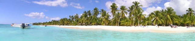
Saona Island, Dominican Republic
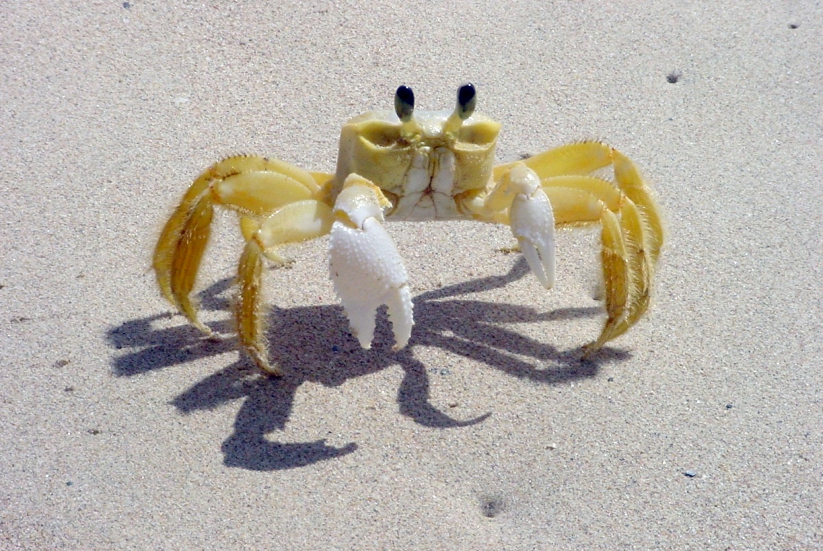
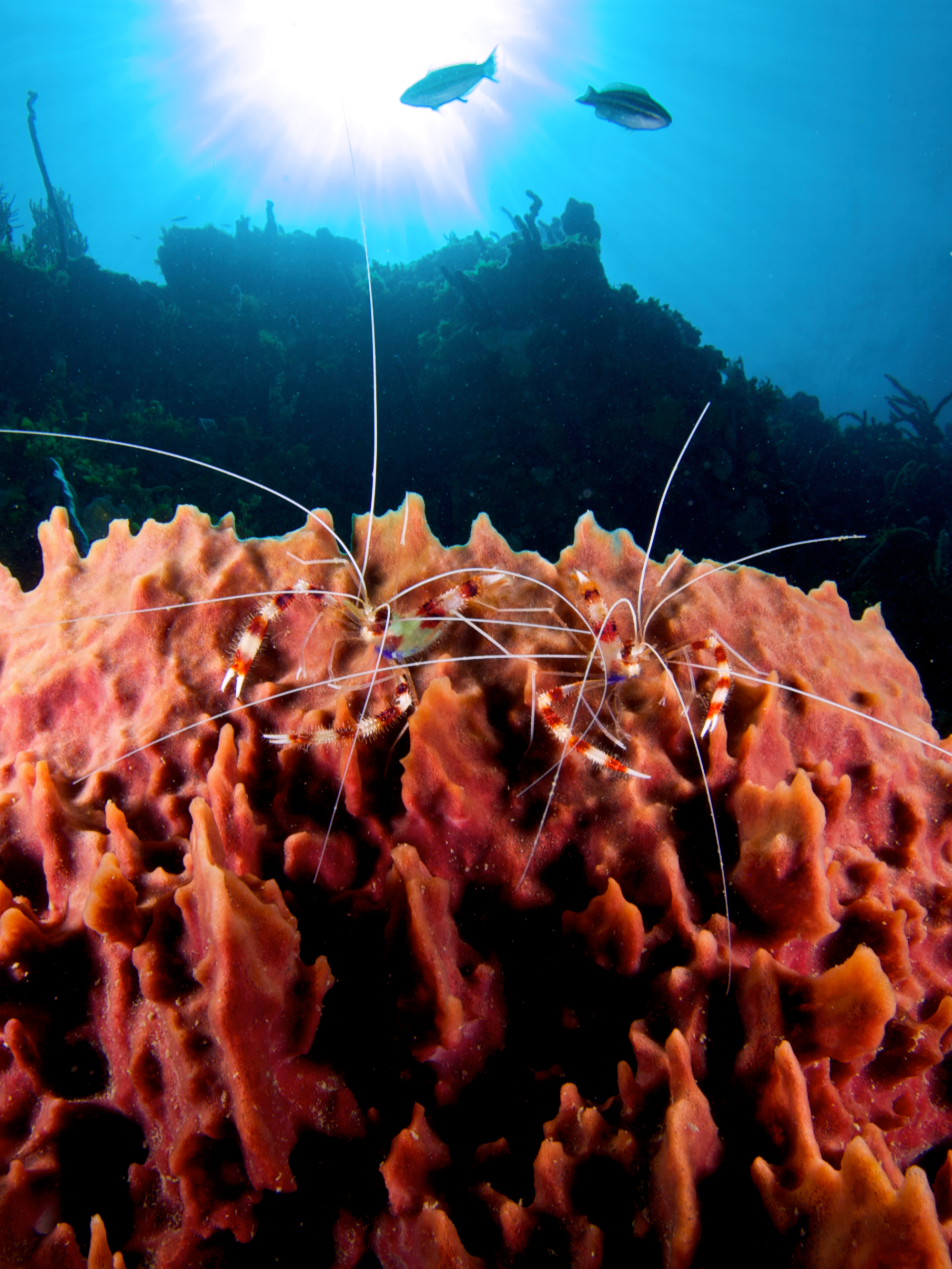
The Caribbean islands have one of the most diverse eco systems in the world. The animals, fungi and plants, and have been classified as one of Conservation International's biodiversity hotspots because of their exceptionally diverse terrestrial and marine ecosystems, ranging from montane cloud forests, to tropical rainforest, to cactus scrublands. The region also contains about 8% (by surface area) of the world's coral reefs[36] along with extensive seagrass meadows,[37] both of which are frequently found in the shallow marine waters bordering the island and continental coasts of the region.
For the fungi, there is a modern checklist based on nearly 90,000 records derived from specimens in reference collections, published accounts and field observations.[38] That checklist includes more than 11,250 species of fungi recorded from the region. As its authors note, the work is far from exhaustive, and it is likely that the true total number of fungal species already known from the Caribbean is higher. The true total number of fungal species occurring in the Caribbean, including species not yet recorded, is likely far higher given the generally accepted estimate that only about 7% of all fungi worldwide have been discovered.[39] Though the amount of available information is still small, a first effort has been made to estimate the number of fungal species endemic to some Caribbean islands. For Cuba, 2200 species of fungi have been tentatively identified as possible endemics of the island;[40] for Puerto Rico, the number is 789 species;[41] for the Dominican Republic, the number is 699 species;[42] for Trinidad and Tobago, the number is 407 species.[43]
Many of the ecosystems of the Caribbean islands have been devastated by deforestation, pollution, and human encroachment. The arrival of the first humans is correlated with extinction of giant owls and dwarf ground sloths.[44] The hotspot contains dozens of highly threatened animals (ranging from birds, to mammals and reptiles), fungi and plants. Examples of threatened animals include the Puerto Rican amazon, two species of solenodon (giant shrews) in Cuba and the Hispaniola island, and the Cuban crocodile.
The region's coral reefs, which contain about 70 species of hard corals and between 500–700 species of reef-associated fishes[45] have undergone rapid decline in ecosystem integrity in recent years, and are considered particularly vulnerable to global warming and ocean acidification.[46] According to a UNEP report, the Caribbean coral reefs might get extinct in next 20 years due to population explosion along the coast lines, overfishing, the pollution of coastal areas and global warming.[47]
Some Caribbean islands have terrain that Europeans found suitable for cultivation for agriculture. Tobacco was an important early crop during the colonial era, but was eventually overtaken by sugarcane production as the region's staple crop. Sugar was produced from sugarcane for export to Europe. Cuba and Barbados were historically the largest producers of sugar. The tropical plantation system thus came to dominate Caribbean settlement. Other islands were found to have terrain unsuited for agriculture, for example Dominica, which remains heavily forested. The islands in the southern Lesser Antilles, Aruba, Bonaire and Curaçao, are extremely arid, making them unsuitable for agriculture. However, they have salt pans that were exploited by the Dutch. Sea water was pumped into shallow ponds, producing coarse salt when the water evaporated.[48]
The natural environmental diversity of the Caribbean islands has led to recent growth in eco-tourism. This type of tourism is growing on islands lacking sandy beaches and dense human populations.[49]
Plants and animals
Demographics
Indigenous groups
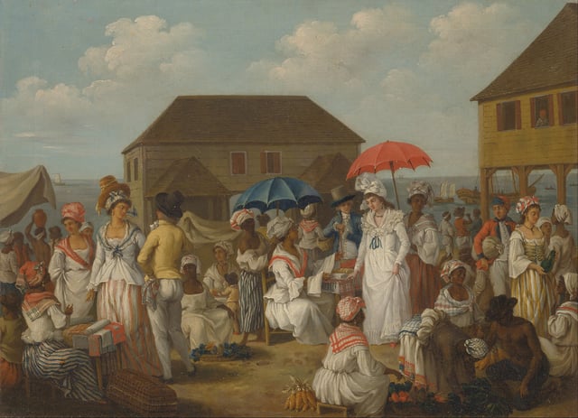
A linen market in Dominica in the 1770s
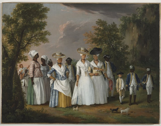
Agostino Brunias. Free Women of Color with Their Children and Servants in a Landscape Brooklyn Museum
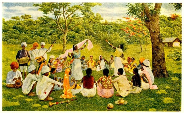
Asian Indians in the late nineteenth century singing and dancing in Trinidad and Tobago

Street scene, Matanzas, Cuba
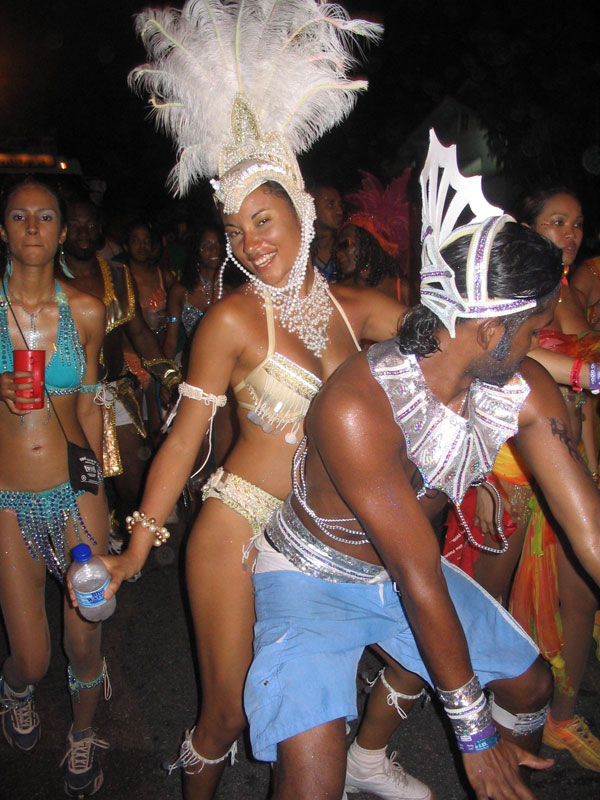
Carnival in Trinidad and Tobago
Arawak peoples Igneri Taíno
Caquetio people
Ciboney
Ciguayo
Garifuna
Kalina
Kalinago
Lucayan
Macorix
Raizal
At the time of European contact, the dominant ethnic groups in the Caribbean included the Taíno of the Greater Antilles and northern Lesser Antilles, the Island Caribs of the southern Lesser Antilles, and smaller distinct groups such as the Guanajatabey of western Cuba and the Ciguayo of eastern Hispaniola. The population of the Caribbean is estimated to have been around 750,000 immediately before European contact, although lower and higher figures are given. After contact, social disruption and epidemic diseases such as smallpox and measles (to which they had no natural immunity)[50] led to a decline in the Amerindian population.[51] From 1500 to 1800 the population rose as slaves arrived from West Africa[52] such as the Kongo, Igbo, Akan, Fon and Yoruba as well as military prisoners from Ireland, who were deported during the Cromwellian reign in England. Immigrants from Britain, Italy, France, Spain, the Netherlands, Portugal and Denmark also arrived, although the mortality rate was high for both groups.[53]
The population is estimated to have reached 2.2 million by 1800.[54] Immigrants from India, China, Indonesia, and other countries arrived in the mid-19th century as indentured servants.[55] After the ending of the Atlantic slave trade, the population increased naturally.[56] The total regional population was estimated at 37.5 million by 2000.[57]
In Haiti and most of the French, Anglophone and Dutch Caribbean, the population is predominantly of African origin; on many islands there are also significant populations of mixed racial origin (including Mulatto-Creole, Dougla, Mestizo, Quadroon, Cholo, Castizo, Criollo, Zambo, Pardo, Asian Latin Americans, Chindian, Cocoa panyols, and Eurasian), as well as populations of European ancestry: Dutch, English, French, Italian, Portuguese and Spanish ancestry. Asians, especially those of Chinese, Indian descent, and Javanese Indonesians, form a significant minority in parts of the region. Indians form a plurality of the population in Trinidad and Tobago, Guyana, and Suriname. Most of their ancestors arrived in the 19th century as indentured laborers.
The Spanish-speaking Caribbean populations are primarily of European, African, or racially mixed origins. Puerto Rico has a European majority with a mixture of European-African-Native American (tri-racial), and a large Mulatto (European-West African) and West African minority. Cuba also has a European majority, along with a significant population of African ancestry. The Dominican Republic has the largest mixed-race population, primarily descended from Europeans, West Africans, and Amerindians.
Jamaica has a large African majority, in addition to a significant population of mixed racial background, and has minorities of Chinese, Europeans, Indians, Latinos, Jews, and Arabs. This is a result of years of importation of slaves and indentured laborers, and migration. Most multi-racial Jamaicans refer to themselves as either mixed race or brown. Similar populations can be found in the Caricom states of Belize, Guyana and Trinidad and Tobago. Trinidad and Tobago has a multi-racial cosmopolitan society due to the arrivals of Africans, Indians, Chinese, Arabs, Jews, Spanish, Portuguese, and Europeans along with the Native Amerindians population. This multi-racial mix has created sub-ethnicities that often straddle the boundaries of major ethnicities and include Dougla, Chindian, Mulatto-Creole, Afro-Asians, Eurasian, Cocoa panyols, and Asian Latin Americans
Language
Spanish (64%), French (25%), English (14%), Dutch, Haitian Creole, and Papiamento are the predominant official languages of various countries in the region, although a handful of unique creole languages or dialects can also be found in virtually every Caribbean country. Other languages such as Caribbean Hindustani, Chinese, Indonesian, Amerindian languages, other African languages, other European languages, other Indian languages, and other Indonesian languages can also be found.
Religion
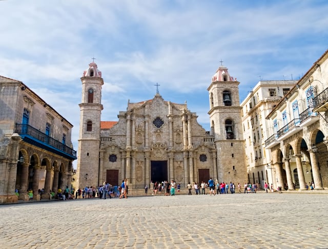
Havana Cathedral (Catholic) in Cuba completed in 1777
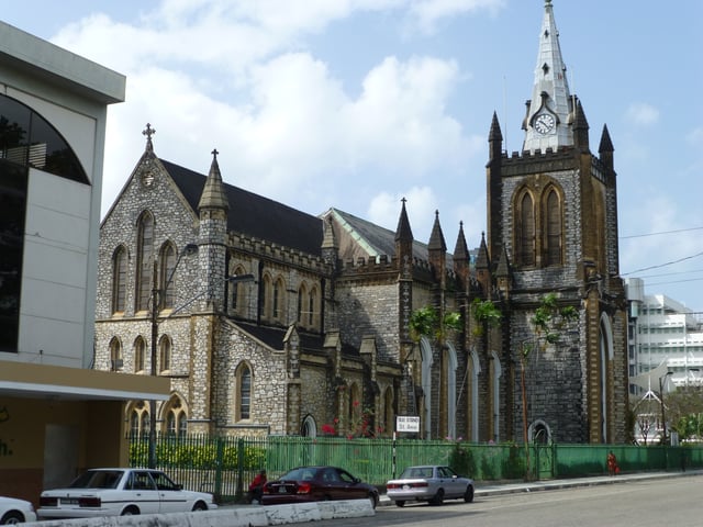
Holy Trinity Cathedral, an Anglican Christian cathedral in Trinidad and Tobago
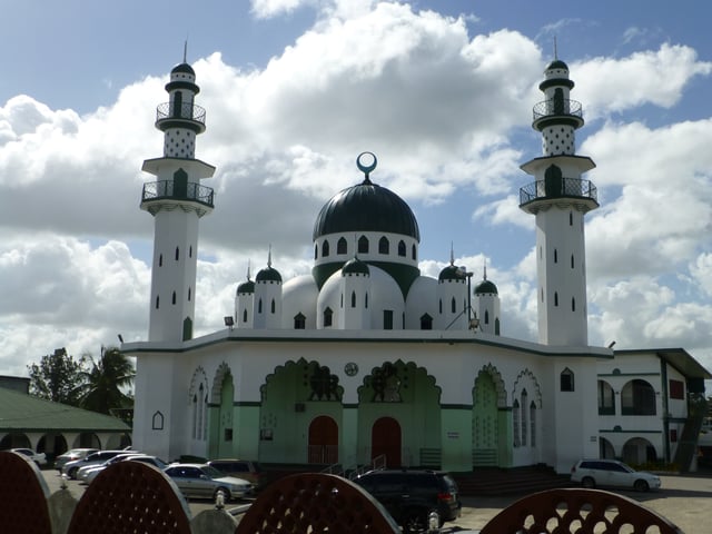
Muhammad Ali Jinnah Memorial Masjid, a Muslim masjid in Trinidad and Tobago

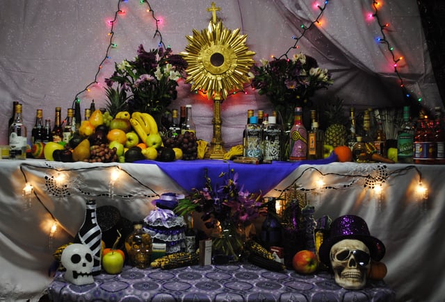
A Haitian Vodou alter
Christianity is the predominant religion in the Caribbean (84.7%).[58] Other religious groups in the region are Hinduism, Islam, Judaism, Rastafarianism, Buddhism, Chinese folk religion (Taoism and Confucianism), Bahá'í, Jainism, Sikhism, Zorastrianism, Kebatinan, Traditional African religions, Afro-American religions, Yoruba (Santería, Trinidad Orisha, Palo, Umbanda, Brujería, Hoodoo, Candomblé, Quimbanda, Orisha, Xangô de Recife, Xangô do Nordeste, Comfa, Espiritismo, Santo Daime, Obeah, Candomblé, Abakuá, Kumina, Winti, Sanse, Cuban Vodú, Dominican Vudú, Louisiana Voodoo, Haitian Vodou, and Vodun).
Politics
Regionalism

Flag of the Caribbean Common Market and Community (CARICOM)
Caribbean societies are very different from other Western societies in terms of size, culture, and degree of mobility of their citizens.[59] The current economic and political problems the states face individually are common to all Caribbean states. Regional development has contributed to attempts to subdue current problems and avoid projected problems. From a political and economic perspective, regionalism serves to make Caribbean states active participants in current international affairs through collective coalitions. In 1973, the first political regionalism in the Caribbean Basin was created by advances of the English-speaking Caribbean nations through the institution known as the Caribbean Common Market and Community (CARICOM)[60] which is located in Guyana.
Certain scholars have argued both for and against generalizing the political structures of the Caribbean. On the one hand the Caribbean states are politically diverse, ranging from communist systems such as Cuba toward more capitalist Westminster-style parliamentary systems as in the Commonwealth Caribbean. Other scholars argue that these differences are superficial, and that they tend to undermine commonalities in the various Caribbean states. Contemporary Caribbean systems seem to reflect a "blending of traditional and modern patterns, yielding hybrid systems that exhibit significant structural variations and divergent constitutional traditions yet ultimately appear to function in similar ways."[61] The political systems of the Caribbean states share similar practices.
The influence of regionalism in the Caribbean is often marginalized. Some scholars believe that regionalism cannot exist in the Caribbean because each small state is unique. On the other hand, scholars also suggest that there are commonalities amongst the Caribbean nations that suggest regionalism exists. "Proximity as well as historical ties among the Caribbean nations has led to cooperation as well as a desire for collective action."[62] These attempts at regionalization reflect the nations' desires to compete in the international economic system.[62]
Furthermore, a lack of interest from other major states promoted regionalism in the region. In recent years the Caribbean has suffered from a lack of U.S. interest. "With the end of the Cold War, U.S. security and economic interests have been focused on other areas. As a result there has been a significant reduction in U.S. aid and investment to the Caribbean."[63] The lack of international support for these small, relatively poor states, helped regionalism prosper.
Following the Cold War another issue of importance in the Caribbean has been the reduced economic growth of some Caribbean States due to the United States and European Union's allegations of special treatment toward the region by each other.
United States-EU trade dispute
The United States under President Bill Clinton launched a challenge in the World Trade Organization against the EU over Europe's preferential program, known as the Lomé Convention, which allowed banana exports from the former colonies of the Group of African, Caribbean and Pacific states (ACP) to enter Europe cheaply.[64] The World Trade Organization sided in the United States' favour and the beneficial elements of the convention to African, Caribbean and Pacific states has been partially dismantled and replaced by the Cotonou Agreement.[65]
During the US/EU dispute, the United States imposed large tariffs on European Union goods (up to 100%) to pressure Europe to change the agreement with the Caribbean nations in favour of the Cotonou Agreement.[66]
Farmers in the Caribbean have complained of falling profits and rising costs as the Lomé Convention weakens. Some farmers have faced increased pressure to turn towards the cultivation of illegal drugs, which has a higher profit margin and fills the sizable demand for these illegal drugs in North America and Europe.[67][68]
Caribbean Financial Action Task Force and Association of Caribbean States
Caribbean nations have also started to more closely cooperate in the Caribbean Financial Action Task Force and other instruments to add oversight of the offshore industry. One of the most important associations that deal with regionalism amongst the nations of the Caribbean Basin has been the Association of Caribbean States (ACS). Proposed by CARICOM in 1992, the ACS soon won the support of the other countries of the region. It was founded in July 1994. The ACS maintains regionalism within the Caribbean on issues unique to the Caribbean Basin. Through coalition building, like the ACS and CARICOM, regionalism has become an undeniable part of the politics and economics of the Caribbean. The successes of region-building initiatives are still debated by scholars, yet regionalism remains prevalent throughout the Caribbean.
Bolivarian Alliance
The President of Venezuela, Hugo Chavez launched an economic group called the Bolivarian Alliance for the Americas (ALBA), which several eastern Caribbean islands joined. In 2012, the nation of Haiti, with 9 million people, became the largest CARICOM nation that sought to join the union.[69]
Regional institutions
Here are some of the bodies that several islands share in collaboration:
African, Caribbean and Pacific Group of States
Association of Caribbean States (ACS), Trinidad and Tobago
Caribbean Association of Industry and Commerce (CAIC), Trinidad and Tobago
Caribbean Association of National Telecommunication Organizations (CANTO), Trinidad and Tobago[70]
Caribbean Community (CARICOM), Guyana
Caribbean Development Bank (CDB), Barbados
Caribbean Disaster Emergency Management Agency (CDERA), Barbados
Caribbean Educators Network[71]
Caribbean Electric Utility Services Corporation (CARILEC), Saint Lucia[72]
Caribbean Examinations Council (CXC), Barbados and Jamaica
Caribbean Financial Action Task Force (CFATF), Trinidad and Tobago
Caribbean Food Crops Society, Puerto Rico
Caribbean Football Union (CFU), Jamaica
Caribbean Hotel & Tourism Association (CHTA), Florida and Puerto Rico[73]
Caribbean Initiative (Initiative of the IUCN)
Caribbean Programme for Economic Competitiveness (CPEC), Saint Lucia
Caribbean Regional Environmental Programme (CREP), Barbados[74]
Caribbean Regional Fisheries Mechanism (CRFM), Belize[75]
Caribbean Regional Negotiating Machinery (CRNM), Barbados and Dominican Republic[76]
Caribbean Telecommunications Union (CTU), Trinidad and Tobago
Caribbean Tourism Organization (CTO), Barbados
Community of Latin American and Caribbean States (CELAC)
Foundation for the Development of Caribbean Children, Barbados
Latin America and Caribbean Network Information Centre (LACNIC), Brazil and Uruguay
Latin American and the Caribbean Economic System, Venezuela
Organisation of Eastern Caribbean States (OECS), Saint Lucia
United Nations Economic Commission for Latin America and the Caribbean (ECLAC), Chile and Trinidad and Tobago
University of the West Indies, Jamaica, Barbados, Trinidad and Tobago.[77] In addition, the fourth campus, the Open Campus was formed in June 2008 as a result of an amalgamation of the Board for Non-Campus Countries and Distance Education, Schools of Continuing Studies, the UWI Distance Education Centres and Tertiary Level Units. The Open Campus has 42 physical sites in 16 Anglophone caribbean countries.
West Indies Cricket Board, Antigua and Barbuda[78]
Cuisine
Favorite or national dishes
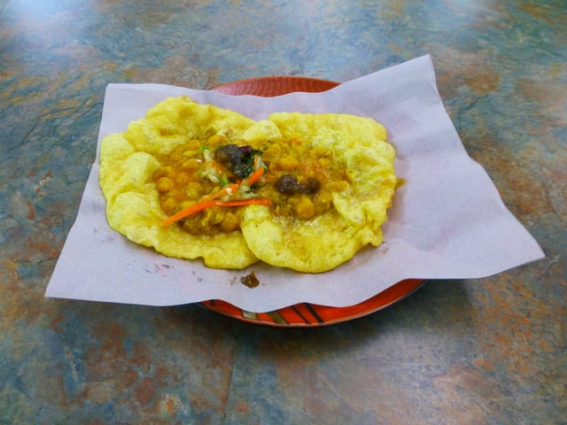
Doubles, one of the national dishes of Trinidad and Tobago
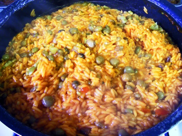
Arroz con gandules, one of the national dishes of Puerto Rico
Anguilla – rice, peas and fish
Antigua and Barbuda – fungee and pepperpot
Bahamas - Guava duff, Conch Salad, Peas n' Rice, and Conch Fritters
Barbados – cou-cou and flying fish
Belize - rice and beans, stew chicken with potato salad ; white rice, stew beans and fry fish with cole slaw
British Virgin Islands – fish and fungee
Cayman Islands – turtle stew, turtle steak, grouper
Colombian Caribbean – rice with coconut milk, arroz con pollo, sancocho, Arab cuisine (due to the large Arab population)
Cuba – platillo Moros y Cristianos, ropa vieja, lechon, maduros, ajiaco
Dominica – mountain chicken, rice and peas, dumplings, saltfish, dashin, bakes (fried dumplings), coconut confiture, curry goat, cassava farine, oxtail
Dominican Republic – arroz con pollo with stewed red kidney beans, pan fried or braised beef, salad/ ensalada de coditos, empanadas, mangú, sancocho
Grenada – oil down, Roti and rice & chicken
Guyana – pepperpot, cookup rice, roti and curry, methem, pholourie
Haiti – griot (fried pork) served with du riz a pois or diri ak pwa (rice and beans)
Jamaica – ackee and saltfish, callaloo, jerk chicken, curry chicken
Montserrat – Goat water
Puerto Rico – yellow rice with green pigeon peas, saltfish stew, roasted pork shoulder, chicken fricassée, mofongo, tripe soup, alcapurria, coconut custard, rice pudding, guava turnovers, Mallorca bread
Saint Kitts and Nevis – goat water, coconut dumplings, spicy plantain, saltfish, breadfruit
Saint Lucia – callaloo, dal roti, dried and salted cod, green bananas, rice and beans
Saint Vincent and the Grenadines – roasted breadfruit and fried jackfish
Suriname – brown beans and rice, roti and curry, peanut soup, battered fried plantain with peanut sauce, nasi goreng, moksie alesi, bara, pom
Trinidad and Tobago – callaloo, doubles, aloo pie, phulourie, bake and shark, curry with roti or dal bhat, curry crab and dumpling
United States Virgin Islands – stewed goat, oxtail or beef, seafood, callaloo, fungee
See also
African diaspora
Anchor coinage
British African-Caribbean people
British Indo-Caribbean people
Climate change in the Caribbean
CONCACAF
Council on Hemispheric Affairs
Culture of the Caribbean
Economy of the Caribbean
Indian diaspora
Indo-Caribbean
Indo-Caribbean American
List of Caribbean music genres
List of sovereign states and dependent territories in the Caribbean
NECOBELAC Project
Piracy in the Caribbean
Politics of the Caribbean
Tourism in the Caribbean
Geography:
Americas (terminology)
List of archipelagos by number of islands
List of Caribbean islands
List of indigenous names of Eastern Caribbean islands
List of mountain peaks of the Caribbean
List of Ultras of the Caribbean
Middle America (Americas)
Latin America and the Caribbean (region)